1930s Maps of Catahoula Parish, Louisiana
Explore 3 historic maps of Catahoula Parish from the 1930s. These maps offer a rare glimpse into what life looked like during the 1930s — showing old roads, neighborhoods, homes, and landmarks that have changed or disappeared over time.
Whether you're researching your family's past, planning a metal detecting trip, or studying how Catahoula Parish's landscape evolved across the 1930s, these high-resolution maps are a powerful tool for exploring the history of this region.
- Focus on a specific era: All maps on this page are from the 1930s, giving you a focused view of this time period.
- See what’s changed: Compare century-old streets, trails, and buildings to today's modern landscape using overlays and satellite layers.
- Research with precision: Use these maps for genealogy, historical research, land use analysis, or educational projects.
- View, download, or print: Maps are fully viewable online in high resolution, and can be downloaded or printed for your own records.
Start exploring Catahoula Parish's history through authentic maps from the 1930s. This is your window into the past.
Catahoula Parish, LA maps
(3)- 1935 Map of Tooleys, 1936 Print
 1935 Tooleys1936 Print · USGSThe alluvial wetlands of Concordia and Catahoula Parishes are documented here during the mid-1930s when river life revolved around local landings. Researchers can trace family roots at Larto Sch, identify ancestral sites near the B M Graveyard, or locate early homesteads by Island Bayou Ldg.
 - 1939 Map of Red Gum, 1941 Print
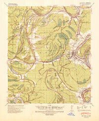 1939 Red Gum1941 Print · USGSConcordia Parish sits at a vital rail and river junction during the late thirties. Researchers can locate numerous historic landings and community pillars like the Rosenwald Sch, New St John Ch, and the crossroads at Ferriday.2 unique versions available
 - 1939 Map of Deer Park, 1951 Print
 1939 Deer Park1951 Print · USGSThe Lower Mississippi River valley in the late thirties reveals a landscape of massive plantations and shifting river bends. Genealogists and historians can trace family land in Moro Plantation, locate schools like Central High School, or find small settlements such as Monterey and Arnot.
End of results
Showing maps 1-3 of 3
Top cities of Catahoula Parish
Frequently asked questions
- What are the different types of historical maps available for Catahoula Parish?
- What is the oldest map of Catahoula Parish?
- Where can I purchase historical maps of Catahoula Parish for my home or office?
- Where can I download high-res historical maps of Catahoula Parish?
- Are there historical topographic maps available for Catahoula Parish?
- Is there historical aerial imagery available for Catahoula Parish?
- Where are historical maps of Catahoula Parish sourced from?