1960s Maps of Catahoula Parish, Louisiana
Explore 6 historic maps of Catahoula Parish from the 1960s. These maps offer a rare glimpse into what life looked like during the 1960s — showing old roads, neighborhoods, homes, and landmarks that have changed or disappeared over time.
Whether you're researching your family's past, planning a metal detecting trip, or studying how Catahoula Parish's landscape evolved across the 1960s, these high-resolution maps are a powerful tool for exploring the history of this region.
- Focus on a specific era: All maps on this page are from the 1960s, giving you a focused view of this time period.
- See what’s changed: Compare century-old streets, trails, and buildings to today's modern landscape using overlays and satellite layers.
- Research with precision: Use these maps for genealogy, historical research, land use analysis, or educational projects.
- View, download, or print: Maps are fully viewable online in high resolution, and can be downloaded or printed for your own records.
Start exploring Catahoula Parish's history through authentic maps from the 1960s. This is your window into the past.
Catahoula Parish, LA maps
(6)- 1960 Map of Jonesville, 1961 Print
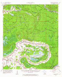
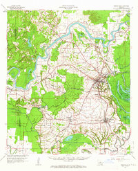
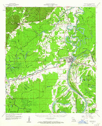 1960 Jonesville1961 Print · USGSThe river-junction town of Jonesville and the surrounding bayou country are captured here at the start of the 1960s. Researchers can trace old family burial grounds like Alexander Cem and rural centers including Lismore and Wallace Ridge.2 unique versions available
 - 1960 Map of Eva, 1961 Print
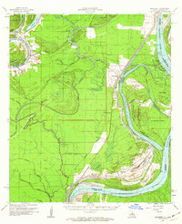
 1960 Eva1961 Print · USGSCatahoula and Concordia Parishes in the early sixties reveal a landscape defined by the winding Black River and the rural communities of Mayna and Acme. Genealogists and local historians can trace family-named landmarks, old cemeteries like Dewey Cem, and rural churches including Glade Ch.3 unique versions available
 - 1961 Map of Ferriday, 1962 Print
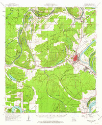 1961 Ferriday1962 Print · USGSConcordia Parish and the Mississippi River bottomlands are captured here in the early sixties, showing a landscape of bayous and rail towns. Researchers can locate many rural landmarks including St Peters Ch, Sevier High Sch, and family sites near Clayton and Frogmore.2 unique versions available
 - 1961 Map of Monterey, 1963 Print
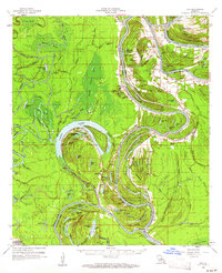
 1961 Monterey1963 Print · USGSConcordia Parish in the early sixties is a landscape of winding bayous and active oil fields. Genealogists can locate family landmarks like Pt Pleasant Cem and Ashland Cem, or trace the path of the Old Railroad near Monterey.3 unique versions available
 - 1962 Map of Moreauville, 1963 Print
 1962 Moreauville1963 Print · USGSAvoyelles Parish in the early sixties reveals a landscape of river meanders and bayou settlements shaped by the Atchafalaya. Researchers can trace rural life through landmarks like St Mark Ch, the Kansas City Southern line, and Bordelonville.2 unique versions available
 - 1962 Map of Marksville, 1964 Print
 1962 Marksville1964 Print · USGSAvoyelles Parish in the early sixties remains a landscape shaped by river bends and rail lines before the modern highway era. Genealogists and historians can trace family locations near St Pauls Ch, Waddill Cem, and the historic Indian Mounds outside Marksville.3 unique versions available
End of results
Showing maps 1-6 of 6
Top cities of Catahoula Parish
Frequently asked questions
- What are the different types of historical maps available for Catahoula Parish?
- What is the oldest map of Catahoula Parish?
- Where can I purchase historical maps of Catahoula Parish for my home or office?
- Where can I download high-res historical maps of Catahoula Parish?
- Are there historical topographic maps available for Catahoula Parish?
- Is there historical aerial imagery available for Catahoula Parish?
- Where are historical maps of Catahoula Parish sourced from?