1980s Maps of Catahoula Parish, Louisiana
Explore 30 historic maps of Catahoula Parish from the 1980s. These maps offer a rare glimpse into what life looked like during the 1980s — showing old roads, neighborhoods, homes, and landmarks that have changed or disappeared over time.
Whether you're researching your family's past, planning a metal detecting trip, or studying how Catahoula Parish's landscape evolved across the 1980s, these high-resolution maps are a powerful tool for exploring the history of this region.
- Focus on a specific era: All maps on this page are from the 1980s, giving you a focused view of this time period.
- See what’s changed: Compare century-old streets, trails, and buildings to today's modern landscape using overlays and satellite layers.
- Research with precision: Use these maps for genealogy, historical research, land use analysis, or educational projects.
- View, download, or print: Maps are fully viewable online in high resolution, and can be downloaded or printed for your own records.
Start exploring Catahoula Parish's history through authentic maps from the 1980s. This is your window into the past.
Catahoula Parish, LA maps
(30)- 1982 Map of Larto Lake South
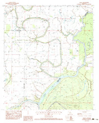
 1982 Larto Lake South1982 Print · USGSThe alluvial wetlands of Catahoula Parish appear in the early 1980s as a complex network of bayous, brakes, and managed wildlife areas. Researchers can locate community anchors like Larto Ch and Central Sch or trace the family-named Pease Cem and Nichols Cem near the water.
 - 1982 Map of Larto Lake North
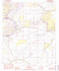
 1982 Larto Lake North1982 Print · USGSCatahoula Parish's intricate wetlands and bayous are meticulously detailed in this early 1980s study of the Larto Lake region. Local researchers can trace the hydrology of the Saline State Wildlife Management Area and find specific landmarks like the Big Bayou Oil Field and Honey Brake Lake.2 unique versions available
 - 1982 Map of Acme
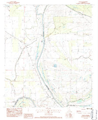
 1982 Acme1982 Print · USGSConcordia Parish in the early 1980s reveals a landscape defined by the winding Black River and its dense network of backwater brakes. Genealogists can trace family footprints through the Acme Ch and rural cemeteries like Trisler Cem, or locate long-standing river landings such as Williams Landing Strip.
 - 1982 Map of Mayna, 1983 Print
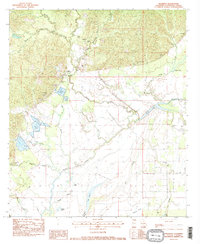
 1982 Mayna1983 Print · USGSThe Louisiana delta country comes alive in the early 1980s as the Black River winds past Mayna and Eva. Locate family landmarks like Pecandale Cem and Flowery Mound Cem, or trace the complex backwaters of Eagle Nest Lake and Buttonwood Slough.
 - 1982 Map of Lac Sainte Agnes, 1983 Print
 1982 Lac Sainte Agnes1983 Print · USGSThe alluvial wetlands of Avoyelles Parish are captured in the early 1980s, showcasing a landscape of winding bayous and cypress brakes. Genealogists and researchers can trace local landmarks such as St James Chapel, the settlement of Ophelia, and the family-named Cypriere a Oncle John.
 - 1983 Map of Jonesville North
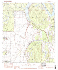
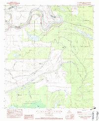
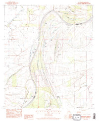
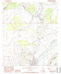
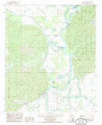
 1983 Jonesville North1983 Print · USGSThe confluence of three major rivers in Catahoula Parish is captured here in the early 1980s. Local researchers can map out family landmarks such as McFarlen Cem and Wallace Ridge Ch or trace the development of the Tew Lake Oil Field.
 - 1983 Map of Frogmore
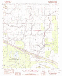
 1983 Frogmore1983 Print · USGSThe bottomlands of Concordia Parish come alive in the early eighties, showcasing a landscape of winding bayous and rural church communities. Genealogists and historians can locate family landmarks like St James Ch, Warren Cem, and the old settlement of Athlone.
 - 1983 Map of Marksville North
 1983 Marksville North1983 Print · USGSAvoyelles Parish during the early eighties shows a landscape defined by the winding Red River and the sprawling wetlands of the Spring Bayou Wildlife Area. Researchers can trace old family sites at Bordelon Cem or follow the water to Spring Bayou Landing.3 unique versions available
 - 1983 Map of Dunbarton, 1984 Print
 1983 Dunbarton1984 Print · USGSConcordia and Catahoula Parishes are revealed in the early 1980s as a landscape of river meanders and historic plantations. Researchers can trace family sites at Haphazard Plantation, visit Cypress Grove Cem, and locate the Frogmore Oil Field.
 - 1983 Map of Jonesville South, 1984 Print
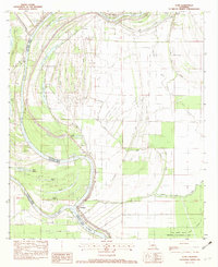
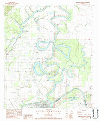
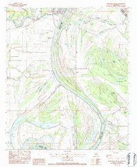 1983 Jonesville South1984 Print · USGSIn the early 1980s, the rural bayous of Catahoula Parish were shaped by the winding Black River and the timber-heavy landscape of the brakes. Researchers can trace rural lineages through family-named sites like Griffin Cem and St Peter Ch or locate the historic Louisiana Midland rail corridor.
 - 1983 Map of Walters, 1984 Print
 1983 Walters1984 Print · USGSCatahoula Parish settlements and delta bayous are captured here in the late seventies, showing the landscape just before the mid-eighties. Genealogists can locate family-named sites like Young Cem, Old Mt Olive Ch, and the community of Lavacca.
 - 1983 Map of Wisner, 1984 Print
 1983 Wisner1984 Print · USGSThe Louisiana delta near Wisner is captured here during the early 1980s, showing a landscape defined by the Missouri Pacific railroad and winding bayous. Researchers can trace rural congregations at New Alpha & Omega Ch or locate family sites near Peck and Metropolis.
 - 1983 Map of Oakley, 1984 Print
 1983 Oakley1984 Print · USGSThe alluvial plains of Franklin Parish in the early eighties reveal a landscape shaped by water and wood. Genealogists and local researchers can trace the old crossing at Kendrick Ferry Bridge and locate rural landmarks like Oak Bluff and the Pentecostal Ch.
 - 1983 Map of Monterey, 1984 Print
 1983 Monterey1984 Print · USGSThe community of Monterey and its surrounding bayous are captured here in the early 1980s, showcasing a landscape shaped by water and the oil industry. Researchers can trace family sites like Rice Cem or Luckett Cem and locate landmarks such as Monterey Sch and Plouden.
 - 1983 Map of Foules, 1984 Print
 1983 Foules1984 Print · USGSThe Tensas River basin in the early 1980s reveals a landscape defined by oxbow lakes and rural parish life. Researchers can locate family landmarks like Elder Shade Cem, New Light Ch, and the small settlement at Foules along the railroad.
 - 1983 Map of Manifest, 1984 Print
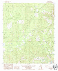
 1983 Manifest1984 Print · USGSCatahoula Parish in the early eighties shows a landscape of low-lying wetlands and rising timberland. Genealogists and local historians can trace family sites at Heard Cem and Huffman Cem, or locate landmarks like the Manifest Sch and the Old RR Grade.2 unique versions available
 - 1983 Map of Sicily Island, 1984 Print
 1983 Sicily Island1984 Print · USGSCatahoula Parish settlements and wetlands are captured in the early 1980s, showcasing the unique elevated terrain of Sicily Island. Genealogists can locate several family burial sites like Mason Cem and Peniston Cem alongside the community at Leland.
 - 1983 Map of Ferriday North, 1984 Print
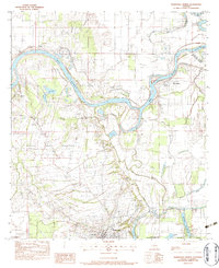
 1983 Ferriday North1984 Print · USGSThe delta country of Concordia Parish is captured here in the early 1980s as the river economy and rail lines shaped local life. Researchers can trace family history through sites like Hill Memorial Ch, Rogers Cem, and the neighborhoods of Ferriday.2 unique versions available
 - 1984 Map of Natchez
 1984 Natchez1984 Print · USGSThe Mississippi-Louisiana borderlands in the mid-eighties show a landscape defined by the winding Mississippi River and its rail networks. Trace family history at the Natchez National Cemetery or explore the river towns of Vidalia and Ferriday.
 - 1984 Map of Woodville
 1984 Woodville1984 Print · USGSThe Mississippi-Louisiana borderlands in the mid-eighties show a landscape defined by the shifting MISSISSIPPI RIVER and sprawling timberlands. Researchers can trace the ILLINOIS CENTRAL GULF railroad through Gloster or locate historic river points like Fort Adams and Point Breeze.
 - 1984 Map of Holum, 1985 Print
 1984 Holum1985 Print · USGSCaldwell and La Salle Parishes in the mid-1980s are defined by their dense network of creeks and bayous. Researchers can trace the settlement at Holum and locate small family landmarks like the Cem tucked away near Funny Louis Bayou and Chickasaw Creek.
 - 1984 Map of Aimwell, 1985 Print
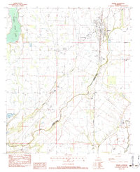
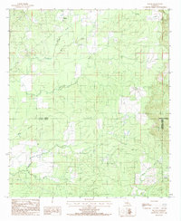
 1984 Aimwell1985 Print · USGSCatahoula Parish in the mid-1980s reveals a landscape of small upland settlements and winding creek valleys. Genealogists and local historians can trace family locations near Aimwell, Spring Ridge, and Sherwood, or locate several rural Cem sites across the Chalk Hills.
 - 1984 Map of Extension, 1985 Print
 1984 Extension1985 Print · USGSFranklin and Catahoula Parishes are captured here in the early eighties, centered on the settlement of Extension and the winding Boeuf River. Researchers can trace old parish boundaries and water-access points through landmarks like Turkey Creek Lake, Hickory Lake, and Rabbit Island.
 - 1984 Map of Harrisonburg, 1985 Print
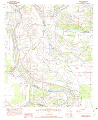
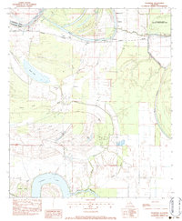
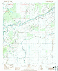
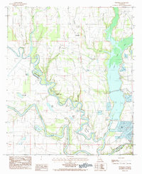
 1984 Harrisonburg1985 Print · USGSHarrisonburg and the surrounding Catahoula Parish wetlands are documented in the mid-1980s as the river-driven economy continued to shape the region. Genealogists and researchers can trace local waterways and landmarks like Gastis Lake, Stafford Lake, and the winding Ouachita River.
 - 1984 Map of Nickel, 1985 Print
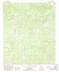
 1984 Nickel1985 Print · USGSLa Salle and Catahoula Parishes are captured in the mid-1980s, showcasing a landscape of timber-driven history and small rural crossroads. Researchers can trace the Old Railroad Grade and locate old settlements like Nickel, Aimwell, and Salem.
Showing maps 1-25 of 30
Top cities of Catahoula Parish
Frequently asked questions
- What are the different types of historical maps available for Catahoula Parish?
- What is the oldest map of Catahoula Parish?
- Where can I purchase historical maps of Catahoula Parish for my home or office?
- Where can I download high-res historical maps of Catahoula Parish?
- Are there historical topographic maps available for Catahoula Parish?
- Is there historical aerial imagery available for Catahoula Parish?
- Where are historical maps of Catahoula Parish sourced from?