1950s Maps of Catahoula Parish, Louisiana
Explore 10 historic maps of Catahoula Parish from the 1950s. These maps offer a rare glimpse into what life looked like during the 1950s — showing old roads, neighborhoods, homes, and landmarks that have changed or disappeared over time.
Whether you're researching your family's past, planning a metal detecting trip, or studying how Catahoula Parish's landscape evolved across the 1950s, these high-resolution maps are a powerful tool for exploring the history of this region.
- Focus on a specific era: All maps on this page are from the 1950s, giving you a focused view of this time period.
- See what’s changed: Compare century-old streets, trails, and buildings to today's modern landscape using overlays and satellite layers.
- Research with precision: Use these maps for genealogy, historical research, land use analysis, or educational projects.
- View, download, or print: Maps are fully viewable online in high resolution, and can be downloaded or printed for your own records.
Start exploring Catahoula Parish's history through authentic maps from the 1950s. This is your window into the past.
Catahoula Parish, LA maps
(10)- 1953 Map of Alexandria, 1963 Print
 1953 Alexandria1963 Print · USGSCentral Louisiana during the early fifties is mapped here at the intersection of the piney woods and the Red River valley. Genealogists and historians can trace the rail-and-river network connecting towns like Alexandria, Natchitoches, and the grounds of Camp Beauregard.3 unique versions available
 - 1953 Map of Natchez, 1966 Print
 1953 Natchez1966 Print · USGSSouthwest Mississippi and the Louisiana border country come alive in this mid-century survey of the river valley and forest lands. Researchers can trace the rail lines of the Illinois Central RR and locate rural hubs like Gloster and Ferriday.3 unique versions available
 - 1955 Map of Alexandria
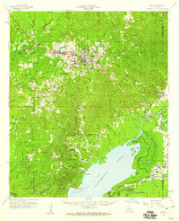
 1955 Alexandria1955 Print · USGSCentral Louisiana in the mid-fifties is a landscape of river-port cities, sprawling timberlands, and massive military reservations. Genealogists and historians can trace the rail networks of the Texas & Pacific RR and locate sites like Camp Polk Military Reservation and Natchitoches.
 - 1955 Map of Olla, 1956 Print
 1955 Olla1956 Print · USGSThe Missouri Pacific Railroad and Bayou Funny Louis defined central Louisiana life in the mid-1950s. Genealogists and local historians can trace family roots through numerous sites like Kelly Sch, Aimwell Ch, and the Davis Cem.3 unique versions available
 - 1956 Map of Natchez
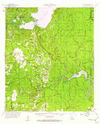
 1956 Natchez1956 Print · USGSThe Mississippi River borderlands and the Pine Hills come alive in this mid-fifties study of the Natchez region. Genealogists and historians can trace rail-era towns along the Illinois Central RR and explore the oxbows of Lake Bruin and Lake Concordia.
 - 1957 Map of Sicily Island
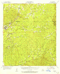
 1957 Sicily Island1957 Print · USGSCatahoula Parish and the surrounding lowlands are captured in the late 1950s, showing a landscape shaped by the Tensas River and its many bayous. Genealogists can trace family roots at New Zion Ch & Cem 37, Loam Land Sch & Cem, or the old Lee Bayou School House.2 unique versions available
 - 1958 Map of Jena, 1959 Print
 1958 Jena1959 Print · USGSLaSalle Parish timber and oil operations are in full swing during the late fifties, centered on the junction of the Louisiana and Arkansas Railway and the town of Jena. Researchers can trace family ties at the Nebo Sch, Searcy Cem, and the worker housing at Webb Quarters.2 unique versions available
 - 1959 Map of Natchez
 1959 Natchez1959 Print · USGSSouthwestern Mississippi and eastern Louisiana are captured in the late fifties, showing a landscape defined by the winding Mississippi River and the timbered Homochitto National Forest. Researchers can trace the sprawling Illinois Central RR and find rural landmarks like Union Church and Camp Van Dorn (Abandoned).
 - 1959 Map of Buckeye, 1960 Print
 1959 Buckeye1960 Print · USGSLouisiana parish lines converge in this late-fifties landscape of complex bayous and oil fields. Researchers can trace rural family roots through numerous local landmarks like Marthas Chapel, Guillory Cem, and the old settlement of Buckeye.2 unique versions available
 - 1959 Map of Harrisonburg, 1960 Print
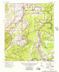
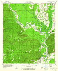 1959 Harrisonburg1960 Print · USGSThe Ouachita River valley comes to life in this late 1950s portrait of Catahoula Parish, showing a landscape of deep bayous and steep hills. Researchers can locate ancestral sites like Old Spring Ridge Cem, the community of Enterprise, and ancient Indian Mounds along the river bluffs.3 unique versions available
End of results
Showing maps 1-10 of 10
Top cities of Catahoula Parish
Frequently asked questions
- What are the different types of historical maps available for Catahoula Parish?
- What is the oldest map of Catahoula Parish?
- Where can I purchase historical maps of Catahoula Parish for my home or office?
- Where can I download high-res historical maps of Catahoula Parish?
- Are there historical topographic maps available for Catahoula Parish?
- Is there historical aerial imagery available for Catahoula Parish?
- Where are historical maps of Catahoula Parish sourced from?