1950s Maps of Tangipahoa Parish, Louisiana
Explore 16 historic maps of Tangipahoa Parish from the 1950s. These maps offer a rare glimpse into what life looked like during the 1950s — showing old roads, neighborhoods, homes, and landmarks that have changed or disappeared over time.
Whether you're researching your family's past, planning a metal detecting trip, or studying how Tangipahoa Parish's landscape evolved across the 1950s, these high-resolution maps are a powerful tool for exploring the history of this region.
- Focus on a specific era: All maps on this page are from the 1950s, giving you a focused view of this time period.
- See what’s changed: Compare century-old streets, trails, and buildings to today's modern landscape using overlays and satellite layers.
- Research with precision: Use these maps for genealogy, historical research, land use analysis, or educational projects.
- View, download, or print: Maps are fully viewable online in high resolution, and can be downloaded or printed for your own records.
Start exploring Tangipahoa Parish's history through authentic maps from the 1950s. This is your window into the past.
Tangipahoa Parish, LA maps
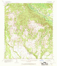
(16)- 1950 Map of Kentwood
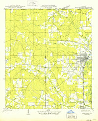 1950 Kentwood1950 Print · USGSCovers Tangipahoa Parish, including Kentwood, Tangipahoa, and other nearby areas
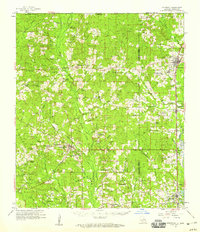
 - 1950 Map of Folsom
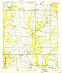 1950 Folsom1950 Print · USGSCovers Tangipahoa Parish, including Folsom, St. Tammany Parish, and other nearby areas
 - 1950 Map of Covington, 1965 Print
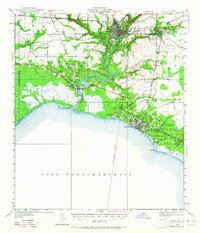 1950 Covington1965 Print · USGSCovers Tangipahoa Parish, including Mandeville, Covington, and other nearby areas
 - 1951 Map of Ponchatoula, 1953 Print
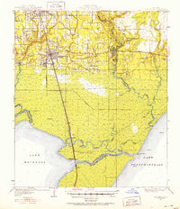 1951 Ponchatoula1953 Print · USGSCovers Tangipahoa Parish, including Hammond, Ponchatoula, and other nearby areas3 unique versions available
 - 1953 Map of Spanish Fort, 1954 Print
 1953 Spanish Fort1954 Print · USGSCovers Tangipahoa Parish, including New Orleans, Kenner, and other nearby areas
 - 1953 Map of Natchez, 1966 Print
 1953 Natchez1966 Print · USGSCovers Tangipahoa Parish, including Natchez, McComb, and other nearby areas3 unique versions available
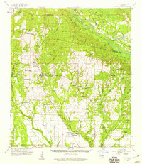
 - 1954 Map of Folsom, 1958 Print
 1954 Folsom1958 Print · USGSCovers Tangipahoa Parish, including Covington, Folsom, and other nearby areas
 - 1954 Map of Baton Rouge, 1974 Print
 1954 Baton Rouge1974 Print · USGSCovers Tangipahoa Parish, including New Orleans, Baton Rouge, and other nearby areas2 unique versions available
 - 1956 Map of Natchez
 1956 Natchez1956 Print · USGSCovers Tangipahoa Parish, including Natchez, McComb, and other nearby areas
 - 1956 Map of Baton Rouge
 1956 Baton Rouge1956 Print · USGSCovers Tangipahoa Parish, including New Orleans, Baton Rouge, and other nearby areas
 - 1958 Map of Kentwood, 1959 Print
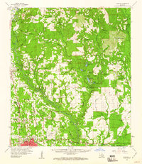
 1958 Kentwood1959 Print · USGSCovers Tangipahoa Parish, including Kentwood, Roseland, and other nearby areas2 unique versions available
 - 1958 Map of Mount Hermon, 1959 Print
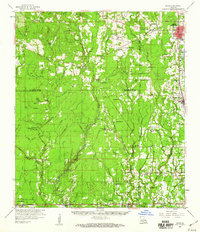
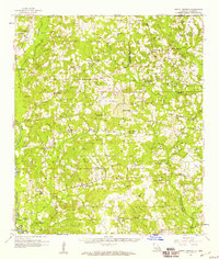 1958 Mount Hermon1959 Print · USGSCovers Tangipahoa Parish, including Kentwood, Roseland, and other nearby areas3 unique versions available
 - 1958 Map of Folsom, 1959 Print
 1958 Folsom1959 Print · USGSCovers Tangipahoa Parish, including Covington, Folsom, and other nearby areas2 unique versions available
 - 1959 Map of Natchez
 1959 Natchez1959 Print · USGSCovers Tangipahoa Parish, including Natchez, McComb, and other nearby areas
 - 1959 Map of Hammond, 1960 Print
 1959 Hammond1960 Print · USGSCovers Tangipahoa Parish, including Hammond, Independence, and other nearby areas2 unique versions available
 - 1959 Map of Amite, 1960 Print
 1959 Amite1960 Print · USGSCovers Tangipahoa Parish, including Hammond, Independence, and other nearby areas3 unique versions available
End of results
Showing maps 1-16 of 16
Top cities of Tangipahoa Parish
- Hammond historical maps
- Ponchatoula historical maps
- Kentwood historical maps
- Independence historical maps
- Roseland historical maps
- Tangipahoa historical maps
See more
Frequently asked questions
- What are the different types of historical maps available for Tangipahoa Parish?
- What is the oldest map of Tangipahoa Parish?
- Where can I purchase historical maps of Tangipahoa Parish for my home or office?
- Where can I download high-res historical maps of Tangipahoa Parish?
- Are there historical topographic maps available for Tangipahoa Parish?
- Is there historical aerial imagery available for Tangipahoa Parish?
- Where are historical maps of Tangipahoa Parish sourced from?