1970s Maps of Presque Isle, Maine
Explore 6 historic maps of Presque Isle from the 1970s. These maps offer a rare glimpse into what life looked like during the 1970s — showing old roads, neighborhoods, homes, and landmarks that have changed or disappeared over time.
Whether you're researching your family's past, planning a metal detecting trip, or studying how Presque Isle's landscape evolved across the 1970s, these high-resolution maps are a powerful tool for exploring the history of this region.
- Focus on a specific era: All maps on this page are from the 1970s, giving you a focused view of this time period.
- See what’s changed: Compare century-old streets, trails, and buildings to today's modern landscape using overlays and satellite layers.
- Research with precision: Use these maps for genealogy, historical research, land use analysis, or educational projects.
- View, download, or print: Maps are fully viewable online in high resolution, and can be downloaded or printed for your own records.
Start exploring Presque Isle's history through authentic maps from the 1970s. This is your window into the past.
Presque Isle, ME maps
(6)- 1975 Map of Caribou SE, 1981 Print
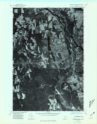
 1975 Caribou SE1981 Print · USGSAroostook County agriculture is captured in high detail during the mid-seventies, showing the sprawling farm fields surrounding the city of Caribou. Researchers can trace old property lines and rural crossroads like Crouseville, Jacobs, and Adaline.
 - 1975 Map of Mars Hill NW, 1981 Print
 1975 Mars Hill NW1981 Print · USGSAroostook County's border with Canada is captured here in the mid-1970s, showcasing a landscape of sprawling potato fields and timber. Trace the rural development of Easton and Parkhurst alongside the waters of Prestile Stream.2 unique versions available
 - 1975 Map of Presque Isle NE, 1981 Print
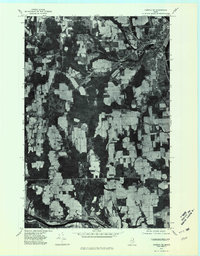
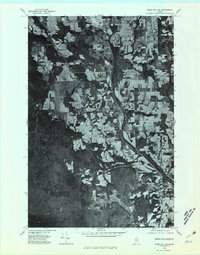
 1975 Presque Isle NE1981 Print · USGSThe northern Maine landscape around the mid-1970s is revealed through this high-resolution orthophotomap of the Presque Isle area. Trace the development of the river valley near Spragueville and the agricultural fields surrounding Echo Lake.
 - 1975 Map of Fort Fairfield SW, 1981 Print
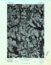
 1975 Fort Fairfield SW1981 Print · USGSAroostook County's legendary farm country is revealed in this mid-seventies aerial survey of the river valleys east of Caribou. Genealogists and historians can trace the homesteads and crossroads of Grimes Mill, East Lyndon, and Goodwin.
 - 1975 Map of Mars Hill SW, 1981 Print
 1975 Mars Hill SW1981 Print · USGSThe Aroostook County countryside near Westfield is shown here in the mid-seventies through detailed aerial photography. Researchers can trace land boundaries, forest edges, and water bodies like Prestile Stream and Bennett Lake.
 - 1975 Map of Presque Isle SE, 1981 Print
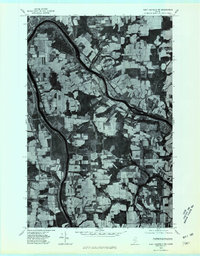
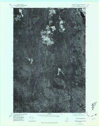 1975 Presque Isle SE1981 Print · USGSNorthern Maine forest and farmland emerge in this mid-seventies aerial study of the Aroostook landscape. Researchers can trace the winding course of Presque Isle Stream and identify early land clearings near Quaggy Joe and Echo Lake.
End of results
Showing maps 1-6 of 6
Top cities near Presque Isle
- Caribou historical maps
- Fort Fairfield historical maps
- Mapleton historical maps
- Washburn historical maps
- Limestone historical maps
- Mars Hill historical maps
See more
Top neighborhoods of Presque Isle
- Sawyer Corner historical maps
- Parkhurst historical maps
- Washburn Junction historical maps
- Rands historical maps
- Campbell historical maps
- Spragueville historical maps
See more
Frequently asked questions
- What are the different types of historical maps available for Presque Isle?
- What is the oldest map of Presque Isle?
- Where can I purchase historical maps of Presque Isle for my home or office?
- Where can I download high-res historical maps of Presque Isle?
- Are there historical topographic maps available for Presque Isle?
- Is there historical aerial imagery available for Presque Isle?
- Where are historical maps of Presque Isle sourced from?