Old Maps of Presque Isle, Maine for Genealogy
Trace your family roots with 60 historic maps of Presque Isle. These high-res maps reveal old neighborhoods, homesites, landmarks, and streets — helping you uncover where your ancestors lived and how the area evolved over time.
- Explore historic neighborhoods: Identify where your relatives may have lived in the 1800s or 1900s.
- Compare maps over time: Trace the changes in streets, buildings, and landmarks for multi-generational research.
- Perfect for genealogy & ancestry research: Used by family historians and researchers to map out lineage and migration.
These maps are an incredible resource for exploring your personal connection to Presque Isle's past.
Presque Isle, ME maps
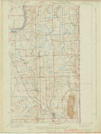
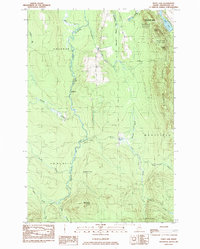
(60)- 1929 Map of Caribou
 1929 Caribou1929 Print · USGSAroostook County's potato and timber country is shown here in the late twenties, centered on the growing hubs of Caribou and Washburn. Researchers can trace family roots through dozens of local schoolhouses and the New Sweden Station and Post Office.
 - 1930 Map of Fort Fairfield
 1930 Fort Fairfield1930 Print · USGSThe international border of Aroostook County comes into focus in the 1930s, showing a landscape of rail-driven agriculture and rural school districts. Genealogists and historians can trace family-named landmarks like Cote Corner, Noyes Mill, and the Riverside Cemetery.
 - 1932 Map of Caribou
 1932 Caribou1932 Print · USGSAroostook County's river valleys and rail corridors are shown here just before the mid-century, mapping a landscape of tight-knit townships and rural schoolhouses. Genealogists can trace family roots through labels like New Sweden Sta and PO, Barnum Ch, and the Hammond Sch.2 unique versions available
 - 1933 Map of Fort Fairfield
 1933 Fort Fairfield1933 Print · USGSAroostook County was a thriving hub of rail and river commerce in the early thirties. Genealogists can trace family names across dozens of rural schoolhouses and landmarks like Grimes Mill, Findlen Sch, and Riverside Cem.3 unique versions available
 - 1935 Map of Presque Isle
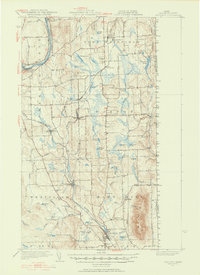
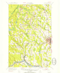
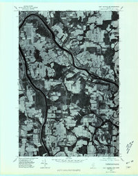
 1935 Presque Isle1935 Print · USGSAroostook County agriculture and industry are at their peak in the 1930s, centered on the river-and-rail hub of Presque Isle. Genealogists and historians can trace dozens of rural schoolhouses like Richardson Sch and find landmarks such as the Landing Field and the State Experimental Farm.3 unique versions available
 - 1936 Map of Mars Hill
 1936 Mars Hill1936 Print · USGSIn the mid-1930s, the rural landscapes of Easton and Blaine were defined by the Bangor and Aroostook RR and a dense network of country schools. Genealogists can trace family landmarks like Pine Tree Cem, Ross Sch, and Morison Mill along the international border.
 - 1940 Map of Mars Hill
 1940 Mars Hill1940 Print · USGSAroostook County was a hub of rail and river commerce in the late 1930s, defined by its connection to the Canadian border. You can trace early schoolhouse locations like Maple Grove Sch and the industrial roots of Monson Mill and Easton Station.3 unique versions available
 - 1951 Map of Mars Hill
 1951 Mars Hill1951 Print · USGSAroostook County's borderlands and rail corridors are preserved here in the mid-century, before modernization reshaped the potato-growing heartland. Genealogists and historians can trace family roots through sites like Kings Grove Cem, East Ridge Ch, and the many stops along the BANGOR AND AROOSTOOK railroad.3 unique versions available
 - 1951 Map of Fort Fairfield, 1952 Print
 1951 Fort Fairfield1952 Print · USGSAroostook County's borderlands come alive in this mid-century survey, showing the busy rail-and-river network connecting Maine to New Brunswick. Genealogists and historians can trace family-named corners and rural schoolhouses such as Kelly Sch, Grimes Mill, and the State Fish Hatchery.5 unique versions available
 - 1953 Map of Presque Isle, 1955 Print
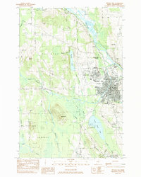
 1953 Presque Isle1955 Print · USGSCentral Aroostook County is seen here during the mid-century expansion of Presque Isle, featuring a landscape shaped by rail and river. Researchers can trace the early Presque Isle Air Force Base, old schoolhouses like Hillside Sch, and landmarks including Hedgehog Mountain.5 unique versions available
 - 1953 Map of Caribou, 1956 Print
 1953 Caribou1956 Print · USGSAroostook County's agricultural and rail heartland is captured here in the early fifties, showing the region's transition from timber to a modernizing economy. Genealogists can locate family sites like Donnelly Bk Sch, Snowman Sch, and Jemtland Cem among the many townships.3 unique versions available
 - 1954 Map of Presque Isle, 1968 Print
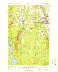
 1954 Presque Isle1968 Print · USGSNorth Woods logging and rail history come alive in this mid-century survey of the Maine-Quebec borderlands. Genealogists and historians can trace the Bangor and Aroostook railroad through timber hubs like Ashland, Smyrna Mills, and Presque Isle.2 unique versions available
 - 1958 Map of Presque Isle
 1958 Presque Isle1958 Print · USGSThe Aroostook timber and potato country is captured here during the late fifties, showing the vital rail-to-river network of Northern Maine. Genealogists and historians can trace the Bangor & Aroostook RR through Mapleton and Ashland, or locate remote sites like Chamberlain Farm and Seven Islands.
 - 1959 Map of Woodstock, 1975 Print
 1959 Woodstock1975 Print · USGSNorthern Maine and New Brunswick meet along the river valleys in the late fifties, showcasing an era of international rail and river commerce. Genealogists can trace family roots through border towns like Woodstock and Houlton, or along the lines of the Bangor & Aroostook railroad.
 - 1960 Map of Presque Isle
 1960 Presque Isle1960 Print · USGSNorthern Maine during the mid-century was a land of timber, rails, and strategic airfields. Genealogists and historians can trace the growth of Presque Isle and Ashland or explore the remote northern reaches of Baxter State Park and Presque Isle AFB.3 unique versions available
 - 1963 Map of Woodstock
 1963 Woodstock1963 Print · USGSThe Maine-New Brunswick borderlands come alive in the early sixties, showing the vital river-and-rail connection between Houlton and Woodstock. Genealogists and historians can trace the paths of the Canadian Pacific RR and locate rural communities like Stickney and Upper Kent.
 - 1975 Map of Caribou SE, 1981 Print
 1975 Caribou SE1981 Print · USGSAroostook County agriculture is captured in high detail during the mid-seventies, showing the sprawling farm fields surrounding the city of Caribou. Researchers can trace old property lines and rural crossroads like Crouseville, Jacobs, and Adaline.
 - 1975 Map of Mars Hill NW, 1981 Print
 1975 Mars Hill NW1981 Print · USGSAroostook County's border with Canada is captured here in the mid-1970s, showcasing a landscape of sprawling potato fields and timber. Trace the rural development of Easton and Parkhurst alongside the waters of Prestile Stream.2 unique versions available
 - 1975 Map of Presque Isle NE, 1981 Print
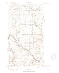
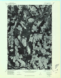
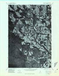
 1975 Presque Isle NE1981 Print · USGSThe northern Maine landscape around the mid-1970s is revealed through this high-resolution orthophotomap of the Presque Isle area. Trace the development of the river valley near Spragueville and the agricultural fields surrounding Echo Lake.
 - 1975 Map of Fort Fairfield SW, 1981 Print
 1975 Fort Fairfield SW1981 Print · USGSAroostook County's legendary farm country is revealed in this mid-seventies aerial survey of the river valleys east of Caribou. Genealogists and historians can trace the homesteads and crossroads of Grimes Mill, East Lyndon, and Goodwin.
 - 1975 Map of Mars Hill SW, 1981 Print
 1975 Mars Hill SW1981 Print · USGSThe Aroostook County countryside near Westfield is shown here in the mid-seventies through detailed aerial photography. Researchers can trace land boundaries, forest edges, and water bodies like Prestile Stream and Bennett Lake.
 - 1975 Map of Presque Isle SE, 1981 Print
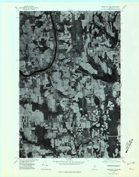
 1975 Presque Isle SE1981 Print · USGSNorthern Maine forest and farmland emerge in this mid-seventies aerial study of the Aroostook landscape. Researchers can trace the winding course of Presque Isle Stream and identify early land clearings near Quaggy Joe and Echo Lake.
 - 1984 Map of Easton
 1984 Easton1984 Print · USGSAroostook County's rail and river economy is on full display in the early eighties as the Bangor and Aroostook lines connect rural hubs. Trace the layout of settlements like Easton Station, Parkhurst, and Phair alongside landmarks like Gould Memorial Hospital.
 - 1984 Map of Echo Lake
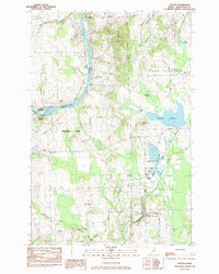
 1984 Echo Lake1984 Print · USGSThe Aroostook County highlands come into sharp focus in the mid-1980s, centered on the rugged peaks of the state's first park. Researchers can trace land divisions across Westfield and Chapman, or locate remote spots like Deadmans Corner and Echo Lake.
 - 1984 Map of Presque Isle
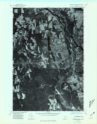
 1984 Presque Isle1984 Print · USGSPresque Isle and the Aroostook River valley are captured here in the early 1980s, showcasing the region's agricultural and academic heart. Researchers can trace historic sites like St Marys Cemetery and the Northern Maine Fairgrounds alongside the BANGOR AND AROOSTOOK rail lines.
Showing maps 1-25 of 60
Top cities near Presque Isle
- Caribou historical maps
- Fort Fairfield historical maps
- Mapleton historical maps
- Washburn historical maps
- Limestone historical maps
- Mars Hill historical maps
See more
Top neighborhoods of Presque Isle
- Sawyer Corner historical maps
- Parkhurst historical maps
- Washburn Junction historical maps
- Rands historical maps
- Campbell historical maps
- Spragueville historical maps
See more
Frequently asked questions
- What are the different types of historical maps available for Presque Isle?
- What is the oldest map of Presque Isle?
- Where can I purchase historical maps of Presque Isle for my home or office?
- Where can I download high-res historical maps of Presque Isle?
- Are there historical topographic maps available for Presque Isle?
- Is there historical aerial imagery available for Presque Isle?
- Where are historical maps of Presque Isle sourced from?