Old Maps of T15 R5 WELS, Maine for Academic Research
Study the evolution of T15 R5 WELS with 40 high-resolution historic maps. Whether you're teaching, researching, or modeling changes in land use, these maps provide essential visual documentation of urban, environmental, and geographic change.
- Analyze long-term change: Track patterns in development, transportation, and natural features.
- Ideal for environmental or urban studies: Support academic projects with primary historical map data.
- Use in the classroom or lab: Educators and researchers rely on these maps to bring historical context to life.
These maps are a powerful tool for teaching, research, and visualizing how T15 R5 WELS has changed over the decades.
T15 R5 WELS, ME maps
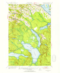
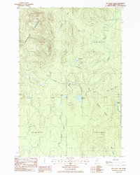
(40)- 1927 Map of Square Lake
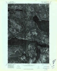
 1927 Square Lake1927 Print · USGSAroostook County's deep woods and connected waterways are captured here in the late 1920s, showing a landscape of timber camps and small school districts. You can trace the rural network of numbered schoolhouses and shoreline landmarks like Larriveau Mill, Red Point City, and Guerette Sch.
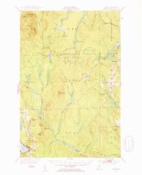
 - 1929 Map of Portage
 1929 Portage1929 Print · USGSNorthern Maine timber country comes to life in the late 1920s as logging camps and rail lines penetrate the deep woods. Genealogists and historians can trace the early industrial landscape through the Old Shingle Mill, Holts Sch, and numerous family-named camps like McDugal Camp.3 unique versions available
 - 1931 Map of Square Lake
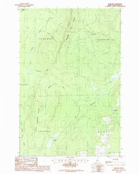
 1931 Square Lake1931 Print · USGSAroostook County's lake country in the early 1930s shows a landscape of timber camps and small rural settlements. Genealogists and historians can trace schools like Guerrette Sch and Thomas Sch or locate family-named landmarks like Ouellette and Yerxa Camp.4 unique versions available
 - 1931 Map of Portage
 1931 Portage1931 Print · USGSAroostook County's deep woods and logging heritage are preserved here as they appeared between the wars, from the shores of Portage Lake to the remote camps of Westmanland. Researchers can trace the early rail network of the Bangor and Aroostook or locate industrial sites like the Old Shingle Mill.3 unique versions available
 - 1953 Map of Square Lake, 1955 Print
 1953 Square Lake1955 Print · USGSUpper Aroostook County’s vast lake chain is captured in the early fifties, showing the remote townships and lakeside camps of the Maine North Woods. Researchers can trace Acadian family footprints at St Agatha, Daigle, and St Eutropus Cem.4 unique versions available
 - 1953 Map of Portage, 1955 Print
 1953 Portage1955 Print · USGSThe northern Maine timberlands around Portage are shown in the mid-fifties just as modern logging began to shift the landscape. Trace old family camps like Hoit Camp, the industrial site of the Old Shingle Mill, and the Bangor and Aroostook rail line.4 unique versions available
 - 1954 Map of Presque Isle, 1968 Print
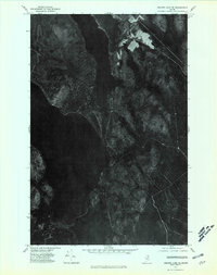
 1954 Presque Isle1968 Print · USGSNorth Woods logging and rail history come alive in this mid-century survey of the Maine-Quebec borderlands. Genealogists and historians can trace the Bangor and Aroostook railroad through timber hubs like Ashland, Smyrna Mills, and Presque Isle.2 unique versions available
 - 1958 Map of Presque Isle
 1958 Presque Isle1958 Print · USGSThe Aroostook timber and potato country is captured here during the late fifties, showing the vital rail-to-river network of Northern Maine. Genealogists and historians can trace the Bangor & Aroostook RR through Mapleton and Ashland, or locate remote sites like Chamberlain Farm and Seven Islands.
 - 1960 Map of Presque Isle
 1960 Presque Isle1960 Print · USGSNorthern Maine during the mid-century was a land of timber, rails, and strategic airfields. Genealogists and historians can trace the growth of Presque Isle and Ashland or explore the remote northern reaches of Baxter State Park and Presque Isle AFB.3 unique versions available
 - 1962 Map of Edmundston, 1966 Print
 1962 Edmundston1966 Print · USGSThe international borderlands of northern Maine and Canada come alive here during the early sixties, centered on the river-and-rail economies of the day. Genealogists and historians can trace the paths of the Bangor and Aroostook railroad through river towns like Fort Kent and St Agatha.2 unique versions available
 - 1975 Map of Portage NW, 1981 Print
 1975 Portage NW1981 Print · USGSAroostook County's deep timberlands are captured from above in the mid-1970s, revealing the intricate network of forest roads and waterways. Researchers can trace the shoreline of Mcclusky Lake and the winding path of Beaver Brook through the dense Maine woods.
 - 1975 Map of Portage NE, 1981 Print
 1975 Portage NE1981 Print · USGSNorthern Maine's timberlands are seen in detail during the mid-seventies, documenting the isolated settlement patterns of the deep woods. Researchers can trace forest roads and the small community at Hanford.
 - 1975 Map of Square Lake SW, 1981 Print
 1975 Square Lake SW1981 Print · USGSAroostook County timberlands are captured in detail during the mid-seventies, showing the intersection of industrial forestry and the great lakes of northern Maine. Researchers can trace the wooded shores of Square Lake and Eagle Lake or locate the remote California Pond.
 - 1975 Map of Square Lake SE, 1981 Print
 1975 Square Lake SE1981 Print · USGSAroostook County's deep woods and waterways are captured in this mid-1970s orthophotograph, showing the area at a moment of quiet rural isolation. Researchers can trace the forested shorelines of Square Lake and locate early clearings near Cross Lake and Carry Pond.
 - 1986 Map of Square Lake West
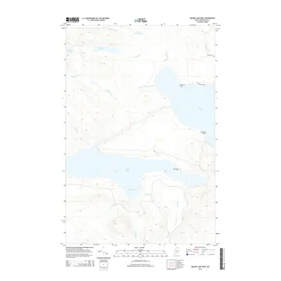
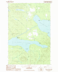 1986 Square Lake West1986 Print · USGSNorthern Maine's lake country is captured here in the mid-1980s, centered on the strategic connection between two major water bodies. Researchers can trace portage routes at The Carry or locate seasonal sites like Michaud Camp and Burnt Landing.
 - 1986 Map of Square Lake East
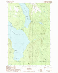 1986 Square Lake East1986 Print · USGSAroostook County's northern lakes are captured here in the mid-1980s, showing the wild connection between two major basins. Map collectors and genealogists can trace the remote shores of Square Lake, locating seasonal landmarks like Fraser Camp and the historic portage route known as The Carry.
 - 1986 Map of Mc Clusky Lake
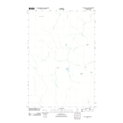
 1986 Mc Clusky Lake1986 Print · USGSAroostook County's remote timberlands are captured here in the mid-1980s, revealing a landscape of high ridges and glacial water. Researchers can trace land features like Goddard Ridge, the heights of Pennington Mountain, and local waters like Joe Dubay Brook.
 - 1986 Map of Hanford
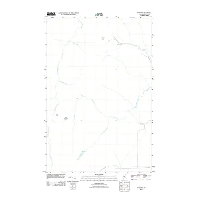
 1986 Hanford1986 Print · USGSNorthern Aroostook County during the mid-1980s reveals a landscape of high timber ridges and winding waterways at the edge of the deep woods. Trace the local topography through Square Lake Ridge, the settlement at Hanford, and family-named features like Joe Dubay Bk.
 - 1994 Map of Presque Isle
 1994 Presque Isle1994 Print · USGSAroostook County in the mid-nineties shows a landscape defined by timber, rail, and river-valley farming. Genealogists and historians can trace the Bangor & Aroostook RR through small stations and settlements like Winterville Sta, Buffalo, and Sheridan.
 - 1994 Map of Madawaska
 1994 Madawaska1994 Print · USGSThe St John Valley in the 1990s remained a unique cultural crossroads of Maine and New Brunswick, centered on the river and the rails. Genealogists and historians can trace family-named settlements like Violette Settlement or explore the shores of Eagle Lake and Long Lake.
 - 2011 Map of Square Lake East, 2011 Print
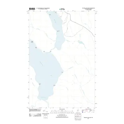 2011 Square Lake East2011 Print · USGSCovers T15 R5 WELS, including Square Lake, Westmanland, and other nearby areas
 - 2011 Map of Square Lake West, 2011 Print
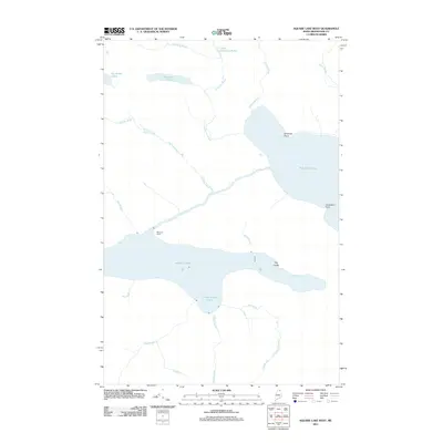 2011 Square Lake West2011 Print · USGSCovers T15 R5 WELS, including Square Lake, New Canada, and other nearby areas
 - 2011 Map of McClusky Lake, 2011 Print
 2011 McClusky Lake2011 Print · USGSCovers T15 R5 WELS, including T15 R6 WELS, T14 R5 WELS, and other nearby areas
 - 2011 Map of Hanford, 2011 Print
 2011 Hanford2011 Print · USGSCovers T15 R5 WELS, including Perham, Westmanland, and other nearby areas
 - 2014 Map of Square Lake West, 2014 Print
 2014 Square Lake West2014 Print · USGSCovers T15 R5 WELS, including Square Lake, New Canada, and other nearby areas
Showing maps 1-25 of 40
Top cities near T15 R5 WELS
- Mapleton historical maps
- Washburn historical maps
- Woodland historical maps
- Eagle Lake historical maps
- New Sweden historical maps
- Square Lake historical maps
See more
Frequently asked questions
- What are the different types of historical maps available for T15 R5 WELS?
- What is the oldest map of T15 R5 WELS?
- Where can I purchase historical maps of T15 R5 WELS for my home or office?
- Where can I download high-res historical maps of T15 R5 WELS?
- Are there historical topographic maps available for T15 R5 WELS?
- Is there historical aerial imagery available for T15 R5 WELS?
- Where are historical maps of T15 R5 WELS sourced from?