1940s Maps of Oxford County, Maine
Explore 22 historic maps of Oxford County from the 1940s. These maps offer a rare glimpse into what life looked like during the 1940s — showing old roads, neighborhoods, homes, and landmarks that have changed or disappeared over time.
Whether you're researching your family's past, planning a metal detecting trip, or studying how Oxford County's landscape evolved across the 1940s, these high-resolution maps are a powerful tool for exploring the history of this region.
- Focus on a specific era: All maps on this page are from the 1940s, giving you a focused view of this time period.
- See what’s changed: Compare century-old streets, trails, and buildings to today's modern landscape using overlays and satellite layers.
- Research with precision: Use these maps for genealogy, historical research, land use analysis, or educational projects.
- View, download, or print: Maps are fully viewable online in high resolution, and can be downloaded or printed for your own records.
Start exploring Oxford County's history through authentic maps from the 1940s. This is your window into the past.
Oxford County, ME maps
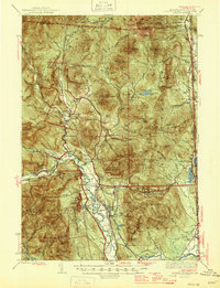
(22)- 1940 Map of Poland, 1942 Print
 1940 Poland1942 Print · USGSMaine's river valleys and rail junctions come to life in the 1940s as the region's industrial and rural networks are captured in detail. Genealogists can trace family landmarks like Hebron Sta P O, the Sanitarium, and the busy hub at Mechanic Falls.
 - 1940 Map of Oquossoc, 1955 Print
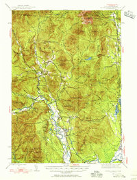
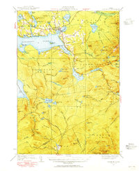
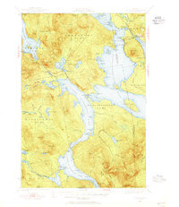 1940 Oquossoc1955 Print · USGSOxford County at the dawn of the 1940s remained a landscape of timber and water, centered on the historic settlements of the Rangeley Lakes. Genealogists and researchers can trace early lakefront communities and the vital water-control sites at Upper Dam, Aziscohos Dam, and Oquossoc.4 unique versions available
 - 1940 Map of Bethel, 1958 Print
 1940 Bethel1958 Print · USGSOxford County at the dawn of the 1940s reveals a landscape of river-valley farming and mountain timberlands. Genealogists and local historians can locate early district schools like Sunday River Sch, the Town House in Albany, and mountain notches like Tyler Notch.2 unique versions available
 - 1941 Map of Bethel
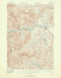
 1941 Bethel1941 Print · USGSOxford County was a landscape of mountain ridges and narrow river valleys just before the mid-century, centered on the Androscoggin River. Genealogists can trace family names and rural landmarks like the Bethel Cem, Mason School, and the village at Town House.
 - 1941 Map of Livermore
 1941 Livermore1941 Print · USGSAndroscoggin County at the start of the 1940s is a landscape defined by the river and rail economy between Livermore Falls and Wayne. Genealogists can trace family footprints across numerous rural districts, locating Brettuns Mills and the many schoolhouses like Young Sch and Pike Sch.
 - 1941 Map of Fryeburg
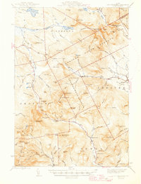
 1941 Fryeburg1941 Print · USGSOxford County and the Maine-New Hampshire borderlands are captured here just before the war, showcasing a landscape of isolated hills and interconnected lakes. Genealogists can locate family-named landmarks like Mc Daniels Hill and numerous rural schools including Plummer Sch and Black Mountain Sch.
 - 1942 Map of Buckfield
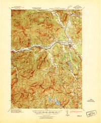
 1942 Buckfield1942 Print · USGSOxford County and the upper Androscoggin valley are shown in detail during the early 1940s as the railroad still anchored the local economy. Genealogists and researchers can trace dozens of rural schoolhouses and family landmarks like Mt Oxford Spring, Brettuns Mills, and the Maine Central rail line.
 - 1942 Map of Bryant Pond
 1942 Bryant Pond1942 Print · USGSOxford County at the dawn of the 1940s shows a landscape of mountain ridges and busy valley railroads. Genealogists can locate family-named landmarks like Walkers Mill and Trap Corner or trace rural education at the Millettville Sch and Patch Mountain Sch.
 - 1942 Map of Poland
 1942 Poland1942 Print · USGSSouth-central Maine is captured here in the early 1940s, showing a landscape of rail-linked mill towns and hilltop farms. Genealogists can trace family names at Hebron Sta P O, Danville Corner, and the Empire Grove Campground.
 - 1942 Map of Gorham
 1942 Gorham1942 Print · USGSIn the early 1940s, the high peaks of the New Hampshire border region were already a hub for hikers and rail travel. Trace the historical routes of the Appalachian Trail and find landmarks like the Mascot Mine, the Glen House, and the Grand Trunk railroad.3 unique versions available
 - 1942 Map of Oquossoc
 1942 Oquossoc1942 Print · USGSMaine's western lakes and timberlands are captured here in the early 1940s, showing a landscape defined by water and woods. You can trace the Appalachian Trail through the high country or locate remote sporting sites like the Oquossoc Angling Assn and Middle Dam.3 unique versions available
 - 1942 Map of North Conway, 1956 Print
 1942 North Conway1956 Print · USGSThe Saco River valley at the onset of the 1940s shows a landscape balancing timber heritage with growing mountain tourism. Researchers can trace historic rail lines like the Maine Central RR, locate the Eastman Sch, or find early wilderness outposts like the Black Mtn Cabin.4 unique versions available
 - 1942 Map of Sebago Lake, 1959 Print
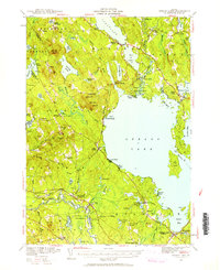 1942 Sebago Lake1959 Print · USGSCumberland County’s lakes and ridges were well-established as a summer destination in the early 1940s, centered around the expanse of Sebago Lake. Researchers can trace old rail routes at East Baldwin Mattocks Sta, find the historic Potter Academy, or locate family sites near South Naples.3 unique versions available
 - 1943 Map of Sebago Lake
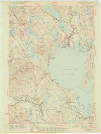 1943 Sebago Lake1943 Print · USGSMaine's lake country thrived during the early 1940s as a hub of rail commerce and early recreation. You can trace the Maine Central Railroad through Steep Falls or find local landmarks like Potter Academy and Songo Lock.3 unique versions available
 - 1943 Map of Old Speck Mtn, 1959 Print
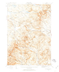 1943 Old Speck Mtn1959 Print · USGSOxford County was a high-elevation wilderness in the 1940s, defined by the Mahoosuc peaks and the early path of the Appalachian Trail. Trace remote outposts like Ketchum and North Newry PO or landmarks like the Old Speck Mtn Fire Tower.4 unique versions available
 - 1945 Map of North Conway
 1945 North Conway1945 Print · USGSThe Mount Washington Valley comes alive in the mid-1940s, showing the early infrastructure of the White Mountains' famous resort villages. Genealogists and historians can locate family landmarks like the Eastman Sch, the Panno Place, and the rail junction at Intervale.3 unique versions available
 - 1945 Map of Old Speck Mtn
 1945 Old Speck Mtn1945 Print · USGSThe Oxford County backcountry in the mid-1940s shows a landscape of timber surpluses and mountain trails. You can trace the Appalachian Trail across Old Speck Mtn or find local heritage sites like the Powers Cem and Ketchum.4 unique versions available
 - 1946 Map of Norway, 1955 Print
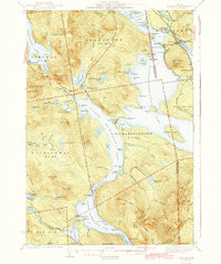
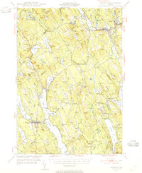 1946 Norway1955 Print · USGSMid-century Oxford County is defined by its deep lake system and timber-driven river settlements before the arrival of modern interstates. Genealogists and historians can trace family plots at Bisbeetown Cem, locate the old Lewis Sch, and find historical hubs like Scribners Mill and the Fairgrounds.4 unique versions available
 - 1949 Map of Portland
 1949 Portland1949 Print · USGSCoastal Maine and the New Hampshire interior are shown in detail during the late forties, from the bustling harbors to the lakeside villages. Researchers can trace historical rail networks like the Boston & Maine RR and locate coastal defenses such as Fort Preble.3 unique versions available
 - 1949 Map of Norway
 1949 Norway1949 Print · USGSOxford County and the upper Cumberland lakes region are shown here in the mid-forties, capturing the era of small-town mills and rail-fed industry. Genealogists and historians can trace family locations through Bisbeetown Cem, Scribners Mill, and the historic Bell Hill Meeting House.2 unique versions available
 - 1949 Map of Jackman
 1949 Jackman1949 Print · USGSThe Quebec and Maine borderlands are shown in great detail during the late 1940s, highlighting the industrial and natural geography of the region. Trace old rail lines like the Canadian Pacific and locate settlements from Sherbrooke to Scotstown.2 unique versions available
 - 1949 Map of Rangeley, 1955 Print
 1949 Rangeley1955 Print · USGSThe western Maine highlands come into focus in the late 1940s, showcasing the region's transition into a premier recreation destination. Track the Appalachian Trail as it crosses peaks like Saddleback Mtn and Bemis Mtn, or locate the Airport and landmarks around Rangeley Lake.4 unique versions available
End of results
Showing maps 1-22 of 22
Top cities of Oxford County
- Paris historical maps
- Norway historical maps
- Rumford historical maps
- Oxford historical maps
- Fryeburg historical maps
- Mexico historical maps
See more
Frequently asked questions
- What are the different types of historical maps available for Oxford County?
- What is the oldest map of Oxford County?
- Where can I purchase historical maps of Oxford County for my home or office?
- Where can I download high-res historical maps of Oxford County?
- Are there historical topographic maps available for Oxford County?
- Is there historical aerial imagery available for Oxford County?
- Where are historical maps of Oxford County sourced from?