1960s Maps of Oxford County, Maine
Explore 30 historic maps of Oxford County from the 1960s. These maps offer a rare glimpse into what life looked like during the 1960s — showing old roads, neighborhoods, homes, and landmarks that have changed or disappeared over time.
Whether you're researching your family's past, planning a metal detecting trip, or studying how Oxford County's landscape evolved across the 1960s, these high-resolution maps are a powerful tool for exploring the history of this region.
- Focus on a specific era: All maps on this page are from the 1960s, giving you a focused view of this time period.
- See what’s changed: Compare century-old streets, trails, and buildings to today's modern landscape using overlays and satellite layers.
- Research with precision: Use these maps for genealogy, historical research, land use analysis, or educational projects.
- View, download, or print: Maps are fully viewable online in high resolution, and can be downloaded or printed for your own records.
Start exploring Oxford County's history through authentic maps from the 1960s. This is your window into the past.
Oxford County, ME maps
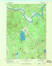
(30)- 1961 Map of Lewiston
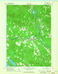
 1961 Lewiston1961 Print · USGSWestern Maine and the White Mountains appear here during the early sixties, showing the industrial river towns and vast timberlands before the modern interstate era. Genealogists and historians can trace the Grand Trunk RR through Berlin or locate landmarks like Old Speck Mountain and Elephant Mountain.
 - 1962 Map of Lewiston
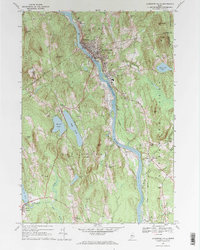
 1962 Lewiston1962 Print · USGSThe industrial river valleys and high peaks of Maine and New Hampshire define the region in the early sixties. Trace the rail-and-river network from Lewiston to the White Mountains, passing through mill towns like Berlin and Rumford.
 - 1963 Map of Portland
 1963 Portland1963 Print · USGSCoastal Maine and New Hampshire thrived as maritime and industrial hubs during the mid-sixties, linked by a dense network of rail and river. Researchers can trace historic transit corridors like the Maine Central RR and locate key sites such as the Portsmouth Naval Shipyard or Pease Air Force Base.3 unique versions available
 - 1963 Map of Jackman
 1963 Jackman1963 Print · USGSThe international borderlands of Maine and Quebec come alive in the mid-twentieth century, showing a landscape of timber towns and rail connections. Genealogists and historians can trace the paths of the Canadian Pacific Railway through Jackman or locate families in Sherbrooke and Megantic.
 - 1963 Map of North Waterford, 1964 Print
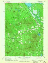
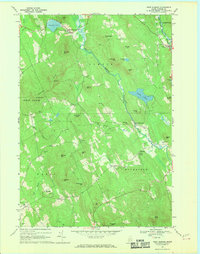
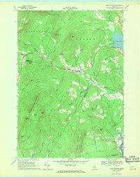
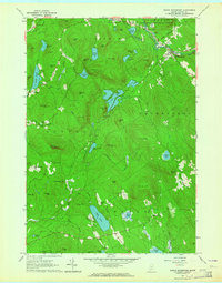 1963 North Waterford1964 Print · USGSOxford County in the early sixties is a landscape of high timber and interconnected glacial lakes before the era of major development. Researchers can trace historic family burial sites like Brackett Cem and explore old settlements from Slab City to Lynchville.2 unique versions available
 - 1963 Map of Center Lovell, 1965 Print
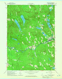
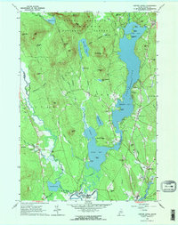 1963 Center Lovell1965 Print · USGSOxford County at the start of the 1960s shows a landscape of deep glacial lakes and forested peaks within the White Mountain National Forest. Researchers can locate historic family sites like the Smith Cem and Lord Cem, or trace the winding Old Course Saco River.2 unique versions available
 - 1963 Map of Pleasant Mtn, 1965 Print
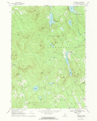
 1963 Pleasant Mtn1965 Print · USGSWestern Maine's highlands and lakes appear here just as the early 1960s began, showing a landscape of small hill settlements and timbered ridges. Genealogists can locate over twenty distinct burial sites like Sawyer Cem and Hio Ridge Cem, or trace the old roads between West Bridgton and Liberty Corner.3 unique versions available
 - 1963 Map of Fryeburg, 1965 Print
 1963 Fryeburg1965 Print · USGSOxford County settlement and the meandering Saco River define this mid-century survey of the Maine-New Hampshire border. Genealogists and local historians can locate numerous family burial grounds like Riverside Cem and Wiley Cem, along with landmarks like Fryeburg Academy.2 unique versions available
 - 1964 Map of Cornish, 1966 Print
 1964 Cornish1966 Print · USGSThe river valleys of York and Cumberland counties come alive in the mid-1960s as timber and rail lines define the landscape. Trace ancestral roots through dozens of family burial grounds like Riverside Cem or locate former landmarks like the Drive-in Theater and the Fairgrounds.3 unique versions available
 - 1964 Map of Hiram, 1966 Print
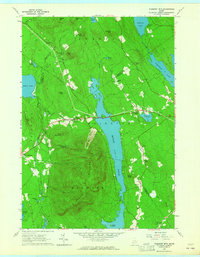
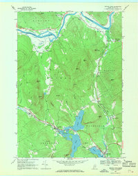
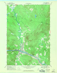
 1964 Hiram1966 Print · USGSOxford County in the 1960s reveals a landscape of river-tied commerce and quiet lakeside settlements. Researchers can locate numerous family burial sites like Harnden Cem, trace the Maine Central Railroad, and explore historic locales like Rankins Mill or Heads Corner.2 unique versions available
 - 1964 Map of Brownfield, 1966 Print
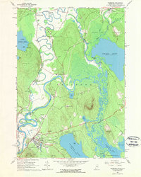
 1964 Brownfield1966 Print · USGSOxford County settlement and the Saco River valley are captured here in the mid-sixties. Genealogists and local historians can trace family burial sites at Merrill Cem and Wentworth Cem or follow the path of the Maine Central Railroad.2 unique versions available
 - 1964 Map of Kezar Falls, 1966 Print
 1964 Kezar Falls1966 Print · USGSThe Maine-New Hampshire borderlands near Kezar Falls are captured here in the mid-sixties, showing a landscape of river-driven towns and upland ponds. Genealogists can trace family lines through numerous rural burial grounds like Churchill Cem and local landmarks such as the Parsonsfield Seminary.4 unique versions available
 - 1966 Map of Sherbrooke
 1966 Sherbrooke1966 Print · USGSThe borderlands of Quebec and Maine come alive in the mid-1960s, documenting the industrial towns and deep woods of the Northeast. Genealogists can trace family lines through Sherbrooke and Coaticook, or locate remote logging outposts along the Moose River and Flagstaff Lake.
 - 1967 Map of Mount Zircon, 1969 Print
 1967 Mount Zircon1969 Print · USGSThe Maine highlands of the late sixties are captured here, showing the rural landscape around Mount Zircon. Trace local history through the remote settlement of East Milton, the Greenleaf Cem, and mountain features like Mollyockett Mountain.
 - 1967 Map of Greenwood, 1969 Print
 1967 Greenwood1969 Print · USGSOxford County's hill country is documented here in the late sixties, showing the vital link between the Grand Trunk railroad and mountain settlements. Researchers can locate remote burial sites like Patch Mountain Cem and family landmarks such as Willis Mill or the Ice Cave.2 unique versions available
 - 1967 Map of Canton, 1969 Print
 1967 Canton1969 Print · USGSThe river and rail landscapes of western Maine are captured in the late 1960s, showing the town of Canton and its rural surroundings. Genealogists can trace family landmarks like Hillside Cem, Bradbury Chapel, and the homes near Lake Anasagunticook.2 unique versions available
 - 1967 Map of West Sumner, 1969 Print
 1967 West Sumner1969 Print · USGSOxford County in the late sixties maintains its traditional character of hill farms and valley hamlets along the West Branch Nezinscot River. Genealogists and historians can trace numerous family burial grounds like Tuell Cem and Prince Cem or locate the old Quarry at Mt Mica.2 unique versions available
 - 1967 Map of Buckfield, 1969 Print
 1967 Buckfield1969 Print · USGSOxford and Androscoggin counties appear in the late 1960s as a landscape of river-valley villages and ridge-top landmarks. Researchers can trace family history through several burial grounds like Hartford Center Cem or locate old industrial sites such as Chase Mills and the Sand Pit near Bog Brook.2 unique versions available
 - 1967 Map of Bryant Pond, 1969 Print
 1967 Bryant Pond1969 Print · USGSThe Oxford County highlands in the late sixties show a landscape shaped by the Grand Trunk rail corridor and the Androscoggin River. Genealogists can locate family names at Bartlett Cem or Howe Hill Cem and trace the mills at Locke Mills.3 unique versions available
 - 1967 Map of West Paris, 1969 Print
 1967 West Paris1969 Print · USGSOxford County's river valleys and rail corridors are captured in the late sixties as the Grand Trunk railroad winds through West Paris. Genealogists can locate family landmarks like Richardson Hollow Cem, Forest Dale Sch, and Stearns Hill Cem.
 - 1967 Map of Livermore Falls, 1970 Print
 1967 Livermore Falls1970 Print · USGSIn the late sixties, the industrial activity along the Androscoggin River and the Maine Central rail line defined this corner of Maine. Researchers can trace ancestral roots at Lakeside Cem or locate old landmarks like Bowman Field and Chisholm.2 unique versions available
 - 1967 Map of Worthley Pond, 1970 Print
 1967 Worthley Pond1970 Print · USGSOxford County was a landscape of steep peaks and quiet river valleys in the late 1960s, just as modern photogrammetry began to capture its rural detail. Local researchers can trace family lines through the Byron Cem or Fields Hill Cem and locate historic homesteads near Dickvale and Sumner.
 - 1968 Map of East Dixfield, 1970 Print
 1968 East Dixfield1970 Print · USGSWestern Maine highlands meet the river valleys in the late sixties, showcasing the rural landscapes of Franklin and Oxford Counties. Genealogists can locate family landmarks like Science Hill Cemetery, Walker Hill, and the community of East Dixfield.2 unique versions available
 - 1968 Map of Dixfield, 1971 Print
 1968 Dixfield1971 Print · USGSOxford County communities like Dixfield and Peru are shown at their industrial and agricultural peak in the late sixties. Researchers can trace the Maine Central rail line or locate family plots at Riverside Cem and Waite Cem.2 unique versions available
 - 1968 Map of Wilton, 1971 Print
 1968 Wilton1971 Print · USGSFranklin County's transition from rural crossroads to an industrial corridor is captured here in the late sixties. Researchers can trace family sites near Lakeview Cem or locate historic industrial sites such as the quarries near North Jay and the Central Maine Railroad.
Showing maps 1-25 of 30
Top cities of Oxford County
- Paris historical maps
- Norway historical maps
- Rumford historical maps
- Oxford historical maps
- Fryeburg historical maps
- Mexico historical maps
See more
Frequently asked questions
- What are the different types of historical maps available for Oxford County?
- What is the oldest map of Oxford County?
- Where can I purchase historical maps of Oxford County for my home or office?
- Where can I download high-res historical maps of Oxford County?
- Are there historical topographic maps available for Oxford County?
- Is there historical aerial imagery available for Oxford County?
- Where are historical maps of Oxford County sourced from?