2000s (21st Century) Maps of Gilead, Maine
Explore 25 historic maps of Gilead from the 2000s (21st Century). These maps offer a rare glimpse into what life looked like during the 2000s — showing old roads, neighborhoods, homes, and landmarks that have changed or disappeared over time.
Whether you're researching your family's past, planning a metal detecting trip, or studying how Gilead's landscape evolved across the 2000s, these high-resolution maps are a powerful tool for exploring the history of this region.
- Focus on a specific era: All maps on this page are from the 2000s, giving you a focused view of this time period.
- See what’s changed: Compare century-old streets, trails, and buildings to today's modern landscape using overlays and satellite layers.
- Research with precision: Use these maps for genealogy, historical research, land use analysis, or educational projects.
- View, download, or print: Maps are fully viewable online in high resolution, and can be downloaded or printed for your own records.
Start exploring Gilead's history through authentic maps from the 2000s. This is your window into the past.
Gilead, ME maps
(25)- 2012 Map of Gilead, 2012 Print
 2012 Gilead2012 Print · USGSCovers Gilead, including Bethel, Newry, and other nearby areas
 - 2012 Map of Speckled Mountain, 2012 Print
 2012 Speckled Mountain2012 Print · USGSCovers Gilead, including Lovell, Stow, and other nearby areas
 - 2012 Map of Bethel, 2012 Print
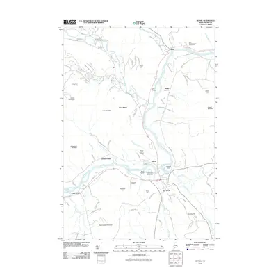 2012 Bethel2012 Print · USGSCovers Gilead, including Bethel, Greenwood, and other nearby areas
 - 2012 Map of Shelburne, 2012 Print
 2012 Shelburne2012 Print · USGSCovers Gilead, including Shelburne, Success, and other nearby areas
 - 2012 Map of Wild River, 2012 Print
 2012 Wild River2012 Print · USGSCovers Gilead, including Stow, Shelburne, and other nearby areas
 - 2014 Map of Gilead, 2014 Print
 2014 Gilead2014 Print · USGSCovers Gilead, including Bethel, Newry, and other nearby areas
 - 2014 Map of Bethel, 2014 Print
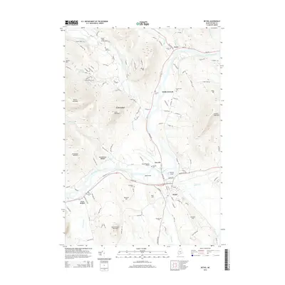 2014 Bethel2014 Print · USGSCovers Gilead, including Bethel, Greenwood, and other nearby areas
 - 2014 Map of Speckled Mountain, 2014 Print
 2014 Speckled Mountain2014 Print · USGSCovers Gilead, including Lovell, Stow, and other nearby areas
 - 2015 Map of Wild River, 2015 Print
 2015 Wild River2015 Print · USGSCovers Gilead, including Stow, Shelburne, and other nearby areas
 - 2015 Map of Shelburne, 2015 Print
 2015 Shelburne2015 Print · USGSCovers Gilead, including Shelburne, Success, and other nearby areas
 - 2018 Map of Shelburne, 2018 Print
 2018 Shelburne2018 Print · USGSCovers Gilead, including Shelburne, Success, and other nearby areas
 - 2018 Map of Wild River, 2018 Print
 2018 Wild River2018 Print · USGSCovers Gilead, including Stow, Shelburne, and other nearby areas
 - 2018 Map of Bethel, 2018 Print
 2018 Bethel2018 Print · USGSCovers Gilead, including Bethel, Greenwood, and other nearby areas
 - 2018 Map of Gilead, 2018 Print
 2018 Gilead2018 Print · USGSCovers Gilead, including Bethel, Newry, and other nearby areas
 - 2018 Map of Speckled Mountain, 2018 Print
 2018 Speckled Mountain2018 Print · USGSCovers Gilead, including Lovell, Stow, and other nearby areas
 - 2021 Map of Bethel, 2021 Print
 2021 Bethel2021 Print · USGSCovers Gilead, including Bethel, Greenwood, and other nearby areas
 - 2021 Map of Speckled Mountain, 2021 Print
 2021 Speckled Mountain2021 Print · USGSCovers Gilead, including Lovell, Stow, and other nearby areas
 - 2021 Map of Gilead, 2021 Print
 2021 Gilead2021 Print · USGSCovers Gilead, including Bethel, Newry, and other nearby areas
 - 2021 Map of Shelburne, 2021 Print
 2021 Shelburne2021 Print · USGSCovers Gilead, including Shelburne, Success, and other nearby areas
 - 2021 Map of Wild River, 2021 Print
 2021 Wild River2021 Print · USGSCovers Gilead, including Stow, Shelburne, and other nearby areas
 - 2024 Map of Speckled Mountain, 2024 Print
 2024 Speckled Mountain2024 Print · USGSThe peaks and valleys of Oxford County are captured here during a contemporary era of forest preservation. Researchers can locate the Hut Road Cem or trace the early paths of the Kings Hwy and Gilead-Snoma Trl through the mountains.
 - 2024 Map of Bethel, 2024 Print
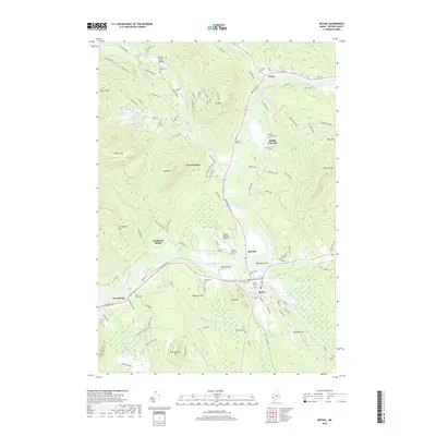
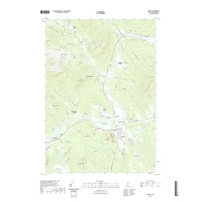
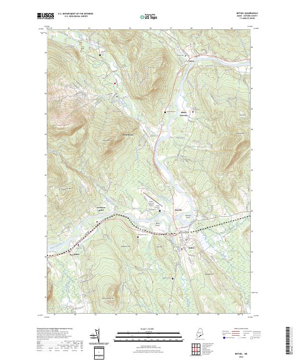 2024 Bethel2024 Print · USGSOxford County mountain communities and the winding Androscoggin River are documented in this contemporary survey. Researchers can trace ancestral sites at Grafton Cem and Skillingston Cem or locate the historic St Lawrence & Atlantic RR line.
 - 2024 Map of Gilead, 2024 Print
 2024 Gilead2024 Print · USGSOxford County mountain terrain and the Androscoggin River valley are captured here in the mid-2020s. Researchers can locate the Peabody Cem, trace the Appalachian National Scenic Trail, or explore the limits of the NG Bog Brook Training Site.
 - 2024 Map of Shelburne, 2024 Print
 2024 Shelburne2024 Print · USGSThe Androscoggin River valley in Coos County is shown here during the mid-2020s, highlighting the intersection of mountain recreation and local settlement. Genealogists and hikers can trace the Appalachian National Scenic Trail past Hazelton Cem and the peaks of the Mahoosuc Range.
 - 2024 Map of Wild River, 2024 Print
 2024 Wild River2024 Print · USGSThe high peaks of the New Hampshire and Maine border are detailed here as they appeared in the early twenty-first century. Hikers and historians can trace the Appalachian National Scenic Trail and find landmarks like Moriah Gorge and The Basin.
End of results
Showing maps 1-25 of 25
Top cities near Gilead
- Berlin historical maps
- Rumford historical maps
- Gorham historical maps
- Bethel historical maps
- Waterford historical maps
- Milan historical maps
See more
Frequently asked questions
- What are the different types of historical maps available for Gilead?
- What is the oldest map of Gilead?
- Where can I purchase historical maps of Gilead for my home or office?
- Where can I download high-res historical maps of Gilead?
- Are there historical topographic maps available for Gilead?
- Is there historical aerial imagery available for Gilead?
- Where are historical maps of Gilead sourced from?