Old Maps of Watersmeet Township, Michigan for Academic Research
Study the evolution of Watersmeet Township with 100 high-resolution historic maps. Whether you're teaching, researching, or modeling changes in land use, these maps provide essential visual documentation of urban, environmental, and geographic change.
- Analyze long-term change: Track patterns in development, transportation, and natural features.
- Ideal for environmental or urban studies: Support academic projects with primary historical map data.
- Use in the classroom or lab: Educators and researchers rely on these maps to bring historical context to life.
These maps are a powerful tool for teaching, research, and visualizing how Watersmeet Township has changed over the decades.
Watersmeet Township, MI maps
(100)- 1938 Map of Phelps, 1946 Print
 1938 Phelps1946 Print · USGSVilas County's northern lakes and timberlands come into focus during the late 1930s, showing a landscape defined by the Michigan-Wisconsin state line and new conservation camps. Genealogists and historians can trace the foundations of local life at the Augustus Adolphus Ch, Conover Cem, and the CCC Camp near Phelps.
 - 1946 Map of Star Lake
 1946 Star Lake1946 Print · USGSVilas County was a landscape of deep woods and glacial lakes in the late thirties as the timber era gave way to early tourism. Genealogists and historians can trace the Chicago and Northwestern Line rail corridor and find early landmarks like the Monahan Fire Tower and Star Lake settlement.
 - 1950 Map of Phelps
 1950 Phelps1950 Print · USGSVilas County's lake country is captured here during the mid-century, showing the development of Phelps and Land O' Lakes along the state line. Researchers can trace the Chicago and Northwestern rail line and locate the Augustus Adolphus Ch or the C C C Camp near Afterglow Lake.
 - 1950 Map of Star Lake
 1950 Star Lake1950 Print · USGSVilas County's lake-strewn borderlands are captured here at mid-century, showing a landscape defined by timber management and early rail travel. Researchers can trace the Chicago and Northwestern Ry through Conover and locate remote outposts like Camp 5 or the Monahan Fire Tower.
 - 1952 Map of Watersmeet, 1954 Print
 1952 Watersmeet1954 Print · USGSThe western Upper Peninsula's rail and timber heartland is captured here in the early fifties. Researchers can locate vanished rural infrastructure like Maple Grove School, the Agate Church, and the expansive Bond Falls Flowage near Watersmeet.5 unique versions available
 - 1952 Map of Thayer, 1954 Print
 1952 Thayer1954 Print · USGSThe timberlands of the western Upper Peninsula are captured in the early fifties, centering on the railway corridor through the Ottawa National Forest. Researchers can trace the legacy of the Chicago and North Western line through Gogebic Station, Thayer, and the shores of Beatons Lake.4 unique versions available
 - 1954 Map of Kenton, 1956 Print
 1954 Kenton1956 Print · USGSThe Upper Peninsula rail corridors and timberlands are well-defined in the mid-1950s, centering on the crossing of the Duluth South Shore and Atlantic. Researchers can locate historic sites like the Kenton Cemetery, Holmes Dam, and the old Lookout Tower.3 unique versions available
 - 1955 Map of Starlake, 1957 Print
 1955 Starlake1957 Print · USGSThe Wisconsin-Michigan border country is shown here in the mid-fifties, dominated by the dense waters of the Northwoods. Researchers can trace the Chicago and North Western line or locate local landmarks like Covenant Ch and Starlake.4 unique versions available
 - 1956 Map of Beechwood, 1957 Print
 1956 Beechwood1957 Print · USGSUpper Peninsula timberlands meet the Wisconsin Northwoods in the 1950s, a landscape defined by rail-line outposts and forestry stations. Researchers can find old rural school sites like Elvoy Sch, the Beechwood Ch, and remote rail stops at Elmwood and Basswood.4 unique versions available
 - 1956 Map of Phelps, 1957 Print
 1956 Phelps1957 Print · USGSVilas County and the Michigan border country are captured here in the mid-fifties, at the height of the Northwoods' timber and rail era. Researchers can locate the Kataktikon Indian Village, the Conover Cemetery, and the old Chicago and North Western rail line.4 unique versions available
 - 1958 Map of Iron River, 1968 Print
 1958 Iron River1968 Print · USGSThe Upper Peninsula in the late fifties is captured here as a landscape of timber, iron, and rail. Genealogists and historians can trace rail stops like Mass Station or explore the coastlines of Lake Gogebic and Keweenaw Bay.3 unique versions available
 - 1960 Map of Iron River
 1960 Iron River1960 Print · USGSThe Upper Peninsula’s western reaches are shown in the late fifties, featuring the industrial infrastructure of the Copper Country and the vast Ottawa National Forest. Researchers can trace the rail lines of the Milwaukee Road through settlements like Bruce Crossing and the White Pine Mine.
 - 1961 Map of Iron River
 1961 Iron River1961 Print · USGSThe Upper Peninsula and northern Wisconsin are shown here in the early 1960s, a landscape defined by the iron range and vast timberlands. Researchers can trace the legacy of mining and rail transport through Caspian, the Lac Du Flambeau Indian Reservation, and the Milwaukee Road.
 - 1967 Map of Iron River, 1968 Print
 1967 Iron River1968 Print · USGSThe Upper Peninsula and northern Wisconsin borderlands are shown here in the late sixties, a landscape of deep woods and iron-country rail lines. Genealogists and historians can trace the lakeside settlements of L'Anse and Ontonagon or follow the Soo Line through towns like Michigamme and Nestoria.
 - 1981 Map of Smoky Lake
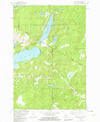 1981 Smoky Lake1981 Print · USGSThe Michigan-Wisconsin borderlands come into focus in the early 1980s, showcasing a landscape of timber and tourism. You can trace the remote shorelines of Smoky Lake and Big Sand Lake or locate the Phelps Municipal Landing Strip and Elvoy Springs.3 unique versions available
 - 1981 Map of Golden Lake, 1982 Print
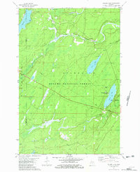 1981 Golden Lake1982 Print · USGSIron County's timberlands and glacial lakes are captured here in the early 1980s, showcasing a landscape dedicated to forestry and recreation. Researchers can trace the Chicago and North Western rail line through Elmwood or locate the University of Michigan Forestry Camp on Golden Lake.
 - 1981 Map of Black Oak Lake, 1982 Print
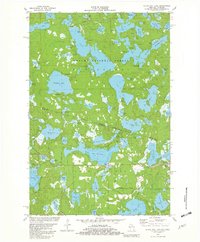 1981 Black Oak Lake1982 Print · USGSThe Michigan-Wisconsin borderlands are captured here in the early eighties, showcasing a landscape defined by wilderness and water. Genealogists and local historians can locate Land O' Lakes Cem and the nearby Fish Hatchery among dozens of named water bodies like Whitefish Lake.2 unique versions available
 - 1981 Map of Thousand Island Lake, 1982 Print
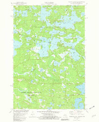 1981 Thousand Island Lake1982 Print · USGSThe Michigan-Wisconsin borderlands come alive in this early eighties survey of the lake-studded Northwoods. Researchers can trace the irregular shorelines and island chains of Thousand Island Lake, Cisco Lake, and the remote Grace Lake.2 unique versions available
 - 1981 Map of Phelps, 1982 Print
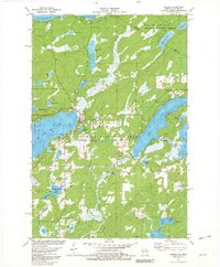 1981 Phelps1982 Print · USGSIn the early 1980s, the village of Phelps sat at the heart of the Wisconsin Northwoods, flanked by the Nicolet National Forest. Researchers can trace the path of the historic Military Road or locate family sites near North Twin Lake and Military Hill.
 - 1982 Map of Land O'Lakes
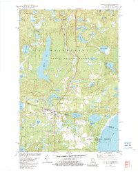 1982 Land O'Lakes1982 Print · USGSThe Wisconsin-Michigan border country comes alive in the early eighties, centered on the rail-and-lake hub of Land O' Lakes. Trace family history at Land O' Lakes Cemetery or locate historic lakeside sites like Reimers Island and Wilson Springs.
 - 1982 Map of Lake Mitigwaki, 1983 Print
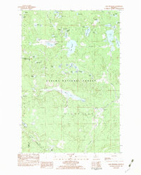 1982 Lake Mitigwaki1983 Print · USGSUpper Peninsula wilderness in the early eighties is defined here by the dense hydrology of the Ottawa National Forest. You can trace the Chicago and North Western rail line and locate remote features like Bear Trap Dam and Lake Mitigwaki.
 - 1982 Map of Imp Lake, 1983 Print
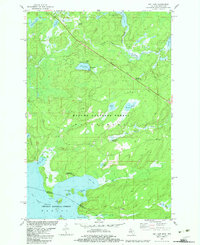 1982 Imp Lake1983 Print · USGSThe Michigan-Wisconsin borderlands come alive in the early eighties as this survey documents the shared forests and waters. Trace ancestral sites at Katakitekon Indian Village or explore landmarks like Misery Bay and Paint River Springs.
 - 1982 Map of Watersmeet, 1983 Print
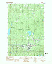 1982 Watersmeet1983 Print · USGSWatersmeet was a vital Upper Peninsula rail and river junction in the early eighties. Researchers can trace the Chicago and North Western line, find the Gravel Pit Cem, and locate the OLD RAILROAD GRADE near Bonifas.2 unique versions available
 - 1982 Map of Beaton, 1983 Print
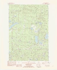 1982 Beaton1983 Print · USGSThe Ottawa National Forest in the early eighties shows a dense lake country at the Gogebic and Ontonagon county line. Researchers can trace the Old Railroad Grade and locate small settlements like Beaton and Ogima near Beatons Lake.2 unique versions available
 - 1982 Map of Thayer, 1983 Print
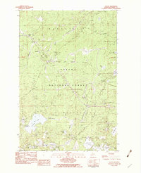 1982 Thayer1983 Print · USGSThe dense forests of Michigan's Upper Peninsula are mapped here in the early 1980s, centered on the Chicago and North Western Railroad corridor. Genealogists and local historians can locate small rail stops like Gogebic Station and Thayer alongside landmarks like Kakabika Falls and Langford Lake.
Showing maps 1-25 of 100
Top cities near Watersmeet Township
Top neighborhoods of Watersmeet Township
- Beaton historical maps
- Thayer historical maps
- Fuller historical maps
- Tamarack historical maps
- Stickley historical maps
- Katakitckon Indian Village historical maps
See more
Frequently asked questions
- What are the different types of historical maps available for Watersmeet Township?
- What is the oldest map of Watersmeet Township?
- Where can I purchase historical maps of Watersmeet Township for my home or office?
- Where can I download high-res historical maps of Watersmeet Township?
- Are there historical topographic maps available for Watersmeet Township?
- Is there historical aerial imagery available for Watersmeet Township?
- Where are historical maps of Watersmeet Township sourced from?