1960s Maps of Polk County, Minnesota
Explore 51 historic maps of Polk County from the 1960s. These maps offer a rare glimpse into what life looked like during the 1960s — showing old roads, neighborhoods, homes, and landmarks that have changed or disappeared over time.
Whether you're researching your family's past, planning a metal detecting trip, or studying how Polk County's landscape evolved across the 1960s, these high-resolution maps are a powerful tool for exploring the history of this region.
- Focus on a specific era: All maps on this page are from the 1960s, giving you a focused view of this time period.
- See what’s changed: Compare century-old streets, trails, and buildings to today's modern landscape using overlays and satellite layers.
- Research with precision: Use these maps for genealogy, historical research, land use analysis, or educational projects.
- View, download, or print: Maps are fully viewable online in high resolution, and can be downloaded or printed for your own records.
Start exploring Polk County's history through authentic maps from the 1960s. This is your window into the past.
Polk County, MN maps
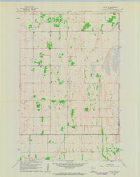
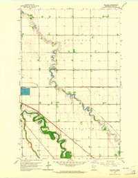
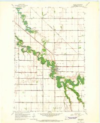
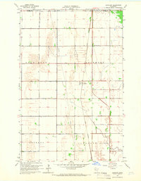
(51)- 1961 Map of Radium, 1963 Print
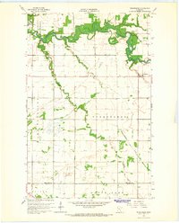
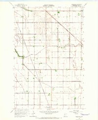
 1961 Radium1963 Print · USGSMarshall County's prairie landscape in the early sixties is defined by remote townships and the essential route of the SOO LINE railroad. Family historians can trace local roots at Immanuel Cem and the Townhall near the winding Snake River.2 unique versions available
 - 1961 Map of Angus SE, 1963 Print
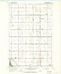
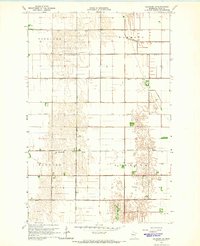
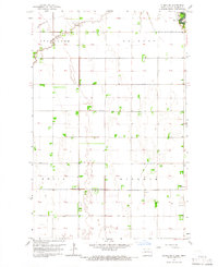
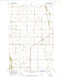
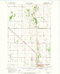
 1961 Angus SE1963 Print · USGSPolk County townships show their mid-century rural character as they appeared in the early sixties. Genealogists and local historians can locate Melo Ch, School No 1659, and the community Cem within the sections of Brandt and Helgeland.
 - 1961 Map of Angus, 1963 Print
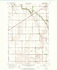
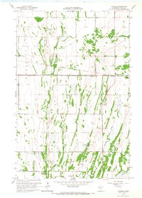
 1961 Angus1963 Print · USGSPolk County in the early sixties remains a landscape of rail-centered agriculture and straight-line township borders. Genealogists and local historians can locate St Pauls Cem, the rail siding at Angus, and various Gravel Pits across the prairie.
 - 1961 Map of Roan, 1963 Print
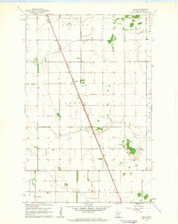
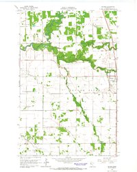
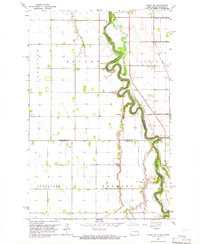
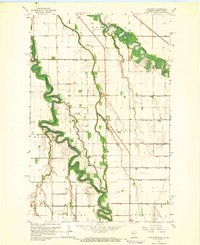
 1961 Roan1963 Print · USGSSettled along the Great Northern railway in the 1960s, this area of Marshall and Polk counties shows a landscape of river meanders and rail lines. You can trace the Soo Line tracks, locate the Roan station, and find mid-century infrastructure like the Warren Airport.2 unique versions available
 - 1963 Map of Shelly, 1964 Print
 1963 Shelly1964 Print · USGSThe fertile Red River Valley is captured here in the early 1960s, showing the agricultural landscape of Norman County and the Minnesota border. Researchers can trace rural life through the presence of the Herberg Sch, Shelly Cem, and the Great Northern rail line.2 unique versions available
 - 1963 Map of Mallory, 1964 Print
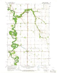
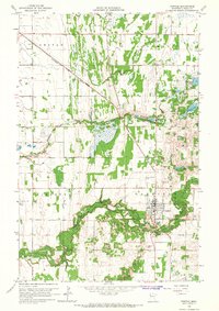
 1963 Mallory1964 Print · USGSPolk County at the start of the sixties reveals a landscape of precision drainage and winding river bends. Trace the railroad community of Mallory and rural landmarks like the Pleasant View Sch or Resthaven Memorial Gardens.3 unique versions available
 - 1963 Map of Key West, 1964 Print
 1963 Key West1964 Print · USGSPolk County agriculture and rail life are centered here in the early sixties, as the prairie is managed through a vast drainage network. Genealogists and rail historians can locate the Nesbit Cem and trace the Northern Pacific tracks through Key West and Davidson.
 - 1963 Map of Grand Forks, 1965 Print
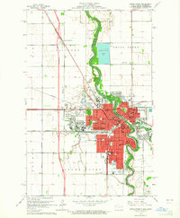 1963 Grand Forks1965 Print · USGSGrand Forks and the Red River Valley are seen here in the early 1960s as the urban footprint expanded around the university. Trace the city's growth through sites like the University of North Dakota, Calspur, and parochial schools such as St Marys Sch.2 unique versions available
 - 1964 Map of Beltrami, 1965 Print
 1964 Beltrami1965 Print · USGSThe rural prairie landscape around Beltrami was defined by rail and reclamation in the mid-sixties. Genealogists and local researchers can trace the early township divisions of Scandia and Reis while locating Scandia Ch and the Fairview Cem.
 - 1964 Map of Terrebonne, 1965 Print
 1964 Terrebonne1965 Print · USGSRed Lake County in the mid-1960s is defined by the winding Clearwater River and the rural agricultural community of Terrebonne. Researchers can trace old property boundaries via field lines or locate local landmarks like the Beau Gerlot Sch and Oak Grove Cem.
 - 1964 Map of Beltrami SW, 1965 Print
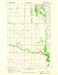
 1964 Beltrami SW1965 Print · USGSAgricultural development in mid-century Polk County is defined by its extensive network of drainage projects and township grids. Researchers can trace land management history through Sandhill River, Zion Cem, and the path of Judicial Ditch No 77.
 - 1964 Map of Girard, 1965 Print
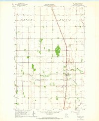
 1964 Girard1965 Print · USGSPolk County at the start of the 1960s shows a landscape defined by industrial agriculture and the steel of the Great Northern railroad. Genealogists and local historians can trace the precise location of family plots at Andover Cem and Hanna Cem or find early settlements like Girard and Wilds.2 unique versions available
 - 1964 Map of Brooks, 1965 Print
 1964 Brooks1965 Print · USGSNorthern Minnesota prairie and river bottomlands are captured here in the mid-sixties, centered on the village of Brooks. Researchers can trace the SOO LINE rail corridor and locate rural landmarks like the local Cem or the winding Poplar River.
 - 1964 Map of Greenview, 1966 Print
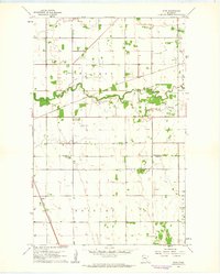
 1964 Greenview1966 Print · USGSPolk County agriculture was at its peak in the mid-sixties, defined by an intricate network of drainage ditches and the rail lines that served the prairie. You can trace the Great Northern tracks past Burwell and Harold or locate the rural Townhall and local water systems like Burnham Creek.
 - 1964 Map of Climax NW, 1966 Print
 1964 Climax NW1966 Print · USGSThe Red River Valley in the mid-sixties is captured here as a landscape of tight oxbows and organized farmsteads. Researchers can trace the drainage of the prairie through Buffalo Coulee or locate rural centers like Rosendahl Ch and North Ringsaker Cem.
 - 1964 Map of Climax SW, 1966 Print
 1964 Climax SW1966 Print · USGSTraill County agricultural lands are captured here in the mid-sixties, showing the rural grid of the Red River Valley. Genealogists can locate family sites near Grue Ch, Salem Cem, and School No 5 along the banks of Buffalo Coulee.
 - 1964 Map of Climax, 1966 Print
 1964 Climax1966 Print · USGSThe Red River Valley in the mid-1960s shows a landscape defined by its winding river border and rail-side towns. Genealogists and local historians can trace the foundations of Climax and Nielsville or locate family sites at Bergit Cem and Skatvold Cem.2 unique versions available
 - 1964 Map of Fisher, 1966 Print
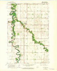
 1964 Fisher1966 Print · USGSFisher and its surrounding townships in the mid-1960s show a landscape shaped by the Red Lake River and the expansion of Great Northern rail lines. Genealogists can trace family footprints near Greenwood Cem or explore the rural停靠站 at Freeman and Fisher.
 - 1964 Map of Bygland, 1966 Print
 1964 Bygland1966 Print · USGSThe Red River Valley in the mid-sixties is captured here as a landscape of grid-patterned farms and winding river bottoms. Genealogists can locate rural landmarks like Bygland Ch, School No 6, and family-named sites like McGrath Landing Strip.
 - 1964 Map of Eldred, 1966 Print
 1964 Eldred1966 Print · USGSPolk County agriculture and transit come into focus during the mid-sixties, showing a landscape defined by rail and drainage. Genealogists and local historians can trace the Great Northern rail line through Eldred or locate the Bardo Cem and local Townhall.2 unique versions available
 - 1965 Map of Dugdale, 1966 Print
 1965 Dugdale1966 Print · USGSPolk County during the mid-1960s reveals a landscape defined by industrial-scale drainage and the footprint of the Great Northern railway. Family researchers can locate the Our Saviors Cem, the local Townhall, and the rail settlements at Dugdale and Tilden Junction.
 - 1965 Map of Lockhart, 1966 Print
 1965 Lockhart1966 Print · USGSThe Red River Valley prairie in the mid-sixties is captured here as a grid of industrial farming and rail transit. Genealogists can trace the rural landscape of Lockhart and the Great Northern line near the Immanuel Ch and local Cem.
 - 1965 Map of Fertile, 1966 Print
 1965 Fertile1966 Print · USGSFertile and the surrounding Polk County townships are shown here in the mid-1960s, a time of steady agricultural and rail activity. Researchers can trace local lineage at St Josephs Cem, follow the Sand Hill River's course, or locate the old Townhall.
 - 1965 Map of Melvin, 1966 Print
 1965 Melvin1966 Print · USGSAgricultural townships in Polk County are captured here in the mid-sixties as the landscape is managed through an intricate system of judicial and county ditches. Family historians can locate Bethel Cem and Lone Star Cem, or trace the rail sidings of the Northern Pacific at Melvin.
 - 1965 Map of Harold, 1966 Print
 1965 Harold1966 Print · USGSNorthwestern Minnesota's agricultural heartland is documented here in the mid-1960s, showing the intersection of major rail lines and rural townships. Researchers can trace family sites at Hafslo Cem, the railroad siding at Benoit, and the small settlement of Harold.
Showing maps 1-25 of 51
Top cities of Polk County
- East Grand Forks historical maps
- Crookston historical maps
- Fosston historical maps
- Fertile historical maps
- McIntosh historical maps
- Fisher historical maps
See more
Frequently asked questions
- What are the different types of historical maps available for Polk County?
- What is the oldest map of Polk County?
- Where can I purchase historical maps of Polk County for my home or office?
- Where can I download high-res historical maps of Polk County?
- Are there historical topographic maps available for Polk County?
- Is there historical aerial imagery available for Polk County?
- Where are historical maps of Polk County sourced from?