Old Maps of Roseau County, Minnesota for Metal Detecting
Plan your next treasure hunt with 307 historic maps of Roseau County. Find old homesites, ghost towns, trails, and gathering spots that may be lost to time — perfect for identifying promising metal detecting locations.
- Locate forgotten sites: Uncover places like long-lost settlements, abandoned rail lines, or gathering spots.
- Plan better hunts: Use map overlays combined with LiDAR or satellite views to narrow in on historically rich areas.
- Made for detectorists: Thousands of hobbyists use these maps to discover relics, coins, and hidden history.
Use these historic maps to boost your research and find new opportunities beneath the surface of Roseau County.
Roseau County, MN maps
(307)- 1918 Map of Goos
 1918 Goos1918 Print · USGSNorthern Minnesota near the Canadian border is shown during a period of massive land reclamation and rail expansion. Genealogists and historians can trace the early drainage network alongside the Great Northern tracks and locate sites like Salol, Mandus, and Boisvert.
 - 1918 Map of Winterroad
 1918 Winterroad1918 Print · USGSNorthern Minnesota’s drainage and timber frontiers are documented here just after the war, showing the massive engineering projects intended to dry the landscape. Local historians can trace the early township divisions of Eugene and Yale alongside landmarks like School 25 and Winter Road Lake.2 unique versions available
 - 1918 Map of Roosevelt
 1918 Roosevelt1918 Print · USGSNorthern Minnesota's wooded frontier is captured here at the end of the Great War, as the railway transformed the lake country. Genealogists and historians can trace early school sites and track the Canadian Northern rail line through Roosevelt and Swift.
 - 1918 Map of Pencer
 1918 Pencer1918 Print · USGSNorthern Minnesota's borderlands appear in the late nineteen-teens as a landscape of timbered swamps and new drainage districts. Genealogists and local researchers can trace early rural life through scattered settlements like Pencer, Wannaska, and Casperson, or locate the Old Indian Reservation Boundary Line.
 - 1918 Map of Roseau
 1918 Roseau1918 Print · USGSNorthern Minnesota’s borderlands come into focus at the end of the Great War, showing a landscape defined by water management and the rail. Trace early schoolhouse locations and rail crossings like Farm Xing near the Great Northern R. R. and Roseau Lake.2 unique versions available
 - 1918 Map of Garland
 1918 Garland1918 Print · USGSNorthern Minnesota borderlands during the First World War reveal a landscape of drainage ditches and early rural post offices. Genealogists can locate long-vanished sites like P.O. Garland and Homolka P.O. or trace the Old Indian Reservation Boundary Line.
 - 1918 Map of Warroad
 1918 Warroad1918 Print · USGSNorthern Minnesota's borderlands come alive in the decade following the drainage surveys, showing the international rail hub at Warroad and the marshy shores of Lake of the Woods. Genealogists can trace early homesteads and schools near Cedarbend, America, and along the Warroad River.
 - 1918 Map of Greenbush, 1943 Print
 1918 Greenbush1943 Print · USGSNorthern Minnesota farming and drainage districts are captured in the late teens as the Great Northeastern railroad connects Greenbush and Strathcona. Genealogists can trace early homestead life via rural landmarks like School 34, Herb, and the Cem. near the county line.
 - 1919 Map of Pelan
 1919 Pelan1919 Print · USGSNorthwestern Minnesota at the close of the Great War was a landscape defined by massive drainage projects. Researchers can trace the early townships of Pelan and Linda, identifying the locations of numerous rural Schools and local hubs like Sanwick.
 - 1919 Map of Badger, 1924 Print
 1919 Badger1924 Print · USGSThe Canada-United States borderlands in Roseau County come into focus during this post-war period of drainage and agricultural expansion. Local historians can trace the early rail network at Badger and locate rural landmarks like School Duxby and Haug.
 - 1930 Map of Juneberry
 1930 Juneberry1930 Print · USGSThe northern Minnesota borderlands come into focus at the start of the 1930s, showing the early efforts to drain the vast marshy plains. Genealogists and local historians can locate rural schoolhouses like Oak Point Sch and family-named features such as Johnson Sch and Moose Point.
 - 1932 Map of Juneberry
 1932 Juneberry1932 Print · USGSThe northern Minnesota borderlands and Roseau County wetlands are captured here in the early thirties, just as large-scale drainage projects transformed the terrain. Researchers can trace the rural school system through Oak Point Sch and Johnson Sch, or locate the settlement of Caribou near the Roseau River.2 unique versions available
 - 1943 Map of Roosevelt
 1943 Roosevelt1943 Print · USGSNear the international boundary in the 1940s, this area shows the early development of Roseau and Beltrami Counties around the Canadian Northern line. Researchers can trace the layout of Roosevelt, Arnesen, and Swift alongside the timbered landscapes of Laona.
 - 1943 Map of Goos
 1943 Goos1943 Print · USGSNorthwestern Minnesota territory along the international border is mapped here during the Second World War based on earlier military surveys. Researchers can trace the Great Northern rail line and locate early rural landmarks like Salol, Mandus, and various School sites.
 - 1943 Map of Warroad
 1943 Warroad1943 Print · USGSThe northern borderlands of Roseau County are captured here in the early 20th century, showing a landscape defined by rail junctions and ambitious drainage projects. Researchers can trace family sites near Warroad, find rural schools in America, or follow the old Great Northern RR line through the Red Lake Indian Reservation.
 - 1952 Map of Thief River Falls, 1967 Print
 1952 Thief River Falls1967 Print · USGSThe Red River Valley's agricultural and conservation landscape is captured in the mid-1950s, detailing a web of rail lines and international border crossings. Researchers can trace family roots in towns like Thief River Falls, locate the State School for Blind, and survey landmarks like the Agassiz National Wildlife Refuge.2 unique versions available
 - 1954 Map of Roseau, 1969 Print
 1954 Roseau1969 Print · USGSNorthern Minnesota's borderlands come alive in the 1950s, showing a landscape defined by timber, water, and rail. Trace family roots through old schools and cemeteries near Roseau, Warroad, and the expansive Red Lake Indian Reservation.2 unique versions available
 - 1956 Map of Thief River Falls
 1956 Thief River Falls1956 Print · USGSThe Red River Valley in the mid-1950s is captured here as a sprawling network of rail corridors and wildlife refuges along the Canadian border. Trace the vanished transport routes of the Dismantled railroad and Abandoned railroad or locate local landmarks like the Herrick Elevator and State School for Blind.
 - 1957 Map of Roseau
 1957 Roseau1957 Print · USGSThe international border and tribal lands define Northern Minnesota in the mid-fifties, from the shores of Lake of the Woods to the Red Lake Indian Reservation. Researchers can trace the path of the Great Northern railroad and locate isolated outposts like the U S Custom House and Ponemah.
 - 1957 Map of Thief River Falls
 1957 Thief River Falls1957 Print · USGSThe Red River Valley in the mid-fifties is captured here as a thriving network of rail towns and conservation lands. Genealogists and historians can trace family roots through settlements like Grafton, Pembina, and Hallock, or locate landmarks such as the State School for Blind and the Great Northern RR corridor.
 - 1957 Map of Pelan, 1959 Print
 1957 Pelan1959 Print · USGSNorthwestern Minnesota in the late fifties was a landscape of township grids and river branches. Genealogists and historians can trace local landmarks like Zion Ch, the rail line of the Minneapolis St Paul and Sault Ste Marie, and the settlement of Pelan.
 - 1958 Map of Roseau
 1958 Roseau1958 Print · USGSNorthern Minnesota's borderlands and vast lake country are captured here in the late fifties. Researchers can trace the Canadian National rail line through Warroad or find family history in frontier settlements like Baudette, Waskish, and Shotley.
 - 1962 Map of Strathcona, 1964 Print
 1962 Strathcona1964 Print · USGSStrathcona and the surrounding townships of Deer and Huntly are shown in the early 1960s, centered on the corridor of the Great Northern railway. Trace local family history through the locations of Bethlehem Cem, Poplar Grove Ch, and the rural Townhall.2 unique versions available
 - 1962 Map of Greenbush NE, 1964 Print
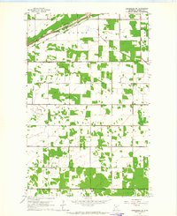 1962 Greenbush NE1964 Print · USGSRoseau County farm country is documented here in the early 1960s, showing the intersection of rail and river in northern Minnesota. Genealogists can trace family land near Zion Ch Cem, the local Townhall, and the Great Northern railroad tracks.2 unique versions available
 - 1962 Map of Greenbush, 1964 Print
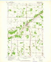 1962 Greenbush1964 Print · USGSGreenbush at the start of the 1960s was a critical rail junction and community center in Roseau County. Genealogists and local historians can trace the town's expansion and find specific locations for Bethania Cem, Greenbush Airport, and the Great Northern rail lines.
Showing maps 1-25 of 307
Top cities of Roseau County
- Roseau historical maps
- Warroad historical maps
- Greenbush historical maps
- Badger historical maps
- Ross historical maps
- Malung historical maps
See more
Frequently asked questions
- What are the different types of historical maps available for Roseau County?
- What is the oldest map of Roseau County?
- Where can I purchase historical maps of Roseau County for my home or office?
- Where can I download high-res historical maps of Roseau County?
- Are there historical topographic maps available for Roseau County?
- Is there historical aerial imagery available for Roseau County?
- Where are historical maps of Roseau County sourced from?