1960s Maps of Roseau County, Minnesota
Explore 43 historic maps of Roseau County from the 1960s. These maps offer a rare glimpse into what life looked like during the 1960s — showing old roads, neighborhoods, homes, and landmarks that have changed or disappeared over time.
Whether you're researching your family's past, planning a metal detecting trip, or studying how Roseau County's landscape evolved across the 1960s, these high-resolution maps are a powerful tool for exploring the history of this region.
- Focus on a specific era: All maps on this page are from the 1960s, giving you a focused view of this time period.
- See what’s changed: Compare century-old streets, trails, and buildings to today's modern landscape using overlays and satellite layers.
- Research with precision: Use these maps for genealogy, historical research, land use analysis, or educational projects.
- View, download, or print: Maps are fully viewable online in high resolution, and can be downloaded or printed for your own records.
Start exploring Roseau County's history through authentic maps from the 1960s. This is your window into the past.
Roseau County, MN maps
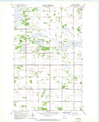
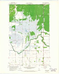
(43)- 1962 Map of Strathcona, 1964 Print
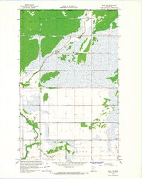
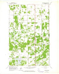 1962 Strathcona1964 Print · USGSStrathcona and the surrounding townships of Deer and Huntly are shown in the early 1960s, centered on the corridor of the Great Northern railway. Trace local family history through the locations of Bethlehem Cem, Poplar Grove Ch, and the rural Townhall.2 unique versions available
 - 1962 Map of Greenbush NE, 1964 Print
 1962 Greenbush NE1964 Print · USGSRoseau County farm country is documented here in the early 1960s, showing the intersection of rail and river in northern Minnesota. Genealogists can trace family land near Zion Ch Cem, the local Townhall, and the Great Northern railroad tracks.2 unique versions available
 - 1962 Map of Greenbush, 1964 Print
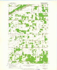
 1962 Greenbush1964 Print · USGSGreenbush at the start of the 1960s was a critical rail junction and community center in Roseau County. Genealogists and local historians can trace the town's expansion and find specific locations for Bethania Cem, Greenbush Airport, and the Great Northern rail lines.
 - 1962 Map of Greenbush SE, 1964 Print
 1962 Greenbush SE1964 Print · USGSThe agricultural borderlands of Roseau and Marshall counties come into focus during the early sixties, revealing a landscape defined by drainage and township lines. Researchers can locate the Lorenson Cem, a local Townhall, and the significant path of Judicial Ditch No 19.
 - 1966 Map of Haug, 1967 Print
 1966 Haug1967 Print · USGSNorthwestern Minnesota marshlands and agricultural townships are mapped here in the mid-1960s. Researchers can locate community centers like the Haug-Leo Sch, the settlement of Haug, and historic sites including Oiland Ch and Bethania Cem.
 - 1966 Map of Pinecreek, 1967 Print
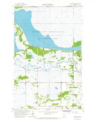
 1966 Pinecreek1967 Print · USGSThe northern edge of Roseau County meets the Canadian border in the mid-1960s, a landscape defined by international transit and extensive river drainage. Genealogists and local historians can locate rural landmarks like Pinecreek Ch, Mellum Cem, and the specialized Port of Entry U S Customs.
 - 1966 Map of Badger NW, 1967 Print
 1966 Badger NW1967 Print · USGSNorthern Roseau County sits along the Canadian border in the mid-sixties, showcasing a landscape defined by extensive water management and wildlife conservation. Researchers can trace the early infrastructure of the Roseau River State Wildlife Management Area and the courses of State Ditch No 69 and the Roseau River.
 - 1966 Map of Caribou, 1967 Print
 1966 Caribou1967 Print · USGSThe Minnesota-Manitoba border comes into focus in the mid-1960s, showing the remote northern reaches of Kittson County. Genealogists and local historians can locate the Caribou settlement and its Cem, or trace the engineering of Judicial Ditch No 32.
 - 1966 Map of Badger, 1967 Print
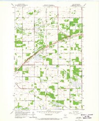
 1966 Badger1967 Print · USGSBadger and the surrounding Skagen township are documented in the mid-1960s, showing the intersection of rail transport and rural agriculture. Genealogists can locate several local burial sites including Badger Creek Cem, Swedish Cem, and St Marys Cem near the Great Northern tracks.
 - 1966 Map of Badger NE, 1967 Print
 1966 Badger NE1967 Print · USGSThe international borderlands of Roseau County are captured here in the mid-1960s, showing a landscape defined by the Roseau River State Wildlife Management Area. Researchers can trace old township lines in Pohlitz and Dieter or locate family sites near Immanuel Cem.
 - 1966 Map of Fox, 1967 Print
 1966 Fox1967 Print · USGSNorthwestern Minnesota's prairie landscape is captured here in the mid-1960s, showing the intersection of rail and drainage infrastructure. Researchers can trace the diagonal route of the Great Northern railroad through Fox or locate the Opdahl Cem and local Townhall.2 unique versions available
 - 1966 Map of Juneberry Ridge, 1967 Print
 1966 Juneberry Ridge1967 Print · USGSThe borderlands of Kittson and Roseau counties are shown here in the mid-sixties, dominated by agricultural drainage networks. Genealogists and researchers can trace the settlement of Polonia or locate old landmarks like Juneberry Ridge and Moose Point.2 unique versions available
 - 1966 Map of Salol NW, 1968 Print
 1966 Salol NW1968 Print · USGSNorthern Roseau County meets the Canadian border in the mid-1960s, showing a landscape defined by extensive wetland drainage and early hydraulic engineering. Genealogists and researchers can trace local water management via Judicial Ditch No 61 or locate the Gaging Station on Sprague Creek.2 unique versions available
 - 1966 Map of Malung, 1968 Print
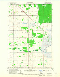
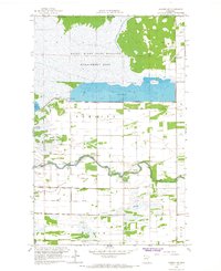
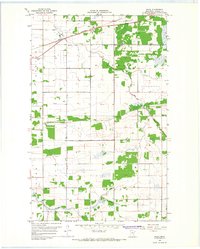
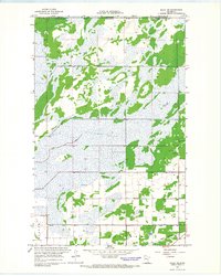
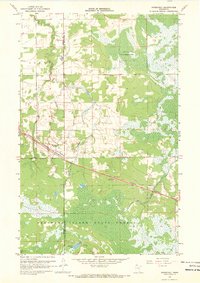
 1966 Malung1968 Print · USGSRoseau County in the mid-1960s reveals a landscape defined by the winding Roseau River and the steady presence of the Great Northern railroad. Genealogists can locate family sites near Spruce Cem, Malung Hall, and the Roseau Municipal Airport.
 - 1966 Map of Roseau, 1968 Print
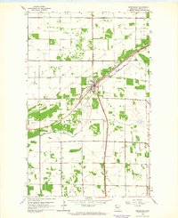
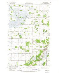
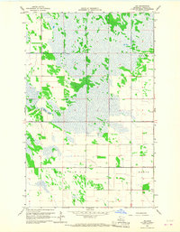
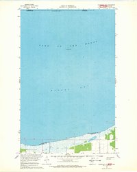
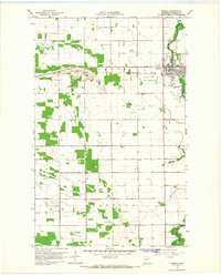 1966 Roseau1968 Print · USGSRoseau flourished in the mid-sixties as a vital rail and river hub for northern Minnesota agriculture. Genealogists can locate family sites at Sacred Heart Cem and Hope Cem, while tracing the influence of the Great Northern railroad and the Roseau River.2 unique versions available
 - 1966 Map of Salol, 1968 Print
 1966 Salol1968 Print · USGSRoseau County, Minnesota, is captured here in the mid-1960s as a landscape of rail-linked settlements and organized drainage. You can trace the Great Northern line through Salol or locate local landmarks like Bethel Ch and Fairview Cem.
 - 1966 Map of Caribou NE, 1968 Print
 1966 Caribou NE1968 Print · USGSThe northern edge of Roseau County meets the Canadian border in the mid-1960s, a landscape defined by expansive wetlands and river management. Researchers can trace local landmarks like Juneberry Cem and the managed waters of Pool No 3 and Blooming Valley.2 unique versions available
 - 1966 Map of Roseau NE, 1968 Print
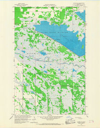
 1966 Roseau NE1968 Print · USGSNear the Manitoba border in the mid-1960s, this area of Roseau County shows a landscape of reclaimed land and international transit. Researchers can trace the winding Roseau River past the U.S. Customs Port of Entry, the local Townhall, and the expansive Lakebed.2 unique versions available
 - 1966 Map of Salol NE, 1968 Print
 1966 Salol NE1968 Print · USGSThe Minnesota borderlands in the mid-1960s reveal a landscape of managed wetlands and isolated rural outposts. Genealogists can locate family landmarks like Salol Mission Cem and Norland Ch near the Great Northern rail line.2 unique versions available
 - 1966 Map of Leo, 1968 Print
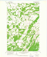
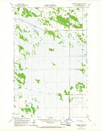
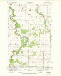
 1966 Leo1968 Print · USGSRoseau County in the mid-1960s was a landscape defined by significant wetland drainage and rural townships. Researchers can locate the small settlement of Leo, the central Townhall, and the engineered path of State Ditch No 72.2 unique versions available
 - 1967 Map of Thief River Falls
 1967 Thief River Falls1967 Print · USGSThe Red River Valley and the international border come alive in the 1960s, showing a landscape shaped by major rail lines and river commerce. Genealogists and historians can trace the paths of the Great Northern and Soo Line through towns like Thief River Falls, Grafton, and Hallock.
 - 1967 Map of Thief Lake NE, 1969 Print
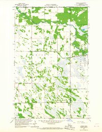
 1967 Thief Lake NE1969 Print · USGSNorthern Minnesota's rural townships are captured in the late sixties, showing a landscape defined by small-scale farming and glacial geology. Genealogists can trace local landmarks like Oak Hill Cem, Stafford Ch, and the settlement at Poplar Grove.2 unique versions available
 - 1967 Map of Roosevelt NW, 1969 Print
 1967 Roosevelt NW1969 Print · USGSThe northern borderlands of Minnesota meet Manitoba in the late 1960s at the wide waters of Lake of the Woods. Genealogists and researchers can trace the shoreline settlement of Moranville and the marshy terrain surrounding Laona.
 - 1967 Map of Roosevelt, 1969 Print
 1967 Roosevelt1969 Print · USGSThe village of Roosevelt is shown at a pivotal moment in the late sixties, centered on the border of Roseau and Lake of the Woods counties. Genealogists and historians can trace the Canadian National rail corridor or locate landmarks like Norquist Lake and the Krull Trail.2 unique versions available
 - 1967 Map of Wannaska, 1969 Print
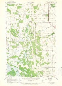
 1967 Wannaska1969 Print · USGSRoseau County near the Canadian border during the late 1960s was a landscape of winding river forks and rural townships. Researchers can trace family history at Mickinock Cem, visit Salem Ch, or locate the community of Wannaska.
Showing maps 1-25 of 43
Top cities of Roseau County
- Roseau historical maps
- Warroad historical maps
- Greenbush historical maps
- Badger historical maps
- Ross historical maps
- Malung historical maps
See more
Frequently asked questions
- What are the different types of historical maps available for Roseau County?
- What is the oldest map of Roseau County?
- Where can I purchase historical maps of Roseau County for my home or office?
- Where can I download high-res historical maps of Roseau County?
- Are there historical topographic maps available for Roseau County?
- Is there historical aerial imagery available for Roseau County?
- Where are historical maps of Roseau County sourced from?