1980s Maps of Roseau County, Minnesota
Explore 5 historic maps of Roseau County from the 1980s. These maps offer a rare glimpse into what life looked like during the 1980s — showing old roads, neighborhoods, homes, and landmarks that have changed or disappeared over time.
Whether you're researching your family's past, planning a metal detecting trip, or studying how Roseau County's landscape evolved across the 1980s, these high-resolution maps are a powerful tool for exploring the history of this region.
- Focus on a specific era: All maps on this page are from the 1980s, giving you a focused view of this time period.
- See what’s changed: Compare century-old streets, trails, and buildings to today's modern landscape using overlays and satellite layers.
- Research with precision: Use these maps for genealogy, historical research, land use analysis, or educational projects.
- View, download, or print: Maps are fully viewable online in high resolution, and can be downloaded or printed for your own records.
Start exploring Roseau County's history through authentic maps from the 1980s. This is your window into the past.
Roseau County, MN maps
(5)- 1982 Map of Pelan
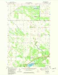 1982 Pelan1982 Print · USGSNorthwestern Minnesota in the early eighties was defined by its vast conservation areas and complex drainage networks. Genealogists and local historians can trace the settlement of Pelan and find the Pioneer Cem near the South Branch Two Rivers.
 - 1982 Map of Pelan SE
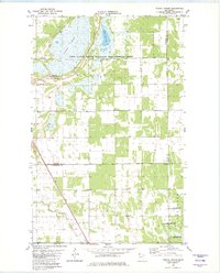
 1982 Pelan SE1982 Print · USGSThe rural borderlands of Roseau and Marshall County are captured here in the early 1980s, defined by a vast drainage network. Local historians can trace family ties at Bethlehem Ch and its Cem, or locate the civic center at the nearby Townhall.
 - 1982 Map of Twistal Swamp
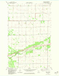
 1982 Twistal Swamp1982 Print · USGSThe marshlands of Kittson County are captured here in the early eighties, showing a landscape defined by the drainage of Twistal Swamp. Local researchers can locate community anchors like the Zion Ch and Townhall alongside the winding Tamarac River.
 - 1982 Map of Pelan NE
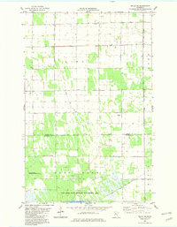
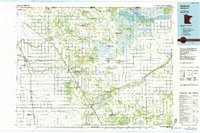
 1982 Pelan NE1982 Print · USGSRoseau County in the early eighties is a landscape of expansive townships and complex drainage systems like State Ditch No 95. Genealogists and local historians can locate the Pelan Pioneer Chapel, Pauli Cem, and the communal Townhall.
 - 1985 Map of Hallock
 1985 Hallock1985 Print · USGSNorthwestern Minnesota’s borderlands are captured here in the mid-1980s as a managed landscape of agriculture and conservation. Trace the Burlington Northern line through historic rail towns like Hallock or locate remote airstrips and the expansive Lake Bronson State Park.2 unique versions available
End of results
Showing maps 1-5 of 5
Top cities of Roseau County
- Roseau historical maps
- Warroad historical maps
- Greenbush historical maps
- Badger historical maps
- Ross historical maps
- Malung historical maps
See more
Frequently asked questions
- What are the different types of historical maps available for Roseau County?
- What is the oldest map of Roseau County?
- Where can I purchase historical maps of Roseau County for my home or office?
- Where can I download high-res historical maps of Roseau County?
- Are there historical topographic maps available for Roseau County?
- Is there historical aerial imagery available for Roseau County?
- Where are historical maps of Roseau County sourced from?