Old Maps of Calhoun County, Mississippi for Academic Research
Study the evolution of Calhoun County with 139 high-resolution historic maps. Whether you're teaching, researching, or modeling changes in land use, these maps provide essential visual documentation of urban, environmental, and geographic change.
- Analyze long-term change: Track patterns in development, transportation, and natural features.
- Ideal for environmental or urban studies: Support academic projects with primary historical map data.
- Use in the classroom or lab: Educators and researchers rely on these maps to bring historical context to life.
These maps are a powerful tool for teaching, research, and visualizing how Calhoun County has changed over the decades.
Calhoun County, MS maps
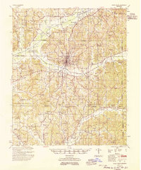
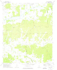
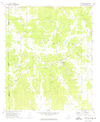
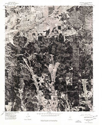
(139)- 1953 Map of Walthall
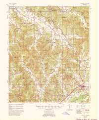 1953 Walthall1953 Print · USGSMid-century Webster County is documented here during a period of rural stability, centered on the county seat and the rail junction at Eupora. Researchers can trace old family sites and rural landmarks like Doolittle Chapel Sch, Greenboro Ch & Cem, and the historic Natchez Trace.
 - 1953 Map of West Point, 1973 Print
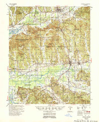
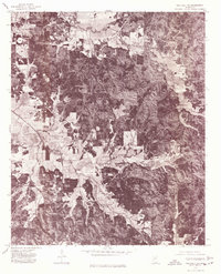
 1953 West Point1973 Print · USGSNorth-Central Mississippi and the Alabama borderlands are captured here during the mid-twentieth century as new reservoirs and national forests transformed the landscape. Researchers can trace the path of the Mississippi & Skuna Valley railroad or locate old landings along the Tombigbee River and Schooner Creek.3 unique versions available
 - 1954 Map of Pittsboro
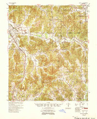
 1954 Pittsboro1954 Print · USGSCalhoun County's river valleys and timberlands are captured here in the mid-fifties as the Grenada Reservoir took shape. Genealogists can locate family landmarks such as Zion Springs Ch & Cem, Worford Ch & Sch, and the Mississippi & Skuna Valley RR.3 unique versions available
 - 1954 Map of Duck Hill
 1954 Duck Hill1954 Print · USGSThe hills of north-central Mississippi come alive in the 1950s, showing a landscape defined by the Illinois Central and small rural parishes. Researchers can trace the layout of Camp McCain (Abandoned) or find family roots at Hays Creek Ch Sch & Cem and Sweatman.2 unique versions available
 - 1954 Map of Water Valley, 1966 Print
 1954 Water Valley1966 Print · USGSYalobusha County was undergoing significant hydrological change in the mid-fifties as the Enid Reservoir reshaped the valley. Researchers can trace dozens of rural church and school sites, from Sylva Rena Ch & Cem to the Pine Valley Sch.2 unique versions available
 - 1955 Map of Water Valley
 1955 Water Valley1955 Print · USGSYalobusha County enters the mid-fifties with the newly formed Enid Reservoir reshaping the valley's geography. Genealogists and historians can trace family locations through numerous rural sites like Sylva Rena Ch & Cem and the Oak Grove Sch.
 - 1955 Map of Coffeeville
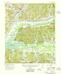 1955 Coffeeville1955 Print · USGSYalobusha and Grenada Counties are captured here in the mid-fifties, just as the local landscape was being reshaped by the rising Grenada Reservoir. Genealogists and historians can trace dozens of rural landmarks, from the Hopewell Ch & Cem to the Indian Mound and the Illinois Central rail line.2 unique versions available
 - 1956 Map of Tupelo, 1967 Print
 1956 Tupelo1967 Print · USGSNortheast Mississippi and parts of Tennessee and Alabama are shown here during the mid-fifties, a time of major reservoir construction and forestry management. Researchers can trace the St Louis-San Francisco RR through Tupelo or locate historic sites like Tishomingo State Park and the University.2 unique versions available
 - 1958 Map of Tupelo
 1958 Tupelo1958 Print · USGSNortheast Mississippi and neighboring Alabama and Tennessee appear here during the late fifties as a region defined by new reservoirs and historic rail lines. Genealogists can trace family locations near Sardis Lake, Woodall Mountain, and the St Louis-San Francisco Ry.
 - 1958 Map of West Point
 1958 West Point1958 Print · USGSNortheastern Mississippi and western Alabama are shown in the late 1950s, highlighting a region defined by its river-and-rail economy. Researchers can trace family roots through numerous settlements like Artesia and Vardaman or explore the corridor of the Tombigbee River.
 - 1963 Map of West Point
 1963 West Point1963 Print · USGSEastern Mississippi and western Alabama are captured in the early sixties as industrial centers and rail lines connected the Black Prairie to the hills. Genealogists and historians can trace family-named watercourses and the early footprints of Starkville, Columbus, and the Noxubee National Wildlife Refuge.2 unique versions available
 - 1972 Map of Paris, 1974 Print
 1972 Paris1974 Print · USGSLafayette County rural life is well-documented in the early seventies, centered on the crossroads at Paris. Researchers can trace old family roots through sites like Rock Hill Ch, Delay, and several smaller cemeteries near Otoucalofa Creek.
 - 1972 Map of Robbs, 1974 Print
 1972 Robbs1974 Print · USGSThis rural Mississippi landscape at the junction of three counties features the scattered communities and church-centered social life of the early 1970s. Researchers can locate family landmarks such as Robbs Chapel, Indian Creek Cem, and the settlement of Reid.
 - 1972 Map of Atlanta, 1974 Print
 1972 Atlanta1974 Print · USGSNortheast Mississippi’s rural landscape is captured here in the early seventies, dominated by the canalization of major watercourses. Genealogists can locate family landmarks such as Old Pleasant Grove Cem, Midway Ch, and Collage Hill Ch.
 - 1972 Map of Banner, 1974 Print
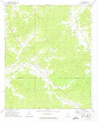
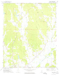
 1972 Banner1974 Print · USGSCalhoun County in the early seventies shows a landscape of family-named lakes and rural crossroads churches. Genealogists can trace local roots through Rapers Chapel, Reasons Cem, and settlements like Banner or Ellard.
 - 1972 Map of Vardaman, 1974 Print
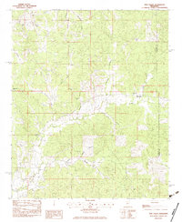
 1972 Vardaman1974 Print · USGSThe area surrounding Vardaman in the early 1970s reflects a landscape of rural communities and crossroads. Researchers can trace family roots through sites like Georgies Chapel, New Liberty Ch, and the Reid Lookout Tower.2 unique versions available
 - 1972 Map of Hohenlinden, 1974 Print
 1972 Hohenlinden1974 Print · USGSWebster County's rural communities and creek valleys are captured here in the early seventies, just as the landscape remained defined by small settlements and winding forest roads. Genealogists can trace family sites at Old Shady Grove Cem or locate historic pulpits like Popular Springs Ch and Hebron Ch.
 - 1972 Map of Randolph, 1974 Print
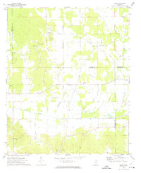
 1972 Randolph1974 Print · USGSRandolph and the surrounding Pontotoc County countryside are shown here in the early 1970s as a network of small family farms and rural churches. Genealogists can trace family names through numerous local burial grounds including Salmon Cem and Harrison-Tutor Cem, or locate landmarks like Camp Yocona.
 - 1972 Map of Sarepta, 1974 Print
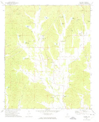
 1972 Sarepta1974 Print · USGSCalhoun County's rural landscape is captured here in the early 1970s, showing a region defined by the Skuna River and its many tributaries. Researchers can locate numerous local landmarks including Lantrip Ch, Duff Chapel, and the Hastings Landing Strip.
 - 1972 Map of Tula, 1975 Print
 1972 Tula1975 Print · USGSLafayette and Calhoun Counties are captured here in the early seventies, showing a landscape defined by the Yocona River and rural crossroads. Local historians can trace the foundations of Tula and Sarepta alongside sites like Stutson Chapel and Old Dallas Cemetery.
 - 1976 Map of Pittsboro SE, 1977 Print
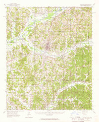
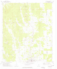
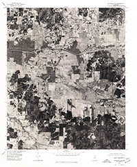 1976 Pittsboro SE1977 Print · USGSCalhoun County in the mid-seventies is seen here through detailed aerial photography, showing the rural landscape around Calhoun City. Researchers can trace land use patterns and water management systems like the Yalobusha Canal and the town grid of Derma.
 - 1976 Map of Pittsboro NE, 1977 Print
 1976 Pittsboro NE1977 Print · USGSNorthern Calhoun County comes into focus in the mid-1970s, showing the intersection of agricultural land and managed timber. Researchers can trace the developed streets of Bruce and the path of the Skuna River Canal through the valley.
 - 1976 Map of Walthall NE, 1977 Print
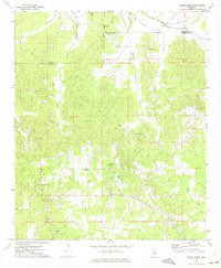
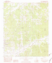
 1976 Walthall NE1977 Print · USGSWebster County’s rural landscape is revealed through mid-seventies aerial imagery, documenting the timberlands and homesteads of northern Mississippi. Researchers can locate exact building footprints and property clearings near Bellefontaine, Slate Spring, and Embry.
 - 1983 Map of Pine Valley
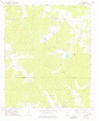
 1983 Pine Valley1983 Print · USGSYalobusha and Calhoun Counties are captured in the early eighties, showing a landscape of timbered ridges and small family homesteads. Genealogists can locate community anchors like Bethel Ch, Macedonia Cem, and the settlement of Pine Valley.
 - 1983 Map of Water Valley East
 1983 Water Valley East1983 Print · USGSThe hills of north-central Mississippi are mapped here in the early eighties, centered on the tri-county borders of Lafayette, Yalobusha, and Calhoun. Genealogists can trace family roots through numerous country landmarks like South Hopewell Ch, Oak Ridge Cem, and Wyatt Chapel Cem.
Showing maps 1-25 of 139
Top cities of Calhoun County
- Bruce historical maps
- Calhoun City historical maps
- Derma historical maps
- Vardaman historical maps
- Pittsboro historical maps
- Big Creek historical maps
Frequently asked questions
- What are the different types of historical maps available for Calhoun County?
- What is the oldest map of Calhoun County?
- Where can I purchase historical maps of Calhoun County for my home or office?
- Where can I download high-res historical maps of Calhoun County?
- Are there historical topographic maps available for Calhoun County?
- Is there historical aerial imagery available for Calhoun County?
- Where are historical maps of Calhoun County sourced from?