Old Maps of Panola County, Mississippi for Metal Detecting
Plan your next treasure hunt with 157 historic maps of Panola County. Find old homesites, ghost towns, trails, and gathering spots that may be lost to time — perfect for identifying promising metal detecting locations.
- Locate forgotten sites: Uncover places like long-lost settlements, abandoned rail lines, or gathering spots.
- Plan better hunts: Use map overlays combined with LiDAR or satellite views to narrow in on historically rich areas.
- Made for detectorists: Thousands of hobbyists use these maps to discover relics, coins, and hidden history.
Use these historic maps to boost your research and find new opportunities beneath the surface of Panola County.
Panola County, MS maps
(157)- 1932 Map of Sledge
 1932 Sledge1932 Print · USGSThe Mississippi Delta's complex water and rail networks are preserved here as they existed in the early thirties. Genealogists and local historians can trace family locations near the Yazoo and Mississippi Valley RR, Porters Ferry Sch, and Sanfords Chapel.2 unique versions available
 - 1932 Map of Crenshaw, 1964 Print
 1932 Crenshaw1964 Print · USGSNorthwest Mississippi in the early thirties reveals a complex network of Delta bayous and hill-country settlements. Genealogists can trace family roots through dozens of rural landmarks, from Cottonville Store to Brooks Chapel and the Longtown Sch.
 - 1935 Map of Crowder
 1935 Crowder1935 Print · USGSThe Mississippi Delta's intricate river systems and rural communities are captured here in the mid-1930s. Researchers can locate vanished landmarks like Dry Bayou Plantation, the Quitman Co Hunting Club, and numerous schools such as Pharsalia Sch.3 unique versions available
 - 1935 Map of Crenshaw
 1935 Crenshaw1935 Print · USGSNorthwest Mississippi in the mid-thirties was a landscape of intricate bayous and thriving rural communities tied to the rail and river. Genealogists can trace family roots through numerous local landmarks like Cottonville Store, New Salem Ch, and Spring Hill Sch.2 unique versions available
 - 1935 Map of Sledge
 1935 Sledge1935 Print · USGSThe Tallahatchie River bottomlands come to life in this mid-1930s survey of the Quitman and Panola county line. Genealogists and local historians can trace the foundations of rural life through family-named landmarks like Harmonious Sch, the railroad hub at Sledge, and Carnes Landing Field.2 unique versions available
 - 1939 Map of Sledge, 1943 Print
 1939 Sledge1943 Print · USGSThe Mississippi Delta's intricate river and rail network comes to life in this late 1930s survey of the Sledge and Batesville area. Genealogists can trace family footprints across dozens of country landmarks like Curtis Station, Mastodon Sch, and Porters Ferry.
 - 1939 Map of Crowder, 1943 Print
 1939 Crowder1943 Print · USGSThe Delta lowlands near the Panola and Quitman border are captured here during a period of transition in water management. Researchers can locate vanished rural landmarks like Independence Sch, Oak Grove Ch, and the Quitman Co Hunting Club.
 - 1940 Map of Oxford, 1956 Print
 1940 Oxford1956 Print · USGSLafayette County was undergoing a major landscape shift in the 1940s as the Sardis Reservoir took shape northwest of Oxford. Researchers can trace the early layout of the University of Mississippi and dozens of rural landmarks like Pearly Gate Ch and College Hill Sta.2 unique versions available
 - 1943 Map of Oxford
 1943 Oxford1943 Print · USGSLafayette County during the early years of the Second World War shows the transformation of the Tallahatchie valley as the Sardis Reservoir begins to dominate the north. Researchers can trace the rural infrastructure of the era through sites like Spring Hill Sch & Ch, the Illinois Central tracks, and the University of Mississippi.2 unique versions available
 - 1944 Map of Senatobia, 1946 Print
 1944 Senatobia1946 Print · USGSNorthwest Mississippi at the end of the war reveals a landscape of rural school-churches and new reservoirs. Genealogists can trace family roots at the Wright Fam Cem, Lashures Sch & Cem, or the Bethlehem African Ch near the Illinois Central line.3 unique versions available
 - 1944 Map of Tyro, 1964 Print
 1944 Tyro1964 Print · USGSMississippi's hill country met a changing river landscape in the mid-1940s as the Sardis Reservoir took shape. Genealogists can trace hundreds of family landmarks, from Harmontown to local institutions like St Josephs Ch & Sch and Lammey Fam Cem.
 - 1948 Map of Helena
 1948 Helena1948 Print · USGSEastern Arkansas and the Mississippi Delta are captured here just after the war, showing a landscape defined by its great rivers and rail lines. Genealogists can trace family locations near Bemis Plantation, Helena, and smaller rail stops like Wheatley and Moro.
 - 1950 Map of Helena
 1950 Helena1950 Print · USGSMid-century Phillips County and the surrounding Delta region are shown at a peak of rail and river commerce. Genealogists and historians can trace family locations through numerous rural communities like Old Austin, Cotton Plant, and West Helena, or follow the routes of the Missouri Pacific RR across Grand Prairie.2 unique versions available
 - 1952 Map of Sardis, 1965 Print
 1952 Sardis1965 Print · USGSPanola County enters the post-war era as the newly formed Sardis Lake reshapes the Tallahatchie River valley. Genealogists can trace decades of community history through numerous rural landmarks like Mt Olivet Ch & Cem and Vaughn Sch.
 - 1953 Map of Sardis
 1953 Sardis1953 Print · USGSPanola County's landscape is defined by the managed waters of the Tallahatchie and the steady pulse of the rail line during the early fifties. Genealogists can locate numerous rural landmarks like Central Academy, Ross Hill Cem, and Simon Chapel No 2 Sch & Cem.
 - 1954 Map of Oakland
 1954 Oakland1954 Print · USGSThe Enid Lake area and the Yocona River valley are captured in the mid-1950s as flood control projects reshaped the Mississippi landscape. Researchers can trace rural lineages through dozens of sites like Mount Pisgah Ch & Cem and Spring Hill Sch & Cem.3 unique versions available
 - 1954 Map of Water Valley, 1966 Print
 1954 Water Valley1966 Print · USGSYalobusha County was undergoing significant hydrological change in the mid-fifties as the Enid Reservoir reshaped the valley. Researchers can trace dozens of rural church and school sites, from Sylva Rena Ch & Cem to the Pine Valley Sch.2 unique versions available
 - 1954 Map of Water Valley West, 1980 Print
 1954 Water Valley West1980 Print · USGSYalobusha and Lafayette counties are shown here as the Enid Lake reservoir reshaped the Yocona River valley in the early 1980s. Genealogists and local historians can locate numerous rural landmarks like Pine Spring Cem, Kind Providence Ch, and the town of Water Valley.
 - 1955 Map of Water Valley
 1955 Water Valley1955 Print · USGSYalobusha County enters the mid-fifties with the newly formed Enid Reservoir reshaping the valley's geography. Genealogists and historians can trace family locations through numerous rural sites like Sylva Rena Ch & Cem and the Oak Grove Sch.
 - 1955 Map of Helena, 1967 Print
 1955 Helena1967 Print · USGSThe Arkansas Delta and Mississippi floodplains are captured here in the mid-fifties, during a period of expanding flood control and rail commerce. Researchers can trace the extensive Chicago Rock Island and Pacific RR lines and locate sites like the Arkansas State College Experimental Rice Farm or Friars Point.2 unique versions available
 - 1956 Map of Tupelo, 1967 Print
 1956 Tupelo1967 Print · USGSNortheast Mississippi and parts of Tennessee and Alabama are shown here during the mid-fifties, a time of major reservoir construction and forestry management. Researchers can trace the St Louis-San Francisco RR through Tupelo or locate historic sites like Tishomingo State Park and the University.2 unique versions available
 - 1958 Map of Tupelo
 1958 Tupelo1958 Print · USGSNortheast Mississippi and neighboring Alabama and Tennessee appear here during the late fifties as a region defined by new reservoirs and historic rail lines. Genealogists can trace family locations near Sardis Lake, Woodall Mountain, and the St Louis-San Francisco Ry.
 - 1959 Map of Helena
 1959 Helena1959 Print · USGSThe Arkansas and Mississippi Delta regions are captured here in the late fifties, showing a landscape defined by the Mississippi River and the Grand Prairie. Genealogists and researchers can trace the rail networks of the Illinois Central RR and locate community landmarks like Helena and the White River National Wildlife Refuge.
 - 1960 Map of Helena
 1960 Helena1960 Print · USGSThe Arkansas and Mississippi Delta regions meet along the great river bends during a period of significant agricultural and rail expansion. Genealogists and historians can trace the paths of the Missouri Pacific railroad through Clarendon or locate landings along the Mississippi River and White River.
 - 1962 Map of Crowder, 1965 Print
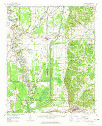 1962 Crowder1965 Print · USGSThe Mississippi Delta meets the eastern hills in the early sixties, showing a landscape shaped by massive water-management projects and deep family roots. Genealogists can locate Shady Grove Cemetery, Walkers Chapel, and the community of Charleston.3 unique versions available
Showing maps 1-25 of 157
Top cities of Panola County
- Batesville historical maps
- Sardis historical maps
- Como historical maps
- Courtland historical maps
- Pope historical maps
Frequently asked questions
- What are the different types of historical maps available for Panola County?
- What is the oldest map of Panola County?
- Where can I purchase historical maps of Panola County for my home or office?
- Where can I download high-res historical maps of Panola County?
- Are there historical topographic maps available for Panola County?
- Is there historical aerial imagery available for Panola County?
- Where are historical maps of Panola County sourced from?