1900s (20th Century) Maps of Lafayette County, Missouri
Explore 54 historic maps of Lafayette County from the 1900s (20th Century). These maps offer a rare glimpse into what life looked like during the 1900s — showing old roads, neighborhoods, homes, and landmarks that have changed or disappeared over time.
Whether you're researching your family's past, planning a metal detecting trip, or studying how Lafayette County's landscape evolved across the 1900s, these high-resolution maps are a powerful tool for exploring the history of this region.
- Focus on a specific era: All maps on this page are from the 1900s, giving you a focused view of this time period.
- See what’s changed: Compare century-old streets, trails, and buildings to today's modern landscape using overlays and satellite layers.
- Research with precision: Use these maps for genealogy, historical research, land use analysis, or educational projects.
- View, download, or print: Maps are fully viewable online in high resolution, and can be downloaded or printed for your own records.
Start exploring Lafayette County's history through authentic maps from the 1900s. This is your window into the past.
Lafayette County, MO maps
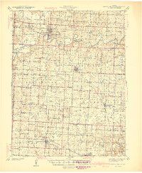
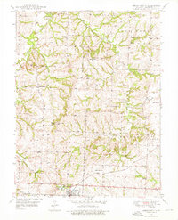
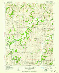
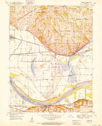
(54)- 1901 Map of Marshall
 1901 Marshall1901 Print · USGSCentral Missouri thrives along the river and rail lines at the turn of the century. Trace the early footprints of Marshall and Slater, or locate long-standing river landings and rural stations like Miami Station, Malta Bend, and Laynesville.5 unique versions available
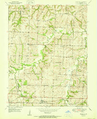
 - 1917 Map of Knobnoster
 1917 Knobnoster1917 Print · USGSSettlement and education are deeply rooted in this early twentieth-century survey of Johnson County, Missouri. Genealogists can trace family school districts like Hepsidam School and Union Prairie School or locate early rail stops at Knobnoster and Montserrat.3 unique versions available
 - 1939 Map of Sweet Springs
 1939 Sweet Springs1939 Print · USGSThe rural borderlands of Saline and Pettis Counties are captured here at the end of the 1930s as the rail and highway systems began to modernize the landscape. Genealogists can locate numerous country schoolhouses and churches like Sunny Dell Sch, Oak Grove Cem, and Houstonia.
 - 1940 Map of Sweet Springs
 1940 Sweet Springs1940 Print · USGSWestern Missouri in the late thirties is revealed here as a landscape of interconnected river valleys and tightly knit rural communities. Genealogists and historians can trace family roots through numerous country schools and landmarks like High Hill Cem, Bleak Mound, and the Missouri Pacific rail line.
 - 1941 Map of Sweet Springs
 1941 Sweet Springs1941 Print · USGSCentral Missouri farmland at the end of the Depression is defined here by the winding Blackwater River and the critical Missouri Pacific rail line. Genealogists and local historians can locate dozens of country schools and churches, such as Holy Cross Sch, Dunksburg, and the High Hill Cem.2 unique versions available
 - 1945 Map of Sweet Springs
 1945 Sweet Springs1945 Print · USGSCentral Missouri farmland at the end of the 1930s is revealed here, spanning the intersection of four counties. Genealogists can trace family roots through numerous rural landmarks like Holy Cross Ch, Weber Sch, and the isolated High Hill Cem.2 unique versions available
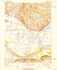
 - 1947 Map of Jefferson City, 1949 Print
 1947 Jefferson City1949 Print · USGSCentral Missouri and the northern Ozarks come into focus in this late 1940s survey of the river-and-rail landscape. Genealogists and historians can trace the growth of Jefferson City and Sedalia or locate family roots near Bagnell Dam and the Lake of the Ozarks.
 - 1947 Map of Lawrence, 1954 Print
 1947 Lawrence1954 Print · USGSEastern Kansas and western Missouri thrive in the late 1940s, showing a landscape defined by major river valleys and a dense railway network. Genealogists can trace family settlements from Lawrence to Greenwood and locate landmarks like Olathe Navy and Lake Lotawana.
 - 1949 Map of Mayview, 1956 Print
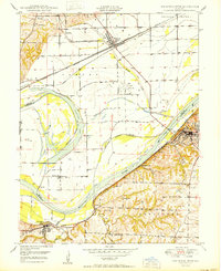
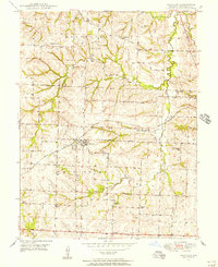 1949 Mayview1956 Print · USGSLafayette County agricultural and mining life is captured here in the late Forties, centered on the railroad town of Mayview. Genealogists and historians can locate numerous rural schools like Plum Grove Sch and churches including Marvin Chapel.2 unique versions available
 - 1949 Map of Lexington East, 1963 Print
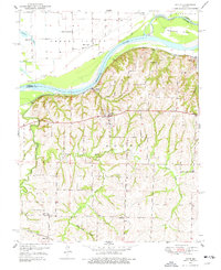
 1949 Lexington East1963 Print · USGSLafayette County enters the post-war era as a hub of river commerce and rural education. Researchers can trace historic coal operations at various Mine Dumps or locate local landmarks like Wentworth Military Academy and the Slusher Sch.3 unique versions available
 - 1949 Map of Lexington West, 1963 Print
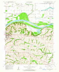
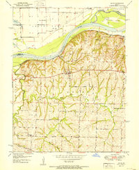
 1949 Lexington West1963 Print · USGSThe Missouri River floodplain in the late 1940s reveals a complex network of rail lines and riverfront industry between Ray and Lafayette counties. Researchers can trace the river's influence through features like the Sunshine Lake oxbow, the Henrietta rail junction, and the Myrick riverfront.3 unique versions available
 - 1949 Map of Odessa North, 1976 Print
 1949 Odessa North1976 Print · USGSLafayette County countryside is captured here in the late 1940s, just as the postwar era began to reshape rural Missouri. You can trace dozens of landmarks including the GULF MOBILE AND OHIO line, Greenton Ch, and old country schools like Cabbage Neck Sch.2 unique versions available
 - 1950 Map of Lexington East
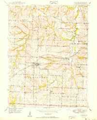
 1950 Lexington East1950 Print · USGSMid-century Lafayette County comes alive through this survey of the river valley and its surrounding uplands. Genealogists and historians can trace local family roots at Forest Grove Cem, Slusher Cem, and several rural schoolhouses like Burns Sch.
 - 1950 Map of Mayview
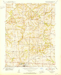
 1950 Mayview1950 Print · USGSLafayette County was a landscape of coal mining and country schoolhouses at mid-century, centered on the rail hub of Mayview. Researchers can trace old family landmarks like Marvin Chapel and numerous vanished rural schools, including Wheatly Sch and Elm Grove Sch.
 - 1950 Map of Kansas City
 1950 Kansas City1950 Print · USGSMid-century Kansas and Missouri are captured here during a period of industrial growth and shifting transportation. Genealogists and historians can trace rail lines like the Wabash RR or locate ancestral homes near the Potawatomi Indian Reservation and Horton.
 - 1950 Map of Odessa North
 1950 Odessa North1950 Print · USGSLafayette County was a patchwork of small school districts and family farms at mid-century, centered around the town of Odessa. Genealogists and local historians can trace the locations of rural landmarks like Greenton Ch, Cabbage Neck Sch, and the Gulf Mobile and Ohio railroad.2 unique versions available
 - 1950 Map of Lawrence
 1950 Lawrence1950 Print · USGSMid-century Kansas and Missouri come alive in this map of the river-valley corridors just as the interstate era was beginning. Researchers can trace the legacy of major rail lines like the Union Pacific RR and locate ancestral roots in towns from Lawrence to Harrisonville.
 - 1950 Map of Camden, 1955 Print
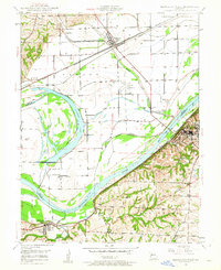
 1950 Camden1955 Print · USGSThe Missouri River bottomlands in the early 1950s show a landscape shaped by three major railroads and a complex levee system. Genealogists and local historians can trace family roots at New Hope Church, Lillard School, and the Cravens Cemetery.4 unique versions available
 - 1950 Map of Bates City, 1959 Print
 1950 Bates City1959 Print · USGSLafayette and Jackson Counties at the start of the 1950s are characterized by small farming communities and a high density of rural schools. Genealogists can locate family landmarks like Anderson Cem and Pleasant Prairie Sch, or trace the rail corridor of the Gulf Mobile and Ohio.2 unique versions available
 - 1950 Map of Lexington West, 1965 Print
 1950 Lexington West1965 Print · USGSThe Missouri River bluffs at the turn of the 1950s reveal a landscape of coal mining and river navigation along the Ray and Lafayette county lines. Researchers can trace family history through sites like Lexington Battle Ground, Sunshine Sch, and Foster Cem.
 - 1950 Map of Dover, 1977 Print
 1950 Dover1977 Print · USGSLafayette County river life and rural education are preserved here in the early 1950s, showing a landscape shaped by the Missouri River and the rail line. Researchers can trace family roots through numerous local landmarks like Dover Station, Page City School, and Baltimore Island.2 unique versions available
 - 1951 Map of Dover
 1951 Dover1951 Print · USGSThe bluffs of Lafayette County overlook the Missouri River bottomlands during the early 1950s. Genealogists and local historians can trace a dense network of rural schools like Dawson School and Page City School alongside the Missouri Pacific rail line.2 unique versions available
 - 1951 Map of Alma
 1951 Alma1951 Print · USGSLafayette County agricultural life and early aviation infrastructure are captured here in the early fifties. Genealogists and local historians can trace family roots through Alma and several country schools like Elk Grove Sch or cemeteries such as Maple Cem.3 unique versions available
 - 1951 Map of Camden
 1951 Camden1951 Print · USGSThe Missouri River floodplain comes alive in this mid-century survey of the Ray and Lafayette county border. Genealogists and local historians can trace rural family sites like Lewis Cem and South Point Cem or locate the old Lillard Sch.2 unique versions available
 - 1951 Map of Bates City
 1951 Bates City1951 Print · USGSBates City and Oak Grove are captured here in the early 1950s, showing the rural character of the Jackson and Lafayette County border. Genealogists can trace family footprints through numerous country schools like Fish Sch and burial sites such as Anderson Cem.2 unique versions available
Showing maps 1-25 of 54
Top cities of Lafayette County
- Odessa historical maps
- Higginsville historical maps
- Lexington historical maps
- Concordia historical maps
- Waverly historical maps
- Wellington historical maps
See more
Frequently asked questions
- What are the different types of historical maps available for Lafayette County?
- What is the oldest map of Lafayette County?
- Where can I purchase historical maps of Lafayette County for my home or office?
- Where can I download high-res historical maps of Lafayette County?
- Are there historical topographic maps available for Lafayette County?
- Is there historical aerial imagery available for Lafayette County?
- Where are historical maps of Lafayette County sourced from?