2020s Maps of Lafayette County, Missouri
Explore 19 historic maps of Lafayette County from the 2020s. These maps offer a rare glimpse into what life looked like during the 2020s — showing old roads, neighborhoods, homes, and landmarks that have changed or disappeared over time.
Whether you're researching your family's past, planning a metal detecting trip, or studying how Lafayette County's landscape evolved across the 2020s, these high-resolution maps are a powerful tool for exploring the history of this region.
- Focus on a specific era: All maps on this page are from the 2020s, giving you a focused view of this time period.
- See what’s changed: Compare century-old streets, trails, and buildings to today's modern landscape using overlays and satellite layers.
- Research with precision: Use these maps for genealogy, historical research, land use analysis, or educational projects.
- View, download, or print: Maps are fully viewable online in high resolution, and can be downloaded or printed for your own records.
Start exploring Lafayette County's history through authentic maps from the 2020s. This is your window into the past.
Lafayette County, MO maps
(19)- 2021 Map of Sweet Springs, 2021 Print
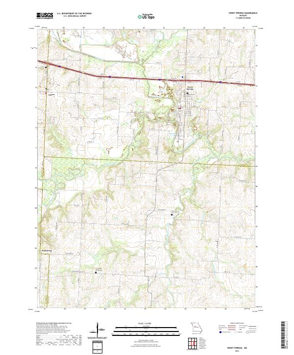 2021 Sweet Springs2021 Print · USGSSweet Springs and the tri-county border area of Saline, Lafayette, and Pettis counties are shown in this 2021 study. Researchers can trace rural lineages through sites like Fairview Cem and Blackwater Chapel Cem or locate the quiet settlements of Emma and Dunksburg.
 - 2021 Map of Concordia, 2021 Print
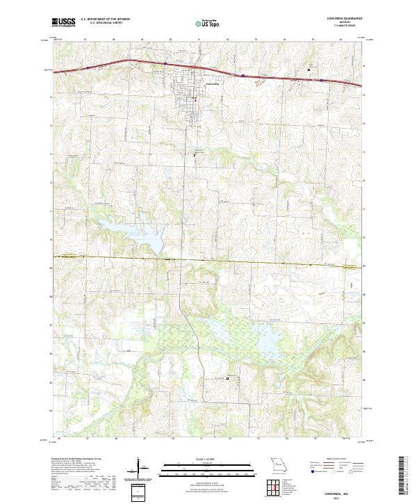 2021 Concordia2021 Print · USGSConcordia and the fertile plains of Lafayette County are captured here in the early 2020s as they border the Blackwater River valley. Researchers can trace family history through sites like Saint Johns Cemetery, Payne Cemetery, and the waters of Edwin A Pape Lake.
 - 2021 Map of Knob Noster NW, 2021 Print
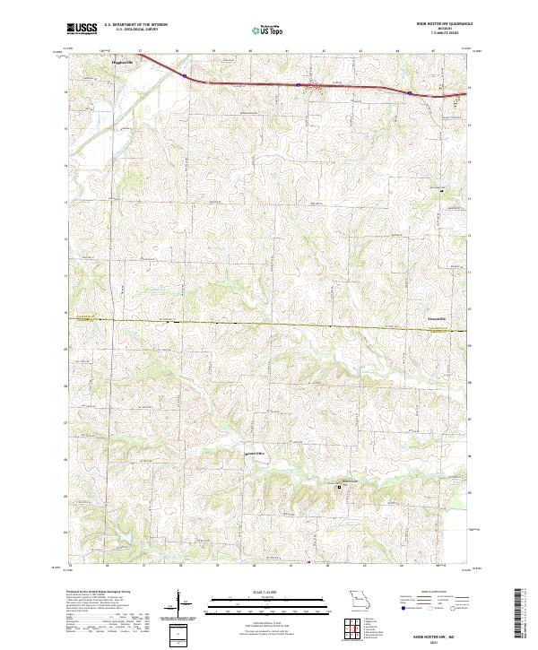 2021 Knob Noster NW2021 Print · USGSLafayette and Johnson Counties are captured here in the early 2020s, showcasing a rural landscape of winding creeks and family-named roads. Genealogists can trace local roots at Mount Olive or Ernestville and locate burials at New Hope Cem.
 - 2021 Map of Odessa South, 2021 Print
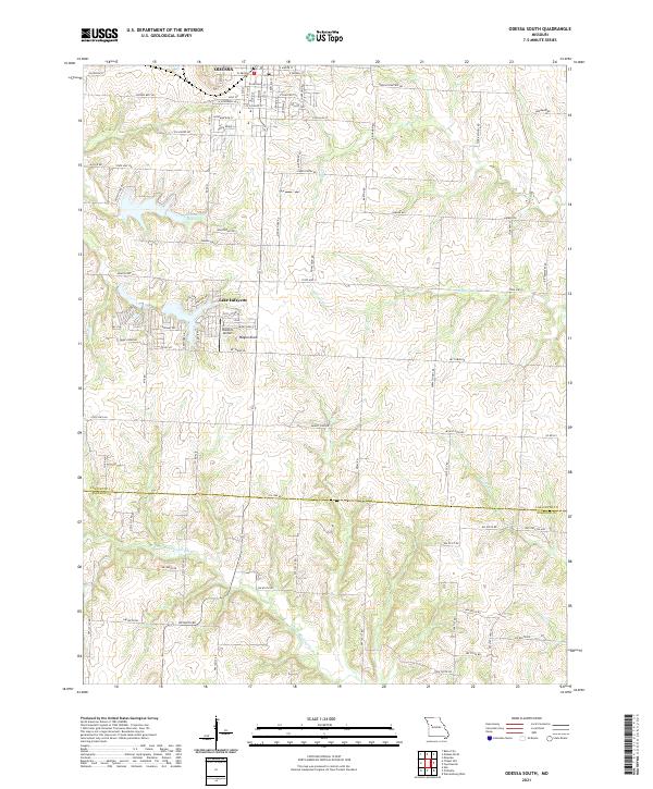 2021 Odessa South2021 Print · USGSLafayette County farmland meets the growing edges of the city in the early 2020s. Researchers can trace the layout of the Odessa Cemetery, identify local landmarks like Wagon Knob, and explore the residential development surrounding Lake Lafayette.
 - 2021 Map of Fayetteville, 2021 Print
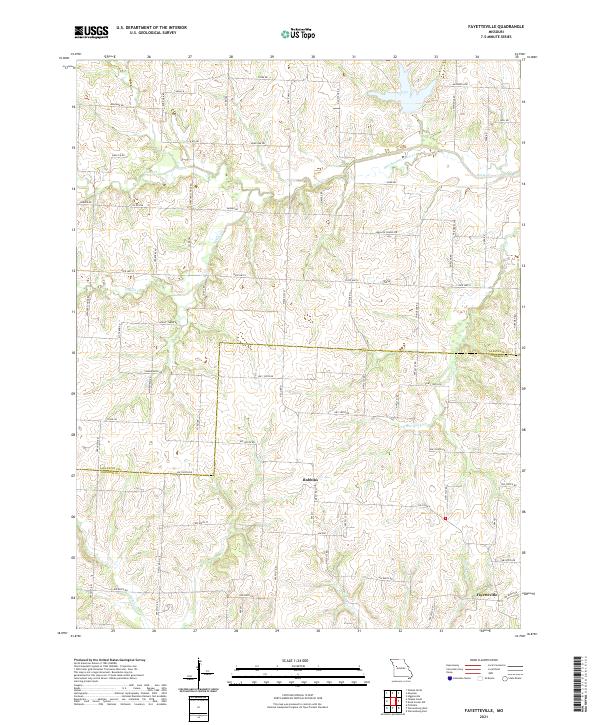 2021 Fayetteville2021 Print · USGSLafayette and Johnson Counties are captured here in the early twenty-first century, showing a landscape shaped by creek beds and country lanes. Genealogists can trace family-named landmarks and old community sites through routes like Oakland School Rd, Mount Tabor Rd, and Robbins.
 - 2021 Map of Carrollton East, 2021 Print
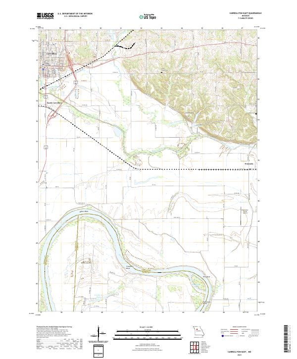 2021 Carrollton East2021 Print · USGSCarrollton and the surrounding Missouri River bottomlands are captured in detail during the early 2020s. Researchers can trace family roots at Willis Chapel Cem or locate specific town lots near the Carroll County Courthouse and South Carrollton.
 - 2021 Map of Higginsville, 2021 Print
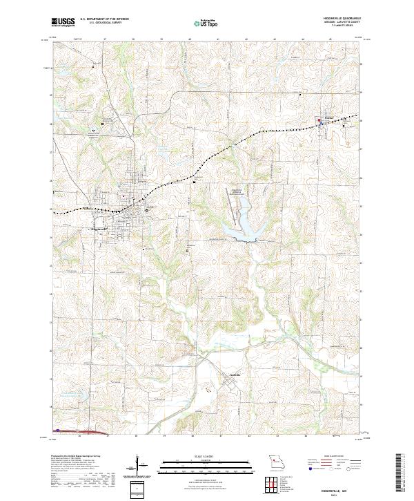 2021 Higginsville2021 Print · USGSLafayette County enters the 2020s with a landscape shaped by historical memory and agricultural roots between Higginsville and Corder. Researchers can trace local lineage through several burial sites like the Confederate Memorial Cem, Brand Cem, and Sharp Cem.
 - 2021 Map of Mayview, 2021 Print
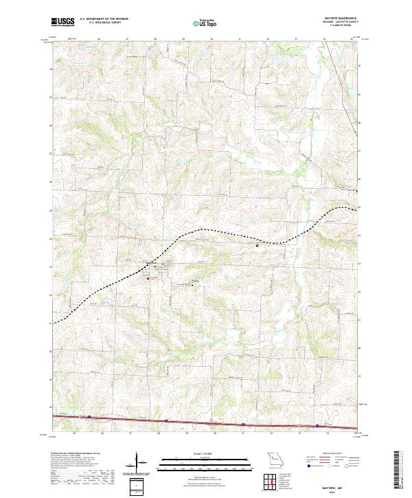 2021 Mayview2021 Print · USGSThe town of Mayview and its surrounding Lafayette County acreage are documented here in the early 2020s, showing a landscape of managed reservoirs and rural homesteads. Genealogists can locate specific burial sites at Mayview - Zion Cem and Poole Cem, or trace properties along Houx Rd and Rabius Rd.
 - 2021 Map of Lexington East, 2021 Print
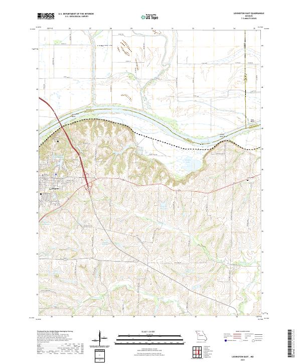 2021 Lexington East2021 Print · USGSLafayette County and the bluffs of the Missouri River are shown in detail during the early 2020s. Researchers can trace the layout of Lexington, identify local landmarks like Jubilee University, and find historic burial sites including Machpelah Cem and Slusher Cem.
 - 2021 Map of Blackburn, 2021 Print
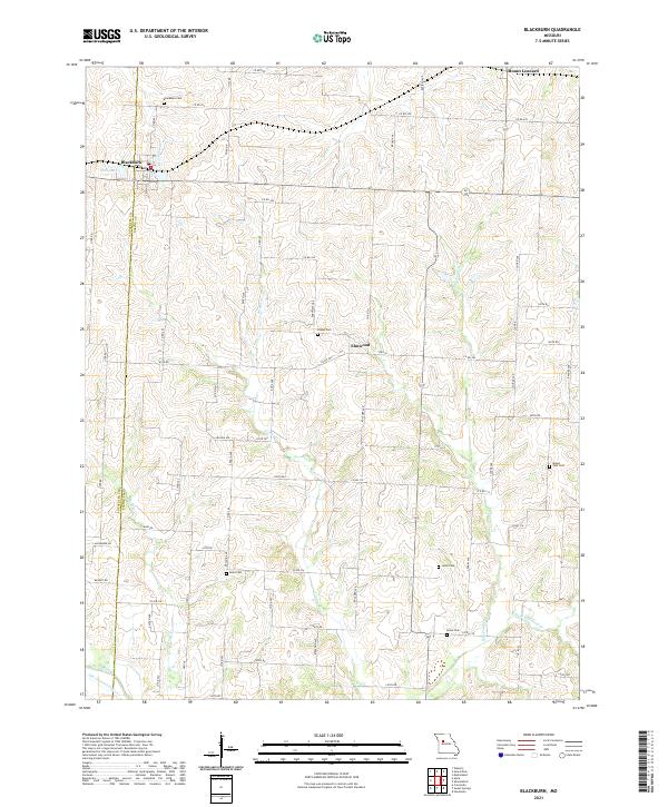 2021 Blackburn2021 Print · USGSThe border of Saline and Lafayette counties comes into focus in this contemporary survey of the rural Missouri heartland. Researchers can trace family history through numerous burial sites like Allen Cem, Gross Cem, and Mount Zion Cem scattered across the farmland.
 - 2021 Map of Lexington West, 2021 Print
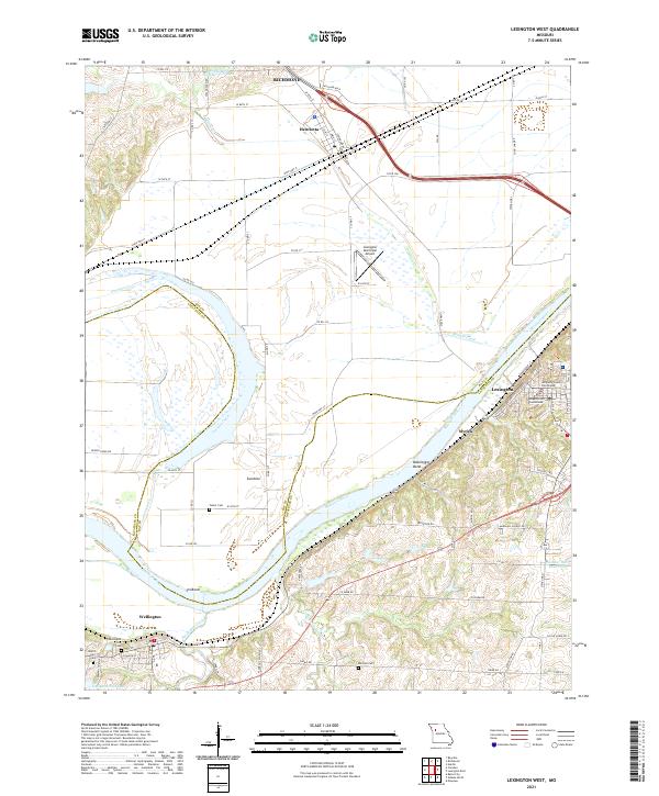 2021 Lexington West2021 Print · USGSThe river bluffs of Lafayette County and the bottomlands of Ray County are detailed here as they appeared in 2021. Researchers can locate family landmarks like Foster Cem and Mitchell Cem or trace the early riverfront history of Myrick and Lexington.
 - 2021 Map of Chapel Hill, 2021 Print
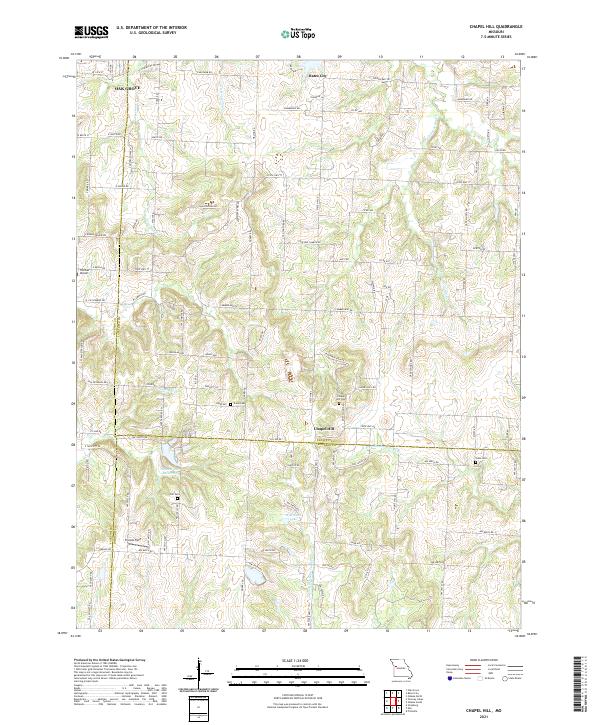 2021 Chapel Hill2021 Print · USGSThe tri-county border of Jackson, Lafayette, and Johnson counties comes together in this 2021 landscape of high ridges and winding headwaters. Genealogists and researchers can trace old family burial grounds at Chapel Hill Cem and Shore Cem near the historic crossroads of Chapel Hill.
 - 2021 Map of Odessa North, 2021 Print
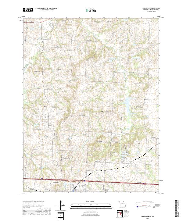 2021 Odessa North2021 Print · USGSThe northern environs of Odessa are shown here as they appeared in the early 2020s, dominated by the drainage basins of Sni-A-Bar Creek. Local historians can trace historical routes like the Old Santa Fe Trl and find family-named landmarks such as the Barker Cem and Flournoy School Rd.
 - 2021 Map of Bates City, 2021 Print
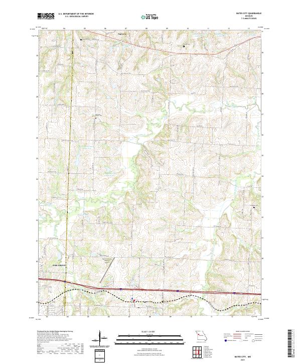 2021 Bates City2021 Print · USGSLafayette and Jackson Counties are shown here during a period of modern regional growth and infrastructure development. Researchers can trace ancestral sites at Anderson Cemetery and Campbell Cemetery or explore the waterways of Sni-A-Bar Creek.
 - 2021 Map of Waverly, 2021 Print
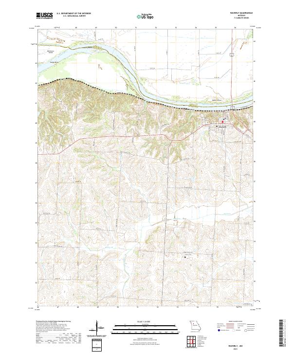 2021 Waverly2021 Print · USGSWaverly sits perched above the Missouri River bluffs in the early 2020s, where river bends and historic transit routes converge. Researchers can trace the Old Santa Fe Trl and locate family sites at Waverly Cem and Catron Cem.
 - 2021 Map of Dover, 2021 Print
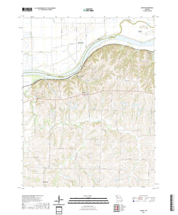 2021 Dover2021 Print · USGSLafayette County communities overlook the winding Missouri River in this recent survey of the region. Researchers can trace land features from Dover Bluff to the river bends, and locate smaller settlements like Dover Station, Miles Point, and Page City.
 - 2021 Map of Camden, 2021 Print
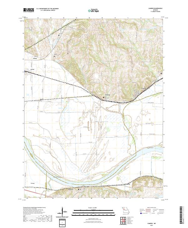 2021 Camden2021 Print · USGSThe Missouri River floodplain comes into sharp focus during the early twenty-first century as it winds past Missouri river towns. Genealogists can trace family names through numerous burial sites like Smith Jackson Cem and Cravens Cem, or locate the historic river bends at Camden Bend.
 - 2021 Map of Alma, 2021 Print
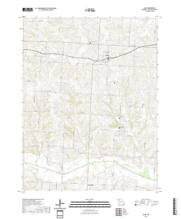 2021 Alma2021 Print · USGSLafayette County farmland around the towns of Alma and Concordia is shown here in the early twenty-first century. Genealogists can trace family roots through numerous burial sites like Maplewood Cem, Corder Cem, and the Lewis Family Cem.
 - 2021 Map of Grand Pass, 2021 Print
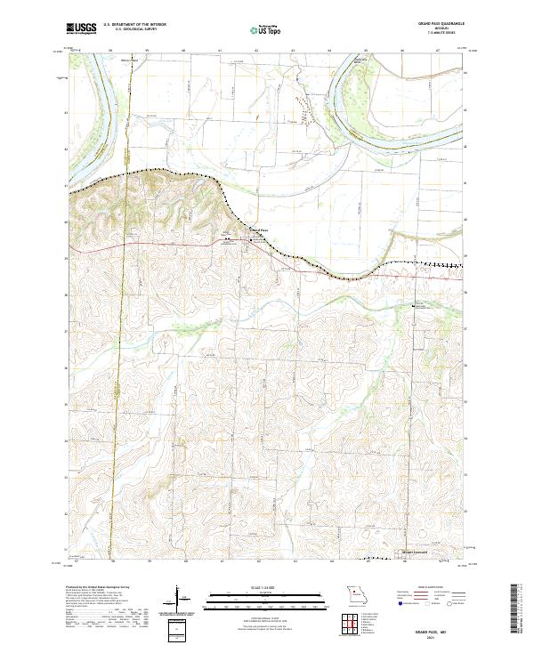 2021 Grand Pass2021 Print · USGSGrand Pass and the northern reaches of Saline County are captured here in the early twenty-first century as the landscape remains tied to the Missouri River. Genealogists can locate several burial grounds including Mount Nebo Cem, Grand Pass Community Cem, and the African Methodist Episcopal Cem.
End of results
Showing maps 1-19 of 19
Top cities of Lafayette County
- Odessa historical maps
- Higginsville historical maps
- Lexington historical maps
- Concordia historical maps
- Waverly historical maps
- Wellington historical maps
See more
Frequently asked questions
- What are the different types of historical maps available for Lafayette County?
- What is the oldest map of Lafayette County?
- Where can I purchase historical maps of Lafayette County for my home or office?
- Where can I download high-res historical maps of Lafayette County?
- Are there historical topographic maps available for Lafayette County?
- Is there historical aerial imagery available for Lafayette County?
- Where are historical maps of Lafayette County sourced from?