1960s Maps of Flathead County, Montana
Explore 121 historic maps of Flathead County from the 1960s. These maps offer a rare glimpse into what life looked like during the 1960s — showing old roads, neighborhoods, homes, and landmarks that have changed or disappeared over time.
Whether you're researching your family's past, planning a metal detecting trip, or studying how Flathead County's landscape evolved across the 1960s, these high-resolution maps are a powerful tool for exploring the history of this region.
- Focus on a specific era: All maps on this page are from the 1960s, giving you a focused view of this time period.
- See what’s changed: Compare century-old streets, trails, and buildings to today's modern landscape using overlays and satellite layers.
- Research with precision: Use these maps for genealogy, historical research, land use analysis, or educational projects.
- View, download, or print: Maps are fully viewable online in high resolution, and can be downloaded or printed for your own records.
Start exploring Flathead County's history through authentic maps from the 1960s. This is your window into the past.
Flathead County, MT maps
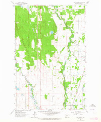
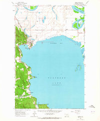
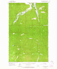
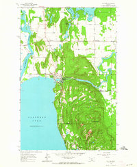
(121)- 1960 Map of Kalispell
 1960 Kalispell1960 Print · USGSNorthwest Montana in the late fifties is defined by the mountain corridors of the Great Northern Railway and the vast reaches of Glacier National Park. Researchers can trace the legacy of timber and mining towns like Libby, Rexford, and Whitefish, or locate landmarks such as the Snowshoe Mine.
 - 1960 Map of Wallace
 1960 Wallace1960 Print · USGSNorthwestern Montana and the Idaho panhandle are captured in the late fifties, showing the vast Flathead Indian Reservation and the mining districts of the Bitterroot Range. Researchers can trace the rail lines of the Northern Pacific or locate early sites like the Morning Mine and the National Bison Range.
 - 1960 Map of Cut Bank, 1968 Print
 1960 Cut Bank1968 Print · USGSThe high peaks of the Rockies meet the eastern plains in the 1960s, showing the intersection of federal lands and the Blackfeet Indian Reservation. Trace the path of the Great Northern railway and find local landmarks like the Blackfoot Boarding School and Family Mission Cem.3 unique versions available
 - 1961 Map of Kalispell
 1961 Kalispell1961 Print · USGSNorthwestern Montana at the start of the 1960s shows a landscape of timber-driven rail towns and the sprawling wild lands of Glacier National Park. Genealogists and historians can trace the route of the Great Northern through mountain passes or locate old settlements like Fortine, Trego, and Warland.
 - 1962 Map of Choteau
 1962 Choteau1962 Print · USGSThe Rocky Mountain Front meets the western plains in the early 1960s, showing a landscape defined by the Continental Divide. Genealogists and researchers can trace the tracks of the Great Northern and find settlements like Choteau, Augusta, and Bynum.
 - 1962 Map of Johnson Peak, 1964 Print
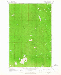
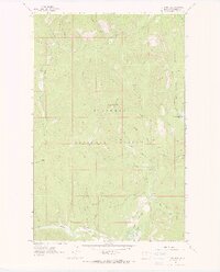 1962 Johnson Peak1964 Print · USGSThe Flathead National Forest wilderness comes into focus in the early sixties, showing the high-country trails and remote peaks of the Montana Rockies. Trace historic resource management at the Star Meadow Guard Station or locate the Lookout Tower atop Johnson Peak.2 unique versions available
 - 1962 Map of Kila, 1964 Print
 1962 Kila1964 Print · USGSIn the early sixties, the forest west of Kalispell was a network of remote ranching outposts and timber access routes. Trace the backcountry through Smith Lake and the high ridges of Wild Bill Mountain to find Truman Cabin and Norden Cabin.2 unique versions available
 - 1962 Map of Columbia Falls South, 1964 Print
 1962 Columbia Falls South1964 Print · USGSFlathead County south of Columbia Falls is captured here in the early sixties as a productive river valley and rail corridor. Researchers can locate family landmarks like Fairview Cem, the La Salle Sch, and the State Soldiers Home.3 unique versions available
 - 1962 Map of Doris Mountain, 1964 Print
 1962 Doris Mountain1964 Print · USGSThe Flathead National Forest wilderness meets modern engineering in the early sixties as the Hungry Horse Reservoir fills the valley. Researchers can trace old mountain routes like the Aurora Trail and find landmarks like Devils Elbow and the Powerhouse.2 unique versions available
 - 1962 Map of Rose Crossing, 1964 Print
 1962 Rose Crossing1964 Print · USGSFlathead County in the early sixties showcases a landscape defined by river confluences and rural schoolhouses. Researchers can trace the Great Northern line and locate community hubs like Rose Crossing, Midway Grange, and Trinity Cem.3 unique versions available
 - 1962 Map of Blue Grass Ridge, 1964 Print
 1962 Blue Grass Ridge1964 Print · USGSFlathead County ranching and timberlands are captured here in the early sixties as the Smith Valley rural community thrived. Genealogists can trace family holdings and local landmarks like Stillwater Grange, Boorman Sch, and the Spring Creek Cem.3 unique versions available
 - 1962 Map of Lion Mountain, 1964 Print
 1962 Lion Mountain1964 Print · USGSThe timbered slopes of the Flathead National Forest are captured here in the early 1960s. Outdoor historians and researchers can trace old routes like the Pack Trail and locate family landmarks such as Baldy Mountain and Blacktail Mountain.2 unique versions available
 - 1962 Map of Hungry Horse, 1964 Print
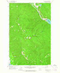
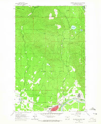
 1962 Hungry Horse1964 Print · USGSThe Flathead Valley in the early sixties showcases the intersection of river management and mountain life. Local researchers can trace the development of Hungry Horse and Coram, and locate landmarks like the Great Northern rail line and Sloan Ranch.4 unique versions available
 - 1962 Map of Somers, 1964 Print
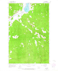
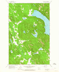
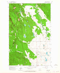
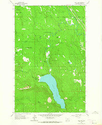
 1962 Somers1964 Print · USGSNorthern Flathead Lake comes to life in the early sixties, showing the vital rail-to-water connection at Somers. Genealogists and historians can locate the Bethel Cem, Somers Sch, and the Cold War-era Kalispell Air Force Station.2 unique versions available
 - 1962 Map of Beaver Lake, 1964 Print
 1962 Beaver Lake1964 Print · USGSNorthwest Montana’s timber and lake country comes into focus in the early sixties, showing the vital rail corridors and forest boundaries of Flathead County. Researchers can trace the dual paths of the Great Northern Railroad and Northern Pacific Railroad past Beaver Lake and Round Prairie.3 unique versions available
 - 1962 Map of Creston, 1964 Print
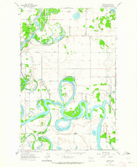 1962 Creston1964 Print · USGSFlathead County's river-bottom lands are captured here in the early 1960s, showing a landscape defined by the winding Flathead River. Local historians can trace the locations of rural schoolhouses like Montford Sch and Egan Sch near the community of Creston.3 unique versions available
 - 1962 Map of Lost Creek Divide, 1964 Print
 1962 Lost Creek Divide1964 Print · USGSFlathead County's high ridges and national forest lands are shown here in the early sixties as a network of trails and lookouts. Researchers can trace historic access routes like Rhodes Draw and the locations of high-point markers such as Lookout Reid Tower 5928.3 unique versions available
 - 1962 Map of Ashley Mountain, 1964 Print
 1962 Ashley Mountain1964 Print · USGSHigh in the Flathead National Forest during the early sixties, this area shows a landscape of mountain lookouts and remote ranching. Researchers can trace the rugged topography around Ashley Mountain to find the Ashley Lookout Tower and Star Meadow Ranch.2 unique versions available
 - 1962 Map of Hash Mountain, 1964 Print
 1962 Hash Mountain1964 Print · USGSNear the edge of the mountains in the early sixties, this area shows a landscape defined by glacial lakes and timber country. Genealogists can locate family landmarks like Cayuse Prairie Sch, Creston Ch, and industrial sites like Jessup Mill Pond.2 unique versions available
 - 1962 Map of Rhodes, 1964 Print
 1962 Rhodes1964 Print · USGSNorthwest Montana in the early sixties reveals a landscape of high timber ridges and active valley communities. Genealogists and local historians can trace the social hubs of the era at the Bissell Sch, Stillwater Ch, and the settlement of Rhodes.2 unique versions available
 - 1962 Map of Kalispell, 1964 Print
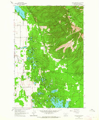
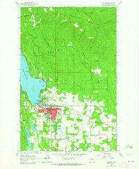
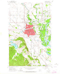 1962 Kalispell1964 Print · USGSKalispell and the surrounding Flathead Valley were expanding in the early sixties as new neighborhoods pushed toward the rivers. Genealogists and local historians can locate several major burying grounds, including Conrad Mem Cem, and trace the rural school system at Demersville Sch or Spring Creek Sch.3 unique versions available
 - 1962 Map of Bigfork, 1964 Print
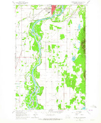
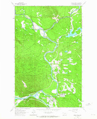
 1962 Bigfork1964 Print · USGSThe Flathead Valley and the shores of Bigfork are captured here during the early sixties, showing a landscape of timber management and lakeside settlement. Researchers can locate the Big Fork Dam, the McCaffery Lookout Tower, and local landmarks like Little Brown Ch and Bethany Ch.3 unique versions available
 - 1962 Map of Tally Lake, 1964 Print
 1962 Tally Lake1964 Print · USGSThe northern Flathead National Forest comes to life in the early sixties, centered on the waters of Tally Lake. Researchers can trace old forest infrastructure like the Tally Lake Ranger Station or the Great Northern rail line near Stillwater River.3 unique versions available
 - 1962 Map of Whitefish, 1964 Print
 1962 Whitefish1964 Print · USGSWhitefish is shown as a thriving mountain and rail hub in the early sixties, caught between the lakeside and the rising peaks. Genealogists and historians can trace local landmarks like Memorial Sch, the Great Northern rail lines, and the Big Mountain Ski Resort.3 unique versions available
 - 1962 Map of Columbia Falls North, 1965 Print
 1962 Columbia Falls North1965 Print · USGSThe North Fork Flathead River valley comes alive in the early sixties as industrial growth meets the wilderness edge. Trace the rails of the Great Northern Railroad past the Aluminum Plant and the old settlement at Halfmoon.4 unique versions available
Showing maps 1-25 of 121
Top cities of Flathead County
- Kalispell historical maps
- Whitefish historical maps
- Columbia Falls historical maps
- West Glacier historical maps
- Olney historical maps
Frequently asked questions
- What are the different types of historical maps available for Flathead County?
- What is the oldest map of Flathead County?
- Where can I purchase historical maps of Flathead County for my home or office?
- Where can I download high-res historical maps of Flathead County?
- Are there historical topographic maps available for Flathead County?
- Is there historical aerial imagery available for Flathead County?
- Where are historical maps of Flathead County sourced from?