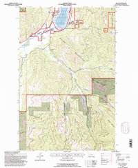
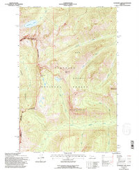
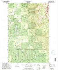
1990s Maps of Flathead County, Montana
Explore 131 historic maps of Flathead County from the 1990s. These maps offer a rare glimpse into what life looked like during the 1990s — showing old roads, neighborhoods, homes, and landmarks that have changed or disappeared over time.
Whether you're researching your family's past, planning a metal detecting trip, or studying how Flathead County's landscape evolved across the 1990s, these high-resolution maps are a powerful tool for exploring the history of this region.
- Focus on a specific era: All maps on this page are from the 1990s, giving you a focused view of this time period.
- See what’s changed: Compare century-old streets, trails, and buildings to today's modern landscape using overlays and satellite layers.
- Research with precision: Use these maps for genealogy, historical research, land use analysis, or educational projects.
- View, download, or print: Maps are fully viewable online in high resolution, and can be downloaded or printed for your own records.
Start exploring Flathead County's history through authentic maps from the 1990s. This is your window into the past.
Flathead County, MT maps
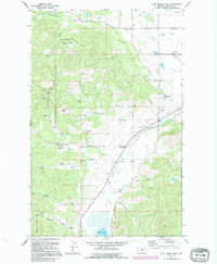
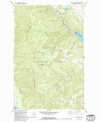
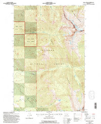
(131)- 1990 Map of Lost Creek Divide, 1997 Print
 1990 Lost Creek Divide1997 Print · USGSFlathead County's high ridges and forest service lands are captured here in the 1990s, just as modern mapping revisions were being finalized. Researchers can trace the drainage patterns of Lost Creek and the high elevations along the Reid Divide or Mountain Meadow.
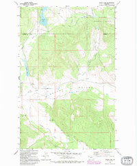
 - 1991 Map of Hash Mountain, 1995 Print
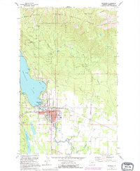
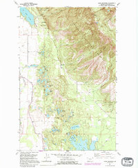 1991 Hash Mountain1995 Print · USGSThe Flathead Valley meets the high ridges of the national forest in this 1990s study of the mountain landscape. Genealogists and historians can locate the Cayuse Prairie Sch, Mountain Brook Sch, and the Fish Hatchery near Lake Blaine.
 - 1991 Map of Creston, 1995 Print
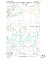 1991 Creston1995 Print · USGSFlathead Valley's intricate network of oxbows and sloughs is captured here during the late twentieth century. Researchers can trace rural school locations like Fairview Sch and Egan Sch or explore the shifting banks of the Flathead River and Egan Slough.
 - 1991 Map of Rhodes, 1995 Print
 1991 Rhodes1995 Print · USGSThe Stillwater River valley in Flathead County comes into focus here during the early 1990s. Genealogists and local historians can trace the foundations of the community through the Bissell Sch, Stillwater Ch, and the Northwest Flathead Community Hall.
 - 1991 Map of Lone Lake, 1995 Print
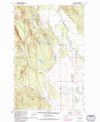
 1991 Lone Lake1995 Print · USGSFlathead County's timberlands and mountain lakes are captured here in the early nineties, showing a region managed for both forest resources and recreation. Genealogists and researchers can locate the Mountain View Sch, a Gravel Pit, and the shoreline of Ashley Lake.
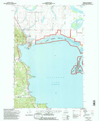
 - 1991 Map of Somers, 1995 Print
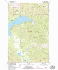
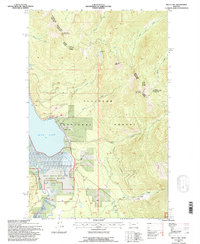
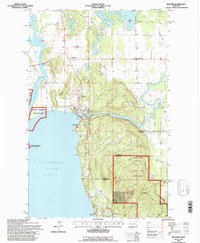
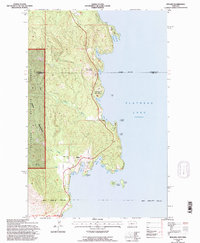
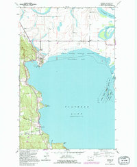 1991 Somers1995 Print · USGSThe northwestern shores of Flathead Lake come into focus in the early nineties as lakeside settlements and conservation areas matured. Researchers can trace the heritage of the region through the Somers lakefront, the historic Bethel Cem, and the Rousselle Sch.
 - 1991 Map of Whitefish, 1995 Print
 1991 Whitefish1995 Print · USGSWhitefish was evolving into a year-round mountain destination in the early nineties, as recreational development expanded along the lake and the peaks. Trace the growth of Whitefish and explore landmarks like Big Mountain Ski Resort, Mistletoe Mine, and Whitefish Lake Golf Club.
 - 1991 Map of Blue Grass Ridge, 1995 Print
 1991 Blue Grass Ridge1995 Print · USGSThe ranching country of Smith Valley is shown here in the 1990s as a community of small rural schools and family-held lands. Genealogists and local historians can trace legacy properties like Keller Ranch or locate burials at Spring Creek Cem and landmarks like Stillwater Grange.
 - 1991 Map of Bigfork, 1995 Print
 1991 Bigfork1995 Print · USGSThe northeast shores of Flathead Lake come alive in the 1990s as the community of Bigfork grows around its river mouth. Genealogists and historians can trace local settlements from Holt to Woods Bay, and locate landmarks like Bethany Ch and the Bigfork Dam.
 - 1991 Map of Doris Mountain, 1995 Print
 1991 Doris Mountain1995 Print · USGSThe Flathead National Forest during the early nineties reveals a landscape of high-altitude lakes and river infrastructure. Trace the northern waters of Hungry Horse Reservoir and the winding Alpine Trail near Doris Mountain.
 - 1991 Map of Lynch Lake, 1995 Print
 1991 Lynch Lake1995 Print · USGSThe borderlands of Lincoln and Flathead Counties are shown in the early 1990s as a landscape of timber and trout streams. Genealogists and historians can trace local landmarks like the Pleasant Valley Sch and water features like Island Lake or the Fisher River.
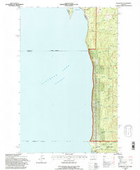
 - 1994 Map of Somers, 1995 Print
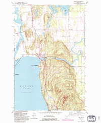
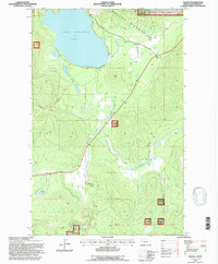
 1994 Somers1995 Print · USGSThe north shore of Flathead Lake is captured here in the mid-1990s, where river deltas meet established lakeside communities. Researchers can trace local landmarks from the Somers Sch and Bethel Cem to the industrial echoes of the Old Grade.
 - 1994 Map of Woods Bay, 1995 Print
 1994 Woods Bay1995 Print · USGSThe eastern shores of Flathead Lake are shown in the mid-nineties as lakeside communities and national forest lands converged. Researchers can trace the drainage patterns of No-see-um Creek and Hunger Creek or locate the U of M Biological Station.
 - 1994 Map of Swan lake, 1996 Print
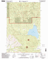
 1994 Swan lake1996 Print · USGSSwan Lake and its surrounding National Forest lands are captured here in the mid-nineties. Researchers can locate the Swan Lake Boat Launch, trace the Swan River through the wildlife refuge, and find remote landmarks like Mission Lookout.
 - 1994 Map of Connor Creek, 1996 Print
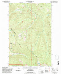 1994 Connor Creek1996 Print · USGSMontana's mountain wilderness in the mid-1990s is captured here, showing the remote high-country drainage of the Flathead. Trace backcountry routes like the Ranger Trail past the Shelter Cabin or explore the shores of Trinkus Lake and Rock Lake.
 - 1994 Map of Swan Peak, 1996 Print
 1994 Swan Peak1996 Print · USGSThe high alpine country of Lake and Flathead counties is captured here in the mid-1990s, where the massive Swan Range meets the Bob Marshall Wilderness. Researchers can trace the drainage patterns of Lion Creek and find remote high-country landmarks like Swan Peak and Pony Lake.
 - 1994 Map of Kofford Ridge, 1996 Print
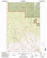 1994 Kofford Ridge1996 Print · USGSThe Hog Heaven mining district and the Flathead Indian Reservation boundary meet in this mid-1990s study of Northwest Montana. Researchers can locate historic mineral sites like the Flathead Mine and Mary Ann Mine or trace the remote Wooster Ranch.
 - 1994 Map of Bigfork, 1996 Print
 1994 Bigfork1996 Print · USGSThe northeastern shores of Flathead Lake come into focus in the mid-1990s as the community of Bigfork expands at the Swan River's mouth. Researchers can trace local landmarks like Little Brown Ch, the Bigfork Dam, and the early layout of Ferndale and Holt.
 - 1994 Map of Kila, 1996 Print
 1994 Kila1996 Print · USGSThe Flathead County backcountry is captured here during the mid-nineties as the timber and ranching landscapes of the Salish Mountains met. Researchers can trace historic property markers like the C M Quarter Circle Ranch and old mountain shelters including Truman Cabin.
 - 1994 Map of Sunburst Lake, 1996 Print
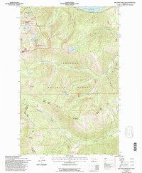
 1994 Sunburst Lake1996 Print · USGSThe northern Rockies and the Bob Marshall Wilderness are captured here in the mid-1990s, documenting a landscape of high summits and glacial lakes. Hikers and geographers can trace the steep routes through Lion Creek Pass and remote waters like Sunburst Lake or Palisade Lake.
 - 1994 Map of Condon, 1996 Print
 1994 Condon1996 Print · USGSIn the mid-1990s, the mountain valley around Condon remained a critical outpost for forestry and wilderness management. Researchers can locate specific infrastructure like the Condon PO, the Condon Forest Service Station, and the Cooney Lookout.
 - 1994 Map of Rollins, 1996 Print
 1994 Rollins1996 Print · USGSThe western shores of Flathead Lake come into focus during the mid-nineties, showing the rugged interface between the Salish Mountains and the water. Genealogists and local historians can locate the Rollins Post Office, Glacier Church Camp, and Shelter Island.
 - 1994 Map of Marion, 1996 Print
 1994 Marion1996 Print · USGSMarion and the Salish Mountains are captured in the mid-1990s, showcasing a landscape of timbered peaks and vital waterways. Researchers can trace local landmarks like Little Bitterroot Lake, the small settlement of Pine Prairie, and the remote Moore Springs.
 - 1994 Map of Lake Mary Ronan, 1996 Print
 1994 Lake Mary Ronan1996 Print · USGSLake and Flathead counties in the mid-1990s reveal a mix of reservation lands and national forest recreation. Researchers can trace lakeshore settlements like Meltons and Lambeth alongside the high peaks of the Hog Heaven Range and Blacktail Mountain.2 unique versions available
 - 1994 Map of Big Hawk Mountain, 1996 Print
 1994 Big Hawk Mountain1996 Print · USGSThe northern Swan Range and the edges of the Hungry Horse Reservoir are detailed here in the mid-1990s. Hikers and historians can trace routes through the Jewel Basin Hiking Area or find secluded waters like Margaret Lake and Tom Tom Lake.
Showing maps 1-25 of 131
Top cities of Flathead County
- Kalispell historical maps
- Whitefish historical maps
- Columbia Falls historical maps
- West Glacier historical maps
- Olney historical maps
Frequently asked questions
- What are the different types of historical maps available for Flathead County?
- What is the oldest map of Flathead County?
- Where can I purchase historical maps of Flathead County for my home or office?
- Where can I download high-res historical maps of Flathead County?
- Are there historical topographic maps available for Flathead County?
- Is there historical aerial imagery available for Flathead County?
- Where are historical maps of Flathead County sourced from?