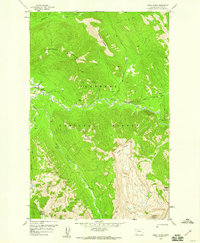
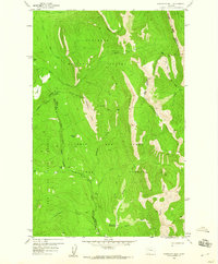
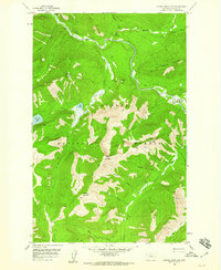
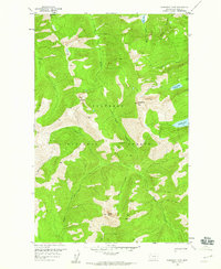
1950s Maps of Flathead County, Montana
Explore 16 historic maps of Flathead County from the 1950s. These maps offer a rare glimpse into what life looked like during the 1950s — showing old roads, neighborhoods, homes, and landmarks that have changed or disappeared over time.
Whether you're researching your family's past, planning a metal detecting trip, or studying how Flathead County's landscape evolved across the 1950s, these high-resolution maps are a powerful tool for exploring the history of this region.
- Focus on a specific era: All maps on this page are from the 1950s, giving you a focused view of this time period.
- See what’s changed: Compare century-old streets, trails, and buildings to today's modern landscape using overlays and satellite layers.
- Research with precision: Use these maps for genealogy, historical research, land use analysis, or educational projects.
- View, download, or print: Maps are fully viewable online in high resolution, and can be downloaded or printed for your own records.
Start exploring Flathead County's history through authentic maps from the 1950s. This is your window into the past.
Flathead County, MT maps
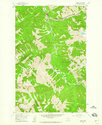
(16)- 1955 Map of Choteau, 1978 Print
 1955 Choteau1978 Print · USGSWestern Montana during the mid-fifties is captured here as a land of rugged high-country wilderness and vital eastern plains irrigation. Genealogists and historians can locate remote outposts like Condon, the communal Miller Colony, and the rail stops of the Chicago Milwaukee St Paul and Pacific.
 - 1956 Map of Wallace, 1966 Print
 1956 Wallace1966 Print · USGSWestern Montana and the Idaho panhandle meet in this mid-century survey of the Bitterroot and Cabinet Mountains. Genealogists and historians can trace the rail-and-river economy through the Northern Pacific line and settlements like Thompson Falls or St. Ignatius.3 unique versions available
 - 1957 Map of Choteau
 1957 Choteau1957 Print · USGSMontana's mountain front meets the eastern plains in the mid-fifties, showing the transition from forested wilderness to irrigated ranch land. Genealogists and historians can trace the rail lines of the Great Northern and find settlements like Choteau, Augusta, and Seeley Lake.
 - 1957 Map of Kalispell, 1967 Print
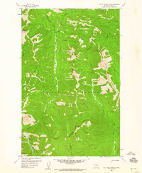
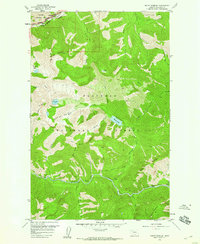
 1957 Kalispell1967 Print · USGSNorthwest Montana in the late fifties showcases a mountain landscape transitioning between wilderness and industry. Genealogists and researchers can trace the Great Northern rail corridor through Kalispell and Whitefish, or locate landmarks like the Montana Soldiers Home and Hungry Horse Reservoir.3 unique versions available
 - 1958 Map of Choteau
 1958 Choteau1958 Print · USGSMontana's front range meets the high wilderness in the late fifties, where the Great Northern railway connects ranching towns to the eastern plains. Researchers can trace the development of irrigation at Bynum Reservoir or locate remote camps like the Big Prairie District Ranger Station and Helmville.2 unique versions available
 - 1958 Map of Red Plume Mountain, 1959 Print
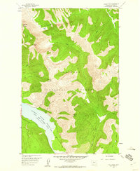
 1958 Red Plume Mountain1959 Print · USGSThe high Montana wilderness of the late fifties is captured here through the remote peaks and creek drainages of the Flathead National Forest. Researchers and hikers can trace early mountain routes like the Skyland Morrison Trail or locate the Challenge Cabin deep within the range.3 unique versions available
 - 1958 Map of Gable Peaks, 1959 Print
 1958 Gable Peaks1959 Print · USGSThe Montana wilderness in the late 1950s is mapped here as a vast roadless expanse of the Flathead National Forest. Researchers can trace the historic Big River Trail as it follows the Middle Fork Flathead River past the isolated Schafer Ranger Sta.2 unique versions available
 - 1958 Map of Porphyry Reef, 1959 Print
 1958 Porphyry Reef1959 Print · USGSThe Montana high country along the Continental Divide is shown here in the late fifties, where the Flathead Range meets the Sun River headwaters. Trace the remote Pack Trail network connecting the Wrong Creek Guard Station to landmarks like Porphyry Reef and Teton Pass.2 unique versions available
 - 1958 Map of Capitol Mountain, 1959 Print
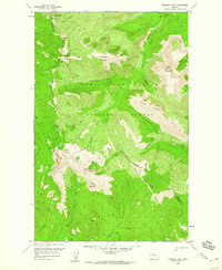
 1958 Capitol Mountain1959 Print · USGSThe Flathead National Forest wilderness in the mid-twentieth century was a landscape of high peaks and pack trails. Researchers can trace the historic route of the Morrison Pack Trail and locate remote landmarks like Schaefer Meadows and Capitol Mountain.4 unique versions available
 - 1958 Map of Circus Peak, 1960 Print
 1958 Circus Peak1960 Print · USGSThe wilderness of the Flathead Valley is captured here in the late fifties, showing the early years of the Hungry Horse Reservoir. Researchers can trace remote alpine routes like the Pack Trail past Circus Peak and Prospector Mountain.2 unique versions available
 - 1958 Map of Nimrod, 1960 Print
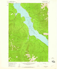
 1958 Nimrod1960 Print · USGSGlacier National Park and the Flathead National Forest met along the Middle Fork during the late 1950s. This survey allows you to trace the high-mountain transit of the Great Northern railroad and locate historic landmarks like the Java Ranger Station and Spruce Lookout.3 unique versions available
 - 1958 Map of Crescent Cliff, 1960 Print
 1958 Crescent Cliff1960 Print · USGSThe Montana wilderness at the crest of the Rockies comes alive in the late fifties, where the Continental Divide splits the national forests. Follow primitive backcountry routes like the Kip Pack Trail and Calbick Trail past landmarks such as Bruin Peaks and Goat Mountain.3 unique versions available
 - 1958 Map of Quintonkon, 1960 Print
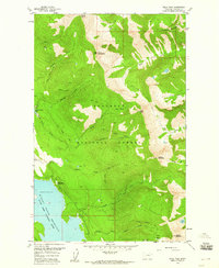
 1958 Quintonkon1960 Print · USGSThe South Fork Flathead River valley is shown here just years after being transformed by the Hungry Horse Dam. Researchers can locate remote sites like the Baptiste Grave, early Core Drill Holes, and high-altitude Pack Trails.4 unique versions available
 - 1958 Map of Mount Bradley, 1960 Print
 1958 Mount Bradley1960 Print · USGSThe Flathead region in the late fifties was a landscape of remote mountain passes and wilderness trails. Genealogists and historians can trace the rail corridor of the Great Northern or locate isolated landmarks like Granite Cabin and Theodore.3 unique versions available
 - 1958 Map of Horseshoe Peak, 1960 Print
 1958 Horseshoe Peak1960 Print · USGSThe high backcountry of the Flathead in the late fifties is captured here through its primitive trail networks and remote mountain summits. You can trace early wilderness access routes like the Pack Trail past Horseshoe Peak to Flotilla Lake.2 unique versions available
 - 1958 Map of Felix Peak, 1960 Print
 1958 Felix Peak1960 Print · USGSThe Flathead National Forest wilderness is documented here in the late fifties, showing the early years of the Hungry Horse Reservoir. Researchers can trace the Felix Mine, lookouts like Baptiste Lookout, and the remote Betty Creek Ranger Station.3 unique versions available
End of results
Showing maps 1-16 of 16
Top cities of Flathead County
- Kalispell historical maps
- Whitefish historical maps
- Columbia Falls historical maps
- West Glacier historical maps
- Olney historical maps
Frequently asked questions
- What are the different types of historical maps available for Flathead County?
- What is the oldest map of Flathead County?
- Where can I purchase historical maps of Flathead County for my home or office?
- Where can I download high-res historical maps of Flathead County?
- Are there historical topographic maps available for Flathead County?
- Is there historical aerial imagery available for Flathead County?
- Where are historical maps of Flathead County sourced from?