1900s (20th Century) Maps of Fort Kipp District, Montana
Explore 34 historic maps of Fort Kipp District from the 1900s (20th Century). These maps offer a rare glimpse into what life looked like during the 1900s — showing old roads, neighborhoods, homes, and landmarks that have changed or disappeared over time.
Whether you're researching your family's past, planning a metal detecting trip, or studying how Fort Kipp District's landscape evolved across the 1900s, these high-resolution maps are a powerful tool for exploring the history of this region.
- Focus on a specific era: All maps on this page are from the 1900s, giving you a focused view of this time period.
- See what’s changed: Compare century-old streets, trails, and buildings to today's modern landscape using overlays and satellite layers.
- Research with precision: Use these maps for genealogy, historical research, land use analysis, or educational projects.
- View, download, or print: Maps are fully viewable online in high resolution, and can be downloaded or printed for your own records.
Start exploring Fort Kipp District's history through authentic maps from the 1900s. This is your window into the past.
Fort Kipp District, MT maps
(34)- 1909 Map of Smoke Creek, 1964 Print
 1909 Smoke Creek1964 Print · USGSNortheastern Montana was still an expansive frontier at the turn of the century, dominated by the Fort Peck Indian Reservation. Researchers can trace early land use and water sources through the West Ranch and the winding course of Smoke Creek.
 - 1912 Map of Smoke Creek
 1912 Smoke Creek1912 Print · USGSThe eastern reaches of the Fort Peck Indian Reservation are captured here in the years following the turn of the century. Genealogists and researchers can trace the early livestock era at Wests Ranch or the natural hydrology of Smoke Creek and Manning Lake.
 - 1914 Map of Brockton
 1914 Brockton1914 Print · USGSNortheastern Montana ranching and rail life are frozen in time just before the First World War. Trace the early layout of Brockton and find local landmarks like Armstrongs Ranch, Schoolhouse Coulee, and the path of the Great Northern R R.3 unique versions available
 - 1914 Map of Homestead
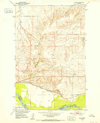
 1914 Homestead1914 Print · USGSNortheastern Montana ranching country comes into focus in this early twentieth-century survey of the Big Muddy Creek valley. Genealogists can trace the location of the Le Clair School and pioneer outposts like Scott Ranch and Walker's Ranch along the rail line.
 - 1947 Map of Rocky Point, 1976 Print
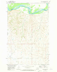
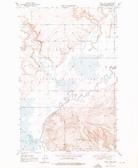 1947 Rocky Point1976 Print · USGSThe Missouri River breaks of Roosevelt County come to life in this post-war survey of the Fort Peck Indian Reservation. Local historians can trace family-named sites like Damm School No. 5 and early industry at the Goal Mines (Abandoned).2 unique versions available
 - 1947 Map of Homestead, 1989 Print
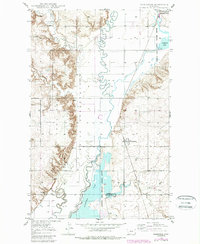 1947 Homestead1989 Print · USGSNortheastern Montana ranching and rail life are detailed here in the late Forties, showing the intersection of the Missouri River country and the Great Plains. You can trace the small-town layouts of Homestead and McCabe near the shores of Medicine Lake and the winding Big Muddy Creek.
 - 1948 Map of Homestead
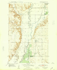 1948 Homestead1948 Print · USGSNortheastern Montana's high plains are captured here just after the war, showing the vital intersection of rail and water near the Fort Peck Indian Reservation. Researchers can trace the Great Northern rail line through the settlements of Homestead and McCabe alongside the waters of Big Muddy Creek.2 unique versions available
 - 1948 Map of Rocky Point
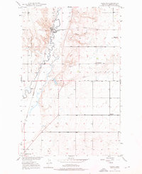
 1948 Rocky Point1948 Print · USGSRoosevelt County's river-carved plains come into focus in the late 1940s, showing the intersection of tribal lands and rural settlement. Genealogists and local historians can trace family-named landmarks like Damm School No 5 and old transit points such as Slab Crossing and Rocky Point.
 - 1948 Map of Reserve, 1976 Print
 1948 Reserve1976 Print · USGSSheridan County's high plains are documented here in the late 1940s as the rail-side economy of Reserve thrived along the Great Northern line. Genealogists can trace early homestead-era landmarks like the Cem, Eden Valley Sch, and the local Coal Mine.2 unique versions available
 - 1948 Map of Alkali Coulee, 1977 Print
 1948 Alkali Coulee1977 Print · USGSSheridan County's high plains come into focus shortly after the war, showing the vital connection between the railway and the land. Researchers can trace the path of the Great Northern into Medicine Lake or locate landmarks like the Rose Valley Sch and a local Coal Mine.3 unique versions available
 - 1948 Map of Fort Kipp, 1989 Print
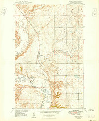
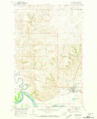
 1948 Fort Kipp1989 Print · USGSThe Missouri River Basin development era is captured here on the plains of the Fort Peck Indian Reservation. Researchers can trace the local landscape through the streets of Fort Kipp, the rural Freidens Ch, and the winding path of Big Muddy Creek.
 - 1948 Map of Antelope, 1989 Print
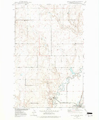
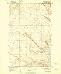
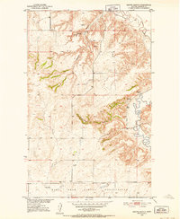
 1948 Antelope1989 Print · USGSSheridan County's high plains are captured here in the mid-twentieth century as the Missouri River Basin development program was underway. Researchers can trace the SOO LINE rail corridor through Antelope and locate historical sites like the Cem and McLaughlin near the Fort Peck Indian Reservation.
 - 1949 Map of Fort Kipp
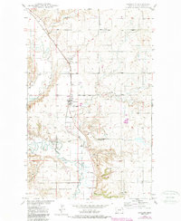
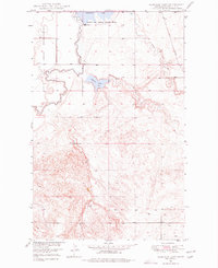
 1949 Fort Kipp1949 Print · USGSRoosevelt County in the late 1940s reveals a landscape defined by the Great Northern railroad and the Fort Peck Indian Reservation. Genealogists and historians can locate early landmarks like Freidens Cem, Blair, and the community of Fort Kipp.2 unique versions available
 - 1949 Map of Reserve
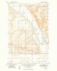
 1949 Reserve1949 Print · USGSSheridan County and the northeastern corner of the Fort Peck Indian Reservation are captured here just after the war. Local historians can trace the Great Northern rail corridor through Reserve or locate school sites like Eden Valley Sch and Smith Sch (Aban'd).
 - 1949 Map of Antelope
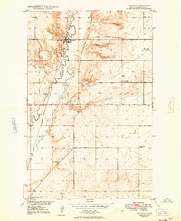
 1949 Antelope1949 Print · USGSSheridan County is captured in the late 1940s as the rail-side community of Antelope serves the surrounding plains. Genealogists and researchers can trace the course of Big Muddy Creek or locate local landmarks like the Cem and the Great Northern tracks.2 unique versions available
 - 1949 Map of Alkali Coulee
 1949 Alkali Coulee1949 Print · USGSSheridan County's high plains and reservation lands are captured here in the late Forties, showing a landscape defined by rail and water. Genealogists and researchers can trace the Great Northern tracks into Medicine Lake or locate the rural Rose Valley Sch.
 - 1949 Map of Johnson Lake, 1977 Print
 1949 Johnson Lake1977 Print · USGSRoosevelt County was a landscape of meandering waterways and reservation borders in the late 1940s. Trace the intricate boundary of the Fort Peck Indian Reservation and locate local landmarks like Johnson Lake, the Dam, and nearby Gravel Pits.2 unique versions available
 - 1950 Map of Johnson Lake
 1950 Johnson Lake1950 Print · USGSRoosevelt County at the mid-century shows a landscape of reservation lands and wildlife conservation areas. Researchers can trace the winding course of Muddy Creek and locate features like the Medicine Lake National Wildlife Refuge, Johnson Lake, and early Gravel Pits.
 - 1950 Map of Coyote Coulee, 1952 Print
 1950 Coyote Coulee1952 Print · USGSRoosevelt County ranching and reservation life are captured here in the early fifties during the Missouri River Basin development era. Genealogists and historians can trace the remote Schnitzler Ranch or the winding paths of Coyote Coulee and Smoke Creek.2 unique versions available
 - 1950 Map of Calais, 1952 Print
 1950 Calais1952 Print · USGSNortheastern Montana's river valley and high plains come into focus at mid-century, where the reservation meets the winding Missouri. Genealogists and historians can trace the Great Northern rail line through Calais or locate the Alton Mine and Bertino Res.2 unique versions available
 - 1950 Map of Shippe Canyon, 1952 Print
 1950 Shippe Canyon1952 Print · USGSSheridan County's high plains and river breaks are captured here in the early fifties, showing the northern reaches of the Fort Peck Indian Reservation. Researchers can locate several Coal Mines (inactive) and follow the drainage of Big Muddy Creek and Richardson Coulee.2 unique versions available
 - 1954 Map of Wolf Point, 1967 Print
 1954 Wolf Point1967 Print · USGSNortheastern Montana and the North Dakota borderlands are shown here in the mid-fifties, dominated by the Missouri River and the Fort Peck Indian Reservation. Genealogists and historians can trace the Great Northern rail line through river towns like Poplar and Culbertson or locate northern border outposts like the U S Custom Office at Raymond.2 unique versions available
 - 1958 Map of Wolf Point
 1958 Wolf Point1958 Print · USGSNortheastern Montana is shown during the mid-fifties, featuring the extensive Fort Peck Indian Reservation and the Missouri River valley. Researchers can trace the Great Northern railroad through Wolf Point or locate sites like Slab Crossing and the Coal Mine near Medicine Lake.
 - 1969 Map of Culbertson, 1973 Print
 1969 Culbertson1973 Print · USGSCulbertson and the Missouri River bottomlands are captured here in the late sixties as the regional rail and ranching economy thrived. Researchers can find Hillside Cem, the historic Burlington Northern line, and the local Rodeo Ground.2 unique versions available
 - 1969 Map of Twomile Creek, 1973 Print
 1969 Twomile Creek1973 Print · USGSEastern Montana rangeland meets the Missouri River in the late sixties, showing the transition from tribal lands to county territory. Researchers can trace the Fort Peck Indian Reservation Bdy and find local landmarks like Charlie and Devils Elbow.2 unique versions available
Showing maps 1-25 of 34
Top cities near Fort Kipp District
- Culbertson historical maps
- Brockton District historical maps
- Medicine Lake historical maps
- Froid historical maps
Top neighborhoods of Fort Kipp District
Frequently asked questions
- What are the different types of historical maps available for Fort Kipp District?
- What is the oldest map of Fort Kipp District?
- Where can I purchase historical maps of Fort Kipp District for my home or office?
- Where can I download high-res historical maps of Fort Kipp District?
- Are there historical topographic maps available for Fort Kipp District?
- Is there historical aerial imagery available for Fort Kipp District?
- Where are historical maps of Fort Kipp District sourced from?