1950s Maps of Gallatin County, Montana
Explore 24 historic maps of Gallatin County from the 1950s. These maps offer a rare glimpse into what life looked like during the 1950s — showing old roads, neighborhoods, homes, and landmarks that have changed or disappeared over time.
Whether you're researching your family's past, planning a metal detecting trip, or studying how Gallatin County's landscape evolved across the 1950s, these high-resolution maps are a powerful tool for exploring the history of this region.
- Focus on a specific era: All maps on this page are from the 1950s, giving you a focused view of this time period.
- See what’s changed: Compare century-old streets, trails, and buildings to today's modern landscape using overlays and satellite layers.
- Research with precision: Use these maps for genealogy, historical research, land use analysis, or educational projects.
- View, download, or print: Maps are fully viewable online in high resolution, and can be downloaded or printed for your own records.
Start exploring Gallatin County's history through authentic maps from the 1950s. This is your window into the past.
Gallatin County, MT maps
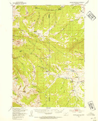
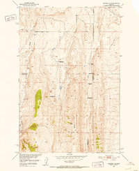
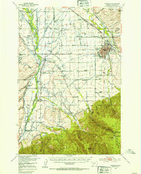
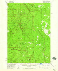
(24)- 1950 Map of Three Forks, 1953 Print
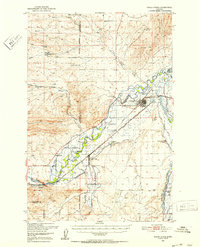 1950 Three Forks1953 Print · USGSThree Forks and the surrounding Gallatin Valley are captured here just after the war, showing the historic meeting of the rivers that form the Missouri. Genealogists and historians can trace the foundations of this ranching community through the Jefferson Sch, Fairview Cem, and the Climbing Arrow Ranch.4 unique versions available
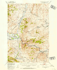
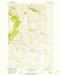
 - 1950 Map of Belgrade, 1953 Print
 1950 Belgrade1953 Print · USGSGallatin County ranching and rail infrastructure are captured here in the early fifties as the valley modernized. Researchers can locate family roots at the Dry Creek Cem, trace the old Menard Wye, or find the Mountain View School (Aband).6 unique versions available
 - 1950 Map of Hebgen Dam, 1954 Print
 1950 Hebgen Dam1954 Print · USGSThe Madison Range and the high country of the Montana-Idaho border come alive in this mid-century survey. You can trace the ranching and early tourism of the era through sites like Olifee Ranch, Campfire Lodge, and the remote Watkins Creek Ranch airstrip.7 unique versions available
 - 1950 Map of Spanish Peaks, 1954 Print
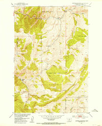
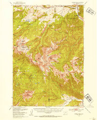 1950 Spanish Peaks1954 Print · USGSThe Madison Range high country comes into focus in this early 1950s survey of the Gallatin and Beaverhead National Forests. Researchers can locate remote mountain landmarks and early ranch sites like 8K Ranch, Crall Ranch, and the Spanish Creek Ranger Station.4 unique versions available
 - 1950 Map of Sphinx Mountain, 1954 Print
 1950 Sphinx Mountain1954 Print · USGSThe high peaks of Madison County and Gallatin County are mapped here in the early postwar era, capturing a landscape of remote ranger stations and historic family ranches. Researchers can locate early forest outposts like Yellow Mule Ranger Sta or trace old backcountry routes such as the Wapiti Trail and Eldridge Trail.4 unique versions available
 - 1950 Map of Jefferson Island, 1954 Print
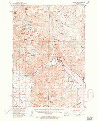
 1950 Jefferson Island1954 Print · USGSThe Jefferson River valley in the early 1950s reveals a landscape of industrial rail lines and established family ranchlands. Genealogists and local historians can locate early homesteads like Tribble Ranch, the Eureka School, and the South Boulder Cemetery.4 unique versions available
 - 1951 Map of Norris
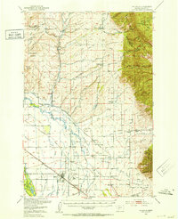
 1951 Norris1951 Print · USGSThe Madison River valley was a hub of irrigation and mining just after the war. Genealogists can locate family holdings like Noble Ranch or Barter Ranch and trace the paths of the Northern Pacific and Cherry Creek School.2 unique versions available
 - 1951 Map of Bozeman Pass, 1952 Print
 1951 Bozeman Pass1952 Print · USGSGallatin and Park counties are captured during the early 1950s, showing the high-country divide between Bozeman and Livingston. Genealogists and historians can trace family-named homesteads and old industrial sites like the Anaconda Copper Mines, Malmborg School, and the Shaodan Sawmill.5 unique versions available
 - 1951 Map of Sixteen NE, 1952 Print
 1951 Sixteen NE1952 Print · USGSThe ranching country of central Montana is captured here just after mid-century as homesteads were consolidating. Genealogists and historians can trace family landmarks and land-use shifts through sites like Campbell Ranch, Heath Ranch, and the Oil Well on Elk Ridge.3 unique versions available
 - 1951 Map of Wallrock, 1953 Print
 1951 Wallrock1953 Print · USGSGallatin and Park counties in the early fifties reveal a high-country landscape at the headwaters of the Missouri River Basin. Researchers can trace the complex drainage of Wallrock Basin and locate the mountain-fed Kistner-Hardy Dam near Wallrock.3 unique versions available
 - 1951 Map of Hatfield Mountain, 1953 Print
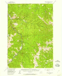
 1951 Hatfield Mountain1953 Print · USGSGallatin County during the early 1950s is captured here as a remote mountain landscape of high ridges and forestry outposts. Researchers can trace the layout of the Troy Ranger Station and identify historical land use at Miller Ranch or Bearskull.3 unique versions available
 - 1951 Map of Sedan, 1956 Print
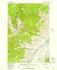
 1951 Sedan1956 Print · USGSThe high country of the Bridger Range and the settlement of Sedan are shown in the early fifties, highlighting a landscape of timber and ranching. Researchers can locate the Ryan Sawmill, the historic Spring Hill Pavilion, and remote outposts like Battle Ridge Ranger Station.3 unique versions available
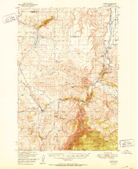
 - 1953 Map of Bozeman
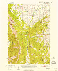
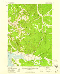
 1953 Bozeman1953 Print · USGSBozeman and the surrounding Gallatin Valley are captured here in the early fifties, showing a landscape defined by collegiate growth and irrigation. Researchers can trace family ranch lands like Patterson Ranch or locate local landmarks including Bozeman Hot Springs and Montana State College.5 unique versions available
 - 1955 Map of Bozeman
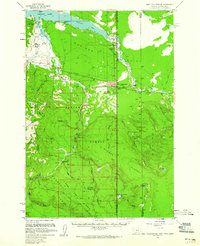
 1955 Bozeman1955 Print · USGSBozeman and the upper Missouri River headwaters are captured here during the mid-fifties, showing the vital rail and river networks of southwestern Montana. Local historians can trace the routes of the Northern Pacific railroad through Livingston and locate smaller settlements like Trident, Anceney, and Jardine.
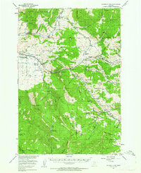
 - 1955 Map of Garnet Mountain, 1957 Print
 1955 Garnet Mountain1957 Print · USGSThe Gallatin Canyon corridor is captured here in the mid-fifties as mountain industry and recreation began to shape the forest. Researchers can trace the development of the Karst Ranch, find the Blanchard Sawmill, and locate the Mica Mine.4 unique versions available
 - 1955 Map of Fridley Peak, 1957 Print
 1955 Fridley Peak1957 Print · USGSThe Yellowstone River valley and the high Gallatin range are shown here in the mid-1950s. Researchers can locate the Northern Pacific line, the Mountain View School, and family landmarks like Ox Yoke Ranch.4 unique versions available
 - 1955 Map of Crown Butte, 1958 Print
 1955 Crown Butte1958 Print · USGSGallatin County and the Madison Range were emerging as a recreational hub in the mid-1950s as travelers began frequenting the high country. Map collectors and genealogists can trace early mountain properties like Porcupine Ranch, Eldridge 320 Ranch, and the Ophir Sch.5 unique versions available
 - 1955 Map of Ashton, 1967 Print
 1955 Ashton1967 Print · USGSThe Greater Yellowstone ecosystem is captured here during the mid-1950s, showing the high plateaus and remote gateway towns of Idaho and Montana. Researchers can trace the Union Pacific line to Ashton or locate small settlements like Squirrel and Grainville.4 unique versions available
 - 1957 Map of Buffalo Lake, 1959 Print
 1957 Buffalo Lake1959 Print · USGSHigh in the northern Rockies during the late fifties, the borders of Idaho, Montana, and Wyoming meet along the high spine of the Continental Divide. Trace the remote wilderness of the Madison Plateau and locate isolated landmarks like the Patrol Cabin or Latham Spring.2 unique versions available
 - 1958 Map of Ashton
 1958 Ashton1958 Print · USGSGreater Yellowstone and the eastern Idaho borderlands appear here in the mid-1950s as rail and road networks connected remote mountain basins. Trace the Union Pacific route through Ashton or locate early outposts like Last Chance, Squirrel, and West Yellowstone.
 - 1958 Map of West Yellowstone, 1960 Print
 1958 West Yellowstone1960 Print · USGSWest Yellowstone and the surrounding national forests are captured here in the late fifties, just before a major earthquake altered the region. Researchers can trace early park access via the Union Pacific and locate remote outposts like Whitmans Cabin and the Basin Ranger Sta.3 unique versions available
 - 1958 Map of Tepee Creek, 1960 Print
 1958 Tepee Creek1960 Print · USGSThe high country of the Montana-Wyoming border is captured here in the late fifties, just prior to the 1959 earthquake. Genealogists and researchers can trace early recreation and forest outposts like Parade Rest Ranch, Cabin Creek Ranger Sta, and Edwards.2 unique versions available
 - 1958 Map of Bozeman, 1968 Print
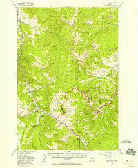
 1958 Bozeman1968 Print · USGSThe Gallatin and Madison River valleys are captured here in the late fifties, showing the region's transition into a modern mountain hub. Genealogists and historians can trace the paths of the Northern Pacific RR, locate the Anceney School, and see the early layout of Bozeman.3 unique versions available
 - 1958 Map of White Sulphur Springs, 1968 Print
 1958 White Sulphur Springs1968 Print · USGSCentral Montana in the late fifties was a landscape of high-country mining and newly formed reservoirs. You can trace the rail-and-river economy of the era through sites like Canyon Ferry Lake, the East Pacific Mine, and the historic Fort Logan.3 unique versions available
End of results
Showing maps 1-24 of 24
Top cities of Gallatin County
- Bozeman historical maps
- Belgrade historical maps
- Big Sky historical maps
- Three Forks historical maps
- Manhattan historical maps
- West Yellowstone historical maps
See more
Frequently asked questions
- What are the different types of historical maps available for Gallatin County?
- What is the oldest map of Gallatin County?
- Where can I purchase historical maps of Gallatin County for my home or office?
- Where can I download high-res historical maps of Gallatin County?
- Are there historical topographic maps available for Gallatin County?
- Is there historical aerial imagery available for Gallatin County?
- Where are historical maps of Gallatin County sourced from?