1960s Maps of Gallatin County, Montana
Explore 8 historic maps of Gallatin County from the 1960s. These maps offer a rare glimpse into what life looked like during the 1960s — showing old roads, neighborhoods, homes, and landmarks that have changed or disappeared over time.
Whether you're researching your family's past, planning a metal detecting trip, or studying how Gallatin County's landscape evolved across the 1960s, these high-resolution maps are a powerful tool for exploring the history of this region.
- Focus on a specific era: All maps on this page are from the 1960s, giving you a focused view of this time period.
- See what’s changed: Compare century-old streets, trails, and buildings to today's modern landscape using overlays and satellite layers.
- Research with precision: Use these maps for genealogy, historical research, land use analysis, or educational projects.
- View, download, or print: Maps are fully viewable online in high resolution, and can be downloaded or printed for your own records.
Start exploring Gallatin County's history through authentic maps from the 1960s. This is your window into the past.
Gallatin County, MT maps
(8)- 1960 Map of Ashton
 1960 Ashton1960 Print · USGSThe Idaho-Montana-Wyoming borderlands at the dawn of the sixties show a landscape defined by the Continental Divide and early wilderness tourism. Genealogists and historians can trace rail-stop settlements like Trude Siding, old outposts like Warm River, and early lodging at Snowball Inn.
 - 1960 Map of Willow Creek, 1962 Print
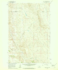 1960 Willow Creek1962 Print · USGSThe rural borderlands between Rosebud and Treasure counties appear in the early sixties as a landscape defined by seasonal waters and range roads. Genealogists and local historians can trace the paths of Willow Creek, Muggins Creek, and the curiously named Bone Coulee.
 - 1961 Map of White Sulphur Springs
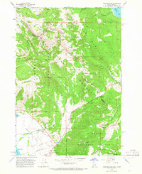
 1961 White Sulphur Springs1961 Print · USGSThe Missouri River valley and central Montana highlands are captured here during a period of significant hydroelectric and rail expansion. Genealogists and rail historians can trace the paths of the Northern Pacific and Chicago Milwaukee St Paul and Pacific through settlements like White Sulphur Springs and Townsend.
 - 1964 Map of Targhee Pass, 1966 Print
 1964 Targhee Pass1966 Print · USGSThe high alpine country of the Idaho-Montana border comes alive in this mid-century survey of the Continental Divide. Trace early mountain routes through Targhee Pass, discover the location of the Targhee Cem, and see the footprint of the ski lift at Lionhead.4 unique versions available
 - 1964 Map of Targhee Peak, 1966 Print
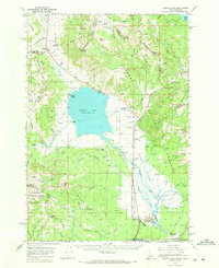
 1964 Targhee Peak1966 Print · USGSThe Idaho-Montana borderlands at the Continental Divide are captured here in the mid-1960s, showing the high-country interface between three National Forests. Genealogists and historians can trace family-named outposts like Wild Rose Ranch and Staley Springs along the northern shores of Henrys Lake.2 unique versions available
 - 1964 Map of Henrys Lake, 1972 Print
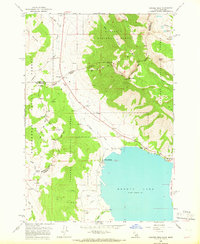
 1964 Henrys Lake1972 Print · USGSThe Idaho-Montana border country is documented here in the early 1960s, a time when ranching life and mountain recreation coexisted. Genealogists and historians can trace local landmarks like Targhee Cem, the Johnson Ranch, and the Lionhead Ski Area.2 unique versions available
 - 1965 Map of White Sulphur Springs
 1965 White Sulphur Springs1965 Print · USGSCentral Montana in the late 1950s and early 60s reveals a rugged mountain landscape shaped by the Missouri River and the emergence of the Canyon Ferry Reservoir. Genealogists and local historians can trace legacy ranching sites, the Northern Pacific rail line, and remote schoolhouses like Cottonwood School and Spokane Creek School.
 - 1965 Map of Bozeman
 1965 Bozeman1965 Print · USGSSouthwestern Montana's river valleys and mountain ranges appear in detail during the early 1960s. Genealogists and historians can trace rail-era settlements like Trident, locate the Anceney School, and see the early footprint of Montana State College.
End of results
Showing maps 1-8 of 8
Top cities of Gallatin County
- Bozeman historical maps
- Belgrade historical maps
- Big Sky historical maps
- Three Forks historical maps
- Manhattan historical maps
- West Yellowstone historical maps
See more
Frequently asked questions
- What are the different types of historical maps available for Gallatin County?
- What is the oldest map of Gallatin County?
- Where can I purchase historical maps of Gallatin County for my home or office?
- Where can I download high-res historical maps of Gallatin County?
- Are there historical topographic maps available for Gallatin County?
- Is there historical aerial imagery available for Gallatin County?
- Where are historical maps of Gallatin County sourced from?