1980s Maps of Gallatin County, Montana
Explore 66 historic maps of Gallatin County from the 1980s. These maps offer a rare glimpse into what life looked like during the 1980s — showing old roads, neighborhoods, homes, and landmarks that have changed or disappeared over time.
Whether you're researching your family's past, planning a metal detecting trip, or studying how Gallatin County's landscape evolved across the 1980s, these high-resolution maps are a powerful tool for exploring the history of this region.
- Focus on a specific era: All maps on this page are from the 1980s, giving you a focused view of this time period.
- See what’s changed: Compare century-old streets, trails, and buildings to today's modern landscape using overlays and satellite layers.
- Research with precision: Use these maps for genealogy, historical research, land use analysis, or educational projects.
- View, download, or print: Maps are fully viewable online in high resolution, and can be downloaded or printed for your own records.
Start exploring Gallatin County's history through authentic maps from the 1980s. This is your window into the past.
Gallatin County, MT maps
(66)- 1986 Map of Deer Park
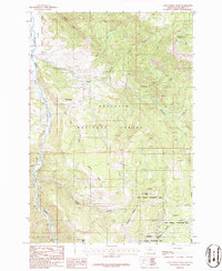
 1986 Deer Park1986 Print · USGSBroadwater and Gallatin counties are captured in the mid-1980s, centered on the rugged canyon country of the Helena National Forest. Researchers can trace the Old Railroad Grade as it winds through the canyon past Deer Park and Sixteenmile Creek.
 - 1986 Map of Jack Straw Basin
 1986 Jack Straw Basin1986 Print · USGSThe wilderness along the Montana and Wyoming border comes into focus in the mid-1980s, documenting the rugged intersection of two massive federal preserves. Researchers can trace the drainage patterns of Jack Straw Basin and identify remote water features like Big Bear Lake and Frog Pond.
 - 1986 Map of Madison Arm
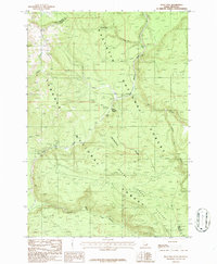
 1986 Madison Arm1986 Print · USGSThe high mountain basins of the Montana-Idaho border are captured here in the mid-1980s, centered on the expansive waters of Hebgen Lake. Researchers can trace the Old Railroad Grade, locate the remote Basin Cabin, and map the rugged line of the Continental Divide.2 unique versions available
 - 1986 Map of Lombard
 1986 Lombard1986 Print · USGSThe Missouri River corridor in Broadwater County is captured here in the mid-1980s as a vital junction of irrigation and rail history. Trace the Old Railroad Grade past Lombard or locate rural landmarks like Cramp Spring and Sixteenmile Creek.
 - 1986 Map of Blacktail Mountain
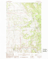
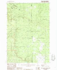
 1986 Blacktail Mountain1986 Print · USGSGallatin County's high ridges and canyons are captured in the mid-1980s as the wilderness transition was well underway. Trace the remnants of an Old RR Grade near Sixteenmile Creek or follow the Gallop Pack Trail through the Bridger Range to peaks like Zade Mountain.
 - 1986 Map of Latham Spring
 1986 Latham Spring1986 Print · USGSThe Idaho-Montana borderlands are captured here in the mid-1980s, centered on the high-elevation drainages of the Targhee National Forest. Local history researchers can trace a remote Trail and find landmarks like Latham Spring and the Thirsty Black Creek Canyon.
 - 1986 Map of Lone Indian Peak
 1986 Lone Indian Peak1986 Print · USGSGallatin County mountain terrain in the mid-1980s reveals a wilderness of high ridges and state wildlife lands. Researchers can trace remote routes like the Pack Trail past Lone Indian Peak and the alpine Golden Trout Lakes.2 unique versions available
 - 1986 Map of Reas Pass
 1986 Reas Pass1986 Print · USGSThe high mountain border between Idaho and Montana is captured here in the mid-1980s at the height of the Continental Divide. Researchers can trace the path of the Old Railroad Grade as it navigates Reas Pass and the banks of the Madison River.
 - 1986 Map of Maudlow
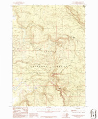
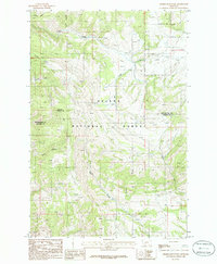
 1986 Maudlow1986 Print · USGSGallatin County in the mid-1980s reveals a landscape of mountain drainages and early rail history. Trace the Old Railroad Grade near Maudlow or locate family-named landmarks like Rouland Spring and Poison Hollow.
 - 1986 Map of Buffalo Lake NE
 1986 Buffalo Lake NE1986 Print · USGSThe high wilderness where Idaho, Montana, and Wyoming meet is captured here in the mid-1980s at the junction of three major protected forests. Trace the Continental Divide as it winds past the headwaters of Black Canyon Creek and Thirsty Creek in Yellowstone National Park.
 - 1986 Map of Roy Gulch
 1986 Roy Gulch1986 Print · USGSThe Horseshoe Hills in the mid-1980s reveal a landscape shaped by drainage and elevation along the Gallatin and Broadwater county lines. Genealogists and historians can trace water rights and old boundaries through named springs like Townsend Spring and gulches such as Home Gulch and Garden Gulch.
 - 1986 Map of Richards Creek
 1986 Richards Creek1986 Print · USGSThe Montana and Wyoming borderlands are captured here in the mid-eighties as they meet the western edge of Yellowstone National Park. Researchers can trace the path of the Pack Trail and locate the small Cem and Gravel Pit near the Madison Valley.
 - 1986 Map of Ramshorn Peak
 1986 Ramshorn Peak1986 Print · USGSThe Gallatin Range in the mid-1980s is captured here, showing a landscape of high summits and protected forests before modern development. Trace mountain trails and remote landmarks like Ramshorn Peak, Lake Elsie, and the Buffalo Horn Pass.2 unique versions available
 - 1986 Map of Sixmile Mountain
 1986 Sixmile Mountain1986 Print · USGSBroadwater and Gallatin counties are captured here in the mid-1980s, showcasing the high-country landscape of the Helena National Forest. Researchers can trace the drainages of Sawmill Gulch and Haw Gulch or locate specific mining Prospects near the slopes of Sixmile Mountain.
 - 1986 Map of Upper Tepee Basin
 1986 Upper Tepee Basin1986 Print · USGSGallatin County was a hub of conservation and wilderness management in the 1980s. Hikers and researchers can trace the high-country paths of the Pack Trail across Red Mountain or follow the waters of Bacon Rind Creek and Tepee Creek.2 unique versions available
 - 1986 Map of Mount Hebgen
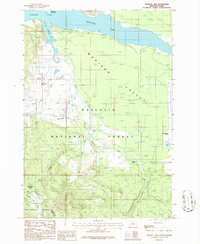
 1986 Mount Hebgen1986 Print · USGSGallatin County's high-country waters and ridges are documented here in the mid-1980s, featuring the detailed shoreline of Hebgen Lake. Researchers can trace the complex geography of Horse Butte Peninsula and landmarks like Rainbow Point or the Marina.
 - 1986 Map of Divide Lake
 1986 Divide Lake1986 Print · USGSHigh wilderness along the Montana and Wyoming border comes into focus in the mid-eighties, where national forest and park lands meet. Track remote drainages and backcountry routes like Pack Trails near Divide Lake and the upper Gallatin River.2 unique versions available
 - 1986 Map of Francis
 1986 Francis1986 Print · USGSThe mountains of Meagher, Broadwater, and Gallatin counties are shown here in the mid-eighties as a hub of early rail engineering. You can trace the Old Railroad Grade past Francis and follow the steep drainages of Sixteenmile Creek and Paddox Run.
 - 1986 Map of Big Horn Peak
 1986 Big Horn Peak1986 Print · USGSThe Montana and Wyoming borderlands are preserved in this mid-eighties survey of high mountain wilderness. Trekkers and historians can trace old routes like the Petrified Forest Pack Trail past Big Horn Peak and Lava Butte.
 - 1986 Map of Sunshine Point, 1987 Print
 1986 Sunshine Point1987 Print · USGSGallatin County in the mid-1980s was a landscape of protected wilderness and high mountain river corridors. Researchers can trace the rugged Pack Trails and remote landmarks like Monument Meadow and the secluded Snowflake Springs.2 unique versions available
 - 1986 Map of West Yellowstone, 1987 Print
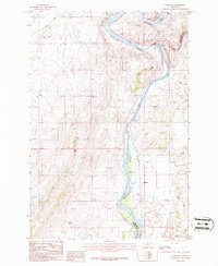
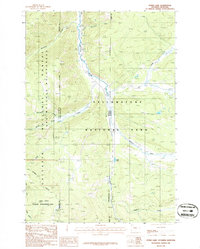
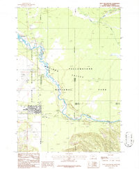 1986 West Yellowstone1987 Print · USGSWest Yellowstone in the mid-1980s marks the meeting point of forest, park, and state lines. Researchers can trace the town's development and find transportation history along the Old Railroad Grade, the Yellowstone Airport, and the Madison River.
 - 1987 Map of Bald Knob
 1987 Bald Knob1987 Print · USGSThe Gallatin Range in the late eighties reveals a landscape of industrial history and forest management on the Gallatin and Park county line. Researchers can trace the legacy of mountain extraction at the Kountz Mine and the Old Russell Mill or find the Trail Creek Guard Station.2 unique versions available
 - 1987 Map of Kelly Creek
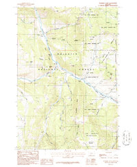
 1987 Kelly Creek1987 Print · USGSGallatin County during the 1980s reveals a landscape where the Bridger Range meets the growing outskirts of Bozeman. Researchers can locate the Mount Ellis Academy, trace the old Bridger Canyon Road, and find local landmarks like the La Motte Sch or the Mine near Chestnut.2 unique versions available
 - 1987 Map of Saddle Peak
 1987 Saddle Peak1987 Print · USGSThe high Bridger Range peaks near Bozeman are captured here in the late eighties, showing a landscape of alpine summits and deep timbered canyons. Researchers can trace recreational footprints at Bridger Bowl Ski Area or find old landmarks like Spring Hill Pavilion and Ross Pass.2 unique versions available
 - 1987 Map of Grassy Mountain
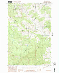
 1987 Grassy Mountain1987 Print · USGSGallatin and Park County are captured in the late 1980s, showing a high-country landscape primarily defined by the Gallatin National Forest. Researchers can trace primitive 4WD trails across Grassy Mountain and down to School Gulch Creek or Bishop Park.
Showing maps 1-25 of 66
Top cities of Gallatin County
- Bozeman historical maps
- Belgrade historical maps
- Big Sky historical maps
- Three Forks historical maps
- Manhattan historical maps
- West Yellowstone historical maps
See more
Frequently asked questions
- What are the different types of historical maps available for Gallatin County?
- What is the oldest map of Gallatin County?
- Where can I purchase historical maps of Gallatin County for my home or office?
- Where can I download high-res historical maps of Gallatin County?
- Are there historical topographic maps available for Gallatin County?
- Is there historical aerial imagery available for Gallatin County?
- Where are historical maps of Gallatin County sourced from?