1950s Maps of Hill County, Montana
Explore 10 historic maps of Hill County from the 1950s. These maps offer a rare glimpse into what life looked like during the 1950s — showing old roads, neighborhoods, homes, and landmarks that have changed or disappeared over time.
Whether you're researching your family's past, planning a metal detecting trip, or studying how Hill County's landscape evolved across the 1950s, these high-resolution maps are a powerful tool for exploring the history of this region.
- Focus on a specific era: All maps on this page are from the 1950s, giving you a focused view of this time period.
- See what’s changed: Compare century-old streets, trails, and buildings to today's modern landscape using overlays and satellite layers.
- Research with precision: Use these maps for genealogy, historical research, land use analysis, or educational projects.
- View, download, or print: Maps are fully viewable online in high resolution, and can be downloaded or printed for your own records.
Start exploring Hill County's history through authentic maps from the 1950s. This is your window into the past.
Hill County, MT maps
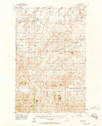
(10)- 1953 Map of Havre, 1967 Print
 1953 Havre1967 Print · USGSNorthern Montana’s Hi-Line comes into focus in the mid-fifties, centered on the Milk River and the critical Great Northern rail link. Genealogists can trace small sidings and settlements like Assinniboine, Laredo, and Box Elder alongside the Fort Belknap Agency.3 unique versions available
 - 1954 Map of Shelby, 1967 Print
 1954 Shelby1967 Print · USGSNorthern Montana's Hi-Line is captured in the mid-fifties, showing a landscape shaped by the Great Northern rail and early oil development. Trace family roots in Shelby and Conrad, or locate rural landmarks like Goose Bill Butte and the Rocky Boys Indian Reservation.3 unique versions available
 - 1956 Map of Lloyd, 1958 Print
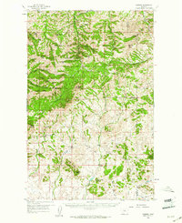
 1956 Lloyd1958 Print · USGSThe northern slopes of the Bearpaw Mountains come into focus in the mid-1950s, showing a landscape of high-plains ranching and early energy development. Genealogists and researchers can locate old rural school sites like Logie Sch and Lloyd Sch or trace the early Gas Wells near Threemile Coulee.2 unique versions available
 - 1957 Map of Havre
 1957 Havre1957 Print · USGSNorth-central Montana at the mid-century is defined by the vital Great Northern rail corridor and the winding Milk River. Researchers can trace old settlements like Laredo and Savoy, or locate historic sites such as the Hays (old) Sub Agency and the Chinook No 1 mine.
 - 1958 Map of Shelby
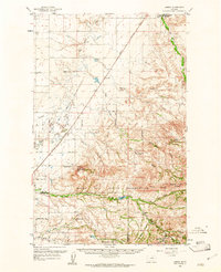
 1958 Shelby1958 Print · USGSNorthern Montana’s high plains and the Sweetgrass Hills come to life in the late fifties as the Tiber Dam begins to reshape the Marias River valley. Genealogists and historians can trace rail-town lineages along the Great Northern line and locate sites like the Hull Coal Mine or Sweet Grass.
 - 1958 Map of Havre
 1958 Havre1958 Print · USGSUpper Montana in the late fifties was a landscape of remote rail towns and vast high-plain ranges. Genealogists and historians can trace the Great Northern railroad through Havre, Chinook, and the Fort Belknap Indian Reservation.
 - 1959 Map of Warrick, 1961 Print
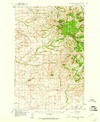
 1959 Warrick1961 Print · USGSThe Bearpaw Mountains of North Central Montana were still a landscape of remote ranching and reservation life in the late fifties. Researchers can trace the grounds of the Upper Dog Creek Sch, the Silver King Mine, and the isolated community of Warrick.3 unique versions available
 - 1959 Map of Laredo, 1961 Print
 1959 Laredo1961 Print · USGSNorth-central Montana at the close of the fifties reveals a landscape defined by the Great Northern railroad and the Rocky Boy Indian Reservation. Researchers can trace old ranch sites like Champagne Ranch and vanished landmarks like the Sangrey Sch.2 unique versions available
 - 1959 Map of Centennial Mountain, 1961 Print
 1959 Centennial Mountain1961 Print · USGSThe northern Bearpaw Mountains and the Rocky Boy Indian Reservation are captured here in the late fifties. Researchers can trace the legacy of local resource extraction and high-country landmarks like the Rocky Boy Mine, Centennial Mountain, and Ryan Butte.3 unique versions available
 - 1959 Map of Shambo, 1961 Print
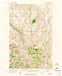 1959 Shambo1961 Print · USGSMontana's high country south of Havre is detailed here in the late fifties, where the plains meet the rising Bear Paw Mountains. Researchers can locate remote rural institutions like Shambo Sch, the boundaries of the Rocky Boy Indian Reservation, and family landmarks like Rotary Hill.3 unique versions available
End of results
Showing maps 1-10 of 10
Top cities of Hill County
Frequently asked questions
- What are the different types of historical maps available for Hill County?
- What is the oldest map of Hill County?
- Where can I purchase historical maps of Hill County for my home or office?
- Where can I download high-res historical maps of Hill County?
- Are there historical topographic maps available for Hill County?
- Is there historical aerial imagery available for Hill County?
- Where are historical maps of Hill County sourced from?