1960s Maps of Hill County, Montana
Explore 26 historic maps of Hill County from the 1960s. These maps offer a rare glimpse into what life looked like during the 1960s — showing old roads, neighborhoods, homes, and landmarks that have changed or disappeared over time.
Whether you're researching your family's past, planning a metal detecting trip, or studying how Hill County's landscape evolved across the 1960s, these high-resolution maps are a powerful tool for exploring the history of this region.
- Focus on a specific era: All maps on this page are from the 1960s, giving you a focused view of this time period.
- See what’s changed: Compare century-old streets, trails, and buildings to today's modern landscape using overlays and satellite layers.
- Research with precision: Use these maps for genealogy, historical research, land use analysis, or educational projects.
- View, download, or print: Maps are fully viewable online in high resolution, and can be downloaded or printed for your own records.
Start exploring Hill County's history through authentic maps from the 1960s. This is your window into the past.
Hill County, MT maps
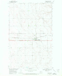
(26)- 1963 Map of Joplin, 1965 Print
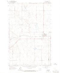 1963 Joplin1965 Print · USGSLiberty County agricultural life in the early sixties centers on the rail-side grain hub of Joplin. Genealogists and historians can trace the local road network including Bison Road, the Great Northern rail line, and the siding at Buelow.
 - 1963 Map of Bobcat Coulee SE, 1966 Print
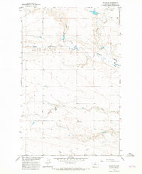
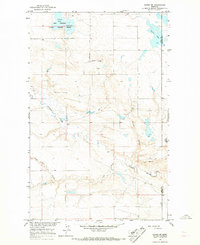
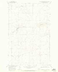
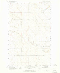 1963 Bobcat Coulee SE1966 Print · USGSNorthern Montana's high plains come into focus in the early sixties, showing the rural landscape along the Liberty and Hill county line. Researchers can locate the Tingdahl School and trace the winding course of Little Sage Creek through this quiet cattle-and-grain country.
 - 1963 Map of Chester NE, 1966 Print
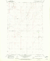
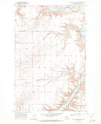
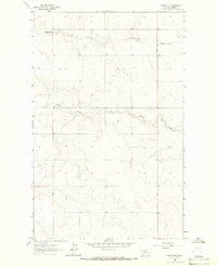 1963 Chester NE1966 Print · USGSLiberty County's high plains are captured here in the early sixties, showing the rural section-line layout north of Chester. Researchers can trace land divisions along Bison Road and identify seasonal watercourses like Fourmile Coulee and O'Brien Coulee.
 - 1964 Map of Bobcat Coulee NE, 1965 Print
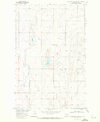
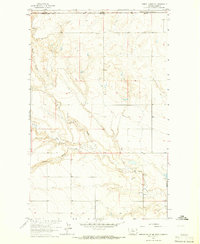 1964 Bobcat Coulee NE1965 Print · USGSThe northern border of Montana meets Alberta in the mid-1960s, showing a remote prairie landscape defined by deep coulees. Genealogists and historians can trace local landmarks like Immanuel Ch and water sources including Sage Creek and Laird Cr.
 - 1964 Map of Havre NW, 1967 Print
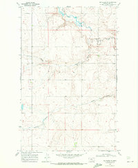
 1964 Havre NW1967 Print · USGSNorth of the Milk River in the mid-sixties, this Hill County landscape reveals the deep coulees and remote community hubs of the Montana plains. Genealogists and historians can locate the North Havre Community Hall, a local Landing Field, and the seasonal waters of Willow Creek.
 - 1964 Map of Havre SE, 1967 Print
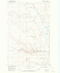
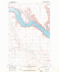
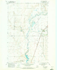
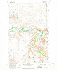 1964 Havre SE1967 Print · USGSThe Milk River valley in Hill County was a critical corridor for the Great Northern railway during the mid-sixties. Local historians can trace early prairie infrastructure like the Davey Sch, the Roadside Park, and several wells scattered across the coulees.2 unique versions available
 - 1964 Map of Havre, 1967 Print
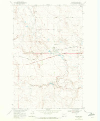
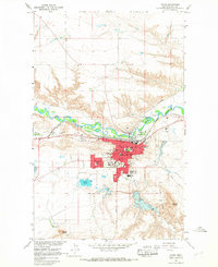 1964 Havre1967 Print · USGSHavre and the Milk River valley are shown here during the mid-1960s, a period of steady growth for this railroad and college town. Researchers can trace the development of Northern Montana College and locate local landmarks from Highland Cem to the Drive-in Theater.2 unique versions available
 - 1964 Map of Lohman, 1967 Print
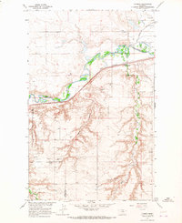 1964 Lohman1967 Print · USGSNorthern Montana river valley life in the mid-sixties centers on the rail-and-water corridor of the Milk River. Trace rural education and energy development through landmarks like Miewald Sch, the Great Northern rail line, and a Gas Compressor Station.
 - 1964 Map of Havre NE, 1967 Print
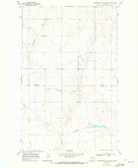
 1964 Havre NE1967 Print · USGSNorthern Montana prairie and the Thibadeau Lake National Wildlife Refuge appear here in the mid-1960s. Trace the seasonal waters of Martin Lake or follow the deep drainage of Redrock Coulee and Coal Coulee across the plains.
 - 1969 Map of Sage Lake, 1972 Print
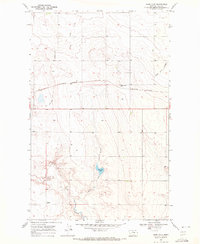 1969 Sage Lake1972 Print · USGSHill County, Montana, is shown here in the late sixties as a land of expansive rail corridors and high-plains hydrology. You can trace the path of the Burlington Northern and find remnants of the past along the Old Railroad Grade and Sage Lake.
 - 1969 Map of Box Elder NW, 1972 Print
 1969 Box Elder NW1972 Print · USGSHill County at the close of the 1960s was a landscape shaped by water and wind across the high northern plains. Researchers can trace the drainage patterns and early water infrastructure of the region through landmarks like Sage Lake, Faulkners Coulee, and Halfway Coulee.
 - 1969 Map of Gildford NE, 1972 Print
 1969 Gildford NE1972 Print · USGSHill County agricultural lands are captured here in the late sixties, showcasing the vast township grids of northern Montana. Researchers can trace local water management and early energy sites through Burkhartsmeyer Reservoir, a Gas Well, and the seasonal Sage Creek.
 - 1969 Map of Fourteenmile Coulee SW, 1972 Print
 1969 Fourteenmile Coulee SW1972 Print · USGSThe Montana prairie straddling the border of Hill and Chouteau counties is captured here in the late sixties, showing the reach of seasonal drainages. Researchers can trace the courses of Black Coulee and Sixmile Coulee or locate rural landmarks like isolated Storage Bins.
 - 1969 Map of Gildford NW, 1972 Print
 1969 Gildford NW1972 Print · USGSHill County, Montana, was a quiet landscape of prairie drainage and cattle range in the late sixties. Trace the winding course of Little Sage Creek and locate water resources like Burkhartsmeyer Reservoir and the deep cuts of Big Coulee.
 - 1969 Map of Kremlin, 1972 Print
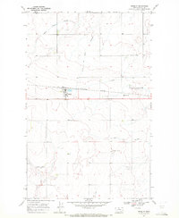 1969 Kremlin1972 Print · USGSHill County agricultural life in the late sixties centers on the rail siding at Kremlin. Researchers can trace the industrial footprint of the High Line through local Grain Elevators, the Burlington Northern tracks, and the Chain of Lakes.
 - 1969 Map of Lonesome Lake, 1972 Print
 1969 Lonesome Lake1972 Print · USGSThe Montana prairie at the turn of the 1970s reveals a sparse landscape of ranching and drainage coulees across the Hill and Chouteau county line. Genealogists and historians can trace local landmarks like Lonesome Lake and the intermittent waters of Twelvemile Coulee.
 - 1969 Map of Hingham, 1972 Print
 1969 Hingham1972 Print · USGSThe grain-country town of Hingham is shown at the height of its rail-era importance in the late sixties. Trace the legacy of the High Line along the Burlington Northern tracks and locate the town's original Landing Strip and England Coulee.
 - 1969 Map of Fourteenmile Coulee NW, 1972 Print
 1969 Fourteenmile Coulee NW1972 Print · USGSHill County ranchlands and coulees are captured in the late sixties, showcasing the remote landscape of northern Montana. Researchers can trace the winding East Fork Black Coulee and locate landmarks like the Landing Strip and Faulkners Coulee.
 - 1969 Map of Saddle Butte, 1972 Print
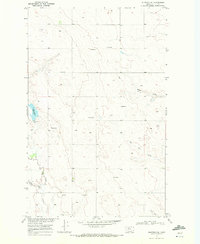
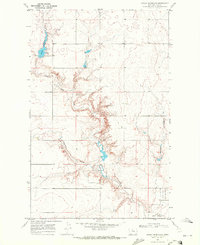
 1969 Saddle Butte1972 Print · USGSHill County ranchlands meet the expansive waters of the Fresno Reservoir in the late sixties. Genealogists and researchers can trace the rugged topography of Saddle Butte and follow the intricate drainages of Watson Coulee and Wild Rose Coulee.
 - 1969 Map of Fourteenmile Coulee SE, 1972 Print
 1969 Fourteenmile Coulee SE1972 Print · USGSThe border of Hill and Chouteau counties was a landscape of deep drainage coulees and prairie industry in the late sixties. Researchers can trace the winding Fourteenmile Coulee past local Gravel Pits and isolated Storage Bins.
 - 1969 Map of Fourteenmile Coulee NE, 1972 Print
 1969 Fourteenmile Coulee NE1972 Print · USGSHill County ranching country appears in the late sixties as a land of expansive plains and winding intermittent streams. Researchers can locate the site of Van, a small Cem, and the distinct path of Fourteenmile Coulee.
 - 1969 Map of Dutch Henry Coulee, 1972 Print
 1969 Dutch Henry Coulee1972 Print · USGSNorth-central Montana’s cattle country is surveyed here in the late sixties, highlighting the deep breaks of the northern plains. Researchers can trace the winding Marias River and the rural settlement at Shepard through the rugged Fourmile Coulee terrain.
 - 1969 Map of Box Elder, 1972 Print
 1969 Box Elder1972 Print · USGSBox Elder and the western edge of the Rocky Boy's Reservation are captured in the late sixties as the rail and ranching economy thrived. Genealogists and local historians can trace the Burlington Northern line and locate the Cem and Rocky Crossing.
 - 1969 Map of Gildford, 1972 Print
 1969 Gildford1972 Print · USGSGildford and the surrounding Hill County plains are captured here in the late sixties, centered on the Burlington Northern line. Researchers can trace the town's footprint, the Gildford Hill County Cem, and the path of the Old Railroad Grade.
 - 1969 Map of Bailey Reservoir, 1972 Print
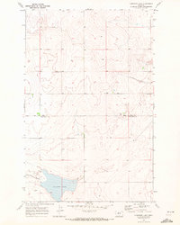
 1969 Bailey Reservoir1972 Print · USGSHill County ranch lands and tribal borders are captured here in the late sixties. Researchers can trace the perimeter of the Rocky Boys Indian Reservation and locate water sources like Bailey Reservoir and Halfway Coulee.
Showing maps 1-25 of 26
Top cities of Hill County
Frequently asked questions
- What are the different types of historical maps available for Hill County?
- What is the oldest map of Hill County?
- Where can I purchase historical maps of Hill County for my home or office?
- Where can I download high-res historical maps of Hill County?
- Are there historical topographic maps available for Hill County?
- Is there historical aerial imagery available for Hill County?
- Where are historical maps of Hill County sourced from?