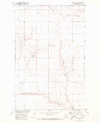
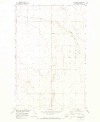
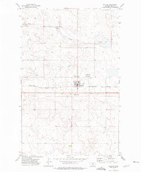
1970s Maps of Hill County, Montana
Explore 35 historic maps of Hill County from the 1970s. These maps offer a rare glimpse into what life looked like during the 1970s — showing old roads, neighborhoods, homes, and landmarks that have changed or disappeared over time.
Whether you're researching your family's past, planning a metal detecting trip, or studying how Hill County's landscape evolved across the 1970s, these high-resolution maps are a powerful tool for exploring the history of this region.
- Focus on a specific era: All maps on this page are from the 1970s, giving you a focused view of this time period.
- See what’s changed: Compare century-old streets, trails, and buildings to today's modern landscape using overlays and satellite layers.
- Research with precision: Use these maps for genealogy, historical research, land use analysis, or educational projects.
- View, download, or print: Maps are fully viewable online in high resolution, and can be downloaded or printed for your own records.
Start exploring Hill County's history through authentic maps from the 1970s. This is your window into the past.
Hill County, MT maps
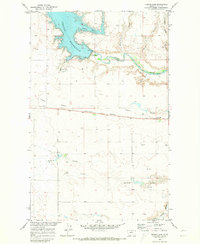
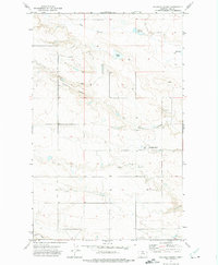
(35)- 1970 Map of Poverty Coulee NE, 1973 Print
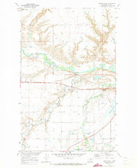
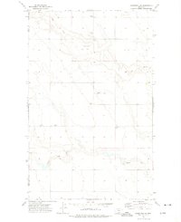
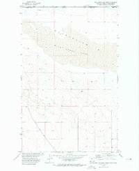
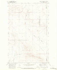 1970 Poverty Coulee NE1973 Print · USGSLiberty and Hill counties meet at this high plains divide in the early seventies, showing a landscape of seasonal waterways and open range. Researchers can trace the drainage of Black Coulee, the heights of Dobie Ridge, and the section lines surrounding Bison.
 - 1970 Map of Penzer School, 1973 Print
 1970 Penzer School1973 Print · USGSThe northern plains of Liberty and Chouteau counties are captured here in the early 1970s, focused on the breaks of the Marias River. Researchers can locate the Penzer Sch and trace the deep drainage patterns of Dead Indian Coulee and Lees Lake.
 - 1970 Map of Rocky Coulee SE, 1973 Print
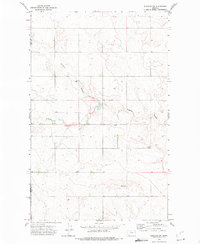
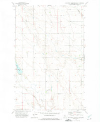
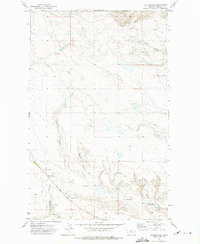
 1970 Rocky Coulee SE1973 Print · USGSThe Montana high plains at the start of the seventies reveal a landscape shaped by water and wind on the Hill and Chouteau county line. Local historians and land researchers can trace the meandering paths of Black Coulee and the Flat Coulee drainage system.
 - 1970 Map of Poverty Coulee SE, 1973 Print
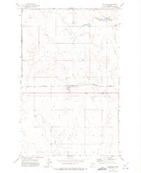
 1970 Poverty Coulee SE1973 Print · USGSLiberty and Hill counties appear here in the early 1970s, showcasing the intricate drainage systems and ranchlands near the Marias River. Trace the geographic layout of family-named landmarks like Wolfe Coulee, Cottonwood Creek, and the remote Landing Strip.
 - 1970 Map of Herron Park, 1973 Print
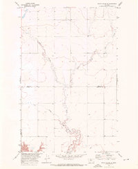
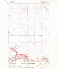
 1970 Herron Park1973 Print · USGSNorth-central Montana in the early seventies reveals a landscape of river-valley agriculture and emerging energy fields. Researchers can trace the Agricultural Experiment Station or explore the rail hubs at Pacific Junction and Burnham.2 unique versions available
 - 1970 Map of Quigley Coulee, 1973 Print
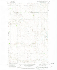
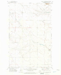
 1970 Quigley Coulee1973 Print · USGSNorthern Montana's plains appear at the start of the 1970s, showcasing a network of seasonal drainages and early rural infrastructure. Researchers can trace family history at Grainbelt Cem or follow the historic Amos Trail past Flagstaff Hill.
 - 1970 Map of Rocky Coulee SW, 1973 Print
 1970 Rocky Coulee SW1973 Print · USGSHill County is captured in the early 1970s as a landscape of wide-open plains and deep river cuts. Historians can trace the winding path of the Marias River and locate the Gaging Sta and Flat Coulee drainage system.
 - 1970 Map of Laredo, 1973 Print
 1970 Laredo1973 Print · USGSHill County in the early seventies shows a landscape defined by the winding Big Sandy Creek and the northern border of the Rocky Boys Indian Reservation. Genealogists and historians can trace the path of the Old Fort Assinniboine Military Road or locate the settlement at Laredo.2 unique versions available
 - 1970 Map of Kiehns Coulee, 1973 Print
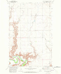
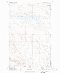
 1970 Kiehns Coulee1973 Print · USGSHill County ranchlands meet the rising waters of the Missouri River Basin project during the early 1970s. Researchers can trace rural landmarks like the Grainbelt Sch and remote Landing Strips among the many coulees feeding the Fresno Reservoir.
 - 1970 Map of Fresno Dam, 1973 Print
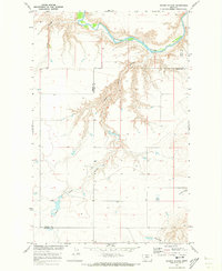
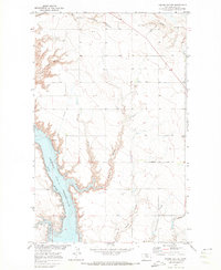
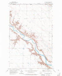
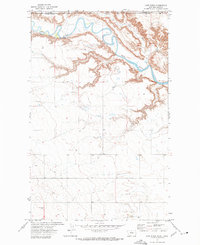
 1970 Fresno Dam1973 Print · USGSThe Milk River valley and its complex irrigation systems are captured here in the early 1970s. Researchers can trace the railroad stop at Burnham and find early energy development sites like the numerous Gas Wells scattered near Fresno Coulee.
 - 1970 Map of Rocky Coulee, 1973 Print
 1970 Rocky Coulee1973 Print · USGSHill County ranchlands are captured here in the early 1970s, showcasing a landscape shaped by seasonal water and open range. Researchers can trace the winding paths of Black Coulee and Rocky Coulee or locate the reliable Cockerel Spring.
 - 1970 Map of Een School, 1973 Print
 1970 Een School1973 Print · USGSHill County, Montana, appears here in the early seventies, capturing a characteristic stretch of rural high plains during the Missouri River Basin development era. Genealogists and local historians can locate the Een School and the Rudyard Gun Club along the winding East Fork Black Coulee.
 - 1972 Map of Rudyard, 1975 Print
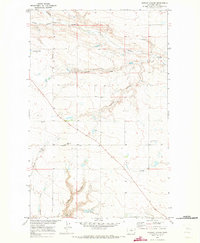
 1972 Rudyard1975 Print · USGSMontana's Hi-Line country in the early seventies centers on the rail-side community of Rudyard. Genealogists and local historians can trace the town's footprint, including the County Cem, Athletic Field, and the Burlington Northern corridor.
 - 1972 Map of Goldstone SW, 1975 Print
 1972 Goldstone SW1975 Print · USGSNorthern Montana prairie life in the early 1970s is captured here along the border of Hill and Liberty counties. Researchers can trace the agricultural footprint of the era through numerous Storage Bins and a rural Landing Strip near Sage Creek.
 - 1972 Map of Lost River NE, 1975 Print
 1972 Lost River NE1975 Print · USGSThe Montana-Alberta borderlands appear here in the early 1970s, marked by the deep canyons of the Milk River. Researchers can trace old fence lines and ranching landmarks like Rattlesnake Butte and the Pugsley & Simpson site.
 - 1972 Map of Rudyard NW, 1975 Print
 1972 Rudyard NW1975 Print · USGSThe high plains of north-central Montana come into focus during the early seventies, showing the rural borderlands of Liberty and Hill counties. Trace family roots and land patterns near Bethel Cem or follow the drainage of O' Brien Coulee.
 - 1972 Map of Inverness, 1975 Print
 1972 Inverness1975 Print · USGSNorthern Montana's high plains are captured here in the early 1970s, focused on the rail-side settlement of Inverness. Local researchers can trace family landmarks like the County Cem and the BURLINGTON NORTHERN railroad route.
 - 1972 Map of Hilldale Colony, 1975 Print
 1972 Hilldale Colony1975 Print · USGSHill County is captured here in the early seventies, showing the established settlement of Hilldale Colony and its surrounding drainage systems. Researchers can trace historical routes like the St Joe Road and the Amos Trail past McLean Reservoir and several local Gravel Pit sites.
 - 1972 Map of Lake Thibadeau SW, 1975 Print
 1972 Lake Thibadeau SW1975 Print · USGSHill County was characterized by vast conservation lands and remote ranching infrastructure in the early 1970s. Researchers can trace land features through Lohman Coulee, find the isolated Landing Strip, and explore the margins of Mud Lake.
 - 1972 Map of Mc Kinnsey Reservoir East, 1975 Print
 1972 Mc Kinnsey Reservoir East1975 Print · USGSHill County ranching and grain farming are captured in the early 1970s, showing a landscape of scattered section-line storage and isolated schools. Researchers can trace the water systems around Mc Kinnsey Reservoir and locate the Mariner Sch and Landing Strip.
 - 1972 Map of Mc Kinnsey Reservoir West, 1975 Print
 1972 Mc Kinnsey Reservoir West1975 Print · USGSHill County farming life in the early seventies centers on remote prairie townships and the vital water of Sage Creek. Researchers can locate community anchors like Goldstone Ch, the Oreana Sch, and the high point of Black Butte near the reservoir.
 - 1972 Map of Wild Horse Lake West, 1975 Print
 1972 Wild Horse Lake West1975 Print · USGSThe high plains of the Montana-Alberta border appear in the early 1970s as a landscape of open range and isolated landmarks. Researchers can trace the path of the Wild Horse Trail and locate historic Well sites and storage bins near the international boundary.
 - 1972 Map of Cottonwood, 1975 Print
 1972 Cottonwood1975 Print · USGSHill County, Montana, was a landscape of remote homesteading hubs and historic transit routes in the early seventies. Genealogists and local historians can locate the Cottonwood Sch, the Cottonwood Cem, and the historic Wild Horse Trail crossing the plains.
 - 1972 Map of Ninemile Coulee West, 1975 Print
 1972 Ninemile Coulee West1975 Print · USGSHill County ranchlands are documented here in the early seventies, showing the sparse but vital infrastructure of the northern Montana plains. Researchers can locate the Landing Strip and trace the drainage of Ninemile Coulee alongside the Wild Horse Trail.
 - 1972 Map of Lost River, 1975 Print
 1972 Lost River1975 Print · USGSThe northern plains along the international border come into focus in the early 1970s as the Milk River winds through the landscape. Researchers can locate remote ranching infrastructure like Storage Bins, an isolated Well, and a Gaging Sta near the Lost River confluence.
Showing maps 1-25 of 35
Top cities of Hill County
Frequently asked questions
- What are the different types of historical maps available for Hill County?
- What is the oldest map of Hill County?
- Where can I purchase historical maps of Hill County for my home or office?
- Where can I download high-res historical maps of Hill County?
- Are there historical topographic maps available for Hill County?
- Is there historical aerial imagery available for Hill County?
- Where are historical maps of Hill County sourced from?