1960s Maps of Powell County, Montana
Explore 30 historic maps of Powell County from the 1960s. These maps offer a rare glimpse into what life looked like during the 1960s — showing old roads, neighborhoods, homes, and landmarks that have changed or disappeared over time.
Whether you're researching your family's past, planning a metal detecting trip, or studying how Powell County's landscape evolved across the 1960s, these high-resolution maps are a powerful tool for exploring the history of this region.
- Focus on a specific era: All maps on this page are from the 1960s, giving you a focused view of this time period.
- See what’s changed: Compare century-old streets, trails, and buildings to today's modern landscape using overlays and satellite layers.
- Research with precision: Use these maps for genealogy, historical research, land use analysis, or educational projects.
- View, download, or print: Maps are fully viewable online in high resolution, and can be downloaded or printed for your own records.
Start exploring Powell County's history through authentic maps from the 1960s. This is your window into the past.
Powell County, MT maps
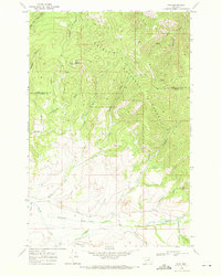
(30)- 1960 Map of Butte
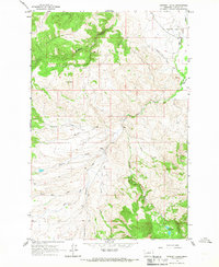
 1960 Butte1960 Print · USGSWestern Montana at the dawn of the sixties is defined by its industrial mining hubs and the railroads that connect them. Genealogists and historians can trace the routes of the Milwaukee Road through Butte or locate smaller settlements like Southern Cross and Bearmouth.
 - 1962 Map of Choteau
 1962 Choteau1962 Print · USGSThe Rocky Mountain Front meets the western plains in the early 1960s, showing a landscape defined by the Continental Divide. Genealogists and researchers can trace the tracks of the Great Northern and find settlements like Choteau, Augusta, and Bynum.
 - 1962 Map of Butte
 1962 Butte1962 Print · USGSWestern Montana in the early sixties remains a landscape of industrial muscle and high-mountain passes. Trace the rail lines of the Northern Pacific through Deer Lodge and the mining history around Anaconda and Philipsburg.
 - 1965 Map of Chimney Lakes, 1967 Print
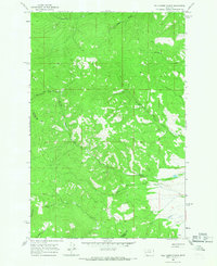
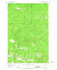
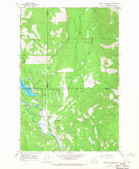
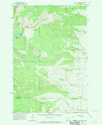
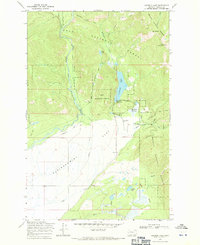
 1965 Chimney Lakes1967 Print · USGSPowell County ranchlands and mountain drainages come into focus in this mid-1960s survey of the Montana high country. Researchers can trace historic water rights and land use through the Number Five Ditch and family holdings like W W Ranch and Manley Ranch.
 - 1965 Map of Wild Horse Parks, 1967 Print
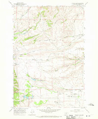
 1965 Wild Horse Parks1967 Print · USGSThe high Montana backcountry along the Granite and Powell county line is captured here during the mid-sixties. Researchers and collectors can trace the remote network of Wild Horse Parks and Jeep Trails connecting landmarks like Nelson Spring and a solitary mountain prospect.
 - 1965 Map of Chamberlain Mountain, 1967 Print
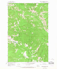
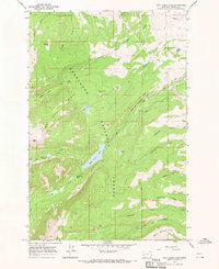
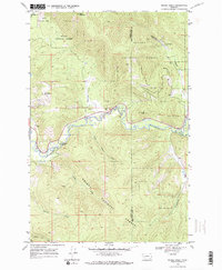
 1965 Chamberlain Mountain1967 Print · USGSPowell County's high Garnet Range peaks and timberlands are captured here in the mid-sixties. Researchers can trace the drainages of the Blackfoot River or locate remote landmarks like the Wales Creek Reservoir and the mining Prospect near Deer Gulch.
 - 1965 Map of Bata Mountain, 1967 Print
 1965 Bata Mountain1967 Print · USGSThe Missoula and Powell County line runs through this forested landscape in the mid-1960s. Researchers can locate remote markers like Chamberlain Meadows, the Mine near Elk Creek, and peaks such as Blacktail Mountain.2 unique versions available
 - 1965 Map of Elevation Mountain, 1967 Print
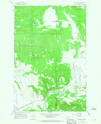
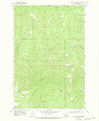
 1965 Elevation Mountain1967 Print · USGSGranite County at the height of the mid-1960s reveals the layout of historic mining camps deep in the mountains. Genealogists and historians can trace the footprint of early settlements like Garnet, Beartown, and Reynolds City in their original geographical context.4 unique versions available
 - 1965 Map of Browns Lake, 1967 Print
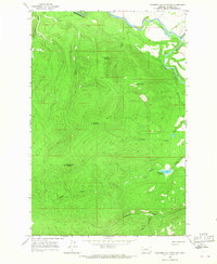
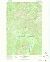
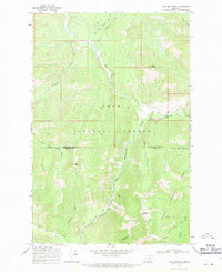
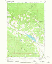
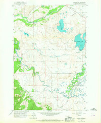 1965 Browns Lake1967 Print · USGSNevada Valley and the Blackfoot River basin are captured here in the mid-1960s, showing a land of glacial lakes and river bottomlands. Researchers can locate the small settlement of Kleinschmidt, the crossing at Raymond Bridge, and family-named landmarks like McElwain Creek.3 unique versions available
 - 1965 Map of Woodworth, 1968 Print
 1965 Woodworth1968 Print · USGSThe timberlands of the Blackfoot River valley are surveyed here in the mid-sixties at the junction of Missoula and Powell Counties. Trace the route of the Chicago Milwaukee St Paul and Pacific railroad past Clearwater and Park Sch.
 - 1965 Map of Morrell Mountain, 1968 Print
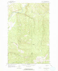
 1965 Morrell Mountain1968 Print · USGSPowell and Missoula counties were characterized by vast wilderness and primitive pack routes in the mid-sixties. Researchers can trace historical backcountry access via the Dunham Trail (Pack) and locate high-altitude landmarks like the Morrell Lookout and Youngs Pass.
 - 1965 Map of Seeley Lake East, 1968 Print
 1965 Seeley Lake East1968 Print · USGSThe community of Seeley Lake and the surrounding Missoula County forests are captured here in the mid-1960s. Genealogists and local historians can trace the town's early footprint near the Seeley Swan High Sch, Big Larch Campground, and the regional Seeley Lake Landing Strip.2 unique versions available
 - 1967 Map of Conleys Lake, 1970 Print
 1967 Conleys Lake1970 Print · USGSThe western outskirts of Deer Lodge in the late sixties reveal a landscape defined by institutional ranching and water management. Trace family history at Hillcrest Cemetery or locate landmarks like Roth Hall and State Prison Ranch No 1.2 unique versions available
 - 1967 Map of Rock Creek Lake, 1970 Print
 1967 Rock Creek Lake1970 Print · USGSHigh in the Montana mountains during the late 1960s, this survey captures the intersection of wilderness and early engineering. Trace historic water rights through the Old China Ditch and Pauly Ditch, or locate the Mine tucked near Pikes Peak.2 unique versions available
 - 1967 Map of Racetrack, 1970 Print
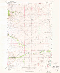 1967 Racetrack1970 Print · USGSThe Clark Fork valley at the height of the mid-century ranching era shows a landscape shaped by water engineering and heavy rail infrastructure. Genealogists and researchers can trace the operations of the Montana State Prison Ranch No 2, the path of the Chicago Milwaukee St Paul and Pacific railroad, and family landmarks like Perkins Ranch.
 - 1967 Map of Mount Powell, 1970 Print
 1967 Mount Powell1970 Print · USGSThe high peaks and alpine basins of the Deer Lodge National Forest are documented here in the late sixties. Trace old resource activity at the mines near Baldy or locate remote landmarks like the Guard Station and South America Park.2 unique versions available
 - 1968 Map of Spread Mountain, 1970 Print
 1968 Spread Mountain1970 Print · USGSThe high backcountry of the Continental Divide in the late sixties is mapped here through a network of primitive routes. Researchers can trace historic pack trails leading to Camp Pass, the high Lookout Tower, and remote water bodies like Lake Otatsy.3 unique versions available
 - 1968 Map of Dunham Point, 1970 Print
 1968 Dunham Point1970 Print · USGSPowell County's forest interior is captured here in the late sixties, highlighting the essential pack trails and fire lookouts of the era. Genealogists and historians can trace the Monture Creek Guard Station, the Center Ridge Lookout Tower, and old landmarks like Burnt Cabin.
 - 1968 Map of Olson Peak, 1971 Print
 1968 Olson Peak1971 Print · USGSThe Lewis and Clark County backcountry is captured in the late sixties, showing a wilderness of converging national forests and high ridges. Researchers can trace the historic Main Line Trail (Pack) past Olson Peak to remote water features like Twin Lakes and Meadow Lake.3 unique versions available
 - 1968 Map of Coopers Lake, 1971 Print
 1968 Coopers Lake1971 Print · USGSHigh Montana ranchlands and national forests meet in the late sixties along the North Fork Blackfoot River. Genealogists and historians can trace local landmarks like the Salmon Creek Sch and the legacy of White Tail Ranch.2 unique versions available
 - 1968 Map of Moose Creek, 1971 Print
 1968 Moose Creek1971 Print · USGSThe Helena National Forest on the Powell and Lewis and Clark County line appears here in the late sixties as a landscape of timber and mining. Genealogists and researchers can locate the Lincoln Gulch Cemetery and trace the legacy of the Blackfoot Mine and the Blackfoot River.2 unique versions available
 - 1968 Map of Nevada Mountain, 1971 Print
 1968 Nevada Mountain1971 Print · USGSHigh along the Continental Divide in the late sixties, this Montana landscape highlights the intersection of county borders and forest lands. Researchers can trace the Helmville Trail and locate remote operations like the Cyclone Mine or Mine sites.3 unique versions available
 - 1968 Map of Lake Mountain, 1971 Print
 1968 Lake Mountain1971 Print · USGSThe high divide of the Montana Rockies comes to life in the late 1960s at the junction of three national forests. Researchers can trace the old pack routes like the Main Line Trail to remote landmarks such as the North Fork Guard Sta and North Fork Falls.2 unique versions available
 - 1968 Map of Nevada Lake, 1971 Print
 1968 Nevada Lake1971 Print · USGSThe mountains of Powell County meet the waters of Nevada Lake in the late sixties, a landscape defined by timber, water management, and mining. Trace old extraction sites at Ogden Mountain or follow the waters of Douglas Creek and Braziel Lake.2 unique versions available
 - 1968 Map of Finn, 1971 Print
 1968 Finn1971 Print · USGSThe Powell County high country comes into focus in the late 1960s, showing a landscape defined by ranching and mountain extraction. Researchers can trace historic routes like the Gould Helmville Trail and locate the Wiggins Mine or the settlement at Finn.3 unique versions available
Showing maps 1-25 of 30
Top cities of Powell County
Frequently asked questions
- What are the different types of historical maps available for Powell County?
- What is the oldest map of Powell County?
- Where can I purchase historical maps of Powell County for my home or office?
- Where can I download high-res historical maps of Powell County?
- Are there historical topographic maps available for Powell County?
- Is there historical aerial imagery available for Powell County?
- Where are historical maps of Powell County sourced from?