1980s Maps of Powell County, Montana
Explore 24 historic maps of Powell County from the 1980s. These maps offer a rare glimpse into what life looked like during the 1980s — showing old roads, neighborhoods, homes, and landmarks that have changed or disappeared over time.
Whether you're researching your family's past, planning a metal detecting trip, or studying how Powell County's landscape evolved across the 1980s, these high-resolution maps are a powerful tool for exploring the history of this region.
- Focus on a specific era: All maps on this page are from the 1980s, giving you a focused view of this time period.
- See what’s changed: Compare century-old streets, trails, and buildings to today's modern landscape using overlays and satellite layers.
- Research with precision: Use these maps for genealogy, historical research, land use analysis, or educational projects.
- View, download, or print: Maps are fully viewable online in high resolution, and can be downloaded or printed for your own records.
Start exploring Powell County's history through authentic maps from the 1980s. This is your window into the past.
Powell County, MT maps
(24)- 1984 Map of Missoula East
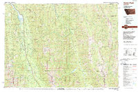
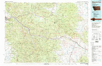 1984 Missoula East1984 Print · USGSThe Clark Fork valley and the Garnet Range are shown here in the mid-1980s as the region's timber and rail heritage remained prominent. Researchers can trace the Burlington Northern line and locate old mining sites like Garnet and the Copper Cliff Mine.
 - 1985 Map of Bison Mountain, 1986 Print
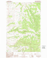
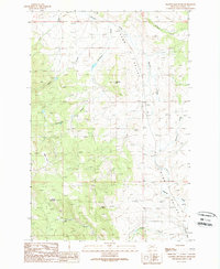
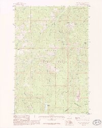 1985 Bison Mountain1986 Print · USGSThe high Montana ridges of the mid-1980s are captured here along the Continental Divide at the county line. Trace historic mineral prospects near Treasure Mountain and the primitive Pack Trail winding through Blackfoot Meadows.2 unique versions available
 - 1985 Map of Thunderbolt Creek, 1986 Print
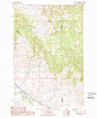
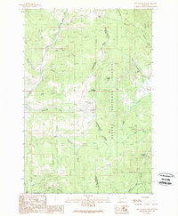
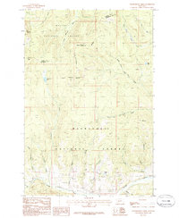 1985 Thunderbolt Creek1986 Print · USGSThe high peaks of the Rockies define this mid-1980s survey of the border between Powell and Jefferson Counties. Hikers and historians can trace the Continental Divide across Thunderbolt Mountain or locate early mining activity at various prospects near Finn Gulch.
 - 1985 Map of Three Brothers, 1986 Print
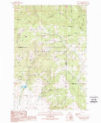
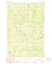 1985 Three Brothers1986 Print · USGSThe Continental Divide straddles the high Montana timberline during the 1980s, where three counties and two national forests meet. Genealogists and historians can locate specific old Mine Shafts and natural landmarks like Jericho Mountain and Scott Reservoir.2 unique versions available
 - 1988 Map of Swan Peak, 1989 Print
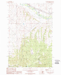
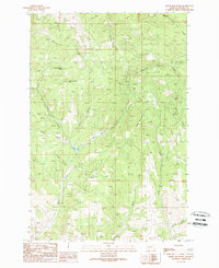
 1988 Swan Peak1989 Print · USGSSettlement in the Swan River Valley and the Bob Marshall Wilderness are captured in this late 1980s survey. Researchers can locate remote backcountry sites like the Spotted Bear Airport, the village of Condon, and the Swan Lake shoreline.
 - 1989 Map of Greenhorn Mountain
 1989 Greenhorn Mountain1989 Print · USGSThe mining camps and high mountain passes of the Continental Divide appear in clear detail during the late twentieth century. Genealogists and historians can trace old mining claims like the Empire Mine or locate the historic settlement of Marysville and the vital crossing at Mullan Pass.
 - 1989 Map of Sugarloaf Mountain
 1989 Sugarloaf Mountain1989 Print · USGSWestern Montana's high ridges are captured in the late eighties, showing the convergence of three counties along the Continental Divide. Researchers can trace old mining footprints at Schurchs Tunnel or explore the drainage basins of Orofino Creek and the Boulder River.
 - 1989 Map of Griffin Creek
 1989 Griffin Creek1989 Print · USGSThe Clark Fork valley and Deerlodge National Forest appear here in the late eighties, showing a landscape shaped by mining and utility expansion. Researchers can trace the Old Railroad Grade and locate mining remnants at Wall City and Pioneer Gulch.
 - 1989 Map of Baggs Creek
 1989 Baggs Creek1989 Print · USGSThe Montana forest boundary between the Helena and Deerlodge systems is captured here in the late twentieth century. Genealogists and historians can trace the remote geography of the regional mining economy through the Hidden Hand Mine and the waters of Baggs Creek.
 - 1989 Map of Dunkleberg Creek
 1989 Dunkleberg Creek1989 Print · USGSGranite and Powell Counties were centers of mountain industry in the 1980s, balancing timber management with high-altitude mining. Researchers can trace historical extraction at the Forest Rose Mine or follow the Old Railroad Grade past the settlement of Jens.
 - 1989 Map of Orofino Creek
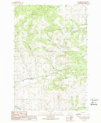
 1989 Orofino Creek1989 Print · USGSThe Clark Fork river valley and the northern edge of the Deerlodge National Forest are shown here in the late 1980s. Researchers can trace historic water rights and family-named landmarks like Reese Anderson Creek, O'Donnell Mountain, and the settlement at Racetrack.
 - 1989 Map of Limestone Ridge
 1989 Limestone Ridge1989 Print · USGSGranite and Powell counties come together along this mountainous divide in the late 1980s. Researchers can trace the Old Railroad Grade along the CLARK FORK and locate landmarks like Limestone Ridge and Sturgeon Mountain.
 - 1989 Map of Avon
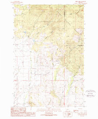
 1989 Avon1989 Print · USGSAvon and the Little Blackfoot River valley are captured in the late eighties as a hub of mountain ranching and infrastructure. Researchers can trace the local Cem and Gravel Pit near Avon, or explore the reaches of the Helena National Forest.
 - 1989 Map of Elliston
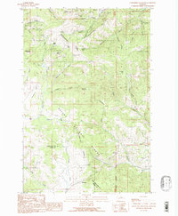
 1989 Elliston1989 Print · USGSElliston and the surrounding mountains of the Helena National Forest are documented here in the late eighties. Researchers can trace the local mining legacy at the Carbonate King Mine and locate landmarks like Camp Child and Lilly Lake.2 unique versions available
 - 1989 Map of Luke Mountain
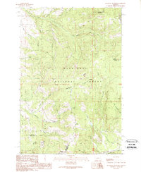
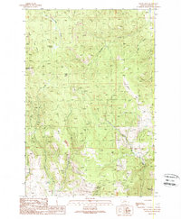
 1989 Luke Mountain1989 Print · USGSPowell County in the late eighties reveals a landscape shaped by mining and mountain hydrology. Genealogists and historians can trace the paths of Luke Mine and Rocky Ridge, or locate points of interest like Roadside Park and the Gaging Station along the rivers.
 - 1989 Map of Garrison
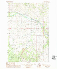
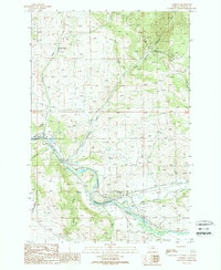 1989 Garrison1989 Print · USGSGarrison and the surrounding Powell County mountains are captured in the late 1980s at the confluence of two major rivers. Genealogists and industrial historians can trace the Old RR Grade, numerous adits, and infrastructure like the tunnels near Clark Fork.
 - 1989 Map of Drummond
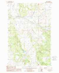
 1989 Drummond1989 Print · USGSThe Clark Fork valley in the late 1980s shows a landscape of mountain gulches and river-bottom agriculture. Researchers can trace historic transport routes like the Old Railroad Grade and locate settlements at Drummond and New Chicago.
 - 1989 Map of Ophir Creek
 1989 Ophir Creek1989 Print · USGSThe high country of the Continental Divide in the late 1980s is documented here, showing the intersection of Powell and Lewis and Clark counties. Researchers can trace historical mining sites like Victory Mine, the settlement at Blackfoot City, and isolated landmarks such as Lost Cabin.
 - 1989 Map of Windy Rock
 1989 Windy Rock1989 Print · USGSThe mountainous terrain of Powell County comes into focus in the 1980s, revealing a landscape shaped by mining and high-country ranching. Researchers can trace the legacy of resource extraction at the Anderson Mine and the Strip Mine or locate landmarks like Windy Rock.
 - 1989 Map of Deer Lodge
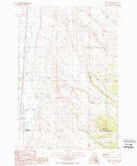
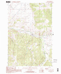
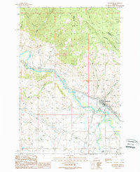
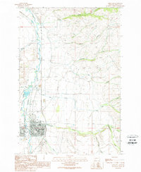 1989 Deer Lodge1989 Print · USGSThe Clark Fork valley in the late eighties comes into focus, showing the ranching landscape around the Grant-Kohrs Ranch. You can trace local civic life in Deer Lodge through the Courthouse and its many Museums.
 - 1989 Map of Gravely Mountain
 1989 Gravely Mountain1989 Print · USGSPowell County's mining and ranching interior is captured here in the late eighties, centered on the high terrain of Gravely Mountain. Local historians and researchers can trace the sites of the Gravely Mine and Gimlet Mine, alongside the winding watercourses of the Avon Valley.
 - 1989 Map of Mac Donald Pass
 1989 Mac Donald Pass1989 Print · USGSThe Continental Divide serves as the backbone for this late-1980s look at the high mountain passes between Powell and Lewis and Clark Counties. Researchers can trace historic mining activity at the Third Term Mine or locate the community at Frontier Town and Camp Thunderbird.2 unique versions available
 - 1989 Map of Esmeralda Hill
 1989 Esmeralda Hill1989 Print · USGSThe Continental Divide bisects this Montana landscape in the late eighties, marking the boundary between Lewis and Clark and Powell counties. Researchers can trace historic mining activity near Ophir Creek via prospects, a mine shaft, and landmarks like Esmeralda Hill.2 unique versions available
 - 1989 Map of Bailey Mountain
 1989 Bailey Mountain1989 Print · USGSHigh in the mountains of Powell County during the late eighties, this terrain showcases a landscape of deep canyons and named peaks. Researchers can trace the drainages of Hoover Creek and Cottonwood Creek, or locate landmarks like MacIver Lake and the Radio Facility on Little Baldy.
End of results
Showing maps 1-24 of 24
Top cities of Powell County
Frequently asked questions
- What are the different types of historical maps available for Powell County?
- What is the oldest map of Powell County?
- Where can I purchase historical maps of Powell County for my home or office?
- Where can I download high-res historical maps of Powell County?
- Are there historical topographic maps available for Powell County?
- Is there historical aerial imagery available for Powell County?
- Where are historical maps of Powell County sourced from?