1980s Maps of Wolf Point District, Montana
Explore 9 historic maps of Wolf Point District from the 1980s. These maps offer a rare glimpse into what life looked like during the 1980s — showing old roads, neighborhoods, homes, and landmarks that have changed or disappeared over time.
Whether you're researching your family's past, planning a metal detecting trip, or studying how Wolf Point District's landscape evolved across the 1980s, these high-resolution maps are a powerful tool for exploring the history of this region.
- Focus on a specific era: All maps on this page are from the 1980s, giving you a focused view of this time period.
- See what’s changed: Compare century-old streets, trails, and buildings to today's modern landscape using overlays and satellite layers.
- Research with precision: Use these maps for genealogy, historical research, land use analysis, or educational projects.
- View, download, or print: Maps are fully viewable online in high resolution, and can be downloaded or printed for your own records.
Start exploring Wolf Point District's history through authentic maps from the 1980s. This is your window into the past.
Wolf Point District, MT maps
(9)- 1983 Map of Todd Lakes NE
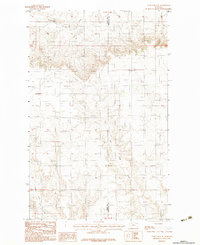 1983 Todd Lakes NE1983 Print · USGSThe high plains of the Fort Peck Indian Reservation are captured here in the early 1980s as the landscape remained defined by its drainages and boundary lines. Researchers can trace the path of Cottonwood Creek or locate a remote Airstrip situated between Valley and Roosevelt counties.
 - 1983 Map of Tule Valley East
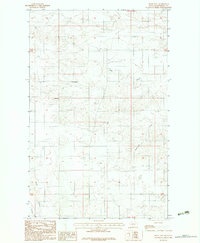
 1983 Tule Valley East1983 Print · USGSRoosevelt County's high plains are captured in the early eighties as the drainage of Tule Valley shapes the landscape. Genealogists and historians can trace the paths of North Fork Tule Creek and Chelsea Creek or locate an early Gravel Pit.
 - 1983 Map of Tule Valley West
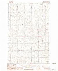
 1983 Tule Valley West1983 Print · USGSNortheastern Montana ranching country comes into focus in this early 1980s survey of Roosevelt County. Genealogists and local historians can locate family landmarks like the Cem and trace the winding paths of Tule Creek and the West Fork Tule Creek.
 - 1983 Map of Bears Nest
 1983 Bears Nest1983 Print · USGSRoosevelt County's high plains and winding coulees are captured in the early eighties as the land remained largely open range. Genealogists and historians can trace water sources and terrain landmarks like Bears Nest, Snell Spring, and Assiniboine Creek.2 unique versions available
 - 1983 Map of Reed Springs
 1983 Reed Springs1983 Print · USGSRoosevelt County's high plains are documented in the early eighties, showing the remote settlement patterns within the Fort Peck Indian Reservation. Researchers can trace the path of Boxelder Creek or locate landmarks like Reed Springs and Castle Rock.
 - 1983 Map of Volt
 1983 Volt1983 Print · USGSNortheastern Montana prairie life near the Fort Peck Indian Reservation is captured here in the early eighties. Researchers can locate the settlement of Volt and trace the winding Tule Creek past a local Cem and Grain Bin.
 - 1983 Map of Sims Spring
 1983 Sims Spring1983 Print · USGSRoosevelt County's high plains are captured here in the early eighties, showcasing the intersection of natural drainage and agricultural industry. Researchers can trace the courses of Boxelder Creek and Chelsea Creek or locate specific landmarks like the Landing Strip and Grain Bins.
 - 1983 Map of Todd Lakes SE
 1983 Todd Lakes SE1983 Print · USGSNortheastern Montana ranchlands and the Fort Peck Indian Reservation are captured in the early 1980s, highlighting the area's complex hydrological network. Genealogists and historians can trace the branching paths of Wolf Creek, Middle Fork, and the East Fork.
 - 1983 Map of Scobey, 1984 Print
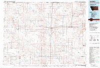 1983 Scobey1984 Print · USGSNorthern Montana prairie life during the early eighties centered on the grain-hauling rail lines and the winding Poplar River forks. Genealogists and historians can trace old homesteads near Whitetail, Peerless, and the Fort Peck Indian Reservation Boundary.
End of results
Showing maps 1-9 of 9
Top cities near Wolf Point District
Top neighborhoods of Wolf Point District
Frequently asked questions
- What are the different types of historical maps available for Wolf Point District?
- What is the oldest map of Wolf Point District?
- Where can I purchase historical maps of Wolf Point District for my home or office?
- Where can I download high-res historical maps of Wolf Point District?
- Are there historical topographic maps available for Wolf Point District?
- Is there historical aerial imagery available for Wolf Point District?
- Where are historical maps of Wolf Point District sourced from?