1970s Maps of Wolf Point District, Montana
Explore 16 historic maps of Wolf Point District from the 1970s. These maps offer a rare glimpse into what life looked like during the 1970s — showing old roads, neighborhoods, homes, and landmarks that have changed or disappeared over time.
Whether you're researching your family's past, planning a metal detecting trip, or studying how Wolf Point District's landscape evolved across the 1970s, these high-resolution maps are a powerful tool for exploring the history of this region.
- Focus on a specific era: All maps on this page are from the 1970s, giving you a focused view of this time period.
- See what’s changed: Compare century-old streets, trails, and buildings to today's modern landscape using overlays and satellite layers.
- Research with precision: Use these maps for genealogy, historical research, land use analysis, or educational projects.
- View, download, or print: Maps are fully viewable online in high resolution, and can be downloaded or printed for your own records.
Start exploring Wolf Point District's history through authentic maps from the 1970s. This is your window into the past.
Wolf Point District, MT maps
(16)- 1972 Map of Flynn Creek North, 1975 Print
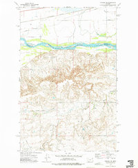
 1972 Flynn Creek North1975 Print · USGSThe Fort Peck Indian Reservation in the early 1970s was a landscape defined by the winding drainages of Wolf Creek and Flynn Creek. Researchers can trace the Valley and Roosevelt County boundary through Badger Hole and across the East Fork Flynn Creek.
 - 1972 Map of Chelsea SW, 1975 Print
 1972 Chelsea SW1975 Print · USGSMcCone and Roosevelt counties are shown here in the early 1970s as industrial pipelines and railroads began to cross the Missouri River breaks. Genealogists and researchers can trace the Fort Peck Indian Reservation Boundary and find local landmarks like Nickwall Dam and the Burlington Northern rail line.
 - 1972 Map of Wolf Point, 1975 Print
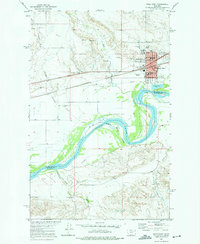 1972 Wolf Point1975 Print · USGSWolf Point thrives as a river and rail center during the early seventies, positioned along the banks of the Missouri River. Genealogists and historians can trace local institutions like Northside Sch, Greenwood Cem, and the Community Hall.
 - 1972 Map of Macon, 1975 Print
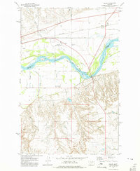 1972 Macon1975 Print · USGSThe Missouri River valley near the Fort Peck Indian Reservation is captured here in the early seventies as a hub of transport and grain. Trace the local community through landmarks like Macon, Courchene Cem, and the Frontier Sch.
 - 1972 Map of Chelsea NW, 1975 Print
 1972 Chelsea NW1975 Print · USGSNortheastern Montana lands within the Fort Peck Indian Reservation are captured here in the early seventies. Researchers can trace the rugged drainages of Tule Creek and Chelsea Creek as they converge near the Burlington Northern railroad and regional Pipeline.
 - 1972 Map of Flynn Creek South, 1975 Print
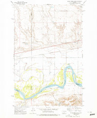 1972 Flynn Creek South1975 Print · USGSThe Missouri River valley at the Fort Peck Indian Reservation is shown here in the 1970s, as the river snakes between multiple county lines. Local researchers can locate the Oswego Ch, a local Cem, and the tracks of the Burlington Northern railroad.2 unique versions available
 - 1972 Map of Wolf Point NE, 1975 Print
 1972 Wolf Point NE1975 Print · USGSThe northern reaches of the Fort Peck Indian Reservation were documented in the early 1970s, showcasing a remote landscape of prairie coulees. Genealogists and researchers can trace drainage patterns along Little Wolf Creek and identify numerous isolated Well and Gravel Pit locations.
 - 1972 Map of Wolf Point NW, 1976 Print
 1972 Wolf Point NW1976 Print · USGSRoosevelt County's high plains on the Fort Peck Indian Reservation are captured here in the early 1970s. Researchers can trace the drainages of Wolf Creek and Tule Creek alongside vital water sources like Spring and West Fork No 2.
 - 1973 Map of Peerless 4 NE, 1976 Print
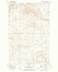
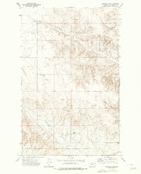 1973 Peerless 4 NE1976 Print · USGSDaniels County ranchlands and tribal borders are captured here in the early 1970s. Trace the Fort Peck Indian Reservation Boundary and the winding paths of Negro Coulee and Police Creek through the plains.2 unique versions available
 - 1973 Map of West Fork NE, 1976 Print
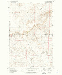
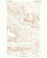 1973 West Fork NE1976 Print · USGSThe Fort Peck Indian Reservation boundary meets the winding waters of northeastern Montana in the early seventies. Researchers can trace the course of the West Fork Poplar River and find landmarks like Hell Creek and Shipstead Coulee.2 unique versions available
 - 1973 Map of Nielsen Coulee, 1976 Print
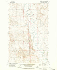
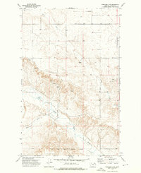
 1973 Nielsen Coulee1976 Print · USGSThe high plains along the Daniels and Roosevelt County line are captured here in the early 1970s. Researchers can trace water sources and drainage patterns along the Poplar River, Nielsen Coulee, and West Fork Poplar River.
 - 1973 Map of Cabarett Coulee, 1976 Print
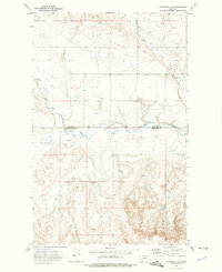
 1973 Cabarett Coulee1976 Print · USGSDaniels County in the early seventies is mapped here along the winding Poplar River and the FORT PECK INDIAN RESERVATION BOUNDARY. Genealogists and local historians can locate Fairview Cem, Silver Star Hall, and various named coulees.
 - 1973 Map of Peerless 4 SE, 1976 Print
 1973 Peerless 4 SE1976 Print · USGSThe high plains of the Fort Peck Indian Reservation are captured here in the early 1970s as the landscape was mapped along the Roosevelt County line. Researchers can trace the winding West Fork Poplar River or locate remote landmarks like the Drill Hole and Police Creek.2 unique versions available
 - 1973 Map of Peerless 4 SW, 1976 Print
 1973 Peerless 4 SW1976 Print · USGSAgricultural life in northeastern Montana takes center stage in the 1970s within the Fort Peck Indian Reservation. Researchers can trace the Daniels and Roosevelt County line while locating landmarks like grain Storage Bins and a Drill Hole.3 unique versions available
 - 1973 Map of Poplar Coulee, 1976 Print
 1973 Poplar Coulee1976 Print · USGSNortheast Montana ranching country is captured here in the early seventies, spanning a corner of the Fort Peck Indian Reservation. Trace the rugged drainage of Shipstead Coulee and locate specific water sources like Cottonwood Creek and various Springs.2 unique versions available
 - 1973 Map of Peerless 4 NW, 1978 Print
 1973 Peerless 4 NW1978 Print · USGSDaniels County in the 1970s reveals a sprawling landscape of ranching and reservation life. Trace the southern Fort Peck Indian Reservation Boundary as it crosses the West Fork Poplar River and Shipstead Coulee.3 unique versions available
End of results
Showing maps 1-16 of 16
Top cities near Wolf Point District
Top neighborhoods of Wolf Point District
Frequently asked questions
- What are the different types of historical maps available for Wolf Point District?
- What is the oldest map of Wolf Point District?
- Where can I purchase historical maps of Wolf Point District for my home or office?
- Where can I download high-res historical maps of Wolf Point District?
- Are there historical topographic maps available for Wolf Point District?
- Is there historical aerial imagery available for Wolf Point District?
- Where are historical maps of Wolf Point District sourced from?