1960s Maps of Antelope County, Nebraska
Explore 24 historic maps of Antelope County from the 1960s. These maps offer a rare glimpse into what life looked like during the 1960s — showing old roads, neighborhoods, homes, and landmarks that have changed or disappeared over time.
Whether you're researching your family's past, planning a metal detecting trip, or studying how Antelope County's landscape evolved across the 1960s, these high-resolution maps are a powerful tool for exploring the history of this region.
- Focus on a specific era: All maps on this page are from the 1960s, giving you a focused view of this time period.
- See what’s changed: Compare century-old streets, trails, and buildings to today's modern landscape using overlays and satellite layers.
- Research with precision: Use these maps for genealogy, historical research, land use analysis, or educational projects.
- View, download, or print: Maps are fully viewable online in high resolution, and can be downloaded or printed for your own records.
Start exploring Antelope County's history through authentic maps from the 1960s. This is your window into the past.
Antelope County, NE maps
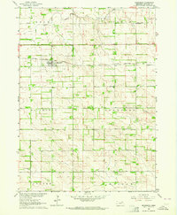
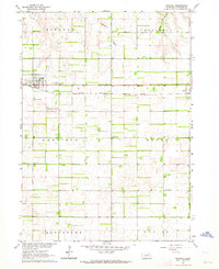
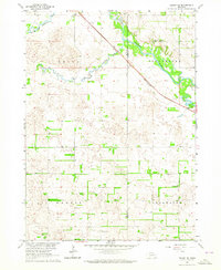
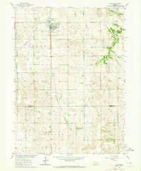
(24)- 1960 Map of Spalding 2 NE, 1962 Print
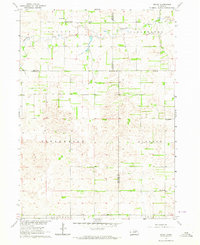
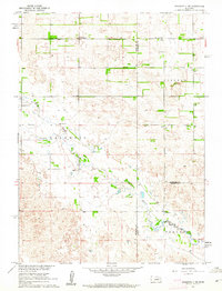 1960 Spalding 2 NE1962 Print · USGSThe rural borderlands of Wheeler and Antelope counties appear here as they were in the early 1960s, prior to widespread school consolidation. Genealogists can trace early landmarks like Park Ch and several district schools, such as Sunnyside Sch and School No 27.3 unique versions available
 - 1963 Map of Orchard NE, 1964 Print
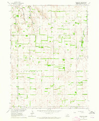
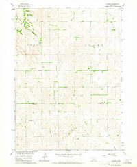
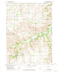
 1963 Orchard NE1964 Print · USGSThe rural border of Knox and Antelope counties is captured here in the early sixties, showing a landscape of townships and winding creek beds. Researchers can locate legacy schoolhouses like School No 77 and family landmarks such as Alcott Cem or Grove Lake.2 unique versions available
 - 1963 Map of Neligh, 1964 Print
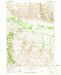
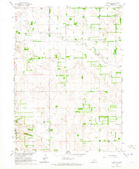
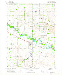
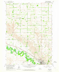 1963 Neligh1964 Print · USGSAntelope County life centered on the Elkhorn River valley during the early sixties, where the railroad and river dictated the layout of the land. Researchers can find numerous rural schoolhouses like Grecian Bend School and trace the original Chicago and North Western rail line.2 unique versions available
 - 1963 Map of Neligh SE, 1964 Print
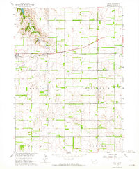
 1963 Neligh SE1964 Print · USGSAntelope County in the early sixties reveals a landscape of prairie townships and river valleys shaped by the rail economy. Genealogists and historians can locate rural landmarks like St Boniface Cem, Needmore Sch, and the Drive-in Theater near Neligh.2 unique versions available
 - 1963 Map of Deloit, 1964 Print
 1963 Deloit1964 Print · USGSAgricultural life in the early sixties centers on the rural township of Deloit. Researchers can trace the network of country schoolhouses like School No 60, find family landmarks at Knievels Corner, or locate the Wolf Cem.2 unique versions available
 - 1963 Map of Oakdale, 1964 Print
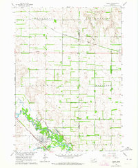
 1963 Oakdale1964 Print · USGSAntelope County in the early 1960s reveals a prairie landscape structured by the Elkhorn River and the railroad. Genealogists and local historians can locate rural schoolhouses like Flag Sch and the Oakdale Cem or trace the early course of Cedar Creek.
 - 1963 Map of Plainview, 1964 Print
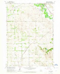
 1963 Plainview1964 Print · USGSPlainview stands at the busy crossing of two major railroads in the early 1960s, surrounded by a productive landscape of Nebraska prairie and creeks. Researchers can locate vanished rural landmarks like School No 48 or trace family roots at Pleasant Ridge Cem and Crawford Valley Ch.
 - 1963 Map of Venus, 1964 Print
 1963 Venus1964 Print · USGSNortheastern Nebraska ranchland is captured here in the early sixties at the meeting point of Holt, Knox, and Antelope counties. Genealogists can trace rural family life through features like Venus, Lambert Cem, and country schools like Cream Ridge Sch.2 unique versions available
 - 1963 Map of Brunswick, 1964 Print
 1963 Brunswick1964 Print · USGSAntelope County in the early 1960s was a landscape defined by the Chicago Burlington and Quincy rail line and scattered rural school districts. Genealogists can locate family landmarks such as Brunswick Cem, Sunny Side Sch, and Wayside Sch among the township grids.
 - 1963 Map of Neligh SW, 1964 Print
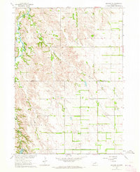
 1963 Neligh SW1964 Print · USGSAntelope County agriculture and local township organization are at the forefront of this mid-century survey. Researchers can locate specific sites like the Lutheran Cem, Midland Sch, and the Edwards Landing Strip.3 unique versions available
 - 1963 Map of Tilden NE, 1964 Print
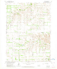
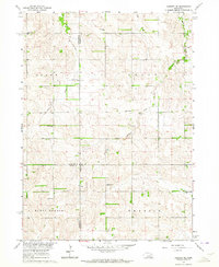
 1963 Tilden NE1964 Print · USGSThe Antelope and Pierce county line runs through this rural Nebraska landscape in the early sixties. Genealogists and local historians can locate several rural landmarks including Stark Valley Ch, Lake Valley Sch, and Rowell Lake.
 - 1963 Map of Royal, 1964 Print
 1963 Royal1964 Print · USGSThe village of Royal and its surrounding townships are shown here in the early sixties, anchored by the Chicago and North Western railroad. Genealogists can locate Royal Cem and several rural schoolhouses like Sunny Side Sch and Hollylodge Sch.3 unique versions available
 - 1963 Map of Orchard, 1964 Print
 1963 Orchard1964 Print · USGSAntelope County in the early 1960s shows a landscape defined by the straight rails of the Chicago Burlington and Quincy. Genealogists can locate family landmarks at Orchard Cem, Highland Sch, and the small settlement of Royal.2 unique versions available
 - 1963 Map of Ewing, 1964 Print
 1963 Ewing1964 Print · USGSEwing and the surrounding Nebraska townships thrive along the river forks during the early sixties. Genealogists and local historians can trace the paths of the Chicago and North Western railroad or locate landmarks like St Peter Cem and Emporia Sch.2 unique versions available
 - 1963 Map of Elgin NW, 1964 Print
 1963 Elgin NW1964 Print · USGSAntelope County agriculture and township boundaries are clearly defined in this mid-century Nebraska survey. Genealogists and local historians can trace property lines through Lincoln and Logan, or locate local hubs like Townhall and School No 91.3 unique versions available
 - 1963 Map of Closter, 1964 Print
 1963 Closter1964 Print · USGSAntelope and Boone Counties in the early sixties reveal a landscape of family farms and rural school districts. Genealogists and local historians can trace family-named landmarks like Star Church, Closter, and several historic schoolhouses including Star School.2 unique versions available
 - 1963 Map of Closter NE, 1964 Print
 1963 Closter NE1964 Print · USGSMadison and Antelope counties appear here in the early sixties as a landscape defined by traditional rural school districts and family farms. Researchers can trace historic locations like St Pauls Ch, Bunker Hill Sch, and Rolling Prairie Sch.2 unique versions available
 - 1963 Map of Deloit NE, 1964 Print
 1963 Deloit NE1964 Print · USGSThe rural prairie of Holt and Antelope counties is captured here in the early sixties, showing the rail-and-river landscape of north-central Nebraska. Genealogists and local historians can locate early landmarks like St Patricks Cem, Riverside Ch, and the Rosedale Sch.2 unique versions available
 - 1963 Map of Tilden NW, 1964 Print
 1963 Tilden NW1964 Print · USGSIn the early sixties, the rural divide between Antelope County townships was still punctuated by a network of local country schools. Trace the locations of historic schoolhouses like Willowdale Sch and School No 27 or find the banks of Black Lake.
 - 1963 Map of Clearwater, 1964 Print
 1963 Clearwater1964 Print · USGSClearwater and its surrounding ranchlands are captured here in the early 1960s, centered on the vital bend of the Elkhorn River. Researchers can trace old family sites near St Theresa Cem, School No 8, or the Chicago and North Western rail line.2 unique versions available
 - 1963 Map of Tilden, 1964 Print
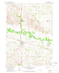 1963 Tilden1964 Print · USGSThe Elkhorn River valley in the early 1960s reveals a landscape of thriving rail towns and rural school districts. Genealogists can trace family roots at St Marys Cem or locate old schoolhouses like Valley View Sch and School No 18.
 - 1963 Map of Elgin, 1964 Print
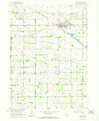
 1963 Elgin1964 Print · USGSElgin and the surrounding Antelope County plains are captured in the early sixties as a thriving railroad and farming community. Genealogists and researchers can trace the Chicago and North Western line as it connects Elgin to the southern settlement of Raeville.2 unique versions available
 - 1963 Map of Orchard NW, 1964 Print
 1963 Orchard NW1964 Print · USGSKnox and Antelope counties in the early sixties reveal a rural landscape of scattered schools and family cemeteries. Genealogists and historians can trace the locations of Enterprise Cem, the Pleasant Hill Sch, and the local Fish Hatchery.2 unique versions available
 - 1969 Map of O'Neill
 1969 O'Neill1969 Print · USGSCentral Nebraska in the mid-fifties is defined here by the expansive Sand Hills and the winding Niobrara River. Trace the Chicago and North Western rail line through cattle towns like O'Neill and Ainsworth.
End of results
Showing maps 1-24 of 24
Top cities of Antelope County
- Neligh historical maps
- Elgin historical maps
- Clearwater historical maps
- Orchard historical maps
- Oakdale historical maps
- Brunswick historical maps
See more
Frequently asked questions
- What are the different types of historical maps available for Antelope County?
- What is the oldest map of Antelope County?
- Where can I purchase historical maps of Antelope County for my home or office?
- Where can I download high-res historical maps of Antelope County?
- Are there historical topographic maps available for Antelope County?
- Is there historical aerial imagery available for Antelope County?
- Where are historical maps of Antelope County sourced from?