1980s Maps of Garden County, Nebraska
Explore 33 historic maps of Garden County from the 1980s. These maps offer a rare glimpse into what life looked like during the 1980s — showing old roads, neighborhoods, homes, and landmarks that have changed or disappeared over time.
Whether you're researching your family's past, planning a metal detecting trip, or studying how Garden County's landscape evolved across the 1980s, these high-resolution maps are a powerful tool for exploring the history of this region.
- Focus on a specific era: All maps on this page are from the 1980s, giving you a focused view of this time period.
- See what’s changed: Compare century-old streets, trails, and buildings to today's modern landscape using overlays and satellite layers.
- Research with precision: Use these maps for genealogy, historical research, land use analysis, or educational projects.
- View, download, or print: Maps are fully viewable online in high resolution, and can be downloaded or printed for your own records.
Start exploring Garden County's history through authentic maps from the 1980s. This is your window into the past.
Garden County, NE maps
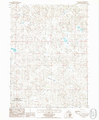
(33)- 1985 Map of Arthur
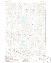
 1985 Arthur1985 Print · USGSThe Nebraska Sandhills in the mid-1980s reveal a landscape of remote cattle ranches and hidden basins between Arthur and Hyannis. Genealogists and historians can trace family-named landmarks and private airfields like the Pioneer Ranch Landing Strip and Haythorn Lake.2 unique versions available
 - 1985 Map of Ogallala
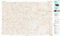
 1985 Ogallala1985 Print · USGSThe Platte River valleys in the mid-eighties show a landscape defined by massive water projects and the Union Pacific corridor. Trace the development of Lake Mc Conaughy and irrigation networks near Ogallala, Paxton, and Sutherland.2 unique versions available
 - 1985 Map of Alliance, 1986 Print
 1985 Alliance1986 Print · USGSThe High Plains of Box Butte and Sheridan counties come alive in the mid-1980s, centered on the rail hub of Alliance. Genealogists and historians can trace the Burlington Northern line through small sidings and towns like Antioch, Lakeside, and Bingham near the Niobrara River.2 unique versions available
 - 1985 Map of Chappell, 1986 Print
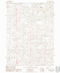
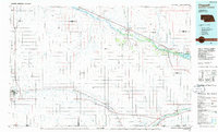 1985 Chappell1986 Print · USGSThe Nebraska panhandle comes into focus in the mid-1980s, where the historic Oregon Trail meets the modern Union Pacific rail lines. Trace family roots and land patterns in Sidney, Chappell, and near the Bluewater Battlefield Overlook Site.2 unique versions available
 - 1985 Map of Crescent Lake, 1986 Print
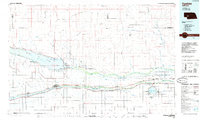
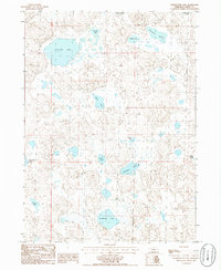
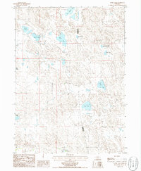
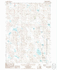
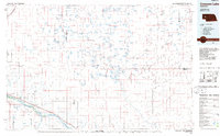 1985 Crescent Lake1986 Print · USGSThe Nebraska Sandhills come into sharp focus in the mid-1980s, centered on the wetlands of Garden County and the North Platte River valley. Researchers can trace the Union Pacific rail line through Broadwater and Lisco, or explore the many named basins within the Crescent Lake National Wildlife Refuge.2 unique versions available
 - 1986 Map of Gusher Spring
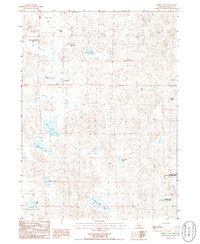
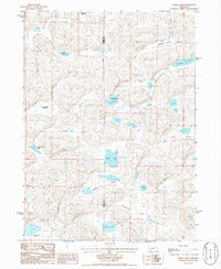
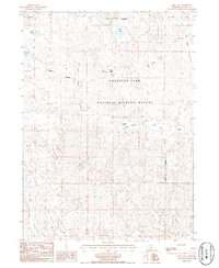
 1986 Gusher Spring1986 Print · USGSGarden County ranching country is captured in the mid-1980s, showing a landscape defined by its isolated water sources and rolling sandhills. Researchers can trace the path of Blue Creek and locate landmarks like Gusher Spring and Wildhorse Hill.
 - 1986 Map of Sugar Loaf Hill
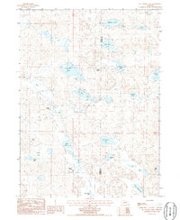
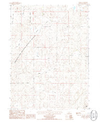
 1986 Sugar Loaf Hill1986 Print · USGSGarden County ranching country is captured here in the mid-1980s, showing the high-plains landscape before modern center-pivot irrigation transformed the terrain. Genealogists and historians can locate the isolated Cem and trace landmarks like Sugar Loaf Hill and Dogtown Flats.
 - 1986 Map of McCarty Lake
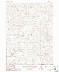
 1986 McCarty Lake1986 Print · USGSGarden County, Nebraska, is documented in the mid-1980s as a landscape of interconnected basins and family-named valleys. Researchers can trace landforms and water sources like Wild Horse Flats, McCarty Lake, and Scheffenburg Valley.
 - 1986 Map of Hessey Lake
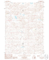
 1986 Hessey Lake1986 Print · USGSIn the mid-1980s, the Nebraska Sandhills remained a landscape of isolated ranching outposts and vital wetland basins. Trace family holdings at Young Ranch and Pawlet Ranch or explore the wetlands of the Crescent Lake National Wildlife Refuge.
 - 1986 Map of McCarthy Lake
 1986 McCarthy Lake1986 Print · USGSThe Nebraska Sandhills ranching country is captured here in the mid-1980s, showcasing a landscape defined by scattered family holdings and natural basins. Researchers can locate remote outposts like Thompson Ranch and Kooper Ranch among numerous water bodies such as McCarthy Lake and Blue Stem Lake.
 - 1986 Map of Bourquim Hill
 1986 Bourquim Hill1986 Print · USGSThe Nebraska Sandhills come into focus in the mid-1980s at the junction of Arthur, Garden, and Grant counties. Genealogists and historians can locate family ranching landmarks like the F Lane Ranch and isolated water points like Cocklebur Windmill.
 - 1986 Map of Curry Lake
 1986 Curry Lake1986 Print · USGSThe Nebraska Sandhills come alive in the mid-1980s, showing a land of named valleys and isolated cattle ranches. Researchers can locate specific legacy holdings like Open Box Arrow Ranch, Sutton N-Arrow Ranch, and the waters of Curry Lake.
 - 1986 Map of Schoonover Lake
 1986 Schoonover Lake1986 Print · USGSGarden County, Nebraska, is revealed in the mid-1980s as a high-plains landscape shaped by sand and water. Researchers can trace the boundaries of the Chisim Ranch or locate isolated water bodies like Schoonover Lake and Sandbeach Lake.
 - 1986 Map of Well Valley
 1986 Well Valley1986 Print · USGSGarden and Grant County ranching country is documented in the mid-1980s, showing a landscape of scattered homesteads and named valleys. Researchers can trace land holdings like the Sutton Buggy Pole Ranch and Hust Ranch within the Well Valley area.
 - 1986 Map of Alkali Lake
 1986 Alkali Lake1986 Print · USGSThe Nebraska Sandhills on the Garden and Grant County border were primarily a landscape of ranching and remote basins in the 1980s. Local researchers can trace family-named landmarks and essential water sources like R Kincaid Lakebed and Potter Lake.
 - 1986 Map of Rackett
 1986 Rackett1986 Print · USGSGarden County ranching country is captured here during the mid-1980s, showcasing the intersection of private cattle lands and protected wilderness. Local historians can trace the boundaries of Crescent Lake National Wildlife Refuge and locate remote outposts like Rackett and Jensen Ranch.
 - 1986 Map of Storm Lake
 1986 Storm Lake1986 Print · USGSThe Nebraska Sandhills in the mid-1980s reveal a landscape dominated by basin hydrology and sparse ranching infrastructure. Researchers can trace family-named landmarks and water sources like Moffit Lake, Storm Lake, and the southern reach of Tar Valley.
 - 1986 Map of Beck Lake
 1986 Beck Lake1986 Print · USGSThe Nebraska Sandhills in the mid-1980s reveal a landscape of ranching and remote lakes. Trace family history and land use through specific water bodies like Beck Lake, Hills Lake, and the local Mule Shoe Bar Ranch.
 - 1986 Map of Black Lake
 1986 Black Lake1986 Print · USGSGarden County ranching and the unique Sandhills landscape are captured in the mid-1980s. Local history researchers can trace cattle operations at Half-Circle Ranch and Black Ranch while exploring the network of basins like Black Lake and Wild Horse Lake.
 - 1986 Map of Velma SW
 1986 Velma SW1986 Print · USGSArthur and Garden counties are captured in the mid-1980s, showcasing the open ranching country of the Nebraska Sandhills. Researchers can trace land boundaries and find family landmarks like the White Ranch along the Arthur Co border.
 - 1986 Map of Young Valley
 1986 Young Valley1986 Print · USGSGarden County is captured in the mid-1980s, showcasing the intricate hydrology and dune-and-valley landscape of the Sandhills. Researchers can trace land patterns across family-named basins like Young Valley and isolated water bodies such as Britton Lake and Mc Carty Lake.
 - 1986 Map of Bean Lake
 1986 Bean Lake1986 Print · USGSGarden County's remote Sandhills are preserved here in the mid-1980s, showing a vast network of wetlands and ranch lands. Researchers can trace historic property boundaries around Eldred Ranch and the varied waters of the Crescent Lake National Wildlife Refuge, including Bean Lake and Alkali Lake.
 - 1986 Map of Deer Lake
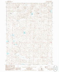
 1986 Deer Lake1986 Print · USGSGarden County's intricate wetland landscape is captured here in the mid-1980s within the Crescent Lake National Wildlife Refuge. Researchers can trace the unique topography of the Sandhills through features like Old Lady Beam Hill, Blue Creek, and Swede Lake.
 - 1986 Map of Crescent Lake
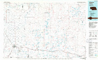
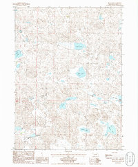
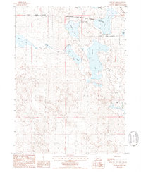 1986 Crescent Lake1986 Print · USGSGarden County's sandhills and wetlands are meticulously charted in the mid-1980s, centered on the Crescent Lake National Wildlife Refuge. Researchers can locate seasonal outposts like Eldred Camp and ranch sites such as Buske Ranch among the shores of Island Lake.
 - 1986 Map of Mumper
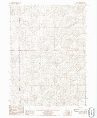
 1986 Mumper1986 Print · USGSGarden County ranchlands and protected wetlands are shown in great detail during the mid-eighties. Researchers can trace the layout of the Crescent Lake National Wildlife Refuge and locate remote sites like the Four D Ranch and Mumper.
Showing maps 1-25 of 33
Top cities of Garden County
Frequently asked questions
- What are the different types of historical maps available for Garden County?
- What is the oldest map of Garden County?
- Where can I purchase historical maps of Garden County for my home or office?
- Where can I download high-res historical maps of Garden County?
- Are there historical topographic maps available for Garden County?
- Is there historical aerial imagery available for Garden County?
- Where are historical maps of Garden County sourced from?