Old Maps of Keith County, Nebraska for Metal Detecting
Plan your next treasure hunt with 159 historic maps of Keith County. Find old homesites, ghost towns, trails, and gathering spots that may be lost to time — perfect for identifying promising metal detecting locations.
- Locate forgotten sites: Uncover places like long-lost settlements, abandoned rail lines, or gathering spots.
- Plan better hunts: Use map overlays combined with LiDAR or satellite views to narrow in on historically rich areas.
- Made for detectorists: Thousands of hobbyists use these maps to discover relics, coins, and hidden history.
Use these historic maps to boost your research and find new opportunities beneath the surface of Keith County.
Keith County, NE maps
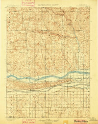
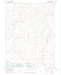
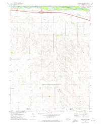
(159)- 1897 Map of Ogallala, 1957 Print
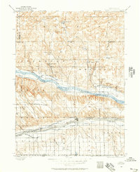 1897 Ogallala1957 Print · USGSWestern Nebraska at the end of the nineteenth century was a corridor of pioneer transit and emerging ranch life. Genealogists and historians can trace the Old California Trail, the Union Pacific rail line, and numerous family homesteads like Kingsley's Ranch.
 - 1898 Map of Paxton, 1960 Print
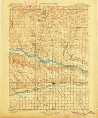
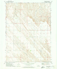
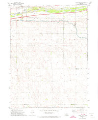
 1898 Paxton1960 Print · USGSWestern Nebraska at the end of the nineteenth century reveals a landscape defined by the convergence of the Platte rivers and the arrival of the railroad. Researchers can trace early ranching sites like Duck Brand Ranch and the vital canal network including the Paxton and Hershey Canal.
 - 1900 Map of Chappell
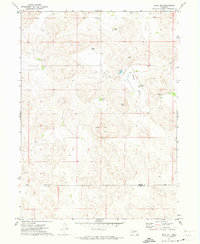
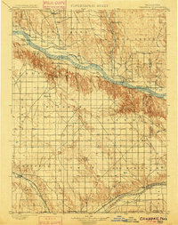 1900 Chappell1900 Print · USGSWestern Nebraska at the dawn of the new century is captured here as a landscape of early irrigation and historic pioneer trails. Trace the path of the Old California Trail past Ash Hollow or locate ranching outposts like Coombe's Ranch and Libbey's Ranch.3 unique versions available
 - 1900 Map of Ogallala
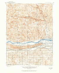
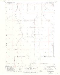
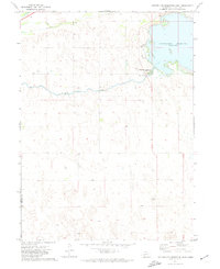
 1900 Ogallala1900 Print · USGSThe Platte River valley in the late 1890s shows the crucial intersection of the Union Pacific R. R. and the historic Old California Trail. Researchers can trace early irrigation canals and family-owned landmarks like Fairchild's Ranch and California Hill.6 unique versions available
 - 1901 Map of Paxton
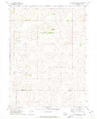
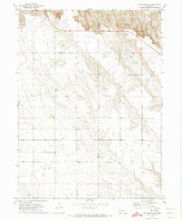
 1901 Paxton1901 Print · USGSThe confluence of the Platte Rivers in western Nebraska appears here at a pivotal moment for irrigation and rail expansion. Researchers can trace early water rights through the Sutherland Canal and locate historic livestock operations like Duck Brand Ranch and Knights Ranch.4 unique versions available
 - 1954 Map of Scottsbluff, 1958 Print
 1954 Scottsbluff1958 Print · USGSThe Nebraska Panhandle's iconic landmarks and rail corridors are captured here during the mid-1950s. Researchers can trace the path of the North Platte River past Chimney Rock or locate the sprawling Sioux Ordnance Depot and the historic streets of Sidney.3 unique versions available
 - 1954 Map of North Platte, 1968 Print
 1954 North Platte1968 Print · USGSThe Nebraska Sand Hills and the Platte River valley are captured here during a period of mid-century growth and agricultural expansion. Trace the vast irrigation network of the Sutherland Canal, locate old rural schoolhouses like Rose Hill School, and find family holdings such as Conrey Ranch.3 unique versions available
 - 1956 Map of North Platte
 1956 North Platte1956 Print · USGSThe Nebraska Sand Hills meet the high plains river valleys in the mid-1950s, a period of intensive water management and rail commerce. Genealogists and historians can trace early prairie settlements like Stapleton and Tryon, or follow the industrial corridor of the Union Pacific through North Platte.
 - 1957 Map of North Platte
 1957 North Platte1957 Print · USGSThe Nebraska Sand Hills and the Platte River valley are captured here in the mid-fifties as the ranching and irrigation economy matured. Genealogists and historians can locate family-named schoolhouses like Maire School or trace the railroad hubs at North Platte and the Fort McPherson National Cemetery.
 - 1958 Map of Scottsbluff
 1958 Scottsbluff1958 Print · USGSThe Nebraska panhandle in the late fifties was a vital corridor of rail-and-river transport defined by the North Platte River and the Union Pacific. Genealogists and historians can trace rail stops like Reddus Station, explore the grounds of the Sioux Ordnance Depot, or locate landmarks like Chimney Rock.2 unique versions available
 - 1961 Map of Big Springs, 1963 Print
 1961 Big Springs1963 Print · USGSSettlement and irrigation define the Nebraska-Colorado borderlands in the early sixties, centered on the South Platte River. Researchers can trace the Union Pacific rail corridor and find local landmarks like the Big Springs Cem and Cottonwood Corner Sch.2 unique versions available
 - 1961 Map of Brule, 1963 Print
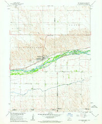
 1961 Brule1963 Print · USGSBrule and the surrounding Keith County plains are captured here in the early 1960s as a vital corridor for rail and irrigation. Genealogists and local historians can trace family-named sites like Megeath and School No 61 alongside the winding South Platte River.
 - 1961 Map of Brule SE, 1963 Print
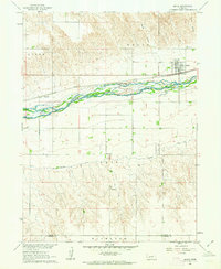
 1961 Brule SE1963 Print · USGSIn the early 1960s, the Nebraska plains near the South Platte River remained a landscape of rural schoolhouses and rail-side industry. Genealogists and researchers can trace the locations of School No 9, Searle Airport, and the Union Pacific line.2 unique versions available
 - 1967 Map of North Platte
 1967 North Platte1967 Print · USGSThe Nebraska Sand Hills and the Platte River valley meet in the 1960s, showing a landscape shaped by water management and rail. Genealogists can trace rural school districts like the Prairie Dell School or find landmarks like the Scott Lookout Tower and Geo P Kingsley Dam.
 - 1971 Map of Martin
 1971 Martin1971 Print · USGSKeith County ranching and recreation intersect in the early 1970s along the northern shores of the reservoir. Genealogists and local historians can trace legacy cattle operations like Broken Axle Ranch and the community layout of Martin near the Union Pacific line.
 - 1971 Map of Brule NW, 1973 Print
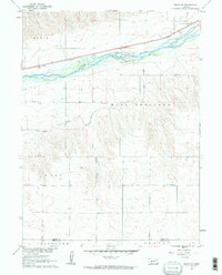
 1971 Brule NW1973 Print · USGSHigh plains ranching and deep canyon systems dominate this Keith County landscape in the early seventies. Genealogists and local historians can locate School No 46 and trace the winding paths of Brule Canyon and Chase Canyon.
 - 1971 Map of Ogallala SW, 1973 Print
 1971 Ogallala SW1973 Print · USGSSouthern Keith County and northern Perkins County are captured here in the early seventies as the High Plains landscape balanced agriculture and new infrastructure. Researchers can locate vanished rural landmarks such as School No 21, the Cornelius Landing Strip, and the winding Happy Hollow.
 - 1971 Map of Belmar, 1973 Print
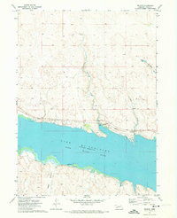 1971 Belmar1973 Print · USGSThe northern shores of Lake McConaughy and the community of Belmar are shown in the early seventies during the height of the reservoir's development. Researchers can trace the Union Pacific rail corridor and find early recreation sites like the Boat Ramp and Campground.
 - 1971 Map of Ogallala SE, 1973 Print
 1971 Ogallala SE1973 Print · USGSKeith County and the South Platte River corridor are captured in the early 1970s during a period of modern transit expansion. Researchers can locate rural landmarks such as St Johns Ch, School No 7, and the Union Pacific rail line along the river.
 - 1971 Map of Bear Hill, 1973 Print
 1971 Bear Hill1973 Print · USGSThe Nebraska Sandhills on the border of Arthur and Keith counties are captured here in the early 1970s. Researchers can locate remote family operations like McKeag Ranch and Enfield Ranch or trace the geography of Indian Valley.
 - 1971 Map of Packard Ranch, 1973 Print
 1971 Packard Ranch1973 Print · USGSThe Nebraska Sandhills in the early seventies reveal a landscape defined by generational cattle operations and high-plains isolation. Researchers can trace family land at the Packard Ranch, Larsen Ranch, and School No 4 tucked into Thoelecke Valley.2 unique versions available
 - 1971 Map of Spotted Horse Valley, 1973 Print
 1971 Spotted Horse Valley1973 Print · USGSThe ranching country of the Nebraska Sandhills is captured here in the early seventies at the Arthur and Keith county line. Genealogists and local historians can trace family operations like the Vasa Ranch, Williams Ranch, and the site of School No 55.
 - 1971 Map of Sutherland Reservoir West, 1974 Print
 1971 Sutherland Reservoir West1974 Print · USGSWestern Nebraska's hydrological engineering is on display in the early seventies as the waters of Sutherland Reservoir meet the plains. Researchers can trace infrastructure from the Sutherland Canal to the Sutherland Reservoir State Park.
 - 1971 Map of Big Springs NE, 1974 Print
 1971 Big Springs NE1974 Print · USGSThe Nebraska panhandle in the early seventies remains a landscape of open range and historic transit routes. You can trace the path of the Oregon Trail as it winds through the bluffs near Day Road and find the locations of scattered wells.
 - 1971 Map of Paxton South, 1974 Print
 1971 Paxton South1974 Print · USGSThe South Platte River corridor near Paxton is shown in the early seventies as a hub of Nebraska rail and water infrastructure. Researchers can trace the path of the Union Pacific and find local landmarks like School No 16 and the Paxton Cem.
Showing maps 1-25 of 159
Top cities of Keith County
Frequently asked questions
- What are the different types of historical maps available for Keith County?
- What is the oldest map of Keith County?
- Where can I purchase historical maps of Keith County for my home or office?
- Where can I download high-res historical maps of Keith County?
- Are there historical topographic maps available for Keith County?
- Is there historical aerial imagery available for Keith County?
- Where are historical maps of Keith County sourced from?