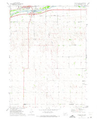
1971 Map of Ogallala SW
USGS Topo · Published 1973About this map
The South Platte River and its braided channels dominate the northern portion of this landscape, just south of the main Ogallala settlement. This early 1970s survey documents a transitional zone where the irrigation and transport infrastructure of the river valley meets the upland ranching country. The Union Pacific railroad and local fairground signal a hub of regional activity, while the presence of scattered rural education sites like School No 21 and School No 22 highlights the historical distribution of school districts across the High Plains.
Find a feature on this map
18 named features on this map. Tap any name to fly to it.
Don’t see what you’re looking for? This feature index may not catch every label — zoom into the map to look around manually.
Map Details
Editions of this 1971 Ogallala SW Map
This is the sole edition of this map. No revisions or reprints were ever made.
Other maps of this area

1897 · Ogallala
USGS Topo · 1:125,000

1900 · Ogallala
USGS Topo · 1:125,000

1954 · McCook
USGS Topo · 1:250,000

1954 · North Platte
USGS Topo · 1:250,000

1956 · North Platte
USGS Topo · 1:250,000

1957 · North Platte
USGS Topo · 1:250,000

1957 · McCook
USGS Topo · 1:250,000

1958 · McCook
USGS Topo · 1:250,000

1961 · Brandon NE
USGS Topo · 1:24,000
1961 · Brule SE
USGS Topo · 1:24,000