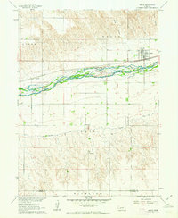
1961 Map of Brule
USGS Topo · Published 1963About this map
Brule is the primary hub of this landscape, situated at the junction of the Union Pacific railroad and U.S. Route 30. The town’s relationship with the water is evident in the complex braiding of the South Platte River and the engineered irrigation system represented by the Western Canal, which skirts the base of the Vail Highland. To the north, the terrain is cut by drainage features like Brule Canyon and Chase Canyon, while the local economy is reflected in a Sandpit and Gravel Pit near the tracks.
Find a feature on this map
15 named features on this map. Tap any name to fly to it.
Don’t see what you’re looking for? This feature index may not catch every label — zoom into the map to look around manually.
Map Details
Editions of this 1961 Brule Map
This is the sole edition of this map. No revisions or reprints were ever made.
Other maps of this area

1897 · Ogallala
USGS Topo · 1:125,000

1900 · Chappell
USGS Topo · 1:125,000

1900 · Ogallala
USGS Topo · 1:125,000

1954 · Sterling
USGS Topo · 1:250,000

1954 · Scottsbluff
USGS Topo · 1:250,000

1954 · McCook
USGS Topo · 1:250,000

1954 · North Platte
USGS Topo · 1:250,000

1956 · North Platte
USGS Topo · 1:250,000

1957 · North Platte
USGS Topo · 1:250,000

1957 · McCook
USGS Topo · 1:250,000