1970s Maps of Keith County, Nebraska
Explore 26 historic maps of Keith County from the 1970s. These maps offer a rare glimpse into what life looked like during the 1970s — showing old roads, neighborhoods, homes, and landmarks that have changed or disappeared over time.
Whether you're researching your family's past, planning a metal detecting trip, or studying how Keith County's landscape evolved across the 1970s, these high-resolution maps are a powerful tool for exploring the history of this region.
- Focus on a specific era: All maps on this page are from the 1970s, giving you a focused view of this time period.
- See what’s changed: Compare century-old streets, trails, and buildings to today's modern landscape using overlays and satellite layers.
- Research with precision: Use these maps for genealogy, historical research, land use analysis, or educational projects.
- View, download, or print: Maps are fully viewable online in high resolution, and can be downloaded or printed for your own records.
Start exploring Keith County's history through authentic maps from the 1970s. This is your window into the past.
Keith County, NE maps
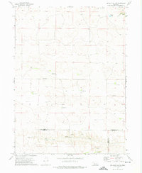
(26)- 1971 Map of Martin
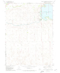
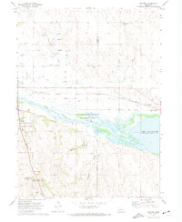
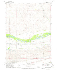
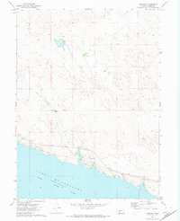
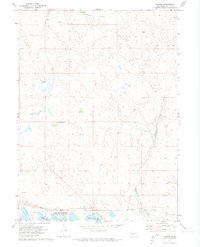 1971 Martin1971 Print · USGSKeith County ranching and recreation intersect in the early 1970s along the northern shores of the reservoir. Genealogists and local historians can trace legacy cattle operations like Broken Axle Ranch and the community layout of Martin near the Union Pacific line.
 - 1971 Map of Brule NW, 1973 Print
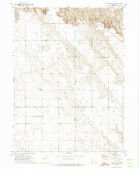
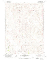
 1971 Brule NW1973 Print · USGSHigh plains ranching and deep canyon systems dominate this Keith County landscape in the early seventies. Genealogists and local historians can locate School No 46 and trace the winding paths of Brule Canyon and Chase Canyon.
 - 1971 Map of Ogallala SW, 1973 Print
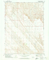
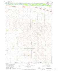
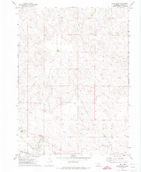
 1971 Ogallala SW1973 Print · USGSSouthern Keith County and northern Perkins County are captured here in the early seventies as the High Plains landscape balanced agriculture and new infrastructure. Researchers can locate vanished rural landmarks such as School No 21, the Cornelius Landing Strip, and the winding Happy Hollow.
 - 1971 Map of Belmar, 1973 Print
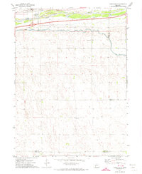
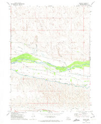
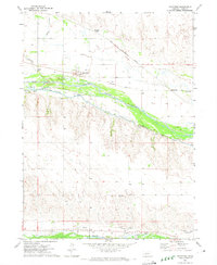
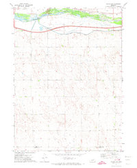
 1971 Belmar1973 Print · USGSThe northern shores of Lake McConaughy and the community of Belmar are shown in the early seventies during the height of the reservoir's development. Researchers can trace the Union Pacific rail corridor and find early recreation sites like the Boat Ramp and Campground.
 - 1971 Map of Ogallala SE, 1973 Print
 1971 Ogallala SE1973 Print · USGSKeith County and the South Platte River corridor are captured in the early 1970s during a period of modern transit expansion. Researchers can locate rural landmarks such as St Johns Ch, School No 7, and the Union Pacific rail line along the river.
 - 1971 Map of Bear Hill, 1973 Print
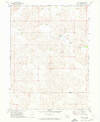 1971 Bear Hill1973 Print · USGSThe Nebraska Sandhills on the border of Arthur and Keith counties are captured here in the early 1970s. Researchers can locate remote family operations like McKeag Ranch and Enfield Ranch or trace the geography of Indian Valley.
 - 1971 Map of Packard Ranch, 1973 Print
 1971 Packard Ranch1973 Print · USGSThe Nebraska Sandhills in the early seventies reveal a landscape defined by generational cattle operations and high-plains isolation. Researchers can trace family land at the Packard Ranch, Larsen Ranch, and School No 4 tucked into Thoelecke Valley.2 unique versions available
 - 1971 Map of Spotted Horse Valley, 1973 Print
 1971 Spotted Horse Valley1973 Print · USGSThe ranching country of the Nebraska Sandhills is captured here in the early seventies at the Arthur and Keith county line. Genealogists and local historians can trace family operations like the Vasa Ranch, Williams Ranch, and the site of School No 55.
 - 1971 Map of Sutherland Reservoir West, 1974 Print
 1971 Sutherland Reservoir West1974 Print · USGSWestern Nebraska's hydrological engineering is on display in the early seventies as the waters of Sutherland Reservoir meet the plains. Researchers can trace infrastructure from the Sutherland Canal to the Sutherland Reservoir State Park.
 - 1971 Map of Big Springs NE, 1974 Print
 1971 Big Springs NE1974 Print · USGSThe Nebraska panhandle in the early seventies remains a landscape of open range and historic transit routes. You can trace the path of the Oregon Trail as it winds through the bluffs near Day Road and find the locations of scattered wells.
 - 1971 Map of Paxton South, 1974 Print
 1971 Paxton South1974 Print · USGSThe South Platte River corridor near Paxton is shown in the early seventies as a hub of Nebraska rail and water infrastructure. Researchers can trace the path of the Union Pacific and find local landmarks like School No 16 and the Paxton Cem.
 - 1971 Map of Glinn Ranch, 1974 Print
 1971 Glinn Ranch1974 Print · USGSKeith County ranching country is captured here in the early 1970s as it appeared just after the post-war expansion of the High Plains cattle industry. Researchers can locate remote homesteads like Glinn Ranch and trace the path of the Union Pacific railroad near Spring Creek.
 - 1971 Map of Ruthton, 1974 Print
 1971 Ruthton1974 Print · USGSThe Oregon Trail and the Union Pacific Railroad meet at the North Platte River valley in the early 1970s. Trace pioneer history at Windlass Hill, explore the western edge of Lake McConaughy, and locate rural landmarks like School No 27 and Ash Hollow Cem.
 - 1971 Map of Old Baldy, 1974 Print
 1971 Old Baldy1974 Print · USGSThe Nebraska sandhills of the early seventies come to life on this survey of the Garden and Keith county line. Genealogists and researchers can locate Fairview Cem or trace the drainage of Ash Creek and the Spring near the southern border.
 - 1971 Map of Nevens, 1974 Print
 1971 Nevens1974 Print · USGSThe North Platte River valley in Keith County is seen here in the early 1970s, defined by its complex network of irrigation and rail infrastructure. Researchers can trace the path of the Union Pacific through Nevens or locate the Buckhorn Springs Ranch.
 - 1971 Map of Ogallala, 1974 Print
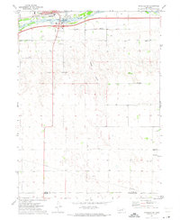
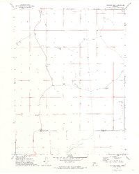
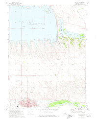 1971 Ogallala1974 Print · USGSOgallala and the neighboring river valleys are shown in detail during the early seventies. Genealogists and historians can trace the town's footprint, from the legendary Boot Hill Cem to the local High Sch and the Union Pacific rail lines.
 - 1971 Map of Paxton North, 1974 Print
 1971 Paxton North1974 Print · USGSKeith County and the Nebraska Sandhills are captured here in the early 1970s as the river and railroad defined local life. Trace the industrial landscape from the Diversion Dam to the small communities of Paxton and Sarben along the Union Pacific tracks.
 - 1971 Map of Keystone, 1974 Print
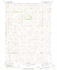
 1971 Keystone1974 Print · USGSKeith County ranching and irrigation systems are captured in the early seventies, showing the vital waterways that sustain the plains. Researchers can locate family landmarks like McGinley Ranch, School No 34, and the settlement of Keystone.
 - 1971 Map of Paxton SW, 1974 Print
 1971 Paxton SW1974 Print · USGSThe South Platte River valley in the early seventies shows a landscape defined by water engineering and rail transport. Genealogists and local historians can locate rural landmarks like School No 8 and the engineering of the Korty Diversion Dam.
 - 1971 Map of Brule NE, 1974 Print
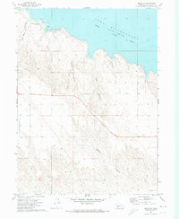 1971 Brule NE1974 Print · USGSThe northern shore of Keith County was a hub for recreation in the early seventies following the damming of the river. Researchers can trace the drainage patterns of Ash Camp Canyon and Kelly Canyon or locate the Trailer Park and Lake McConaughy Landing Strip.
 - 1971 Map of Lemoyne, 1974 Print
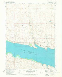
 1971 Lemoyne1974 Print · USGSCoastal Keith County during the early 1970s shows a landscape shaped by the rising waters and the railroad. Genealogists and historians can trace ranching lineages through Berry Ranch and Baumann Ranch or explore the shoreline of Lake Mc Conaughy and the village of Lemoyne.
 - 1971 Map of Williams Ranch, 1974 Print
 1971 Williams Ranch1974 Print · USGSCattle ranching in the Nebraska Sandhills is documented in the early 1970s at the junction of three counties. Genealogists and researchers can trace local land use through family-named sites like Williams Ranch and Orr Ranch alongside numerous remote water Well locations.
 - 1972 Map of Big Bald Hill SE, 1975 Print
 1972 Big Bald Hill SE1975 Print · USGSThe Nebraska sandhills of the early seventies are documented here at the boundary of two counties. Researchers can locate the isolated Glen Echo Ch and several early Well sites scattered across the ranchlands of Keith Co and Lincoln Co.
 - 1972 Map of Big Bald Hill, 1975 Print
 1972 Big Bald Hill1975 Print · USGSThe Nebraska Sandhills during the early seventies are captured here in fine detail, showing a landscape of dunes and isolated cattle operations. Genealogists and local historians can trace the footprints of the Barnt Ranch and Rudd Ranch or locate the prominent Big Bald Hill.
 - 1972 Map of Big Bald Hill NE, 1975 Print
 1972 Big Bald Hill NE1975 Print · USGSThe high plains of Nebraska in the early seventies reveal a landscape of family-run operations where McPherson, Keith, and Lincoln counties converge. Genealogists can trace the footprint of the Moriarty Ranch, Valley Rang Sch, and the Valley View Cem.
Showing maps 1-25 of 26
Top cities of Keith County
Frequently asked questions
- What are the different types of historical maps available for Keith County?
- What is the oldest map of Keith County?
- Where can I purchase historical maps of Keith County for my home or office?
- Where can I download high-res historical maps of Keith County?
- Are there historical topographic maps available for Keith County?
- Is there historical aerial imagery available for Keith County?
- Where are historical maps of Keith County sourced from?