Old Maps of Kimball County, Nebraska for Genealogy
Trace your family roots with 141 historic maps of Kimball County. These high-res maps reveal old neighborhoods, homesites, landmarks, and streets — helping you uncover where your ancestors lived and how the area evolved over time.
- Explore historic neighborhoods: Identify where your relatives may have lived in the 1800s or 1900s.
- Compare maps over time: Trace the changes in streets, buildings, and landmarks for multi-generational research.
- Perfect for genealogy & ancestry research: Used by family historians and researchers to map out lineage and migration.
These maps are an incredible resource for exploring your personal connection to Kimball County's past.
Kimball County, NE maps
(141)- 1954 Map of Scottsbluff, 1958 Print
 1954 Scottsbluff1958 Print · USGSThe Nebraska Panhandle's iconic landmarks and rail corridors are captured here during the mid-1950s. Researchers can trace the path of the North Platte River past Chimney Rock or locate the sprawling Sioux Ordnance Depot and the historic streets of Sidney.3 unique versions available
 - 1954 Map of Cheyenne, 1963 Print
 1954 Cheyenne1963 Print · USGSSoutheastern Wyoming's high plains and the capital city's mid-century expansion are documented here during the early Cold War. Genealogists and historians can trace rail-aligned settlements like Pine Bluffs and Hillsdale, or explore landmarks like the Ames Monument and Francis E. Warren Air Force Base.3 unique versions available
 - 1958 Map of Cheyenne
 1958 Cheyenne1958 Print · USGSSoutheast Wyoming and the Nebraska border appear in the late 1950s as a hub of military defense and rail commerce. Genealogists can trace the Union Pacific through Cheyenne or locate the Horse Creek Oil Field and the State Capitol.2 unique versions available
 - 1958 Map of Scottsbluff
 1958 Scottsbluff1958 Print · USGSThe Nebraska panhandle in the late fifties was a vital corridor of rail-and-river transport defined by the North Platte River and the Union Pacific. Genealogists and historians can trace rail stops like Reddus Station, explore the grounds of the Sioux Ordnance Depot, or locate landmarks like Chimney Rock.2 unique versions available
 - 1963 Map of Pine Bluffs, 1967 Print
 1963 Pine Bluffs1967 Print · USGSThe Wyoming-Nebraska borderlands in the early sixties reveal a landscape defined by the Union Pacific railroad and the town of Pine Bluffs. Local historians can trace the community's mid-century layout, including the Rodeo Ground, High Sch, and the Wisvoth Reservoir.3 unique versions available
 - 1963 Map of Lindbergh, 1967 Print
 1963 Lindbergh1967 Print · USGSThe High Plains of the Wyoming-Nebraska border are shown here in the 1960s, centered on the Union Pacific rail corridor. Researchers can trace local history through the Lindbergh Cem and the small settlements of Lindbergh and Russell.
 - 1963 Map of Pine Bluffs SE, 1967 Print
 1963 Pine Bluffs SE1967 Print · USGSThe High Plains borderlands of Wyoming, Nebraska, and Colorado come into focus in the early sixties, showing a landscape shaped by ranching and resource transport. Researchers can trace the sharp escarpment of Pine Bluffs and locate isolated landmarks like a Shed or the long path of the southern Pipeline.3 unique versions available
 - 1968 Map of Pine Bluffs, 1978 Print
 1968 Pine Bluffs1978 Print · USGSSouthern Wyoming's high desert reveals its dramatic geology during the late 1960s and 1970s. Researchers can trace resource exploration and water sources across the Kinney Rim, locating isolated sites like Jackknife Spring and Sand Butte Spring.
 - 1972 Map of Bushnell SW, 1974 Print
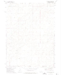 1972 Bushnell SW1974 Print · USGSThe High Plains energy landscape of the early 1970s is captured here at the intersection of the Nebraska and Colorado borders. Local researchers can trace the footprint of the Oil Field and locate industrial landmarks like the Pipeline and various Oil Well sites.
 - 1972 Map of Potter SW, 1975 Print
 1972 Potter SW1975 Print · USGSThe Nebraska and Colorado borderlands meet in this early 1970s survey, capturing a landscape defined by ranching terrain and energy development. Researchers can trace industrial growth through an extensive Oil Field, numerous Oil Wells, and the path of Sidney Draw.
 - 1972 Map of Dix, 1975 Print
 1972 Dix1975 Print · USGSThe Nebraska panhandle in the early seventies reveals a landscape shaped by the rail-and-oil economy near Dix. Researchers can trace the Union Pacific corridor through Jacinto or locate the Dix Cem and the Bar J Lazy V Airport.
 - 1972 Map of Owasco, 1975 Print
 1972 Owasco1975 Print · USGSKimball County's high plains are captured here in the early seventies, showing a landscape shaped by energy production and the railroad. Researchers can trace the UNION PACIFIC line through Owasco and locate specific sites like the Four Winds Country Club or the local OIL FIELD.
 - 1972 Map of Kimball SE, 1975 Print
 1972 Kimball SE1975 Print · USGSThe Nebraska and Colorado borderlands are captured in the early 1970s, showing a landscape defined by energy production and high-plains topography. Trace the local impact of the Oil and Gas Field along Sidney Draw and locate scattered oil wells.
 - 1972 Map of Kimball SW, 1975 Print
 1972 Kimball SW1975 Print · USGSThe high plains along the Nebraska-Colorado border are captured in the early 1970s, showcasing an active energy and ranching landscape. Trace the development of the Oil Field and extensive pipelines that cross the terrain near Sidney Draw.
 - 1972 Map of Bushnell, 1975 Print
 1972 Bushnell1975 Print · USGSWestern Nebraska's high plains are captured here in the early seventies as the local economy balanced rail transit and energy production. Genealogists and researchers can trace the footprint of Bushnell, the siding at Malm, and numerous Oil Wells along the Union Pacific line.
 - 1972 Map of Kimball, 1975 Print
 1972 Kimball1975 Print · USGSNebraska's High Plains region in the early seventies centers on the growing rail and transit hub of Kimball. Genealogists and local historians can trace civic landmarks like St Josephs Sch or rural sites such as Prairie Dale Sch and the Cemetery.
 - 1972 Map of Bushnell SE, 1975 Print
 1972 Bushnell SE1975 Print · USGSThe Nebraska-Colorado borderlands come alive in the early 1970s, showcasing a landscape defined by ranching and energy. Researchers can pinpoint the location of School No 22 or trace the extensive network of the Oil Field and its many Oil Wells.
 - 1972 Map of Oliver Reservoir, 1975 Print
 1972 Oliver Reservoir1975 Print · USGSKimball County's high plains landscape was centered on water and transit in the early seventies, dominated by the waters of Oliver Reservoir. Genealogists and researchers can trace the Union Pacific rail line past the Bushnell Cem and identify numerous Oil Wells across the rural terrain.
 - 1973 Map of Potter 2 SW, 1974 Print
 1973 Potter 2 SW1974 Print · USGSCovers Kimball County, including Cheyenne County, United States, and other nearby areas
 - 1973 Map of Kimball 2 NE, 1974 Print
 1973 Kimball 2 NE1974 Print · USGSBanner County, Nebraska, is seen here in the early seventies through a detailed aerial perspective of its agricultural and ranching heartland. Genealogists and researchers can trace the natural contours of Rocky Hollow and examine the specific layout of historical farmsteads and irrigation patterns.
 - 1973 Map of Kimball 2 SE, 1974 Print
 1973 Kimball 2 SE1974 Print · USGSCovers Kimball County, including United States, Nebraska, and other nearby areas
 - 1973 Map of Kimball 1 SE, 1974 Print
 1973 Kimball 1 SE1974 Print · USGSKimball County agriculture is seen in detail during the early seventies, showing the transition of Nebraska panhandle farmland. Researchers can trace the path of Lodgepole Creek and locate water sources like Bennett Reservoir.
 - 1973 Map of Kimball 2 SW, 1974 Print
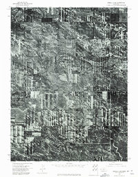 1973 Kimball 2 SW1974 Print · USGSCovers Kimball County, including United States, Nebraska, and other nearby areas
 - 1973 Map of Kimball 1 NE, 1975 Print
 1973 Kimball 1 NE1975 Print · USGSBanner County farmland meets the deep drainage of Rocky Hollow in the early seventies, as shown in this detailed orthophoto. Local historians can trace the precise boundaries of agricultural strip cropping and the natural terrain of the Nebraska Panhandle.
 - 1973 Map of Kimball 2 NW, 1975 Print
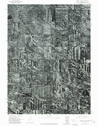 1973 Kimball 2 NW1975 Print · USGSAgricultural patterns in the Nebraska Panhandle are preserved here as they appeared in the early seventies through detailed aerial photography. Local historians and land researchers can trace the natural contours of Long Canyon and the layout of mid-century strip-cropping.
Showing maps 1-25 of 141
Top cities of Kimball County
Frequently asked questions
- What are the different types of historical maps available for Kimball County?
- What is the oldest map of Kimball County?
- Where can I purchase historical maps of Kimball County for my home or office?
- Where can I download high-res historical maps of Kimball County?
- Are there historical topographic maps available for Kimball County?
- Is there historical aerial imagery available for Kimball County?
- Where are historical maps of Kimball County sourced from?