1970s Maps of Bowen Precinct, Nebraska
Explore 16 historic maps of Bowen Precinct from the 1970s. These maps offer a rare glimpse into what life looked like during the 1970s — showing old roads, neighborhoods, homes, and landmarks that have changed or disappeared over time.
Whether you're researching your family's past, planning a metal detecting trip, or studying how Bowen Precinct's landscape evolved across the 1970s, these high-resolution maps are a powerful tool for exploring the history of this region.
- Focus on a specific era: All maps on this page are from the 1970s, giving you a focused view of this time period.
- See what’s changed: Compare century-old streets, trails, and buildings to today's modern landscape using overlays and satellite layers.
- Research with precision: Use these maps for genealogy, historical research, land use analysis, or educational projects.
- View, download, or print: Maps are fully viewable online in high resolution, and can be downloaded or printed for your own records.
Start exploring Bowen Precinct's history through authentic maps from the 1970s. This is your window into the past.
Bowen Precinct, NE maps
(16)- 1974 Map of Spoon Butte, 1978 Print
 1974 Spoon Butte1978 Print · USGSThe high plains straddling the Wyoming and Nebraska border are captured here in the mid-1970s, showcasing a landscape defined by water and ranching. Genealogists and historians can trace the intersection of Goshen and Sioux counties near Spoon Butte and Sheep Creek.2 unique versions available
 - 1977 Map of Van Tassell, 1978 Print
 1977 Van Tassell1978 Print · USGSThe Wyoming and Nebraska borderlands in the late seventies show a landscape of isolated ranching and rail transport. Genealogists and historians can trace the Chicago and North Western line past Van Tassell and locate the local Cem and Steamboat Rock.
 - 1977 Map of Van Tassell SE, 1978 Print
 1977 Van Tassell SE1978 Print · USGSThe high plains borderland where Wyoming and Nebraska meet is captured in the late 1970s, showcasing a tri-county boundary. Researchers can trace the intersection of Niobrara and Sioux counties alongside local landmarks like a Gravel Pit and numerous Well sites.
 - 1978 Map of Torrington
 1978 Torrington1978 Print · USGSSoutheast Wyoming in the late seventies reveals a landscape shaped by the North Platte River and a dense network of major rail lines. Researchers can locate the Fort Laramie National Historic Site, the Camp Guernsey Training Area, and original stops along the Union Pacific railroad.2 unique versions available
 - 1978 Map of Lone Sand Hill
 1978 Lone Sand Hill1978 Print · USGSThe high plains along the state line between Wyoming and Nebraska come into focus in the late seventies. Researchers can trace land boundaries across Goshen Co and Sioux Co while locating landmarks like the prominent Lone Sand Hill.2 unique versions available
 - 1978 Map of Harrison West, 1979 Print
 1978 Harrison West1979 Print · USGSSioux County life in the late 1970s centers on the railroad crossroads of Harrison and the surrounding High Plains. Researchers can trace the Chicago and North Western line, locate the Cem, and see the layout of the County Fairground.
 - 1978 Map of Oat Creek, 1979 Print
 1978 Oat Creek1979 Print · USGSThis late 1970s survey captures the tri-state boundary area where Wyoming, South Dakota, and Nebraska meet. Researchers can trace the rugged drainage of Oat Creek and South Cottonwood Creek alongside isolated ranching landmarks like the numerous Tank and Well sites.2 unique versions available
 - 1978 Map of Sherrill Hills, 1991 Print
 1978 Sherrill Hills1991 Print · USGSThe high plains along the Wyoming and Nebraska border are captured here in the late seventies. Researchers can trace land use and drainage patterns across Sherrill Hills, finding named landmarks like Bald Butte, Turner Peak, and Grandma Creek.
 - 1978 Map of Kirtley, 1991 Print
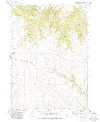
 1978 Kirtley1991 Print · USGSThe Wyoming-Nebraska borderlands in the late seventies feature a high-plains landscape shaped by the dramatic Hat Creek Breaks. Genealogists and local historians can locate the Pleasant Ridge Pioneer Cem, the Klondike School, and the remote settlement of Kirtley.
 - 1979 Map of Harrison SE
 1979 Harrison SE1979 Print · USGSSioux County rangeland in the late 1970s reveals a spare landscape of high plains ranching and remote outposts. Researchers can trace the network of unimproved roads and livestock infrastructure, including the settlement at Buckley, a prominent northern Trail, and numerous vital Well sites.
 - 1979 Map of Mount Edna
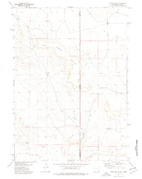
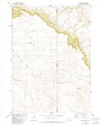
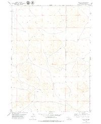
 1979 Mount Edna1979 Print · USGSThe high plains of Sioux County are captured in the late seventies, showing a quiet landscape of ranching and remote outposts. Researchers can identify the exact locations of family-run water points and the small settlement of Royville near Mount Edna and the Flat.
 - 1979 Map of Harrison SW
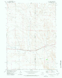
 1979 Harrison SW1979 Print · USGSSioux County ranch lands are captured here in the late seventies, showing the vital role of water in this Nebraska landscape. Researchers can trace the meandering Niobrara River and early irrigation efforts like the Lakatoh Ditch.
 - 1979 Map of Agate SW
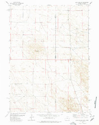
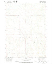
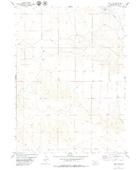
 1979 Agate SW1979 Print · USGSSioux County, Nebraska, is seen here in the late seventies as a quiet landscape of ranchland and high plains. Genealogists and local historians can locate the isolated Hilltop Sch, a solitary Grave, and numerous water sources including a Spring.
 - 1979 Map of Agate NW
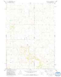
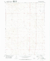
 1979 Agate NW1979 Print · USGSHigh Plains ranching country in western Nebraska is captured here in the late seventies. Researchers can locate the Panhandle Sch and trace local water resources like the Niobrara River and a remote Jeep Trail.
 - 1979 Map of Agate
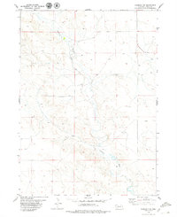
 1979 Agate1979 Print · USGSSioux County's fossil-rich river valley is captured here in the late 1970s, focused on the paleontological landscape. Genealogists and researchers can trace local landmarks like the Grandview Sch and the settlement of Agate along the Niobrara River.
 - 1979 Map of Harrison East, 1988 Print
 1979 Harrison East1988 Print · USGSNear the high Nebraska border in the late seventies, this survey captures a vital rail and ranching landscape. Genealogists and local historians can trace the foundations of Harrison and locate family names at Harrison Cem or St Mary Cem along the Chicago and North Western line.
End of results
Showing maps 1-16 of 16
Top cities near Bowen Precinct
Top neighborhoods of Bowen Precinct
- Story historical maps
- Glen historical maps
- Joder historical maps
- Montrose historical maps
- Five Points historical maps
- Andrews historical maps
See more
Frequently asked questions
- What are the different types of historical maps available for Bowen Precinct?
- What is the oldest map of Bowen Precinct?
- Where can I purchase historical maps of Bowen Precinct for my home or office?
- Where can I download high-res historical maps of Bowen Precinct?
- Are there historical topographic maps available for Bowen Precinct?
- Is there historical aerial imagery available for Bowen Precinct?
- Where are historical maps of Bowen Precinct sourced from?