Old Maps of Mesquite, Nevada for Academic Research
Study the evolution of Mesquite with 15 high-resolution historic maps. Whether you're teaching, researching, or modeling changes in land use, these maps provide essential visual documentation of urban, environmental, and geographic change.
- Analyze long-term change: Track patterns in development, transportation, and natural features.
- Ideal for environmental or urban studies: Support academic projects with primary historical map data.
- Use in the classroom or lab: Educators and researchers rely on these maps to bring historical context to life.
These maps are a powerful tool for teaching, research, and visualizing how Mesquite has changed over the decades.
Mesquite, NV maps
(15)- 1886 Map of Saint Thomas
 1886 Saint Thomas1886 Print · USGSSoutheastern Nevada's river valleys and early trails are captured here in the late nineteenth century, long before the creation of Lake Mead. Genealogists and historians can locate early settlements like Saint Thomas and Old Callville, and trace river crossings at Stone Ferry and Scanlon Ferry.6 unique versions available
 - 1893 Map of Saint Thomas
 1893 Saint Thomas1893 Print · USGSSouthern Nevada at the close of the nineteenth century reveals a network of river-based settlements and trails. Genealogists and researchers can trace the early locations of Saint Thomas, Old Callville, and the Stone Ferry crossing.
 - 1954 Map of Las Vegas
 1954 Las Vegas1954 Print · USGSLas Vegas and the Mojave Desert are shown in the early fifties as the region's military and recreational footprint expanded. Genealogists and historians can trace the early layout of North Las Vegas, the sites of Indian Springs Air Force Base, and long-established towns like Bunkerville.5 unique versions available
 - 1957 Map of Las Vegas
 1957 Las Vegas1957 Print · USGSSouthern Nevada in the mid-fifties is a landscape of massive federal ranges and the early growth of Las Vegas. Researchers can trace the development of McCarran Field, the expansive Lake Mead National Recreation Area, and the industrial footprint of Henderson.
 - 1957 Map of Mesquite, 1959 Print
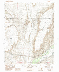
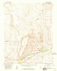 1957 Mesquite1959 Print · USGSMesquite and the Virgin River valley appear here in the late fifties, during a period of steady growth along the old highway corridors. Researchers can trace the layout of early Bunkerville and Mesquite, locating the cemetery, local Airport, and various water controls along the Virgin River.2 unique versions available
 - 1958 Map of Virgin Peak, 1960 Print
 1958 Virgin Peak1960 Print · USGSThe Nevada-Arizona border country comes to life in the late fifties, showing the high ridges of the Virgin Mountains. Researchers can trace old desert outposts like Juanita Springs Ranch and Whitney Ranch, or locate historic Petroglyphs and the Great Western Mine.2 unique versions available
 - 1959 Map of Las Vegas
 1959 Las Vegas1959 Print · USGSSouthern Nevada in the late fifties was a landscape of rapid suburban growth and massive federal installations. Genealogists and historians can trace early housing at Victory Village, the grounds of Camp Desert Rock, and the remote Tule Springs Ranch.
 - 1962 Map of Las Vegas
 1962 Las Vegas1962 Print · USGSSouthern Nevada is captured here during a period of significant military and industrial growth in the early sixties. Researchers can trace the development of Las Vegas alongside the Magnesium Plant in Henderson and the expansive Nellis Air Force Base.
 - 1983 Map of Riverside, 1984 Print
 1983 Riverside1984 Print · USGSNortheastern Clark County was still a land of remote ranching and mining outposts in the early eighties. Researchers can trace the legacy of early desert life through landmarks like Juanita Springs Ranch, the Great Eastern Mine, and the waters of North Key West Spring.
 - 1985 Map of Mesquite
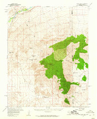
 1985 Mesquite1985 Print · USGSThe Virgin River valley at the Nevada-Arizona border shows its agricultural roots and desert landscape in the mid-eighties. Genealogists and researchers can trace local infrastructure through the Mesquite Flume Ditch and locations like the Cem and Bunkerville.
 - 1985 Map of Flat Top Mesa
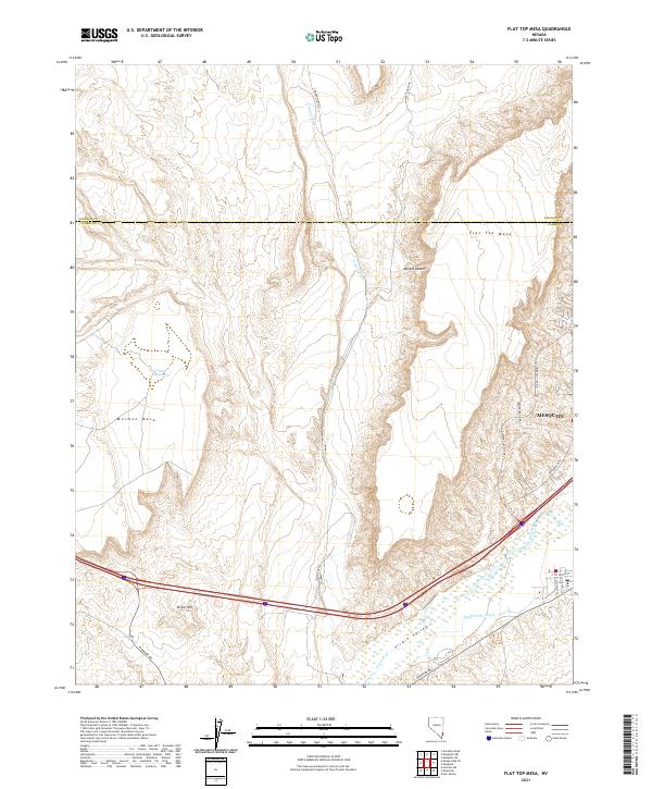
 1985 Flat Top Mesa1985 Print · USGSBunkerville and the Virgin River valley are captured in the mid-1980s as agricultural life persisted between towering desert plateaus. Researchers can trace the path of the Bunkerville Ditch and explore the rugged borders of Flat Top Mesa and Mormon Mesa.
 - 1987 Map of Overton, 1988 Print
 1987 Overton1988 Print · USGSSoutheastern Nevada at the end of the 1980s reveals a desert landscape of river-valley settlements and vast public lands. Trace the Union Pacific line through Moapa or locate family sites in Logandale and Bunkerville along the Virgin River.2 unique versions available
 - 2021 Map of Riverside, 2021 Print
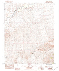
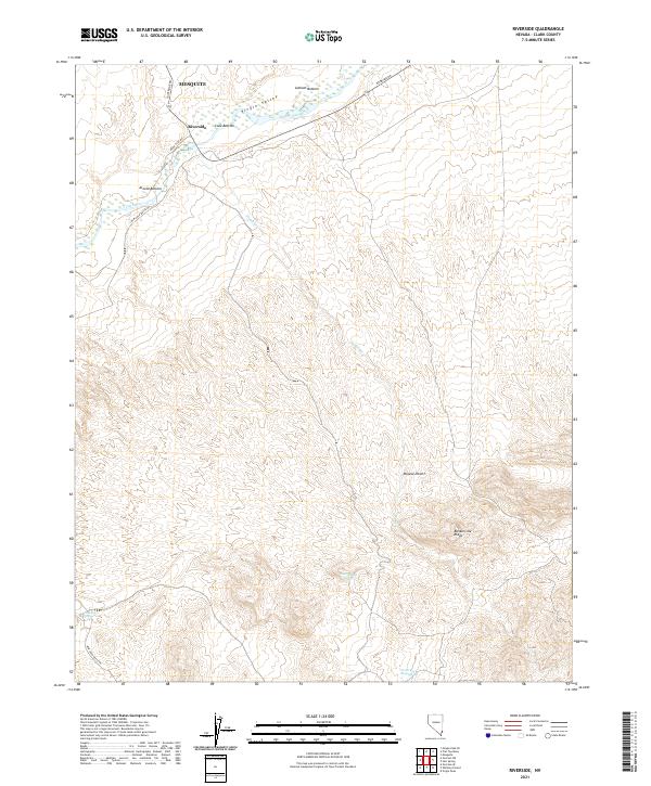 2021 Riverside2021 Print · USGSThe Virgin River valley in Clark County appears here during the early twenty-first century, showing the intersection of desert water sources and local travel. Researchers can trace the river bottoms from Riverside to Arnold Bottom or locate remote sites like Government Spring.
 - 2021 Map of Flat Top Mesa, 2021 Print
 2021 Flat Top Mesa2021 Print · USGSThe Clark and Lincoln county borderlands come alive in this recent survey of the northeast Mojave. Trace the intersection of desert terrain and modern growth from Mesquite to the Virgin River and landmarks like Mormon Mesa.
 - 2021 Map of Mesquite, 2021 Print
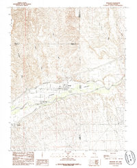
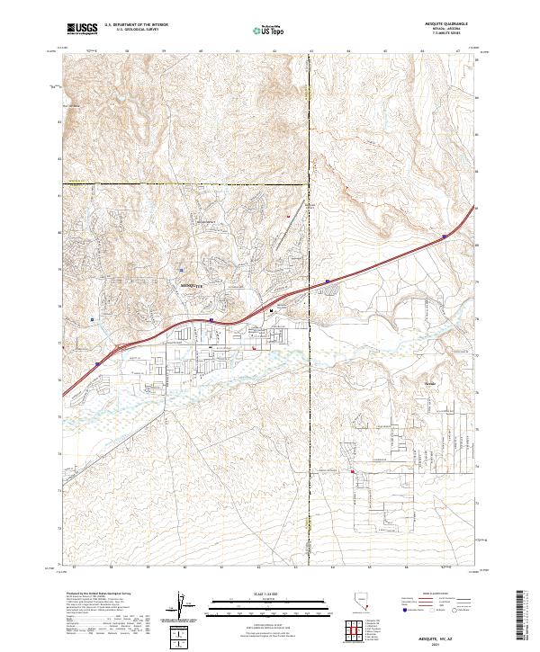 2021 Mesquite2021 Print · USGSMesquite and the Virgin River valley are shown in detail during a period of modern expansion at the Nevada-Arizona border. Local historians can trace old routes like the 1849 Trl and E Lead Mine Rd or locate the Mesquite City Cem near the valley floor.
End of results
Showing maps 1-15 of 15
Top cities near Mesquite
Top neighborhoods of Mesquite
- Mesquite Bluffs Apartments historical maps
- Santa Fe Springs historical maps
- The Springs historical maps
- Sandstone historical maps
- Rising Star historical maps
- Desert Winds historical maps
See more
Frequently asked questions
- What are the different types of historical maps available for Mesquite?
- What is the oldest map of Mesquite?
- Where can I purchase historical maps of Mesquite for my home or office?
- Where can I download high-res historical maps of Mesquite?
- Are there historical topographic maps available for Mesquite?
- Is there historical aerial imagery available for Mesquite?
- Where are historical maps of Mesquite sourced from?