1960s Maps of Elko County, Nevada
Explore 112 historic maps of Elko County from the 1960s. These maps offer a rare glimpse into what life looked like during the 1960s — showing old roads, neighborhoods, homes, and landmarks that have changed or disappeared over time.
Whether you're researching your family's past, planning a metal detecting trip, or studying how Elko County's landscape evolved across the 1960s, these high-resolution maps are a powerful tool for exploring the history of this region.
- Focus on a specific era: All maps on this page are from the 1960s, giving you a focused view of this time period.
- See what’s changed: Compare century-old streets, trails, and buildings to today's modern landscape using overlays and satellite layers.
- Research with precision: Use these maps for genealogy, historical research, land use analysis, or educational projects.
- View, download, or print: Maps are fully viewable online in high resolution, and can be downloaded or printed for your own records.
Start exploring Elko County's history through authentic maps from the 1960s. This is your window into the past.
Elko County, NV maps
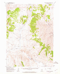
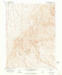
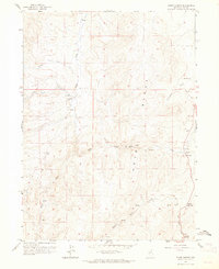
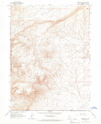
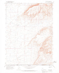
(112)- 1961 Map of Wells
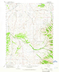
 1961 Wells1961 Print · USGSNortheastern Nevada's high basin and range country is captured here during the early sixties, showing the vital rail corridors and ranching outposts. Researchers can trace the heritage of remote settlements like Metropolis, locate the Delano Mines, and follow the path of the Southern Pacific through the Pequop Mountains.
 - 1961 Map of Delano Mountains, 1963 Print
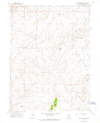
 1961 Delano Mountains1963 Print · USGSElko County mining and ranching endure in the high desert during the early sixties. Researchers can trace historical silver and lead operations at the Delno Mines or locate traditional outposts like the Twentyone Mile Ranch and Delano Well.2 unique versions available
 - 1961 Map of Gollaher Mountain, 1963 Print
 1961 Gollaher Mountain1963 Print · USGSThe Nevada-Idaho borderlands come into focus in the early sixties, showing a landscape shaped by high-desert springs and remote peaks. Researchers can locate named water sources like Indian Mike Spring and Moonshine Spring or trace routes through Devils Pass.2 unique versions available
 - 1961 Map of Goose Creek, 1963 Print
 1961 Goose Creek1963 Print · USGSThe tri-state border region of Nevada, Utah, and Idaho comes alive in this early 1960s survey of the High Desert. Historians and genealogists can trace the Old Emigrant Trail and locate family-run outposts like Trout Creek Ranch and Judd Ranch.3 unique versions available
 - 1961 Map of Dairy Valley, 1963 Print
 1961 Dairy Valley1963 Print · USGSRanching and remote mountain routes define this Nevada-Utah borderland in the early sixties. Researchers can trace historic paths through Signboard Pass and locate early settlements like Dairy and Toms Cabin tucked near the high desert springs.2 unique versions available
 - 1962 Map of Elko
 1962 Elko1962 Print · USGSNortheastern Nevada in the early sixties is a landscape of mountain ranges and rail corridors, where the river valleys support ranching and transit. Locate old mining operations like Battle Creek Mine, rural stops like Moleen, and the sprawling Wendover Bombing and Gunnery Range.
 - 1962 Map of Winnemucca
 1962 Winnemucca1962 Print · USGSNorthern Nevada's high desert comes alive in the mid-1950s as a vital transportation and mining corridor following the Humboldt River. Trace the early rail-and-ranch economy through stops like Palisade, find old workings at the Adelaide Mine, and see the layout of Winnemucca before the interstate era.
 - 1962 Map of Kittridge Springs, 1964 Print
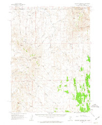
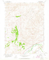
 1962 Kittridge Springs1964 Print · USGSElko County ranching country is captured here in the early sixties, showing a landscape defined by high peaks and essential water sources. Trace the remote trails near Kittridge Ranch or locate family-named landmarks like Sherman Peak and Kittridge Springs.3 unique versions available
 - 1962 Map of Boyd Reservoir, 1964 Print
 1962 Boyd Reservoir1964 Print · USGSElko County ranching and water management are captured here in the early sixties, showing the vital infrastructure of the high desert. Researchers can locate remote landmarks like Sustacha Well, the isolated Grave, and the waters of Hog Tommy Spring.2 unique versions available
 - 1962 Map of Ryndon, 1964 Print
 1962 Ryndon1964 Print · USGSElko County, Nevada, is captured in the early sixties as a vital transit corridor where the river and rails meet. Genealogists and historians can trace the paths of the Southern Pacific and Western Pacific through Ryndon and Elburz, or locate a lonely Grave along the tracks.3 unique versions available
 - 1962 Map of Osino, 1964 Print
 1962 Osino1964 Print · USGSOsino and the Humboldt River valley are seen here in the early sixties as a vital crossroads for the rail and ranching economy. Genealogists and historians can trace the paths of the Southern Pacific and the grounds of the Nevada Youth Training Center.3 unique versions available
 - 1962 Map of Adobe Summit, 1965 Print
 1962 Adobe Summit1965 Print · USGSElko County ranching and rugged terrain are documented here in the early sixties, showing a landscape defined by its water sources and trails. Researchers can trace the layout of the Adobe Ranch, find the remote Camp, and locate various Springs and Gravel Pits.
 - 1962 Map of Hunter, 1965 Print
 1962 Hunter1965 Print · USGSElko County's high desert reveals its mid-century transportation and water networks as the railroads and the Humboldt River converge. Researchers can trace the dual paths of the Southern Pacific and Western Pacific railroads past the settlement of Hunter.2 unique versions available
 - 1962 Map of Elko East, 1965 Print
 1962 Elko East1965 Print · USGSElko's eastern outskirts and the surrounding high-desert basins are captured here during a period of steady mid-century growth. Researchers can trace the dual rail lines of the Southern Pacific and Western Pacific or locate early landmarks like Radio Station (KELK) and the Te-Moak Indian Reservation.3 unique versions available
 - 1962 Map of Elko West, 1965 Print
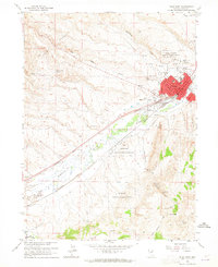 1962 Elko West1965 Print · USGSElko underwent significant expansion during the early sixties, as shown on this survey of the river valley and rail corridor. Researchers can locate the Elko Colony Indian Reservation, the old Elko-Hamilton Stage Route, and the Elko Municipal Airport.3 unique versions available
 - 1962 Map of Lee, 1966 Print
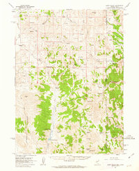
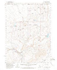
 1962 Lee1966 Print · USGSElko County ranching and tribal lands are captured here in the early sixties, centered on the Te-Moak Indian Reservation. Researchers can trace early water systems like the Hankins Bellinger Ditch and the remote settlement of Lee.
 - 1962 Map of Lamoille, 1966 Print
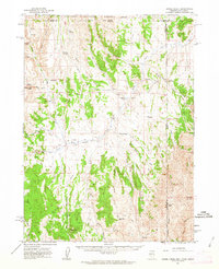
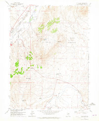
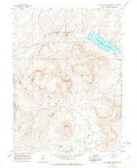
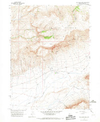
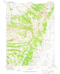 1962 Lamoille1966 Print · USGSThe high alpine peaks and deep canyons of the Ruby Mountains are documented here in the early 1960s. Genealogists and local historians can locate the Ruby Valley School, the Shorty Cemetery, and remote mining operations like the American Beauty Mine.2 unique versions available
 - 1964 Map of Hat Peak, 1966 Print
 1964 Hat Peak1966 Print · USGSThe high-desert borderlands of Elko County and Owyhee County are captured here in the mid-1960s, showing the early infrastructure of the Duck Valley Indian Reservation. Trace the rugged water-management network of the era, from remote landmarks like Hat Peak and Butte Spring to the winding South Fork Owyhee River.2 unique versions available
 - 1964 Map of Wilson Reservoir, 1966 Print
 1964 Wilson Reservoir1966 Print · USGSNorthern Nevada ranching and high-country water management are documented here in the mid-1960s. Genealogists and historians can trace family-run operations like the YP Ranch and Mitchum Ranch, or locate the Edgemont Sch and Wilson Reservoir.2 unique versions available
 - 1965 Map of Elko
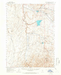
 1965 Elko1965 Print · USGSElko and the northeastern Nevada desert are captured here in the mid-1960s, showcasing a landscape of high ranges and essential rail corridors. Researchers can trace the path of the Western Pacific railroad through small stops like Tobar and Ventosa, or locate remote sites like Shanty Town near the Ruby Lake wetlands.
 - 1965 Map of Sixmile Hill, 1967 Print
 1965 Sixmile Hill1967 Print · USGSElko and Lander counties remain largely undeveloped in the mid-1960s, defined by the high-desert terrain of the Great Basin. Local historians can trace the course of Sixmile Creek and locate several isolated spring sites near Sixmile Hill.
 - 1965 Map of Willow Creek Reservoir, 1967 Print
 1965 Willow Creek Reservoir1967 Print · USGSElko County, Nevada, is shown in the mid-1960s as a landscape of high-desert mining and water management. Researchers can trace remote operations like Rimrock Mine and Governor Mine or locate vital water sources such as Ivanhoe Spring and Buttercup Spring.2 unique versions available
 - 1965 Map of Jake Creek Mtn, 1967 Print
 1965 Jake Creek Mtn1967 Print · USGSElko County high-country ranching and water rights are well-documented in this mid-1960s survey. Researchers can trace remote operations at Upper Clover Ranch and locate named water sources like Big Spring and Sawtooth Spring along the Owyhee Bluffs.
 - 1965 Map of Squaw Valley Ranch, 1967 Print
 1965 Squaw Valley Ranch1967 Print · USGSElko County ranching and mining lands come into focus during the mid-sixties, showing a landscape defined by water rights and high-desert industry. Researchers can trace the path of the High Line Canal or locate the Squaw Valley Ranch and Sheep Corral Mine.
 - 1965 Map of Midas SW, 1967 Print
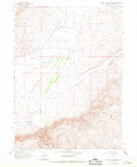
 1965 Midas SW1967 Print · USGSElko and Lander Counties were primarily open rangeland in the mid-sixties, punctuated only by essential water improvements. Local history researchers can trace the boundary between Elko and Lander while locating the Guard Corral and Evans Creek.
Showing maps 1-25 of 112
Top cities of Elko County
- Elko historical maps
- Spring Creek historical maps
- West Wendover historical maps
- Carlin historical maps
- Wells historical maps
- Owyhee historical maps
See more
Frequently asked questions
- What are the different types of historical maps available for Elko County?
- What is the oldest map of Elko County?
- Where can I purchase historical maps of Elko County for my home or office?
- Where can I download high-res historical maps of Elko County?
- Are there historical topographic maps available for Elko County?
- Is there historical aerial imagery available for Elko County?
- Where are historical maps of Elko County sourced from?