1950s Maps of Elko County, Nevada
Explore 32 historic maps of Elko County from the 1950s. These maps offer a rare glimpse into what life looked like during the 1950s — showing old roads, neighborhoods, homes, and landmarks that have changed or disappeared over time.
Whether you're researching your family's past, planning a metal detecting trip, or studying how Elko County's landscape evolved across the 1950s, these high-resolution maps are a powerful tool for exploring the history of this region.
- Focus on a specific era: All maps on this page are from the 1950s, giving you a focused view of this time period.
- See what’s changed: Compare century-old streets, trails, and buildings to today's modern landscape using overlays and satellite layers.
- Research with precision: Use these maps for genealogy, historical research, land use analysis, or educational projects.
- View, download, or print: Maps are fully viewable online in high resolution, and can be downloaded or printed for your own records.
Start exploring Elko County's history through authentic maps from the 1950s. This is your window into the past.
Elko County, NV maps
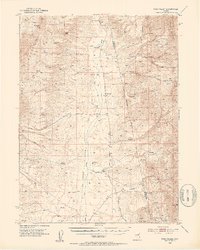
(32)- 1952 Map of Dixie Flats, 1954 Print
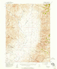
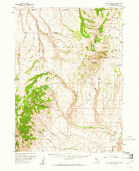
 1952 Dixie Flats1954 Print · USGSNorthern Nevada ranching and rail activity are captured here in the early fifties, where the Southern Pacific meets the desert. Genealogists can trace early homesteads like Tomera Ranch and the haunting Site of Old Bullion.4 unique versions available
 - 1952 Map of Pine Valley, 1954 Print
 1952 Pine Valley1954 Print · USGSPine Valley and the surrounding mountains are documented here in the early fifties, showing the high-desert ranching life of the Great Basin. Genealogists and historians can trace family properties like Slagowski Ranch or locate the Indian Campground and Dismantled Railroad.4 unique versions available
 - 1952 Map of Carlin, 1954 Print
 1952 Carlin1954 Print · USGSThe Nevada high desert meets the iron rail in the early 1950s as the Southern Pacific and Western Pacific navigate the Humboldt River corridor. Researchers can trace historic routes like the California Trail or locate family sites like Raine Ranch and Thomas Place.5 unique versions available
 - 1953 Map of Spruce Mountain, 1955 Print
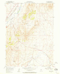
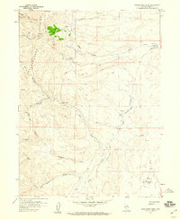
 1953 Spruce Mountain1955 Print · USGSIn the high basins of Elko County during the early fifties, the mining and ranching legacy of the Great Basin is clearly etched. Trace the mineral operations of the Monarch Mine and Black Forest Mine, or locate the historic settlement at Sprucemont and seasonal outposts like Sheep Camp.4 unique versions available
 - 1953 Map of Spruce Mountain 4, 1955 Print
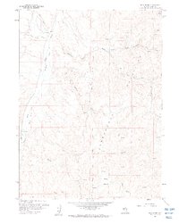
 1953 Spruce Mountain 41955 Print · USGSElko County was a high-desert crossroads in the early fifties, where vital rail lines navigated the rugged gaps between mountain ranges. Researchers can trace the paths of the Western Pacific and Nevada Northern railroads past Hogan and Dolly Varden.4 unique versions available
 - 1955 Map of McDermitt
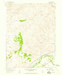
 1955 McDermitt1955 Print · USGSNorthern Nevada in the mid-fifties shows a landscape of mining camps and vast cattle ranges. Trace the early footprints of Tuscarora or the remote Cordero Mine and National Mine tucked into the high desert peaks.3 unique versions available
 - 1955 Map of Wells, 1966 Print
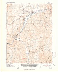
 1955 Wells1966 Print · USGSNortheastern Nevada's high basin-and-range country is documented here in the mid-fifties, showing a landscape of remote ranching outposts and massive federal forest lands. Researchers can locate the early mining districts at Delano Mines and trace the paths of the Southern Pacific railroad through settlements like Deeth and Cobre.4 unique versions available
 - 1955 Map of Winnemucca, 1968 Print
 1955 Winnemucca1968 Print · USGSNorthern Nevada's high desert corridor is captured here in the mid-fifties, centered on the river-and-rail hub of Winnemucca. Researchers can trace the dual tracks of the Southern Pacific and Western Pacific railroads through towns like Golconda and Valmy.3 unique versions available
 - 1955 Map of Elko, 1974 Print
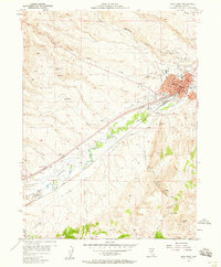
 1955 Elko1974 Print · USGSNortheastern Nevada in the mid-fifties is captured here as a crossroads of transcontinental rail and high desert ranching. Trace old rail stops from Wells to Elko or find remote landmarks like Shanty Town and Medicine Spring.3 unique versions available
 - 1956 Map of Robinson Mtn, 1957 Print
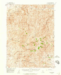
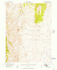 1956 Robinson Mtn1957 Print · USGSRanching life in the mid-1950s is captured across this high-desert landscape as the local cattle economy relied on scattered water sources and isolated outposts. Researchers can trace family-named locations like Elliott High Ranch, Red Rock Ranch, and the Old Porter Ranch.2 unique versions available
 - 1956 Map of Tuscarora, 1958 Print
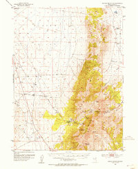
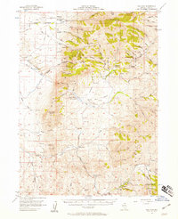
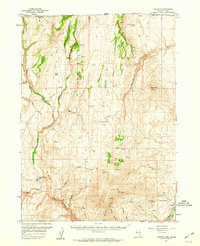
 1956 Tuscarora1958 Print · USGSElko County’s high desert and mining country are captured here in the mid-1950s, showing the intersection of ranching and hard-rock mining. You can trace the proximity of the Tuscarora settlement to historical workings like the Grand Prize Mine and Spanish Ranch.3 unique versions available
 - 1956 Map of Mt. Blitzen, 1958 Print
 1956 Mt. Blitzen1958 Print · USGSElko County high country during the mid-fifties shows a landscape of remote mining claims and rugged cattle range. Genealogists and historians can trace old operations at the Amazon Mine and Falcon Mines or locate summits like Mt Blitzen.3 unique versions available
 - 1956 Map of Bull Run, 1958 Print
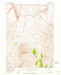
 1956 Bull Run1958 Print · USGSElko County in the mid-fifties is captured here as a landscape of remote mining claims and cattle outfits. Researchers can trace historic operations like the Edgemont Mine, Blue Jacket Mine, and the 7-J Ranch across the rugged Bull Run Mountains.3 unique versions available
 - 1956 Map of Wild Horse, 1958 Print
 1956 Wild Horse1958 Print · USGSElko County ranching and water management come into focus in the mid-1950s as the Wild Horse Reservoir serves this high-elevation basin. Researchers can trace historic family-named sites like Doheny Ranch, Stevens Ranch, and the isolated Harrison School.3 unique versions available
 - 1957 Map of Elko West, 1958 Print
 1957 Elko West1958 Print · USGSElko emerged as a major rail and aviation hub by the late 1950s, bridging the gap between old stage routes and modern infrastructure. Genealogists and historians can trace the city’s footprint from the Elko Colony Indian Reservation to the Cemeteries and the Elko-Hamilton Stage Route.
 - 1957 Map of Elko East, 1958 Print
 1957 Elko East1958 Print · USGSElko was expanding into the high desert during the late fifties as the regional rail and river network shaped its growth. Researchers can trace the dual tracks of the Southern Pacific and Western Pacific or find landmarks like Radio Station (KELK) and Burner Basin.
 - 1957 Map of Contact, 1960 Print
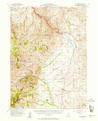
 1957 Contact1960 Print · USGSElko County ranching and mining country is captured here during the late fifties, spanning the border into Idaho. Genealogists and historians can locate the Contact School, trace operations at the Marshall Mine, or find remote landmarks like Browns Bench Ranch.3 unique versions available
 - 1957 Map of Delaplain, 1960 Print
 1957 Delaplain1960 Print · USGSThe Nevada-Idaho borderlands come into focus during the late 1950s, showing the early footprints of ranching and transit in Elko County. Genealogists and researchers can trace the historic San Jacinto Ranch, the rail stop at Idavada, and the waters of Shoshone Warm Springs.2 unique versions available
 - 1957 Map of Elk Mountain, 1961 Print
 1957 Elk Mountain1961 Print · USGSThe high desert border between Nevada and Idaho is captured here in the late fifties, a landscape of isolated ranches and national forest. Trace early access routes and landmarks like O'Neil Ranch, the Pole Creek Ranger Sta, and Red Elephant Butte.3 unique versions available
 - 1958 Map of Winnemucca
 1958 Winnemucca1958 Print · USGSNorthern Nevada in the late fifties was defined by the parallel rhythms of the great transcontinental railroads and a resilient mining industry. Genealogists and historians can trace old mining camps and remote rail sidings from Gold Acres and Palisade to the Adelaide district.2 unique versions available
 - 1958 Map of Wells
 1958 Wells1958 Print · USGSNortheastern Nevada's high desert and mountain ranges are documented here in the late fifties as the regional rail and ranching economy thrived. Genealogists and historians can trace the paths of the Southern Pacific railroad to remote stations at Cobre and Metropolis, or locate the high-altitude Delno Mines.
 - 1958 Map of Elko
 1958 Elko1958 Print · USGSNorthern Nevada in the late fifties shows a landscape of high-desert ranching and Cold War aviation. Trace old rail lines like the Nevada Northern or locate the Victoria Mine and Wendover Air Force Base.2 unique versions available
 - 1958 Map of Singletree Creek, 1959 Print
 1958 Singletree Creek1959 Print · USGSElko County's high-desert mining and ranching life are captured in the late fifties as the Independence Mountains was explored for mineral wealth. Researchers can locate remote outposts like Sproule Cabin and map the workings of the Rio Van Winkle Mine and Nannies Peak.2 unique versions available
 - 1958 Map of Hunter, 1960 Print
 1958 Hunter1960 Print · USGSElko County's high desert rail corridor is documented here in the late fifties as it follows the winding Humboldt River. Trace the parallel tracks of the Southern Pacific and Western Pacific through Hunter, or locate remote landmarks like the Airway Beacon and Upper Dry Susie Spring.
 - 1958 Map of Blue Basin, 1960 Print
 1958 Blue Basin1960 Print · USGSThe Independence Mountains of Elko County are shown here in the late fifties, revealing a landscape of high-desert ranching and remote trails. Researchers can trace the path of the Carlin Trail and locate dozens of named water sources like Maggie Creek and Blue Basin.3 unique versions available
Showing maps 1-25 of 32
Top cities of Elko County
- Elko historical maps
- Spring Creek historical maps
- West Wendover historical maps
- Carlin historical maps
- Wells historical maps
- Owyhee historical maps
See more
Frequently asked questions
- What are the different types of historical maps available for Elko County?
- What is the oldest map of Elko County?
- Where can I purchase historical maps of Elko County for my home or office?
- Where can I download high-res historical maps of Elko County?
- Are there historical topographic maps available for Elko County?
- Is there historical aerial imagery available for Elko County?
- Where are historical maps of Elko County sourced from?