1970s Maps of Washoe County, Nevada
Explore 29 historic maps of Washoe County from the 1970s. These maps offer a rare glimpse into what life looked like during the 1970s — showing old roads, neighborhoods, homes, and landmarks that have changed or disappeared over time.
Whether you're researching your family's past, planning a metal detecting trip, or studying how Washoe County's landscape evolved across the 1970s, these high-resolution maps are a powerful tool for exploring the history of this region.
- Focus on a specific era: All maps on this page are from the 1970s, giving you a focused view of this time period.
- See what’s changed: Compare century-old streets, trails, and buildings to today's modern landscape using overlays and satellite layers.
- Research with precision: Use these maps for genealogy, historical research, land use analysis, or educational projects.
- View, download, or print: Maps are fully viewable online in high resolution, and can be downloaded or printed for your own records.
Start exploring Washoe County's history through authentic maps from the 1970s. This is your window into the past.
Washoe County, NV maps
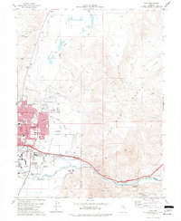
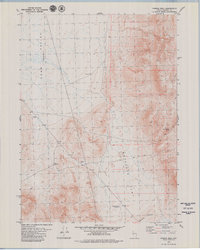
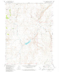
(29)- 1970 Map of Patrick, 1973 Print
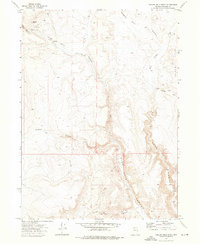
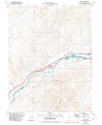 1970 Patrick1973 Print · USGSThe Truckee River valley in the late 1970s shows a critical intersection of Nevada's rail industry and power infrastructure. Genealogists and historians can trace riverside settlements like Patrick and Hafed or locate the storied 102 Ranch and Old Lonesome near the railroad.
 - 1972 Map of Mahogany Mtn, 1976 Print
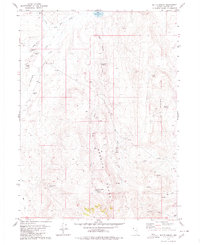
 1972 Mahogany Mtn1976 Print · USGSWashoe County's high desert ranching landscape is documented here in the early 1970s, showing the vital network of springs and camps. Researchers can trace seasonal water sources like Sage Hen Spring and livestock landmarks such as Woodruff Camp and Big Mahogany Res.2 unique versions available
 - 1972 Map of High Rock Lake, 1976 Print
 1972 High Rock Lake1976 Print · USGSNorthwestern Nevada in the early 1970s is a landscape of desert canyons and vital springs along the Washoe and Humboldt county line. Researchers can trace remote campsites and geologic landmarks like Mahogany Creek Canyon Camp, The Potholes, and High Rock Lake.2 unique versions available
 - 1972 Map of Yellow Hills East, 1976 Print
 1972 Yellow Hills East1976 Print · USGSNorthern Nevada high-desert terrain is captured here in the early 1970s, straddling the Washoe and Humboldt county lines. Trace remote routes like the Jeep Trail past landmarks such as Black Buttes and reliable water at Mustang Spring.
 - 1972 Map of Yellow Hills West, 1976 Print
 1972 Yellow Hills West1976 Print · USGSWashoe County's high desert plateaus are captured here in the early 1970s, showing a landscape of deep basalt canyons and isolated livestock camps. Researchers can locate remote homestead sites and ranching landmarks like Stevens Camp, Bernards Corrals, and the Van Riper Place.3 unique versions available
 - 1974 Map of Reno, 1976 Print
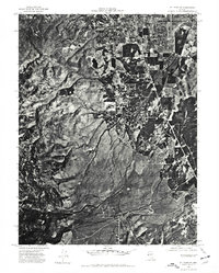
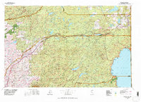
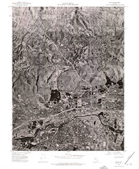 1974 Reno1976 Print · USGSNorthern Nevada during the mid-seventies comes into sharp focus in this aerial study of the growing Reno-Sparks area. Trace the urban sprawl and early infrastructure surrounding Reno, Sparks, and the winding Truckee River.
 - 1974 Map of Virginia City, 1977 Print
 1974 Virginia City1977 Print · USGSVirginia City and the Comstock region are seen from above in the mid-1970s, revealing the dense settlement patterns and the mining-scarred landscape. Trace historic drainages like Gold Canyon or examine the rugged layout of the Virginia Range.
 - 1974 Map of Washoe City, 1977 Print
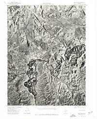
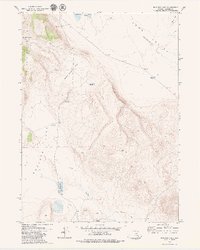
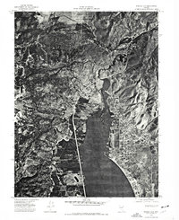 1974 Washoe City1977 Print · USGSWashoe Valley in the mid-1970s is seen here in sharp detail through aerial photography, showing the region's development between Reno and Carson City. Trace the residential layout of New Washoe City along the shores of Washoe Lake and the original site of Washoe City.
 - 1974 Map of Mt. Rose NE, 1977 Print
 1974 Mt. Rose NE1977 Print · USGSThe southern fringes of Reno meet the high desert in the mid-1970s, showcasing a landscape in the midst of suburban expansion. Researchers can trace the natural drainage of Evans Creek and Thomas Creek as they flow toward the Truckee Meadows.
 - 1974 Map of New Empire, 1977 Print
 1974 New Empire1977 Print · USGSCarson City and the adjacent industrial site of New Empire are shown in detail through mid-1970s aerial photography. Trace the city’s expansion into Eagle Valley and follow the natural curves of the Carson River as it winds toward the foothills.
 - 1974 Map of Carson City, 1977 Print
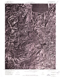 1974 Carson City1977 Print · USGSCarson City and the surrounding Nevada high desert are captured in this mid-seventies aerial study. Researchers can trace the mid-century footprint of Carson City within Eagle Valley and the shoreline of Washoe Lake.
 - 1975 Map of Beckwourth Pass, 1977 Print
 1975 Beckwourth Pass1977 Print · USGSUpper Long Valley in the mid-seventies is a high Sierra corridor shaped by rail lines and ranching trails. Researchers can trace the Western Pacific Railroad through the Beckwourth Pass Tunnel and locate the historic Summit (Site).
 - 1975 Map of Vista, 1977 Print
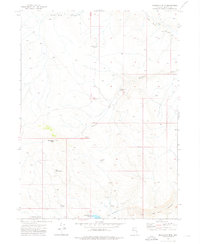
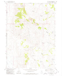
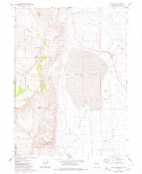
 1975 Vista1977 Print · USGSMid-century Nevada expansion is evident here as the city of Sparks reaches toward the Pah Rah Range. Researchers can trace the mid-seventies landscape of schools like Reed High Sch, agricultural sites like the University of Nevada Farm, and small outposts such as Mustang.4 unique versions available
 - 1977 Map of Truckee, 1978 Print
 1977 Truckee1978 Print · USGSThe High Sierra and Lake Tahoe regions come into focus in the late seventies, showing a landscape defined by massive reservoir projects and mountain transit. Genealogists and historians can trace the Southern Pacific rail line through Truckee or explore old mining districts near North Bloomfield and Colfax.2 unique versions available
 - 1978 Map of Evans Canyon
 1978 Evans Canyon1978 Print · USGSThe high-desert ranching country of the Sierra-Nevada border is captured here in the late seventies. Researchers can trace the Western Pacific rail line through Long Valley or locate local landmarks like Balls Ranch and Purdy.2 unique versions available
 - 1978 Map of Hart Mountain, 1979 Print
 1978 Hart Mountain1979 Print · USGSNorthwestern Nevada high country in the late 1970s reveals a landscape defined by seasonal camps and essential water sources. Genealogists and historians can trace livestock history and backcountry routes through Hart Camp, Antelope Flat, and named watering points like Nellie Spring.
 - 1979 Map of Dogskin Mtn
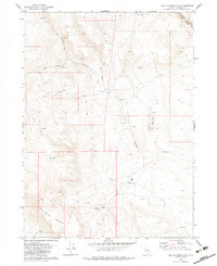
 1979 Dogskin Mtn1979 Print · USGSThe Nevada and California borderlands during the late seventies reveal a high-desert landscape centered on the Winnemucca Ranch Road. Researchers can trace old livestock hubs like Lees Flat or locate specific pioneer sites such as a lonely Grave and scattered Prospects.3 unique versions available
 - 1979 Map of Powers Well
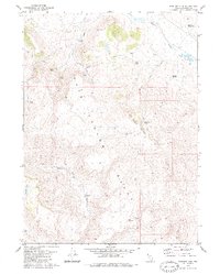
 1979 Powers Well1979 Print · USGSWashoe County ranching lands are captured here in the late seventies, showing the vital water and trail networks of the high desert. Researchers can trace land use through the Powers Well, 3-C Windmill, and remote water sources like Lone Jumper Spring.2 unique versions available
 - 1979 Map of Nellie Spring Mtn
 1979 Nellie Spring Mtn1979 Print · USGSWashoe County ranching life in the late 1970s is centered around Grassy Ranch and its vital water sources. Researchers can trace remote livestock infrastructure and mineral Prospects near Nellie Spring Mountain and High Rock Canyon.2 unique versions available
 - 1979 Map of Boulder Lake
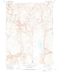
 1979 Boulder Lake1979 Print · USGSWashoe County's high desert landscape is documented here in the late seventies, showing a territory defined by isolated water sources and range infrastructure. Researchers can locate remote landmarks like the Button Brush Windmill, Orphan Reservoir, and the shoreline of Boulder Lake.2 unique versions available
 - 1979 Map of Hays Canyon, 1980 Print
 1979 Hays Canyon1980 Print · USGSWashoe County's high-desert borderland is captured here in the late seventies, showing the vital spring-and-trail networks of the basin and range. Researchers can trace remote water sources like Pick And Shovel Springs No 1 and sites like Indian Pole Camp.
 - 1979 Map of Wall Canyon Reservoir, 1980 Print
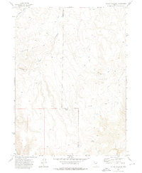
 1979 Wall Canyon Reservoir1980 Print · USGSRemote Washoe County ranching country is documented here in the late seventies, centered on the vital waters of the Wall Canyon Reservoir. Researchers can trace old mountain access routes via a Jeep Trail network to landmarks like Cockrell Trough and Kissler Springs.
 - 1979 Map of Duck Lake, 1980 Print
 1979 Duck Lake1980 Print · USGSRemote ranching and desert aviation define this corner of the Nevada-California border in the late seventies. Researchers can trace land use through landmarks like Cockrell Ranch, the Lackerman Air Strip, and Bud Brown Cabin.2 unique versions available
 - 1979 Map of Butte Spring, 1980 Print
 1979 Butte Spring1980 Print · USGSWashoe County's high desert landscape comes into focus during the late 1970s, showing a remote world of ranching outposts and critical water holes. Researchers can locate family landmarks like Swedes Place and Swingle Ranch or trace trails through the Granite Range.
 - 1979 Map of Boulder Mtn. , 1980 Print
 1979 Boulder Mtn.1980 Print · USGSWashoe County ranching land is documented in the late seventies as a network of vital springs and remote camps. Researchers can trace the water sources and high-country landmarks of the era, including Home Camp, Mahogany Lake, and Black Rock Reservoir.2 unique versions available
Showing maps 1-25 of 29
Top cities of Washoe County
- Reno historical maps
- Sparks historical maps
- Cold Springs historical maps
- Lemmon Valley historical maps
- New Washoe City historical maps
- Golden Valley historical maps
See more
Frequently asked questions
- What are the different types of historical maps available for Washoe County?
- What is the oldest map of Washoe County?
- Where can I purchase historical maps of Washoe County for my home or office?
- Where can I download high-res historical maps of Washoe County?
- Are there historical topographic maps available for Washoe County?
- Is there historical aerial imagery available for Washoe County?
- Where are historical maps of Washoe County sourced from?