1920s Maps of Merrimack County, New Hampshire
Explore 10 historic maps of Merrimack County from the 1920s. These maps offer a rare glimpse into what life looked like during the 1920s — showing old roads, neighborhoods, homes, and landmarks that have changed or disappeared over time.
Whether you're researching your family's past, planning a metal detecting trip, or studying how Merrimack County's landscape evolved across the 1920s, these high-resolution maps are a powerful tool for exploring the history of this region.
- Focus on a specific era: All maps on this page are from the 1920s, giving you a focused view of this time period.
- See what’s changed: Compare century-old streets, trails, and buildings to today's modern landscape using overlays and satellite layers.
- Research with precision: Use these maps for genealogy, historical research, land use analysis, or educational projects.
- View, download, or print: Maps are fully viewable online in high resolution, and can be downloaded or printed for your own records.
Start exploring Merrimack County's history through authentic maps from the 1920s. This is your window into the past.
Merrimack County, NH maps
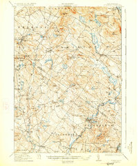
(10)- 1921 Map of Suncook
 1921 Suncook1921 Print · USGSMerrimack and Suncook River valleys thrive in the early 1920s as bustling centers of rail travel and local education. Genealogists can locate family homesteads near dozens of rural schoolhouses like Borough School or trace the old Boston and Maine Railroad through Suncook and Hooksett.5 unique versions available
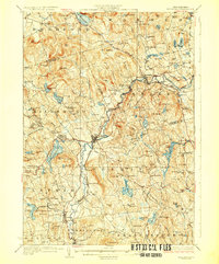
 - 1925 Map of Holderness, 1956 Print
 1925 Holderness1956 Print · USGSCentral New Hampshire in the mid-twenties centers on the Pemigewasset River and the bustling rail corridor. Genealogists can trace a network of rural schoolhouses like Sargent School and landmarks including Profile Falls and the Bay Meeting House.
 - 1926 Map of Hillsboro
 1926 Hillsboro1926 Print · USGSHillsborough County's mill towns and hill farms are captured here in the mid-1920s as the rail-and-river economy remained the local heartbeat. Researchers can trace the Boston and Maine line through Slab City or locate the Birthplace of Franklin Pierce near Jackman Reservoir.2 unique versions available
 - 1927 Map of Concord
 1927 Concord1927 Print · USGSMerrimack and Hillsborough counties show a landscape of river-driven industry and rural school districts during the mid-twenties. Genealogists can trace family lines through dozens of local schoolhouses and institutions like St Pauls School or the Quaker Church.6 unique versions available
 - 1927 Map of Penacook
 1927 Penacook1927 Print · USGSThe Merrimack and Winnipesaukee valleys in the mid-1920s reveal a landscape of river-powered industry and rural school districts. Researchers can trace dozens of family-named landmarks and institutions, from Kezer Seminary to the Soldiers Home and Swetts Mills.8 unique versions available
 - 1927 Map of Gilmanton
 1927 Gilmanton1927 Print · USGSBelknap and Merrimack Counties appear here in the late twenties, showing a landscape of rural schoolhouses and established hill towns. Genealogists can trace family names through landmarks like Smith Meetinghouse, Shaker Village, and the South Pittsfield Friends Meetinghouse.5 unique versions available
 - 1927 Map of Holderness
 1927 Holderness1927 Print · USGSThe Lakes Region in the late twenties reveals a landscape of small hill-town schools and winding river valleys. Genealogists can locate family landmarks like Sargent School, Dana Church, and numerous small waters from Squam Lake to Wickwas Pond.6 unique versions available
 - 1927 Map of Cardigan, 1957 Print
 1927 Cardigan1957 Print · USGSGrafton and Merrimack Counties were defined by rail-side industry and early lakeside tourism in the late 1920s. Genealogists and historians can trace defunct schoolhouses like School No 8 and find deep-woods sites like the Alexandria Mica Mine.
 - 1928 Map of Mount Kearsarge
 1928 Mount Kearsarge1928 Print · USGSMerrimack County and the surrounding highlands are captured in the late 1920s as the rail-and-river economy flourished. Genealogists and historians can trace defunct schools and rural crossroads like Scribners Corner, the BOSTON AND MAINE RR corridor, and the COAL HEARTH CEMETERY.5 unique versions available
 - 1929 Map of Hillsboro
 1929 Hillsboro1929 Print · USGSCentral New Hampshire in the late twenties reveals a landscape of river-powered towns and remote hill farms. Trace family history at the Birthplace of Franklin Pierce or locate old schoolhouses like Liberty Union Sch and Hemlock Sch.5 unique versions available
End of results
Showing maps 1-10 of 10
Top cities of Merrimack County
- Concord historical maps
- Hooksett historical maps
- Franklin historical maps
- Bow historical maps
- Pembroke historical maps
- Hopkinton historical maps
See more
Frequently asked questions
- What are the different types of historical maps available for Merrimack County?
- What is the oldest map of Merrimack County?
- Where can I purchase historical maps of Merrimack County for my home or office?
- Where can I download high-res historical maps of Merrimack County?
- Are there historical topographic maps available for Merrimack County?
- Is there historical aerial imagery available for Merrimack County?
- Where are historical maps of Merrimack County sourced from?