1950s Maps of Merrimack County, New Hampshire
Explore 15 historic maps of Merrimack County from the 1950s. These maps offer a rare glimpse into what life looked like during the 1950s — showing old roads, neighborhoods, homes, and landmarks that have changed or disappeared over time.
Whether you're researching your family's past, planning a metal detecting trip, or studying how Merrimack County's landscape evolved across the 1950s, these high-resolution maps are a powerful tool for exploring the history of this region.
- Focus on a specific era: All maps on this page are from the 1950s, giving you a focused view of this time period.
- See what’s changed: Compare century-old streets, trails, and buildings to today's modern landscape using overlays and satellite layers.
- Research with precision: Use these maps for genealogy, historical research, land use analysis, or educational projects.
- View, download, or print: Maps are fully viewable online in high resolution, and can be downloaded or printed for your own records.
Start exploring Merrimack County's history through authentic maps from the 1950s. This is your window into the past.
Merrimack County, NH maps
(15)- 1950 Map of Glens Falls
 1950 Glens Falls1950 Print · USGSThe Adirondacks and the Green Mountains meet in this mid-century survey of the New York and Vermont borderlands. Researchers can trace the industrial rail corridors of the Rutland RR and Delaware & Hudson RR connecting Glens Falls, Rutland, and the shores of Lake George.
 - 1955 Map of Sunapee, 1957 Print
 1955 Sunapee1957 Print · USGSSullivan County in the mid-fifties is captured here as a landscape of granite ridges, industrial valleys, and developing lakefronts. Genealogists and historians can locate the Little Red Schoolhouse Museum, the Wayside Chapel, and active rail lines like the Boston and Maine RR.3 unique versions available
 - 1956 Map of Cardigan, 1958 Print
 1956 Cardigan1958 Print · USGSGrafton County's high ridges and lake shores are captured here during the mid-fifties, showing the region's transition toward recreation and conservation. Genealogists and hikers can trace the Boston and Maine rail line through Grafton Center or locate old district sites like the Red Sch and Alexandria Mica Mine.3 unique versions available
 - 1956 Map of Penacook, 1959 Print
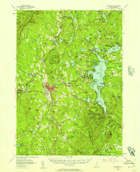
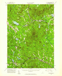
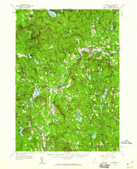
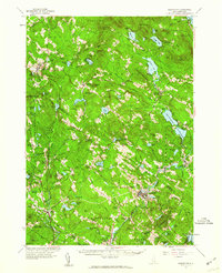
 1956 Penacook1959 Print · USGSMerrimack County’s river valleys and rail lines are captured here in the mid-fifties, showing the industrial and civic hubs of Franklin and Penacook. Genealogists can locate family landmarks like Snyders Mill and Gerrish Corner or historic sites like the Daniel Webster Birthplace.3 unique versions available
 - 1956 Map of Holderness, 1959 Print
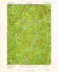
 1956 Holderness1959 Print · USGSNew Hampshire’s Lakes Region and the Pemigewasset valley are captured here in the mid-fifties as the area’s rail-and-road network supported growing tourism and local industry. Genealogists can trace family sites at the Bay Meetinghouse, North Sanbornton, and small rural schoolhouses like River Road Sch.3 unique versions available
 - 1956 Map of Mt. Kearsarge, 1959 Print
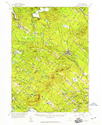
 1956 Mt. Kearsarge1959 Print · USGSMerrimack County’s upland terrain and valley settlements are captured in the mid-1950s, showing the height of the region’s rail-and-resort character. Researchers can trace the Boston & Maine RR line through Potter Place and locate historic markers like Colby Jr College and Lake Massasecum.4 unique versions available
 - 1956 Map of Portland, 1963 Print
 1956 Portland1963 Print · USGSSouthern Maine and eastern New Hampshire are captured here in the mid-fifties, during a time of major highway expansion and military growth. You can trace the path of the Maine Turnpike and locate landmarks like the Portsmouth Naval Shipyard and Sebago Lake.4 unique versions available
 - 1956 Map of Glens Falls, 1968 Print
 1956 Glens Falls1968 Print · USGSUpper New York and the Vermont mountains are captured here in the mid-fifties, showing the rugged rail-and-river network of the Northeast. Researchers can trace the paths of the Delaware and Hudson RR and Rutland RR as they wind through valley towns like Poultney and Whitehall.3 unique versions available
 - 1957 Map of Alton, 1959 Print
 1957 Alton1959 Print · USGSEastern New Hampshire’s Lakes Region and the Blue Hill Range are captured here during the late 1950s. Genealogists and researchers can locate old schoolhouses and crossroads, including Austin Cate Academy, Gerrish Chapel, and the Nute Ridge Sch.4 unique versions available
 - 1957 Map of Lovewell Mountain, 1959 Print
 1957 Lovewell Mountain1959 Print · USGSThe hill country of southwestern New Hampshire is captured here in the mid-1950s, showing the intersection of Sullivan, Cheshire, and Hillsborough counties. Researchers can trace old routes like the Dartmouth College Highway and locate rural landmarks such as Advent Ch, Mill Village, and East Lempster.4 unique versions available
 - 1957 Map of Suncook, 1959 Print
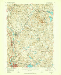 1957 Suncook1959 Print · USGSCentral New Hampshire comes into focus during the late fifties, capturing the growth of Manchester and the surrounding river valleys. Genealogists can trace family names at Pembroke Cem or locate historic schools like Pembroke Academy and Center Sch.4 unique versions available
 - 1957 Map of Hillsboro, 1960 Print
 1957 Hillsboro1960 Print · USGSHillsborough County in the mid-fifties remains a landscape of river-powered mill towns and mountain forests. Researchers can trace the Boston and Maine rail corridor through Henniker and Hillsboro, or locate family sites near Donkey School and Maple Avenue Cemetery.3 unique versions available
 - 1957 Map of Gilmanton, 1960 Print
 1957 Gilmanton1960 Print · USGSBelknap and Merrimack Counties are shown in the late 1950s, a period when rural schoolhouses and communal religious sites still anchored these small towns. Researchers can locate family landmarks like Pearls Corner, the historic Shaker Village, and the prominent Gilmanton Ironworks settlement.5 unique versions available
 - 1959 Map of Glens Falls
 1959 Glens Falls1959 Print · USGSUpper New York and Vermont are captured here during the late 1950s, a period of transition for these mountain communities. Researchers can trace the legacy of the region's river-and-rail economy through landmarks like Lake George, Saratoga Springs, and Killington Peak.2 unique versions available
 - 1959 Map of Portland
 1959 Portland1959 Print · USGSThe Maine and New Hampshire coastlines meet in this mid-century portrait of maritime commerce and inland rail networks. Researchers can trace the legacy of coastal defense at Fort Williams and follow the historic path of the Maine Central RR through the White Mountain National Forest.2 unique versions available
End of results
Showing maps 1-15 of 15
Top cities of Merrimack County
- Concord historical maps
- Hooksett historical maps
- Franklin historical maps
- Bow historical maps
- Pembroke historical maps
- Hopkinton historical maps
See more
Frequently asked questions
- What are the different types of historical maps available for Merrimack County?
- What is the oldest map of Merrimack County?
- Where can I purchase historical maps of Merrimack County for my home or office?
- Where can I download high-res historical maps of Merrimack County?
- Are there historical topographic maps available for Merrimack County?
- Is there historical aerial imagery available for Merrimack County?
- Where are historical maps of Merrimack County sourced from?