1960s Maps of Otero County, New Mexico
Explore 39 historic maps of Otero County from the 1960s. These maps offer a rare glimpse into what life looked like during the 1960s — showing old roads, neighborhoods, homes, and landmarks that have changed or disappeared over time.
Whether you're researching your family's past, planning a metal detecting trip, or studying how Otero County's landscape evolved across the 1960s, these high-resolution maps are a powerful tool for exploring the history of this region.
- Focus on a specific era: All maps on this page are from the 1960s, giving you a focused view of this time period.
- See what’s changed: Compare century-old streets, trails, and buildings to today's modern landscape using overlays and satellite layers.
- Research with precision: Use these maps for genealogy, historical research, land use analysis, or educational projects.
- View, download, or print: Maps are fully viewable online in high resolution, and can be downloaded or printed for your own records.
Start exploring Otero County's history through authentic maps from the 1960s. This is your window into the past.
Otero County, NM maps
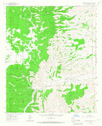
(39)- 1961 Map of Lincoln, 1964 Print
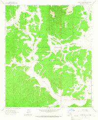
 1961 Lincoln1964 Print · USGSThe valleys of the Bonito and Ruidoso rivers come alive in this early 1960s survey of south-central New Mexico. Genealogists can trace family holdings and local landmarks like San Patricio, Glencoe, and the Le Roy McKnight Ranch.
 - 1962 Map of Roswell
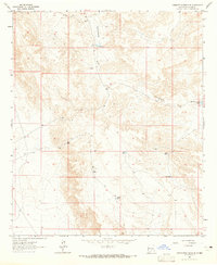
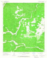
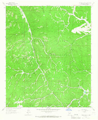
 1962 Roswell1962 Print · USGSSoutheastern New Mexico in the early sixties shows a landscape defined by high mountain peaks and a growing military presence at Roswell. Genealogists and historians can trace the roads connecting Fort Stanton, Capitan, and the Mescalero Apache Indian Reservation.
 - 1963 Map of Cornucopia Canyon, 1965 Print
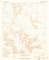
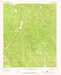
 1963 Cornucopia Canyon1965 Print · USGSRemote ranching life in Chaves County is captured in the early sixties, showing a landscape defined by desert water management and livestock outposts. Genealogists and historians can trace the operations of Cornucopia Ranch, the Runyan Line Shack, and numerous stock tanks like Lake Tank.
 - 1963 Map of Hackberry Hill, 1965 Print
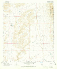
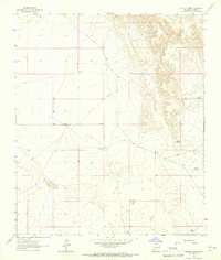
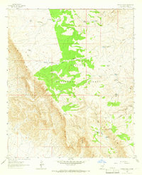
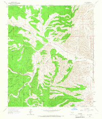
 1963 Hackberry Hill1965 Print · USGSOtero County ranching culture and desert hydrology are captured here in the early sixties. Genealogists and local historians can locate remote outposts like Templeton Ranch and trace the vital water network of Perry Well and Hackberry Well.
 - 1963 Map of Cornucopia Ranch SE, 1965 Print
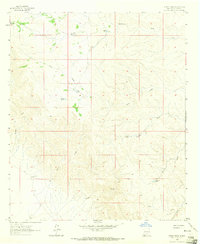
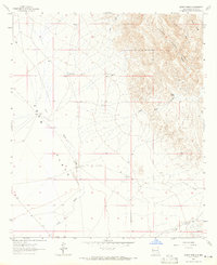
 1963 Cornucopia Ranch SE1965 Print · USGSArid rangelands in Otero County are documented here during the early sixties, showing the vital water infrastructure of the high desert. Researchers can locate isolated outposts like the Runyan Line Shack and essential ranching features such as Double Tank and the Cornucopia Diversion Dam.
 - 1963 Map of Tanner Ranch, 1965 Print
 1963 Tanner Ranch1965 Print · USGSOtero County ranchlands are captured here in the early sixties, showing a landscape defined by isolated homesteads and essential water catchments. Genealogists and historians can locate legacy sites like Tanner Ranch, the Jernigan Homestead, and Dean Ranch.2 unique versions available
 - 1963 Map of Indian Draw, 1965 Print
 1963 Indian Draw1965 Print · USGSOtero County, New Mexico, is captured in the early sixties as a vast network of desert drainages and ranching outposts. Researchers can trace historic water sources and landmarks like Johnson Well, Indian Draw, and Moccasin Draw.2 unique versions available
 - 1963 Map of Cleones Tank, 1965 Print
 1963 Cleones Tank1965 Print · USGSOtero County ranch lands are captured here in the early 1960s, showing the critical infrastructure of high-desert life. Researchers can trace the water sources and landholdings of the era through sites like Stevens Ranch, Cleones Tank, and Earl Tank.
 - 1963 Map of Gowdy Ranch, 1965 Print
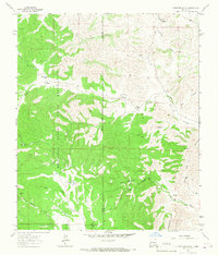
 1963 Gowdy Ranch1965 Print · USGSHigh desert ranching and forest lands in Otero County come into focus during the early sixties. Genealogists and historians can locate family-named landmarks like Gowdy Ranch and Walker Ranch or trace water sources across Crow Flats.
 - 1963 Map of Clements Ranch, 1966 Print
 1963 Clements Ranch1966 Print · USGSRanching and tribal lands meet in the high country during the early sixties, showing the vital network of wells and tanks sustaining this arid landscape. Genealogists and historians can trace family-named outposts like Clements Ranch, Pendergrass Wells, and Mc Carty Well along the old Lincoln Road.2 unique versions available
 - 1963 Map of Mayhill, 1966 Print
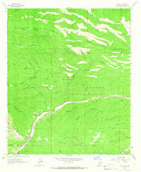 1963 Mayhill1966 Print · USGSMayhill and the surrounding Sacramento Mountains are shown here in the early sixties, centered on the junction of several canyon valleys. Researchers can locate family landmarks like Mtn View Acres Cem, the Mayhill Ranger Station, and the Rio Peñasco riverfront.2 unique versions available
 - 1963 Map of Panama Ranch, 1966 Print
 1963 Panama Ranch1966 Print · USGSRanching life in the Otero County high country during the early sixties is centered on the Lincoln National Forest plateau. Researchers can locate remote water sources like Cantrell Lake, Panama Tank, and the historic Panama Ranch.2 unique versions available
 - 1963 Map of Turkey Peak, 1966 Print
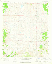
 1963 Turkey Peak1966 Print · USGSThe Mescalero Apache tribal lands meet the national forest in the early 1960s, revealing a landscape of high ridges and managed water sources. Local history researchers can trace old ranching and forest infrastructure through features like Tommy Jones Flat Tank, Felix Well, and Turkey Well.2 unique versions available
 - 1963 Map of Deadman Lake, 1966 Print
 1963 Deadman Lake1966 Print · USGSHigh-desert ranching and tribal lands meet in the early 1960s along the Otero and Lincoln county lines. Researchers can trace historic water sources and ranch sites like Joyce Ranch, Whitetail Windmill, and Big Flying H Lake.
 - 1963 Map of Ruidoso Downs, 1967 Print
 1963 Ruidoso Downs1967 Print · USGSRuidoso Downs in the early sixties sits at the intersection of forest and reservation lands as the valley begins to develop. Genealogists and historians can trace family-named sites like Herrera Lane and find landmarks like the Drive-in Theater or Baston Spring.2 unique versions available
 - 1963 Map of Robertson Canyon, 1967 Print
 1963 Robertson Canyon1967 Print · USGSSoutheast New Mexico in the early sixties reveals a landscape of high-altitude ranching and rugged drainages along the Chaves and Otero county line. Researchers can locate remote landmarks like the Cox Cem, Jernigan Ranch, and the waters of Gowen Lake.2 unique versions available
 - 1963 Map of Ruidoso, 1967 Print
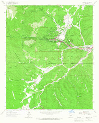 1963 Ruidoso1967 Print · USGSRuidoso and the surrounding mountain canyons are shown here in the early sixties, as recreation and infrastructure expanded in the Lincoln National Forest. Researchers can trace old mountain roads and landmarks like Forest Lawn Cem, the Drive-in Theater, and Jose Second Dam No 1.3 unique versions available
 - 1963 Map of Woodson Canyon, 1967 Print
 1963 Woodson Canyon1967 Print · USGSOtero County ranching and forest lands are captured here in the early sixties as the regional water network supported local high-country life. Researchers can trace family-named landmarks and water sources like Lewis Ranch, Stephens Well, and Barkley Lake.2 unique versions available
 - 1963 Map of Angus, 1967 Print
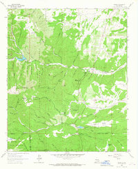 1963 Angus1967 Print · USGSLincoln County mountain life in the early sixties centers on high-altitude ranching and the critical waters of the Rio Bonito. Genealogists and researchers can trace family-named sites like Loma Grande Ranch, find the Coal Mine at Little Creek, and locate Eagle Creek Lodge.4 unique versions available
 - 1963 Map of Pajarita Mountain, 1967 Print
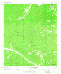
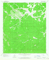
 1963 Pajarita Mountain1967 Print · USGSThe Mescalero Apache Indian Reservation in the early sixties remains a remote landscape of high ridges and deep canyons. Researchers can trace the infrastructure of high-desert ranching through features like Cow Camp No 1, Rock House Well, and the Lookout Tower atop Pajarita Mountain.
 - 1963 Map of Firman Canyon, 1967 Print
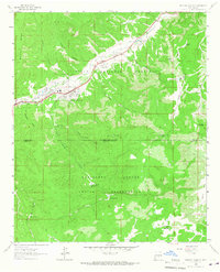
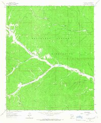
 1963 Firman Canyon1967 Print · USGSThe Mescalero Apache Reservation in the early 1960s is mapped here in high detail, focusing on the drainage of the South Fork Tularosa Canyon. You can trace remote water sources and high-country landmarks like Red Cabin, Firman Spring, and the Rio Tularosa.
 - 1963 Map of Apache Summit, 1967 Print
 1963 Apache Summit1967 Print · USGSThe Mescalero Apache Indian Reservation in the 1960s reveals a high-country landscape of deep canyons and ranching infrastructure. Genealogists and historians can trace water sources and landmarks like Pete Gaines Canyon, Harley Mtn, and the Tularosa Canyon.3 unique versions available
 - 1963 Map of Elk, 1967 Print
 1963 Elk1967 Print · USGSChaves and Otero counties are captured in the early sixties as ranching and forestry defined the rhythm of life in the southern mountains. Genealogists and historians can trace family roots through the Crockett Ranch, Elk Cemetery, and family-named landmarks like Mathews Canyon.2 unique versions available
 - 1963 Map of Whitetail, 1967 Print
 1963 Whitetail1967 Print · USGSThe Mescalero Apache high country in the early 1960s is centered here on the remote settlement of Whitetail. Researchers can trace tribal history and land use through landmarks like Whitetail Cem, the Lookout Tower on Harley Mtn, and numerous named springs.2 unique versions available
 - 1963 Map of Elk-Silver, 1967 Print
 1963 Elk-Silver1967 Print · USGSThe Mescalero Apache Indian Reservation and Lincoln National Forest meet in the 1960s, showing a network of high canyons and vital water tanks. Trace the road to Elk-Silver or locate remote sites like Camp Geronimo and Solon Dam.2 unique versions available
Showing maps 1-25 of 39
Top cities of Otero County
- Alamogordo historical maps
- Tularosa historical maps
- Boles Acres historical maps
- Alamorosa historical maps
- High Rolls historical maps
- Cloudcroft historical maps
See more
Frequently asked questions
- What are the different types of historical maps available for Otero County?
- What is the oldest map of Otero County?
- Where can I purchase historical maps of Otero County for my home or office?
- Where can I download high-res historical maps of Otero County?
- Are there historical topographic maps available for Otero County?
- Is there historical aerial imagery available for Otero County?
- Where are historical maps of Otero County sourced from?