1950s Maps of Otero County, New Mexico
Explore 38 historic maps of Otero County from the 1950s. These maps offer a rare glimpse into what life looked like during the 1950s — showing old roads, neighborhoods, homes, and landmarks that have changed or disappeared over time.
Whether you're researching your family's past, planning a metal detecting trip, or studying how Otero County's landscape evolved across the 1950s, these high-resolution maps are a powerful tool for exploring the history of this region.
- Focus on a specific era: All maps on this page are from the 1950s, giving you a focused view of this time period.
- See what’s changed: Compare century-old streets, trails, and buildings to today's modern landscape using overlays and satellite layers.
- Research with precision: Use these maps for genealogy, historical research, land use analysis, or educational projects.
- View, download, or print: Maps are fully viewable online in high resolution, and can be downloaded or printed for your own records.
Start exploring Otero County's history through authentic maps from the 1950s. This is your window into the past.
Otero County, NM maps
(38)- 1950 Map of Lake Lucero
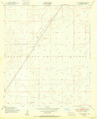
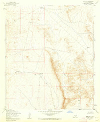
 1950 Lake Lucero1950 Print · USGSThe Tularosa Basin meets the high ridges of the San Andres Mountains at mid-century, where military testing grounds and wildlife refuges overlap. Researchers can find the site of Lucero Ranch, the expanse of Lake Lucero, and remote landmarks like Ash Canyon.
 - 1950 Map of Lake Lucero SW
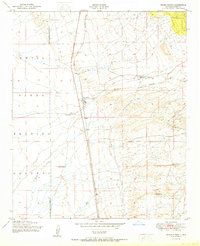
 1950 Lake Lucero SW1950 Print · USGSThe San Andres Mountains meet the military frontier of New Mexico in the early Cold War years. Genealogists and historians can trace isolated desert outposts like Saunders Ranch, Lathermans Well, and the SK White Ranch.
 - 1950 Map of Lake Lucero SE
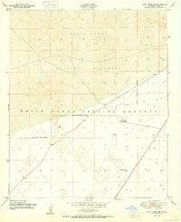
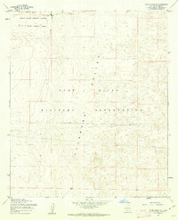
 1950 Lake Lucero SE1950 Print · USGSOtero County was a critical military landscape in the years following World War II, dedicated to testing and tactical ranges. Historians and researchers can locate specific desert water sources like Windmill Water and Burch Tank amidst the White Sands Proving Grounds.
 - 1950 Map of Three Rivers
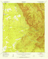
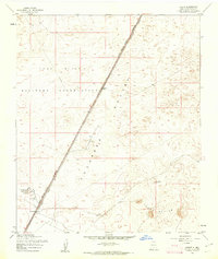
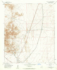
 1950 Three Rivers1950 Print · USGSMid-century Otero County is captured here at the intersection of traditional ranching and the expanding White Sands Proving Grounds. Researchers can trace the Southern Pacific rail line and locate Three Rivers, Falls Ranch, and Aguilar Spring.
 - 1950 Map of Lake Lucero NE
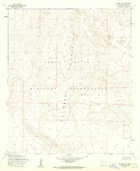
 1950 Lake Lucero NE1950 Print · USGSThe Tularosa Basin desert during the early Cold War era is captured here, showing the intersection of ranching and military land. Trace local family holdings like Bairds Ranch or find water sources like Antelope Tank and various Windmills.
 - 1950 Map of Oscura
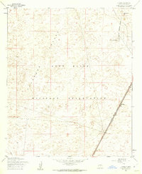
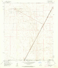
 1950 Oscura1950 Print · USGSMid-century Lincoln County is shown here as a landscape of remote rail sidings and military expansion. You can trace the Southern Pacific line through Oscura and locate high-desert water sources like Malagro Springs and Norton Well.
 - 1950 Map of Escondido Canyon, 1954 Print
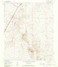
 1950 Escondido Canyon1954 Print · USGSOtero County's high desert and mountain slopes are captured here in the mid-century, featuring the transition from the rail-centered basin to the Lincoln National Forest. Genealogists and historians can trace the site of Sacramento City (Abandoned) and ranching landmarks like McCracken Ranch.2 unique versions available
 - 1950 Map of Alamogordo, 1955 Print
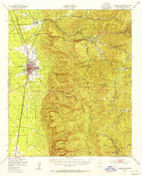 1950 Alamogordo1955 Print · USGSMid-century Alamogordo and the Sacramento Mountains are captured here during a period of steady growth and high-altitude development. Researchers can trace the Southern Pacific rail line, locate the State Sch For Blind, or find mountain sites like High Rolls and the Warnock Mine.3 unique versions available
 - 1950 Map of Sierra Blanca Peak, 1955 Print
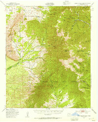 1950 Sierra Blanca Peak1955 Print · USGSThe high Sacramento Mountains are documented at mid-century as this area was managed by federal and tribal authorities. Researchers can trace remote canyons and water sources like Cienegita Spring, Three Rivers, and the slopes of Sierra Blanca Peak.2 unique versions available
 - 1950 Map of Mescalero, 1955 Print
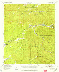 1950 Mescalero1955 Print · USGSThe Mescalero Apache Indian Reservation and the Sacramento Mountains are mapped here at the start of the 1950s. Researchers can trace tribal and forest lands, local schools like Bent Public Sch, and landmarks including St Josephs Mission and Blazers Mill.2 unique versions available
 - 1952 Map of Parker Lake
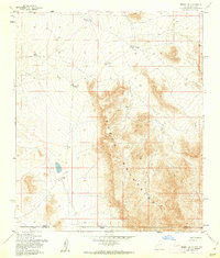
 1952 Parker Lake1952 Print · USGSIn the mid-century New Mexico desert, military expansion and ranching heritage intersect within the Tularosa Basin. Researchers can trace early water management at Parker Lake and Old Bennett Tank or locate the historic Hall Ranch and White Sands settlement.
 - 1952 Map of Cloudcroft, 1954 Print
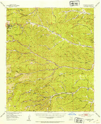 1952 Cloudcroft1954 Print · USGSHigh in the Sacramento Mountains during the early fifties, this area centers on the alpine community of Cloudcroft. Local researchers can trace family landmarks like the Weed Cem, St Joseph Church, and the Artesia Camp.3 unique versions available
 - 1954 Map of Carlsbad, 1963 Print
 1954 Carlsbad1963 Print · USGSSoutheastern New Mexico's desert peaks and river valleys appear in this mid-century study of the borderlands. Researchers can locate vanished sites like Sacramento City, trace the Pecos River reservoirs, and explore Carlsbad Caverns.3 unique versions available
 - 1954 Map of Tularosa, 1963 Print
 1954 Tularosa1963 Print · USGSSouth-central New Mexico in the early fifties shows a landscape of desert basins and high peaks under heavy military and water-reclamation use. Trace the path of the Atchison Topeka and Santa Fe Railway past San Marcial and into the massive White Sands Proving Ground.4 unique versions available
 - 1955 Map of Desert, 1962 Print
 1955 Desert1962 Print · USGSThe Tularosa Valley in the mid-fifties shows the intersection of military expansion and early rail travel. Local historians can trace the Southern Pacific line past Desert and the isolated peaks of Three Buttes near the Fort Bliss Military Reservation.2 unique versions available
 - 1955 Map of Orogrande South, 1962 Print
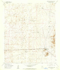
 1955 Orogrande South1962 Print · USGSThe high desert of Otero County comes into focus in the mid-1950s as a crossroads of rail transport and military expansion. Genealogists and historians can trace the early footprint of Orogrande, locating the local Cem and the tracks of the SOUTHERN PACIFIC.2 unique versions available
 - 1955 Map of El Wood, 1962 Print
 1955 El Wood1962 Print · USGSTularosa Valley at the height of the mid-century military expansion shows a stark desert landscape shaped by defense and rail. Genealogists and historians can trace the Southern Pacific line through the Fort Bliss Military Reservation to find the Elwood settlement and R.R Semaphore.3 unique versions available
 - 1955 Map of Newman NE, 1962 Print
 1955 Newman NE1962 Print · USGSMid-century Otero County is defined by the vast training grounds of the Fort Bliss Military Reservation during a period of significant military growth. Researchers can trace the desert topography and dry drainage patterns across the Tularosa Valley.2 unique versions available
 - 1955 Map of Desert NE, 1962 Print
 1955 Desert NE1962 Print · USGSOtero County in the mid-1950s reveals a landscape defined by ranching infrastructure and desert water management. Researchers can trace the network of unimproved roads and catchments like Alvarado Tank No 2, South Well, and School Tank.2 unique versions available
 - 1955 Map of White Sands SE, 1962 Print
 1955 White Sands SE1962 Print · USGSThe high desert of Otero County served as a critical defense corridor during the mid-1950s. Researchers can trace the overlapping territories of the White Sands Proving Ground and Fort Bliss Military Reservation, or locate isolated Ruins on the valley floor.3 unique versions available
 - 1955 Map of Newman, 1962 Print
 1955 Newman1962 Print · USGSThe high desert of the New Mexico and Texas border comes into focus in the mid-1950s, centered on the Newman settlement. Researchers can trace the diagonal path of the Southern Pacific railroad and locate early military infrastructure like a Meteorological Station and several Ruins.2 unique versions available
 - 1955 Map of Elephant Mountain, 1962 Print
 1955 Elephant Mountain1962 Print · USGSThe Tularosa Valley in the mid-fifties shows the intersection of desert ranching and Cold War defense. Researchers can locate the Orogrande Range Camp, the McNew Well Camp Ruins, and the prominent profile of Elephant Mountain.2 unique versions available
 - 1955 Map of Orogrande North, 1962 Print
 1955 Orogrande North1962 Print · USGSOtero County mining districts and desert rail corridors come into focus in this mid-century survey of the New Mexico basin. Researchers can trace the industrial footprint of the Jarilla Mountains through the Iron Queen Mine, the settlement of Turquoise, and old water infrastructure.3 unique versions available
 - 1955 Map of Davies Tank, 1962 Print
 1955 Davies Tank1962 Print · USGSDona Ana County was a focal point of military expansion in the mid-fifties, dominated by defense reservations and arid basin landscapes. Researchers can trace the boundaries of the White Sands Proving Ground and locate desert landmarks like Condron Air Force Auxiliary Field or Davies Tank.3 unique versions available
 - 1955 Map of Desert SE, 1962 Print
 1955 Desert SE1962 Print · USGSThe high desert borderlands between New Mexico and Texas are captured here in the mid-1950s. Researchers can trace the era's arid-land infrastructure through numerous water catchments like Lake Tank and find evidence of past habitation at the Ruins near the Hueco Mountains.
Showing maps 1-25 of 38
Top cities of Otero County
- Alamogordo historical maps
- Tularosa historical maps
- Boles Acres historical maps
- Alamorosa historical maps
- High Rolls historical maps
- Cloudcroft historical maps
See more
Frequently asked questions
- What are the different types of historical maps available for Otero County?
- What is the oldest map of Otero County?
- Where can I purchase historical maps of Otero County for my home or office?
- Where can I download high-res historical maps of Otero County?
- Are there historical topographic maps available for Otero County?
- Is there historical aerial imagery available for Otero County?
- Where are historical maps of Otero County sourced from?